Brington

Settlement in Huntingdonshire Huntingdonshire

England

Brington

The former Fox pub, next to the A14 near Brington
The former Fox pub, next to the A14 near Brington Credit: Christopher Hilton

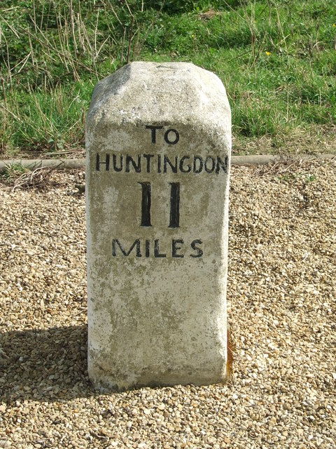
Brington is a small village located in the historic county of Huntingdonshire, in the eastern region of England. Situated approximately 5 miles northwest of the town of Huntingdon, Brington is nestled amidst picturesque countryside, offering residents and visitors a tranquil and idyllic setting.

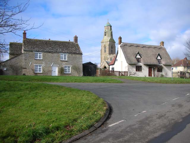
The village has a population of around 400 people, making it a close-knit community where neighbors often know each other by name. Brington is characterized by its quintessential English charm, with a variety of traditional thatched-roof cottages and historic buildings that dot the village streets.

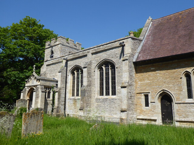
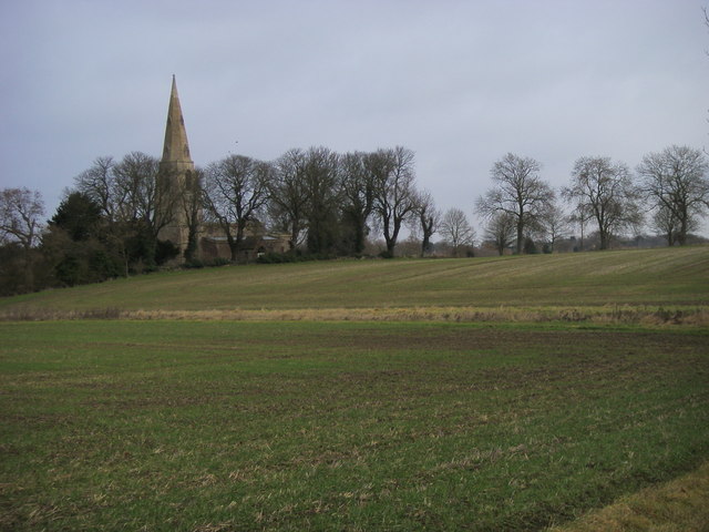
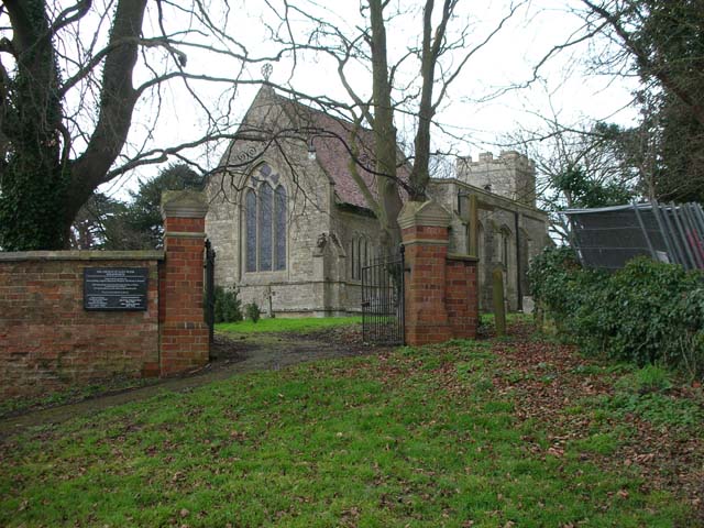
The centerpiece of Brington is the Church of St. Mary the Virgin, a beautiful medieval parish church that dates back to the 13th century. With its striking architecture and rich history, the church is not only a place of worship but also a popular tourist attraction.

Despite its small size, Brington boasts a vibrant community spirit. The village has a primary school, providing education for the local children, and a village hall that serves as a venue for various social gatherings and events.

Surrounded by stunning countryside, Brington offers ample opportunities for outdoor activities. The village is located near the Great Ouse River, providing residents with the chance to enjoy picturesque walks and fishing. Additionally, the nearby Hinchingbrooke Country Park offers extensive parkland and woodland for exploration.

Overall, Brington is a charming and peaceful village that offers a close community, historic architecture, and access to beautiful natural surroundings.

If you have any feedback on the listing, please let us know in the comments section below.
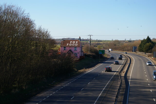
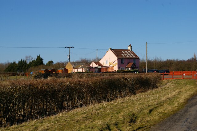
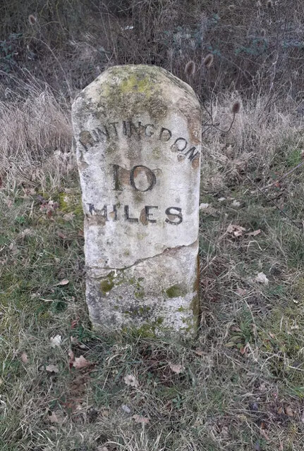
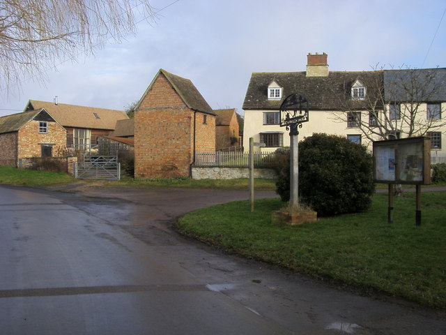
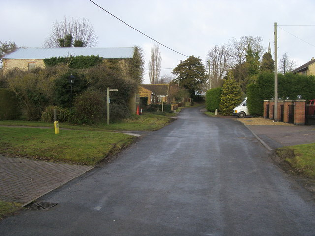
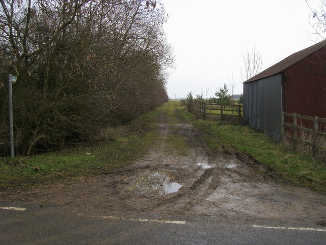
Brington Images

Images are sourced within 2km of 52.373463/-0.4085 or Grid Reference TL0876. Thanks to Geograph Open Source API. All images are credited.

The former Fox pub, next to the A14 near Brington
Looking east along the A14 from the bridge at Brington
The former Fox pub, next to the A14 near Brington Seen from the truncated stub of Fox Road, which used to lead to a crossing of the A14 but is now superseded by a new road and bridge.
The former Fox pub, next to the A14 near Brington
Seen from the truncated stub of Fox Road, which used to lead to a crossing of the A14 but is now superseded by a new road and bridge.
Looking west near the former Fox pub Seen from the stub of Fox Road that leads to the former pub and formerly to a crossing of the road that is now the A14.
Looking west near the former Fox pub
Seen from the stub of Fox Road that leads to the former pub and formerly to a crossing of the road that is now the A14.
Molesworth, St Peter
Fox Road Interchange, Brington Connecting to the A14
Fox Road Interchange, Brington
Connecting to the A14
Old Milestone by the A14 Carved stone post by the A14, in parish of CATWORTH (HUNTINGDONSHIRE District), on slip road, near junction with B660, on the verge (DC reinstated close to original place), on Northwest side of road. Huntingdon stone, erected by the Market Harborough & Brampton turnpike trust in the 19th century. An earlier photograph can be found here <a title="https://www.geograph.org.uk/photo/6038244" href="https://www.geograph.org.uk/photo/6038244">Link</a>.

Inscription reads:-
: TO / THRAPSTON / 7 / MILES : : TO / HUNTINGDON / 10 / MILES : 

Milestone Society National ID: HU_HUTH10.
Old Milestone by the A14
Carved stone post by the A14, in parish of CATWORTH (HUNTINGDONSHIRE District), on slip road, near junction with B660, on the verge (DC reinstated close to original place), on Northwest side of road. Huntingdon stone, erected by the Market Harborough & Brampton turnpike trust in the 19th century. An earlier photograph can be found here Link. Inscription reads:- : TO / THRAPSTON / 7 / MILES : : TO / HUNTINGDON / 10 / MILES : Milestone Society National ID: HU_HUTH10.
B660 at the A14 junction Fox Road B660 at the A14 junction
B660 at the A14 junction
Fox Road B660 at the A14 junction
Molesworth village Molesworth village with the village sign by the bridleway to Brington
Molesworth village
Molesworth village with the village sign by the bridleway to Brington
Church Lane Brington Church Lane Brington by the footpath to Molesworth
Church Lane Brington
Church Lane Brington by the footpath to Molesworth
Bridleway by Glebe Farm From the road to Brington the bridleway by Glebe Farm
Bridleway by Glebe Farm
From the road to Brington the bridleway by Glebe Farm
St Swithin's church Old Weston From the B660 road looking to St Swithin's church Old Weston
St Swithin's church Old Weston
From the B660 road looking to St Swithin's church Old Weston
Cruise missile bunkers (former) The overnight annexation and fence building all round the perimeter of Molesworth certainly put this quiet part of old Huntingdonshire in the world news headlines for a year or two. Here's one the USAF took earlier  <span class="nowrap"><a title="http://en.wikipedia.org/wiki/File:RAF-Molesworth-25Jan1989.jpg" rel="nofollow ugc noopener" href="http://en.wikipedia.org/wiki/File:RAF-Molesworth-25Jan1989.jpg">Link</a><img style="margin-left:2px;" alt="External link" title="External link - shift click to open in new window" src="https://s1.geograph.org.uk/img/external.png" width="10" height="10"/></span>
Cruise missile bunkers (former)
The overnight annexation and fence building all round the perimeter of Molesworth certainly put this quiet part of old Huntingdonshire in the world news headlines for a year or two. Here's one the USAF took earlier LinkExternal link
Old Milepost Old milepost near to Molesworth, Cambridgeshire for overall view see <a title="https://www.geograph.org.uk/photo/2880666" href="https://www.geograph.org.uk/photo/2880666">Link</a>
Old Milepost
Old milepost near to Molesworth, Cambridgeshire for overall view see Link
To Thrapston 6 Old milepost near to Easton, Cambridgeshire for close up view see <a title="https://www.geograph.org.uk/photo/2880648" href="https://www.geograph.org.uk/photo/2880648">Link</a>
To Thrapston 6
Old milepost near to Easton, Cambridgeshire for close up view see Link
Old Milepost Old milepost near to Brington, Cambridgeshire. The correct location would have been half a mile further east but must have been moved with the creation of the A.14. For overall view see <a title="https://www.geograph.org.uk/photo/2880795" href="https://www.geograph.org.uk/photo/2880795">Link</a>
Old Milepost
Old milepost near to Brington, Cambridgeshire. The correct location would have been half a mile further east but must have been moved with the creation of the A.14. For overall view see Link
To Thrapston 7 Old milepost near to Brington, Cambridgeshire. The correct location would have been half a mile further east but must have been moved with the creation of the A.14. For close up view see <a title="https://www.geograph.org.uk/photo/2880782" href="https://www.geograph.org.uk/photo/2880782">Link</a>
To Thrapston 7
Old milepost near to Brington, Cambridgeshire. The correct location would have been half a mile further east but must have been moved with the creation of the A.14. For close up view see Link
St Swithin's church, Old Weston
Show me another place!

Brington is located at Grid Ref: TL0876 (Lat: 52.373463, Lng: -0.4085)

Administrative County: Cambridgeshire

District: Huntingdonshire

Police Authority: Cambridgeshire

What 3 Words

///shook.amps.shovels. Near Kimbolton, Cambridgeshire

Nearby Locations

Brington

Related Wikis

Brington, Cambridgeshire

Brington is a village and former civil parish, now in the parish of Brington and Molesworth, in Cambridgeshire, England. Brington lies approximately 9...
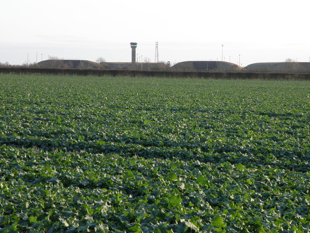
RAF Molesworth

Royal Air Force Molesworth or more simply RAF Molesworth is a Royal Air Force station located near Molesworth, Cambridgeshire, England with a history dating...

Molesworth, Cambridgeshire

Molesworth is a village and former civil parish, now in the parish of Brington and Molesworth in Cambridgeshire, England. Molesworth is 10 miles (16 km...

Bythorn

Bythorn is a village and former civil parish, now in the parish of Bythorn and Keyston, in Cambridgeshire, England. Bythorn lies approximately 11 miles...

Nearby Amenities

Located within 500m of 52.373463,-0.4085
Created By: Merkaartor 0.12
Lat/Long: 52.3693633/-0.4084789
Created By: Merkaartor 0.12
Lat/Long: 52.375157/-0.408072
Created By: Merkaartor 0.12
Lat/Long: 52.3756711/-0.4079961
Created By: Merkaartor 0.12
Lat/Long: 52.3770662/-0.4080176
Brington
Place: village
Wikidata: Q2694371
Lat/Long: 52.369716/-0.4100004
Created By: Merkaartor 0.12
Lat/Long: 52.3709222/-0.4109907
Telephone
Booth: K6
Covered: booth
Listed Status: Grade II
Man Made: telephone_box
Lat/Long: 52.3716108/-0.4087135
Post Box
Post Box Type: lamp
Ref: PE28 65
Royal Cypher: EIIR
Royal Cypher Wikidata: Q33102113
Lat/Long: 52.3716529/-0.4087187
Man Made: silo
Lat/Long: 52.3716928/-0.4077674
Power: pole
Lat/Long: 52.3703837/-0.4051313
Power: pole
Lat/Long: 52.3708569/-0.4042515
Power: pole
Lat/Long: 52.3697531/-0.4061023
Power: pole
Lat/Long: 52.3713418/-0.4033502
Power: pole
Lat/Long: 52.3691161/-0.4071242
Power: pole
Lat/Long: 52.3718952/-0.4021918
Historic: memorial
Memorial: war_memorial
Lat/Long: 52.3708341/-0.4111615
The data included in this document is from www.openstreetmap.org. The data is made available under ODbL.

Have you been to Brington?

Leave your review of Brington below (or comments, questions and feedback).