Bringsty Common

Settlement in Herefordshire

England

Bringsty Common

Lane at Yearsett The track rising on the left gives access to the old railway line, now used as a farm track, at the site of the temporary station of Yearsett, in use 1874-77.
Lane at Yearsett Credit: Peter Whatley

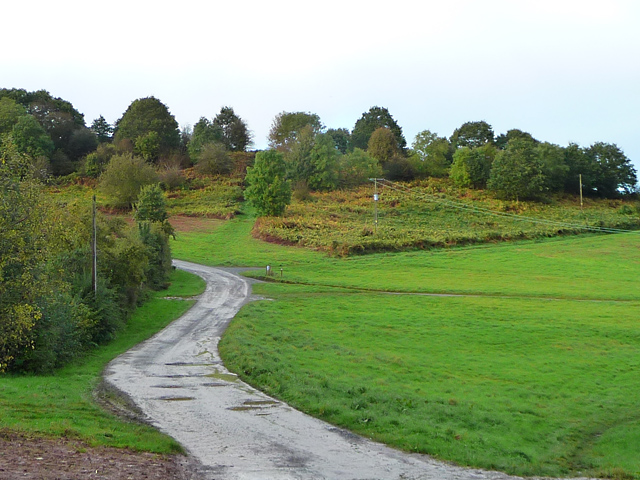
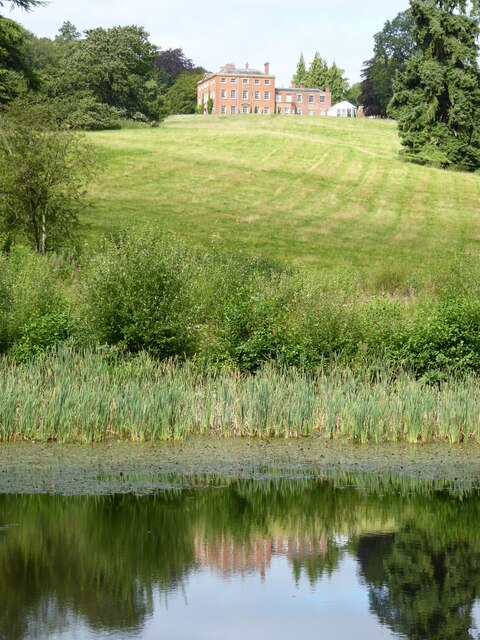
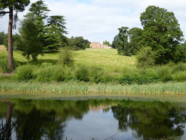
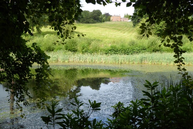
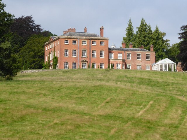
Bringsty Common is a picturesque area located in the county of Herefordshire, England. Situated near the village of Bromyard, it spans approximately 400 acres and is an important natural and cultural landmark in the region. The common is characterized by its rolling hills, open fields, and a diverse range of flora and fauna, making it a popular destination for nature enthusiasts and walkers.

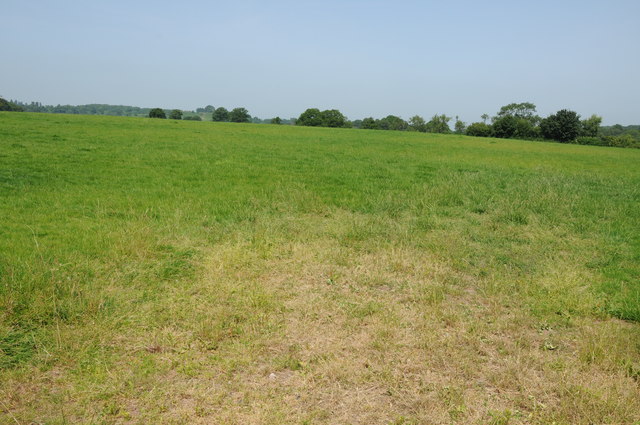
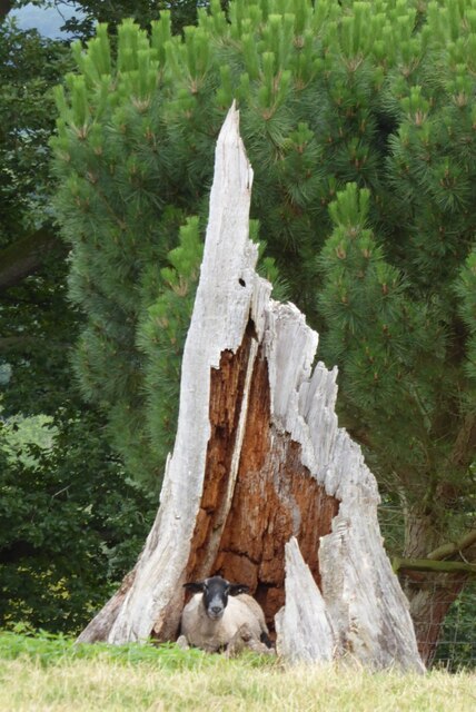
The landscape of Bringsty Common is a mix of grasslands, heathland, and woodlands, providing a habitat for various wildlife species. It is home to a wide range of plants, including heather, gorse, and oak trees, which add to its scenic beauty. The common also boasts a network of footpaths and bridleways, allowing visitors to explore and enjoy the tranquil surroundings.

Historically, Bringsty Common has played an important role in the local community. It was once used as a meeting point for livestock trading, and ancient drover roads can still be seen crossing the area. Additionally, the common is known for its association with the famous poet, Elizabeth Barrett Browning, who lived nearby and wrote about the surrounding countryside.

Today, Bringsty Common continues to be a cherished natural space for both locals and visitors alike. Its peaceful ambiance, combined with its rich biodiversity, makes it a haven for anyone seeking solace in nature. Whether it's a leisurely walk, a picnic, or simply admiring the stunning views, Bringsty Common offers a delightful escape from the hustle and bustle of everyday life.

If you have any feedback on the listing, please let us know in the comments section below.

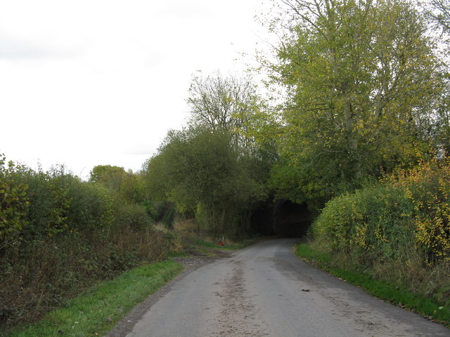
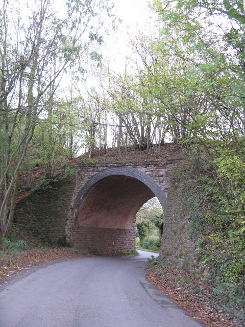
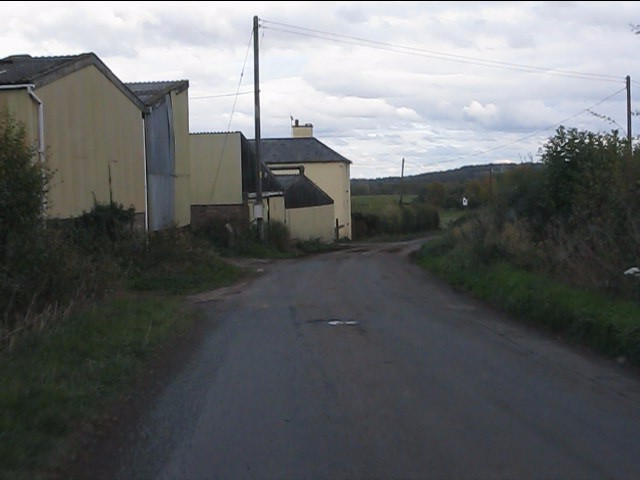
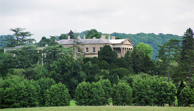
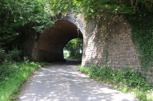
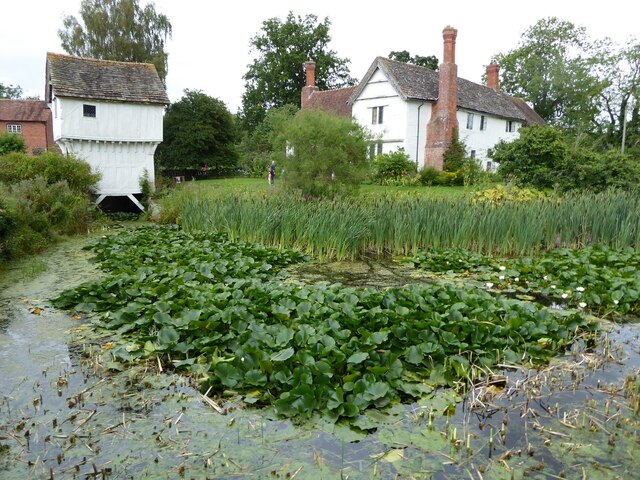
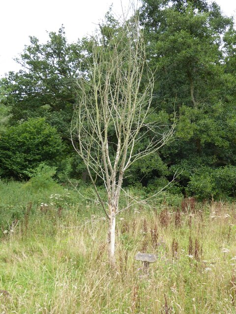
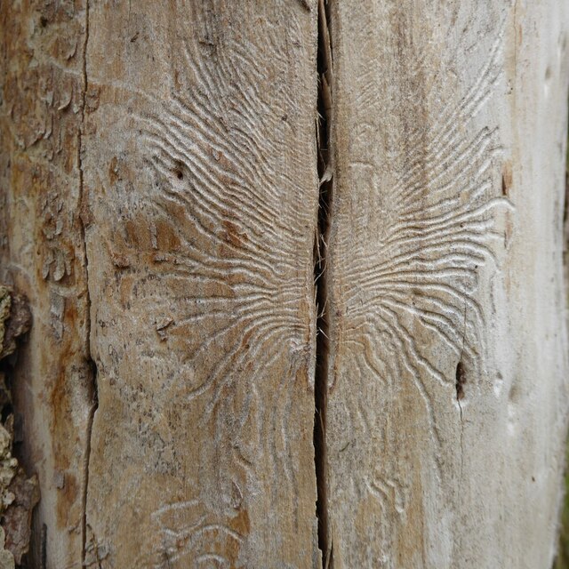
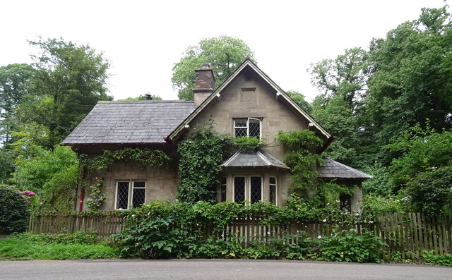
Bringsty Common Images

Images are sourced within 2km of 52.192416/-2.4402858 or Grid Reference SO7055. Thanks to Geograph Open Source API. All images are credited.

Lane at Yearsett The track rising on the left gives access to the old railway line, now used as a farm track, at the site of the temporary station of Yearsett, in use 1874-77.
Lane at Yearsett
The track rising on the left gives access to the old railway line, now used as a farm track, at the site of the temporary station of Yearsett, in use 1874-77.
Worcester & Bromyard railway bridge, Yearsett One of several expensive structures on the line.
Worcester & Bromyard railway bridge, Yearsett
One of several expensive structures on the line.
Lower Yearsett Farm
Lower Yearsett Farm
A44 at Bringsty Common The emporium to the right sells antique and reclaimed artifacts.
The cafe is worth a stop too.
A44 at Bringsty Common
The emporium to the right sells antique and reclaimed artifacts. The cafe is worth a stop too.
Roadway on Bringsty Common Looking from close to the Live and Let Live pub.
Roadway on Bringsty Common
Looking from close to the Live and Let Live pub.
Whitbourne Hall, Whitbourne Actually only a distant view of part of the imposing Greek Ionic portico, inspired by the Erechtheum in Athens. All the work of E.W. Elmslie, 1860-62, for Edward Bickerton Evans, banker, wine and vinegar brewer, and amateur archaeologist. The date is late for such a revival building. Grade II* listed.
A closer view: <a href="https://www.geograph.org.uk/photo/688419">SO7056 : Whitbourne Hall</a>.
Whitbourne Hall, Whitbourne
Actually only a distant view of part of the imposing Greek Ionic portico, inspired by the Erechtheum in Athens. All the work of E.W. Elmslie, 1860-62, for Edward Bickerton Evans, banker, wine and vinegar brewer, and amateur archaeologist. The date is late for such a revival building. Grade II* listed. A closer view: SO7056 : Whitbourne Hall.
Former railway bridge near Suckley Knowl Railway bridge on the former Worcester to Bromyard railway.  The railway opened in  1877 and closed to regular passengers in September 1952.
Former railway bridge near Suckley Knowl
Railway bridge on the former Worcester to Bromyard railway. The railway opened in 1877 and closed to regular passengers in September 1952.
Field near Yearsett Court Bringsty Common can be seen in the background.
Field near Yearsett Court
Bringsty Common can be seen in the background.
The A44 trunk road near Moorhall
Ewe in hollow tree stump I couldn't resist photographing this ewe sitting inside a hollow tree stump when I saw it on the Brockhampton estate.
Ewe in hollow tree stump
I couldn't resist photographing this ewe sitting inside a hollow tree stump when I saw it on the Brockhampton estate.
Brockhampton House reflected in Lawn Pool Brockhampton House reflected in Lawn Pool on the Brockhampton Estate.
Brockhampton House reflected in Lawn Pool
Brockhampton House reflected in Lawn Pool on the Brockhampton Estate.
Lawn Pool, Brockhampton Brockhampton House reflected in Lawn Pool on the Brockhampton estate.
Lawn Pool, Brockhampton
Brockhampton House reflected in Lawn Pool on the Brockhampton estate.
Lawn Pool, Brockhampton rockhampton House reflected in Lawn Pool on the Brockhampton estate.
Lawn Pool, Brockhampton
rockhampton House reflected in Lawn Pool on the Brockhampton estate.
Brockhampton Park Brockhampton Park is a mid-18th century red-brick Georgian house, here it is viewed from Lawn Pool.  The house is Grade II* listed, see: <span class="nowrap"><a title="https://historicengland.org.uk/listing/the-list/list-entry/1176659" rel="nofollow ugc noopener" href="https://historicengland.org.uk/listing/the-list/list-entry/1176659">Link</a><img style="margin-left:2px;" alt="External link" title="External link - shift click to open in new window" src="https://s1.geograph.org.uk/img/external.png" width="10" height="10"/></span> The house is private amidst National Trust owned parkland.
Brockhampton Park
Brockhampton Park is a mid-18th century red-brick Georgian house, here it is viewed from Lawn Pool. The house is Grade II* listed, see: LinkExternal link The house is private amidst National Trust owned parkland.
Lower Brockhampton  Lower Brockhampton is a moated half-timbered manor house dating from the late 14th century, complete with a timber-framed gatehouse straddling the moat. The Brockhampton Estate was bequeathed to the National Trust in 1946 by Colonel John Talbot Lutley. The house is Grade I listed.
Lower Brockhampton
Lower Brockhampton is a moated half-timbered manor house dating from the late 14th century, complete with a timber-framed gatehouse straddling the moat. The Brockhampton Estate was bequeathed to the National Trust in 1946 by Colonel John Talbot Lutley. The house is Grade I listed.
A dead wych elm I remember elm trees being a common tree before Dutch elm disease wiped them out in the 1970s.  Three years ago I was surprised to see a young wych elm tree growing here <a href="https://www.geograph.org.uk/photo/5786065">SO6856 : A wych elm at Lower Brockhampton</a> and sadly as appears to happen the young trees still succumb to this disease.
A dead wych elm
I remember elm trees being a common tree before Dutch elm disease wiped them out in the 1970s. Three years ago I was surprised to see a young wych elm tree growing here SO6856 : A wych elm at Lower Brockhampton and sadly as appears to happen the young trees still succumb to this disease.
Dutch elm disease This pattern on the trunk of a dead wych elm tree was caused by the elm bark beetle which carries the fungi which causes Dutch elm disease and killed the tree.
Dutch elm disease
This pattern on the trunk of a dead wych elm tree was caused by the elm bark beetle which carries the fungi which causes Dutch elm disease and killed the tree.
Bromyard Lodge West lodge to Brockhampton Park off the A44.
Bromyard Lodge
West lodge to Brockhampton Park off the A44.
Show me another place!

Bringsty Common is located at Grid Ref: SO7055 (Lat: 52.192416, Lng: -2.4402858)

Unitary Authority: County of Herefordshire

Police Authority: West Mercia

What 3 Words

///fades.sharper.dentures. Near Bromyard, Herefordshire

Nearby Locations

Bringsty Common

Related Wikis

Bringsty Common

Bringsty Common is a scattered settlement and 220 acres (89 ha) of common land in Herefordshire, England, spanning the A44. It lies close to the Worcestershire...

Brockhampton (near Bromyard)

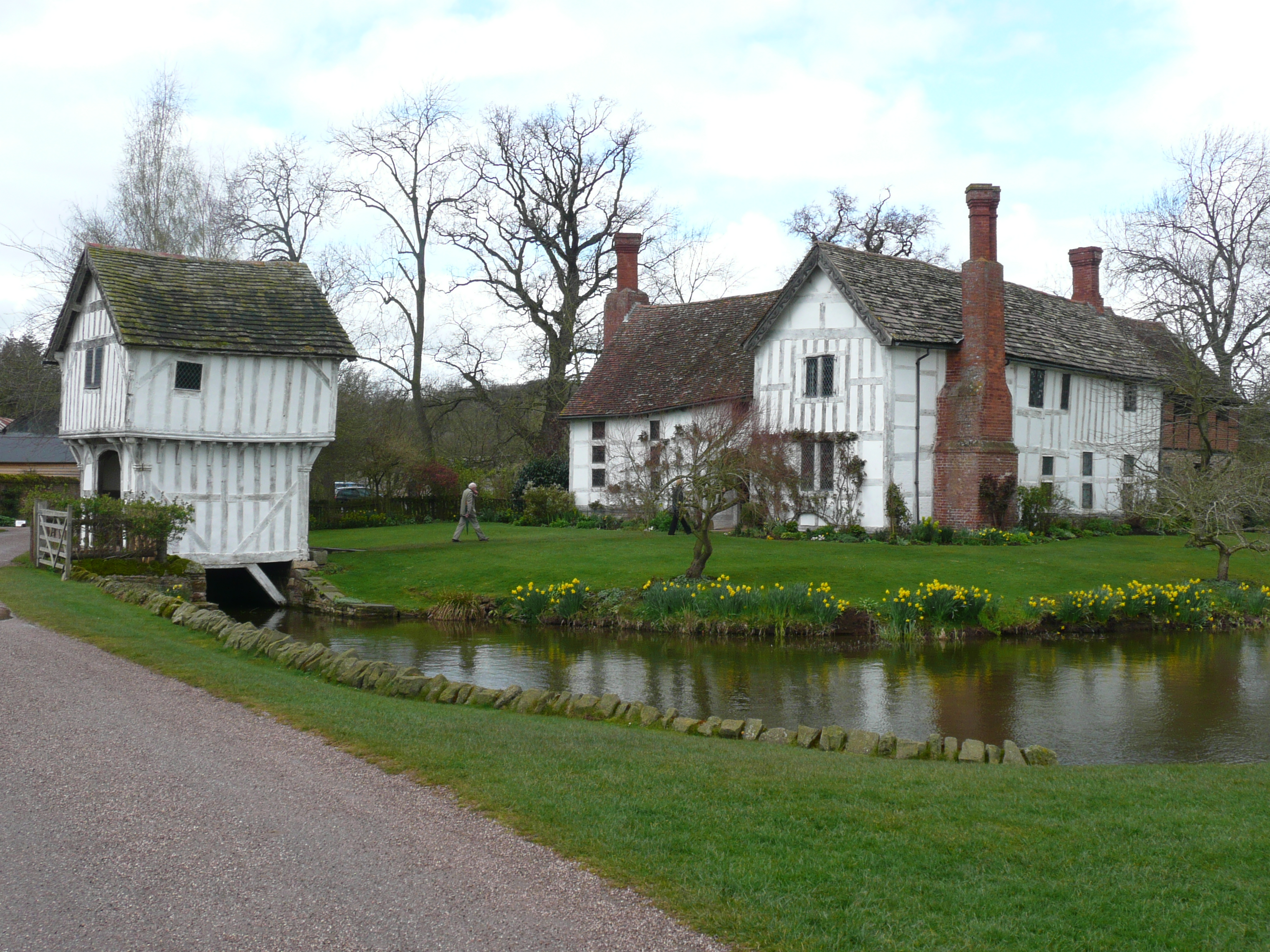
Brockhampton is a civil parish in Herefordshire, England, about 4 km (2 mi) east of Bromyard. The parish comprises the National Trust property of Brockhampton...
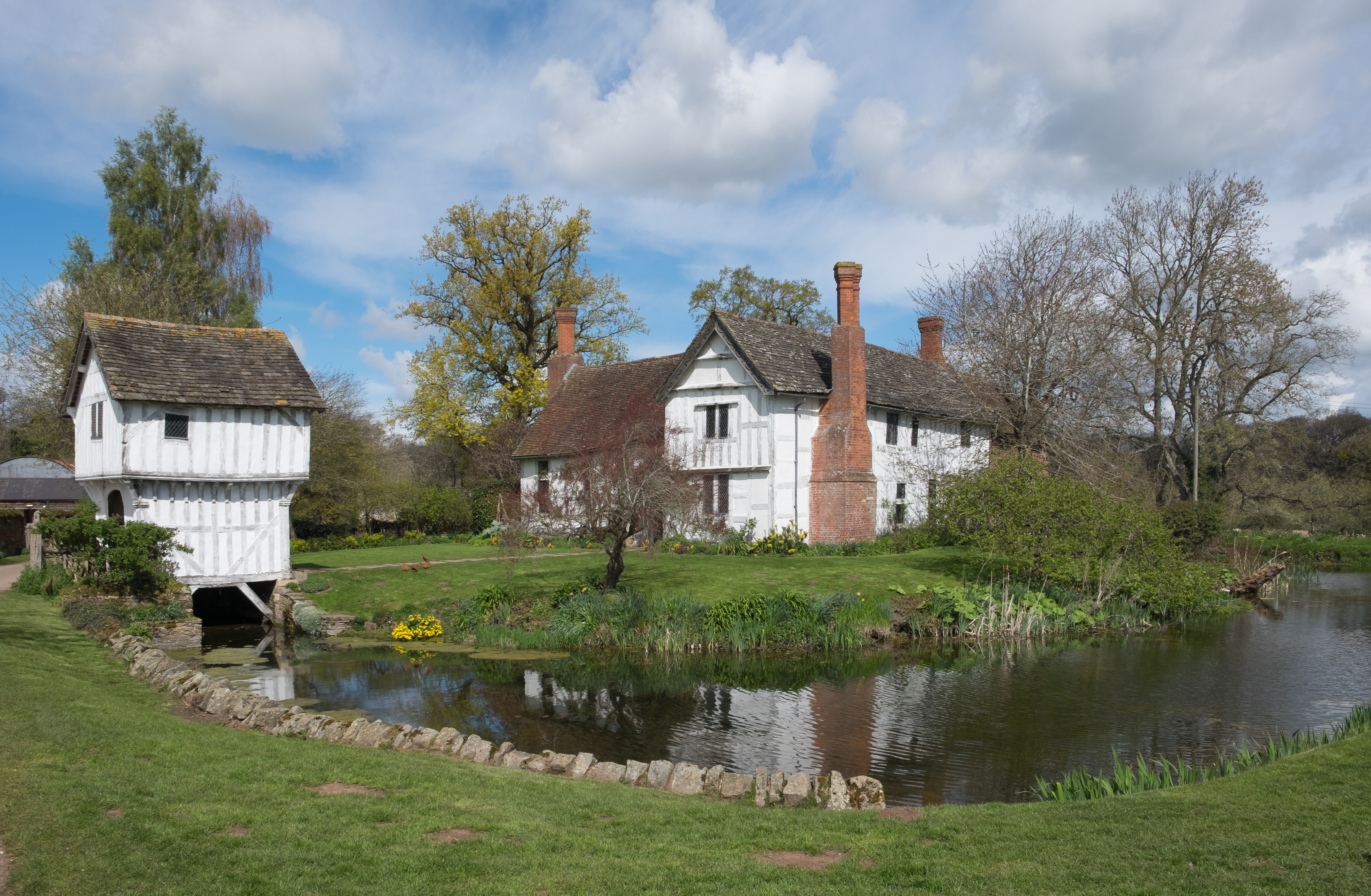
Brockhampton Estate

The Brockhampton Estate is a National Trust property in Herefordshire, England, and is to the north of the A44 Bromyard to Worcester road, opposite the...

Linton (near Bromyard)

Linton is a civil parish in north-east of Herefordshire, England, and is approximately 14 miles (23 km) north-east from the city and county town of Hereford...

Nearby Amenities

Located within 500m of 52.192416,-2.4402858
Bringsty
Ele: 152
Natural: peak
Lat/Long: 52.1914419/-2.443609
Toposcope
Tourism: viewpoint
Lat/Long: 52.1910793/-2.4448193
Bench
Backrest: no
Lat/Long: 52.1908902/-2.4448086
Bench
Backrest: yes
Lat/Long: 52.1911155/-2.4444653
Information: map
Tourism: information
Lat/Long: 52.1931017/-2.4424348
Post Office
BringstyMobile Service Post Office
Addr City: Bromyard
Addr Postcode: WR6 5UJ
Fixme: verify by survey
Fixme Addr 1: Layby Opposite Bringsty Antiques Cafe
Fixme Addr 2: A44
Fixme Addr 3: Bringsty Common
Opening Hours: Mo 12:30-13:30
Ref Pol Id: 134082
Source: pol_branch_list_2018-02
Lat/Long: 52.1946995/-2.4350473
Power: pole
Source: estimate
Lat/Long: 52.1946692/-2.4454317
Power: pole
Source: bing
Lat/Long: 52.1897981/-2.4461934
Power: pole
Source: bing
Lat/Long: 52.1939424/-2.4471724
Power: pole
Source: bing
Lat/Long: 52.1943453/-2.4462175
Power: pole
Source: bing
Lat/Long: 52.1950407/-2.4445559
Power: pole
Source: bing
Lat/Long: 52.195243/-2.4440785
Power: pole
Source: bing
Lat/Long: 52.1955948/-2.4432242
Power: pole
Source: bing
Lat/Long: 52.1958414/-2.4426395
Rose Cottage
Power: pole
Source: bing
Transformer: distribution
Voltage Primary: 11000
Lat/Long: 52.1959877/-2.4422586
Power: pole
Source: bing
Lat/Long: 52.1964234/-2.4411374
The Oaks
Power: pole
Source: bing
Transformer: distribution
Voltage Primary: 11000
Lat/Long: 52.1960716/-2.4394584
Power: pole
Source: bing
Lat/Long: 52.196795/-2.440145
Power: pole
Source: bing
Lat/Long: 52.1885575/-2.4377632
Power: pole
Source: bing
Lat/Long: 52.1891116/-2.4381495
Power: pole
Source: bing
Lat/Long: 52.1895375/-2.438482
Power: pole
Source: bing
Lat/Long: 52.1899362/-2.4387905
Power: pole
Source: bing
Lat/Long: 52.1904682/-2.4391714
Live & Let Live
Power: pole
Source: bing
Transformer: distribution
Voltage Primary: 11000
Lat/Long: 52.1908661/-2.4394718
Power: pole
Source: bing
Lat/Long: 52.1913956/-2.439563
Power: pole
Source: bing
Lat/Long: 52.1917737/-2.4396488
Power: pole
Source: bing
Transformer: distribution
Voltage Primary: 11000
Lat/Long: 52.1924479/-2.4397722
Power: pole
Source: bing
Lat/Long: 52.1917121/-2.4351333
Power: pole
Source: bing
Lat/Long: 52.1922654/-2.4339853
Power: pole
Source: bing
Lat/Long: 52.1926583/-2.4332128
Power: pole
Source: bing
Lat/Long: 52.1931878/-2.4335065
Power: pole
Source: bing
Lat/Long: 52.1937567/-2.4338298
Bringsty Common
Power: pole
Source: bing
Transformer: distribution
Voltage Primary: 11000
Lat/Long: 52.1944123/-2.4342234
Power: pole
Source: bing
Lat/Long: 52.1950046/-2.4345446
Man Made: survey_point
Lat/Long: 52.1914424/-2.4435648
Defibrillator
Emergency: defibrillator
Lat/Long: 52.1945401/-2.4349068
Bus Stop
Bringsty Garage
Bus: yes
Naptan AtcoCode: 2090A052201
Naptan Bearing: E
Naptan BusStopType: CUS
Naptan CommonName: Garage
Naptan Indicator: opp
Naptan Landmark: Bringsty Garage
Naptan NaptanCode: heradamp
Naptan Street: A44
Naptan Verified: no
Public Transport: platform
Source: naptan_import
Lat/Long: 52.194681/-2.4351046
Power: pole
Lat/Long: 52.1905315/-2.4377377
Lower Craddocks
Power: pole
Transformer: distribution
Voltage Primary: 11000
Lat/Long: 52.1905989/-2.435836
Power: pole
Lat/Long: 52.1911596/-2.4363671
Power: pole
Lat/Long: 52.1962191/-2.436526
Orchard Cottage
Power: pole
Transformer: distribution
Voltage Primary: 11000
Lat/Long: 52.1957987/-2.4368848
Power: pole
Lat/Long: 52.1940933/-2.4468277
The data included in this document is from www.openstreetmap.org. The data is made available under ODbL.

Have you been to Bringsty Common?

Leave your review of Bringsty Common below (or comments, questions and feedback).