Belper

Civil Parish in Derbyshire Amber Valley

England

Belper

New houses, Cowhill Belper is expanding, some new houses on Cowhill, to the southeast of the town.
New houses, Cowhill Credit: Richard Webb

Belper is a civil parish located in the county of Derbyshire, England. Situated on the banks of the River Derwent, it lies approximately 8 miles north of Derby and has a population of around 23,000 people. The town is part of the Amber Valley district and falls within the parliamentary constituency of Mid Derbyshire.

Belper has a rich industrial heritage, with its history rooted in the cotton spinning and nail-making industries that flourished during the Industrial Revolution. The town's iconic North Mill, a former cotton mill, is now a UNESCO World Heritage Site and serves as a museum dedicated to the area's industrial past.

Today, Belper is a thriving community with a mix of residential, commercial, and retail areas. The town center boasts a range of independent shops, cafes, and restaurants, as well as larger chain stores. The River Gardens, located along the riverbanks, provide a scenic area for relaxation and recreation.

Belper is also known for its vibrant arts scene, with various cultural events and festivals taking place throughout the year. The town hosts an annual arts festival, showcasing local talent in music, theater, and visual arts.

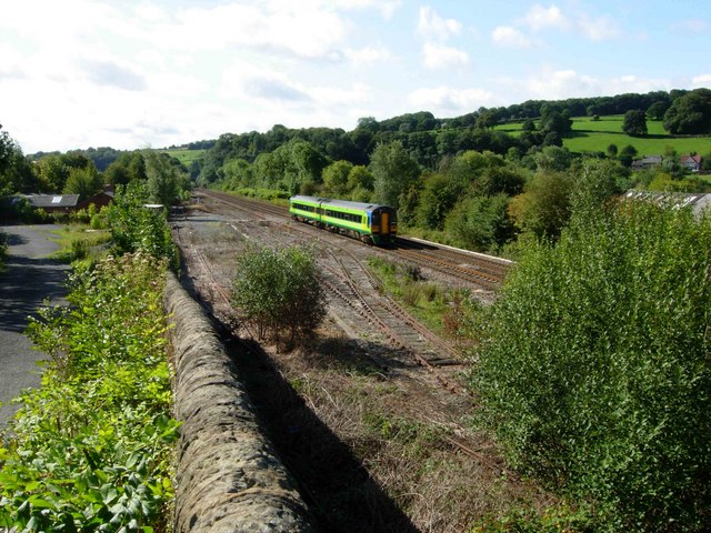
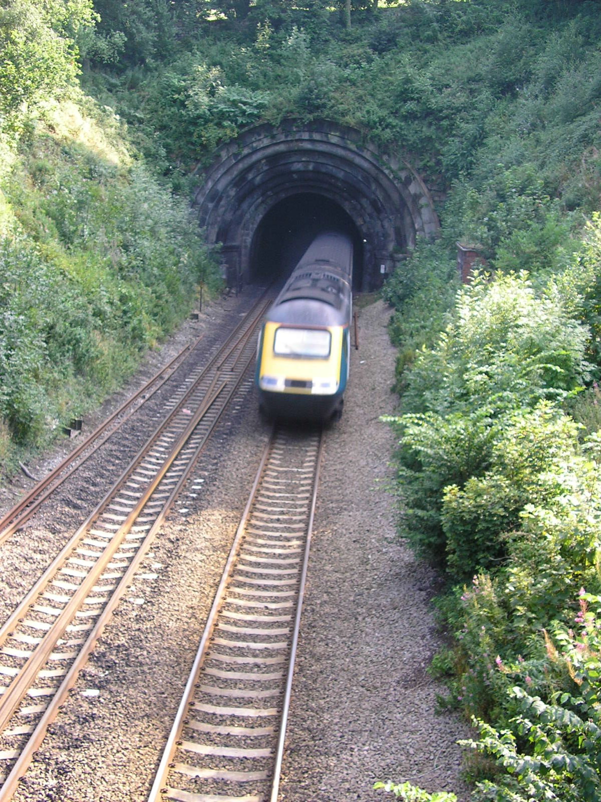
In terms of transportation, Belper is well-connected by road and rail. The A6 road runs through the town, providing easy access to surrounding areas, and the Belper railway station offers regular train services to Derby, Nottingham, and other nearby cities.

Overall, Belper offers a mix of historical charm, scenic beauty, and modern amenities, making it an attractive place to live and visit in Derbyshire.

If you have any feedback on the listing, please let us know in the comments section below.
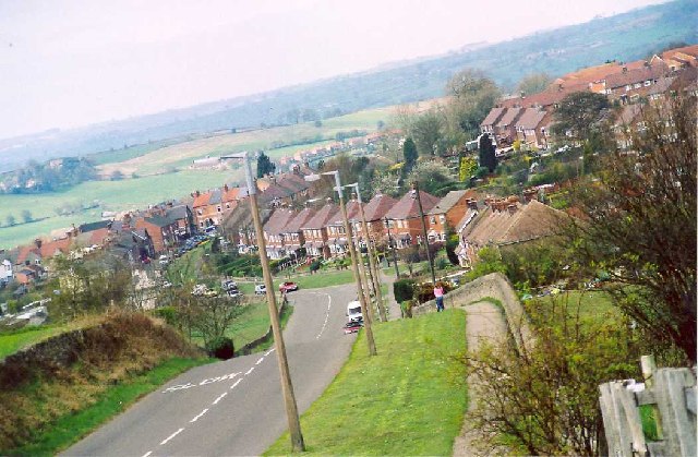
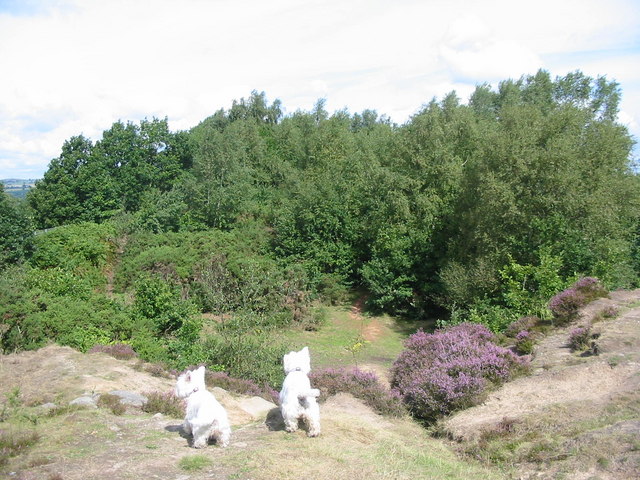
Belper Images

Images are sourced within 2km of 53.000762/-1.480652 or Grid Reference SK3444. Thanks to Geograph Open Source API. All images are credited.

New houses, Cowhill Belper is expanding, some new houses on Cowhill, to the southeast of the town.
New houses, Cowhill
Belper is expanding, some new houses on Cowhill, to the southeast of the town.
Bargate Rd, Belper This is looking North West along Bargate Rd with the edge of Parks Estate to the right (an ancient deer park). A few hundred metres down the hill you can see over the township of Belper. This was the home of the Strutt family dynasty and their cotton mills.
Bargate Rd, Belper
This is looking North West along Bargate Rd with the edge of Parks Estate to the right (an ancient deer park). A few hundred metres down the hill you can see over the township of Belper. This was the home of the Strutt family dynasty and their cotton mills.
Holy Trinity Church & War Memorial, Milford Holy Trinity Church was built in 1848 at a cost of £2,000. The War Memorial was erected in 1926.
Holy Trinity Church & War Memorial, Milford
Holy Trinity Church was built in 1848 at a cost of £2,000. The War Memorial was erected in 1926.
Duffieldbank House from Duffieldbank The land rises steeply on the east of the Derwent near Duffield.  Duffieldbank House overlooks the river and enjoys views over the village of Duffield.
Duffieldbank House from Duffieldbank
The land rises steeply on the east of the Derwent near Duffield. Duffieldbank House overlooks the river and enjoys views over the village of Duffield.
Ecclesbourne Valley Railway Station The railway between Duffield and Wirksworth was closed in the 1980s when the last freight trains ran from the quarries just north of Wirksworth.  The line lay dormant for many years but has now been taken over by the Ecclesbourne Valley Railway group and has been reopened for preserved steam and diesel power.  A new station has been provided as shown in the photo.  The main line station lies just to the right of this photo - the preserved and main lines are no longer connected.
Ecclesbourne Valley Railway Station
The railway between Duffield and Wirksworth was closed in the 1980s when the last freight trains ran from the quarries just north of Wirksworth. The line lay dormant for many years but has now been taken over by the Ecclesbourne Valley Railway group and has been reopened for preserved steam and diesel power. A new station has been provided as shown in the photo. The main line station lies just to the right of this photo - the preserved and main lines are no longer connected.
Duffield Castle Duffield Castle is/was an 11th century stone motte and bailey fortress, founded by Henry de Ferrers, Earl of Derby.  The castle was destroyed in the 13th century and not much survives other than a few areas of tarmac and concrete showing the outlines.
Duffield Castle
Duffield Castle is/was an 11th century stone motte and bailey fortress, founded by Henry de Ferrers, Earl of Derby. The castle was destroyed in the 13th century and not much survives other than a few areas of tarmac and concrete showing the outlines.
Chevinend This track runs along a high ridge overlooking the Derwent valley just north of Duffield.  Chevin golf course extends up onto the ridge and enjoys spectacular views over Duffield and down the valley to Derby.
Chevinend
This track runs along a high ridge overlooking the Derwent valley just north of Duffield. Chevin golf course extends up onto the ridge and enjoys spectacular views over Duffield and down the valley to Derby.
Wall on Chevin Ridge This wall is next to the track that leads over the Chevin ridge just north of Duffield.  The wall is a very substantial construction but stands isolated and serves no obvious purpose.  It has been suggested that it was once part of a firing range and the location at the end of a long narrow field seems to support this.
Wall on Chevin Ridge
This wall is next to the track that leads over the Chevin ridge just north of Duffield. The wall is a very substantial construction but stands isolated and serves no obvious purpose. It has been suggested that it was once part of a firing range and the location at the end of a long narrow field seems to support this.
Quarry on Firestone Hill This disused quarry is on the top of Firestone Hill - a high ridge overlooking the Derwent valley near Belper.
Quarry on Firestone Hill
This disused quarry is on the top of Firestone Hill - a high ridge overlooking the Derwent valley near Belper.
Site of Colour Works in Duffield This is the site of the former colour works in Duffield.  Now cleared and soon to be turned over the inevitable residential development by the look of the encroaching houses in the background.
Site of Colour Works in Duffield
This is the site of the former colour works in Duffield. Now cleared and soon to be turned over the inevitable residential development by the look of the encroaching houses in the background.
Railway south of Belper A train heads down the Derwent Valley towards Derby.
Railway south of Belper
A train heads down the Derwent Valley towards Derby.
Sandbed Lane, Bargate Looking towards Openwoodgate.
Sandbed Lane, Bargate
Looking towards Openwoodgate.
Holbrook Moor Looking towards Bargate.
Holbrook Moor
Looking towards Bargate.
Stone terrace houses, Makeney Terrace houses, overlooking the Derwent River valley, catching the late afternoon sun. The Derwent Valley Heritage Way follows the road through Makeney.
Stone terrace houses, Makeney
Terrace houses, overlooking the Derwent River valley, catching the late afternoon sun. The Derwent Valley Heritage Way follows the road through Makeney.
Milford Mill weir Horseshoe weir on the River Derwent at Milford near Belper. Also visible the footings for a pipe or footbridge to the former mill site across the river.
Milford Mill weir
Horseshoe weir on the River Derwent at Milford near Belper. Also visible the footings for a pipe or footbridge to the former mill site across the river.
Sunnyhill Triangulation pillar in a small field.
Sunnyhill
Triangulation pillar in a small field.
Milford Mills This former textile mill on the River Derwent now provides a home to a number of small businesses
Milford Mills
This former textile mill on the River Derwent now provides a home to a number of small businesses
Mill leat, Milford Mills The size of the leat gives a good indication of how much power was available when this mill was still water powered.
Mill leat, Milford Mills
The size of the leat gives a good indication of how much power was available when this mill was still water powered.
Show me another place!

Belper is located at Grid Ref: SK3444 (Lat: 53.000762, Lng: -1.480652)

Administrative County: Derbyshire

District: Amber Valley

Police Authority: Derbyshire

What 3 Words

///safety.patrolled.cookie. Near Duffield, Derbyshire

Related Wikis

Nearby Amenities

Located within 500m of 53.000762,-1.480652
Traffic Signals
Lat/Long: 53.0030447/-1.4776685
Note: 40 mph speed limit sign NW-bound
Lat/Long: 53.0039764/-1.4779476
Milford
Is In Country: UK
Is In County: Derbyshire
Place: village
Wikidata: Q6851692
Wikipedia: en:Milford, Derbyshire
Lat/Long: 53.0027022/-1.4807007
Makeney
Is In: Derbyshire, England, UK
Place: village
Lat/Long: 52.9980653/-1.478086
Ebenezer Chapel
Addr City: Belper
Addr Postcode: DE56 0RR
Addr Street: The Bridge
Addr Village: Milford
Operator: Derbyshire Holidays
Tourism: self_catering
Lat/Long: 53.0024864/-1.4771956
Barrier: stile
Material: stone
Stile: squeezer
Lat/Long: 53.0013587/-1.4754618
Barrier: stile
Material: wood
Steps: 2
Stile: stepover
Lat/Long: 53.0008955/-1.4755704
Post Box
Brand: Royal Mail
Brand Wikidata: Q638098
Brand Wikipedia: en:Royal Mail
Collection Times: Mo-Fr 09:00; Sa 07:00
Operator: Royal Mail
Operator Wikidata: Q638098
Post Box Type: wall
Ref: DE56 571D
Royal Cypher: GR
Royal Cypher Wikidata: Q33102273
Lat/Long: 52.9974289/-1.4774177
Post Box
Operator: Royal Mail
Operator Wikidata: Q638098
Ref: DE56 476
Lat/Long: 53.0025331/-1.4805248
Barrier: stile
Material: stone
Stile: squeezer
Lat/Long: 53.0019443/-1.474133
Barrier: stile
Material: wood
Steps: 2
Stile: stepover
Lat/Long: 52.9992212/-1.475963
Note: 30 mph sign northbound
Lat/Long: 52.9996584/-1.4825207
Ele: 94.0000000
Lat/Long: 53.000274/-1.4746185
Ele: 88.0000000
Lat/Long: 53.0002807/-1.4751257
Ele: 50.0000000
Lat/Long: 53.0008379/-1.4786148
Ele: 53.0000000
Lat/Long: 53.0002967/-1.4785286
Ele: 92.0000000
Lat/Long: 53.0010567/-1.4748888
Bus Stop
Strutt Arms
Bench: yes
Bus: yes
Public Transport: platform
Shelter: yes
Lat/Long: 53.001942/-1.4805955
Turning Circle
Lat/Long: 53.0018404/-1.4825747
Bus Stop
Strutt Arms
Bus: yes
Public Transport: platform
Lat/Long: 53.0012974/-1.480795
Dojo
Kawagishi Dojo
Leisure: sports_centre
Sport: Martial Arts
Lat/Long: 53.0005289/-1.479277
Riverside Fitness Centre
Addr City: Belper
Addr Postcode: DE56 0RU
Addr Street: Makeney Road
Addr Village: Milford
Fhrs Id: 1128
Leisure: sports_centre
Lat/Long: 53.0007291/-1.4790926
Historic: memorial
Inscription: IN MEMORY OF THOSE WHO FELL 1914 - 1919
Memorial: war_memorial
Lat/Long: 53.0044918/-1.4785945
Barrier: stile
Material: wood
Source: survey;gps
Stile: squeezer
Lat/Long: 52.9984699/-1.4752115
Social Facility
Coach House Nursing Home
Addr City: Belper
Addr Postcode: DE56 0QF
Addr Street: Derby Road
Addr Village: Milford
Fhrs Id: 1085
Social Facility: group_home
Social Facility For: senior
Lat/Long: 53.0014737/-1.4814853
Milford Social Club
Addr City: Belper
Addr Housenumber: 5
Addr Postcode: DE56 0QH
Addr Street: Chevin Road
Addr Village: Milford
Club: yes
Fhrs Id: 1076
Lat/Long: 53.0030011/-1.4804441
Addr City: Belper
Addr Housenumber: 10
Addr Parentstreet: Chevin Road
Addr Postcode: DE56 0QJ
Addr Street: Bank Buildings
Addr Village: Milford
Lat/Long: 53.0047358/-1.4841419
Power: substation
Lat/Long: 53.002957/-1.4774193
Public Bookcase
Booth: K6
Colour: red
Disused Amenity: telephone
Listed Status: Grade II
Man Made: telephone_box
Public Bookcase Type: phone_box
Tourism: information
Lat/Long: 53.0028827/-1.4775266
Defibrillator
Access: yes
Defibrillator Location: next to red telephone box on Derby Road in Belper
Emergency: defibrillator
Indoor: no
Ref GB The Circuit: 5616B73F-24AB-4DD6-9FE2-B04400A4858A
Lat/Long: 53.0029295/-1.4775132
Addr City: Belper
Addr Housename: The Old Bike Shop
Addr Housenumber: 2
Addr Postcode: DE56 0RR
Addr Street: The Bridge
Addr Village: Milford
Lat/Long: 53.0024211/-1.4776527
Addr City: Belper
Addr Housename: Quarry House
Addr Postcode: DE56 0RR
Addr Street: The Bridge
Addr Village: Milford
Lat/Long: 53.0025567/-1.477583
Addr City: Belper
Addr Housename: The Old Post Office
Addr Postcode: DE56 0RR
Addr Street: The Bridge
Addr Village: Milford
Lat/Long: 53.0026567/-1.4775588
Addr City: Belper
Addr Housename: Quarry Cottage
Addr Postcode: DE56 0RR
Addr Street: The Bridge
Addr Village: Milford
Lat/Long: 53.0027294/-1.4775454
Addr City: Belper
Addr Housenumber: 4
Addr Postcode: DE56 0RR
Addr Street: The Bridge
Addr Village: Milford
Lat/Long: 53.0028085/-1.4775347
Addr City: Belper
Addr Housenumber: 1
Addr Postcode: DE56 0RR
Addr Street: The Bridge
Addr Village: Milford
Lat/Long: 53.0026648/-1.4779129
Addr City: Belper
Addr Housename: Riverbank House
Addr Housenumber: 1
Addr Postcode: DE56 0RR
Addr Street: The Bridge
Addr Village: Milford
Lat/Long: 53.0027665/-1.4778914
Riverbank Floristry
Addr City: Belper
Addr Housename: Riverbank House
Addr Housenumber: 1
Addr Postcode: DE56 0RR
Addr Street: The Bridge
Addr Village: Milford
Shop: florist
Website: https://www.riverbankfloristry.co.uk/
Lat/Long: 53.0028537/-1.4778807
Nealies Function Room
Addr City: Belper
Addr Postcode: DE56 0QF
Addr Street: Derby Road
Addr Village: Milford
Club: yes
Contact Facebook: https://www.facebook.com/nealiesfunctionroom/
Fhrs Id: 1084
Not Addr Postcode: DE56 0QR
Lat/Long: 53.0007913/-1.4806325
Tourism: artwork
Lat/Long: 53.0022275/-1.4803063
Bus Stop
Hopping Hill
Bus: yes
Naptan AtcoCode: 1000DMDR3928
Naptan NaptanCode: dbsatgpa
Public Transport: platform
Shelter: no
Lat/Long: 53.0043312/-1.4785865
Bus Stop
Hopping Hill
Bus: yes
Naptan AtcoCode: 1000DMDR3929
Naptan NaptanCode: dbsatgpd
Public Transport: platform
Lat/Long: 53.0041186/-1.4780447
Bus Stop
Makeney Road
Bus: yes
Naptan AtcoCode: 1000DMDR3927
Naptan NaptanCode: dbsatgmw
Public Transport: platform
Shelter: no
Lat/Long: 53.0028653/-1.4776558
Bus Stop
Makeney Road
Bench: no
Bus: yes
Public Transport: platform
Shelter: no
Lat/Long: 53.0028572/-1.4777771
Generator Method: photovoltaic
Generator Output Electricity: yes
Generator Source: solar
Generator Type: solar_photovoltaic_panel
Location: roof
Power: generator
Lat/Long: 53.0037244/-1.4754411
Generator Method: photovoltaic
Generator Output Electricity: yes
Generator Source: solar
Generator Type: solar_photovoltaic_panel
Location: roof
Power: generator
Lat/Long: 53.0037325/-1.4755028
Generator Method: photovoltaic
Generator Output Electricity: yes
Generator Source: solar
Generator Type: solar_photovoltaic_panel
Location: roof
Power: generator
Lat/Long: 53.0014532/-1.4858011
Generator Method: photovoltaic
Generator Output Electricity: yes
Generator Source: solar
Generator Type: solar_photovoltaic_panel
Location: roof
Power: generator
Lat/Long: 53.0014565/-1.4858937
Power: pole
Lat/Long: 52.9965598/-1.4783853
Power: pole
Lat/Long: 52.9965049/-1.4793831
Power: pole
Lat/Long: 52.9964419/-1.4803755
Power: pole
Lat/Long: 52.9963919/-1.4813572
Pub
The Elephant & Peacock
Addr City: Belper
Addr Postcode: DE56 0QF
Addr Street: Derby Road
Addr Village: Milford
Contact Facebook: https://www.facebook.com/theelephantandpeacock
Contact Instagram: https://www.instagram.com/theelephantandpeacock
Email: info@elephantandpeacock.co.uk
Fhrs Id: 1083
Food: yes
Note: Pub classics with an indian twist
Opening Hours: Mo-Su 12:00-23:00
Outdoor Seating: yes
Phone: +44 1332 300818
Real Ale: yes
Website: https://www.elephantandpeacock.co.uk/
Lat/Long: 53.0019209/-1.480219
The data included in this document is from www.openstreetmap.org. The data is made available under ODbL.

Have you been to Belper?

Leave your review of Belper below (or comments, questions and feedback).