Beech Hill

Civil Parish in Berkshire

England

Beech Hill

Barge Lane at the junction of Welsh Lane
Barge Lane at the junction of Welsh Lane Credit: David Howard

The requested URL returned error: 429 Too Many Requests

If you have any feedback on the listing, please let us know in the comments section below.
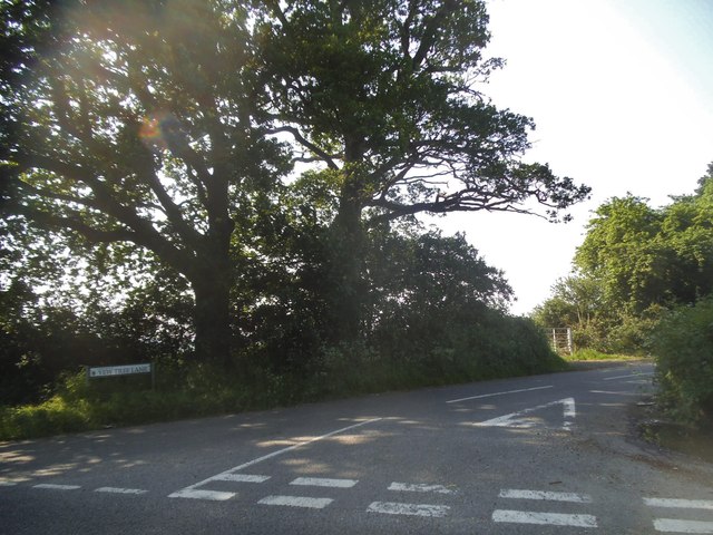
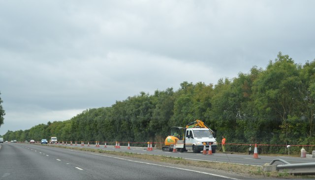
Beech Hill Images

Images are sourced within 2km of 51.375719/-1.000129 or Grid Reference SU6964. Thanks to Geograph Open Source API. All images are credited.

Barge Lane at the junction of Welsh Lane
Bridge on Chequer Lane, Stanford End
Abandoned track in Fair Cross
Approach to Barge Lane on A33 Taken just past where the road crosses a substantial land drain.
Approach to Barge Lane on A33
Taken just past where the road crosses a substantial land drain.
Beech Hill Road Bridge, A33 The A33 is a 52 mile long road from Reading to Southampton.
It is split into two distinct sections - the first is the main cross country route from Reading to Basingstoke, and the second the ancient Roman road from Popham, through Winchester, to Southampton. 
<span class="nowrap"><a title="http://www.sabre-roads.org.uk/wiki/index.php?title=A33" rel="nofollow ugc noopener" href="http://www.sabre-roads.org.uk/wiki/index.php?title=A33">Link</a><img style="margin-left:2px;" alt="External link" title="External link - shift click to open in new window" src="https://s1.geograph.org.uk/img/external.png" width="10" height="10"/></span>
Beech Hill Road Bridge, A33
The A33 is a 52 mile long road from Reading to Southampton. It is split into two distinct sections - the first is the main cross country route from Reading to Basingstoke, and the second the ancient Roman road from Popham, through Winchester, to Southampton. LinkExternal link
Yew Tree Lane at the junction of Beech Hill Road
Lambs Lane at the junction of Beech Hill Road
Private track off Beech Hill Road
Stanford End Pumping Station A groundwater source belonging to the Environment Agency.
Designed to be used for river augmentation in times of drought.
Stanford End Pumping Station
A groundwater source belonging to the Environment Agency. Designed to be used for river augmentation in times of drought.
River Loddon at Stanford End Bridge
Barge Lane, Stanford End A quiet, narrow country lane which suddenly meets the A33 dual carriageway a short way round the corner.
Barge Lane, Stanford End
A quiet, narrow country lane which suddenly meets the A33 dual carriageway a short way round the corner.
Fields West of Barge Lane
Beech Hill Road Bridge, A33 The A33 is a 52 mile long road from Reading to Southampton.
It is split into two distinct sections - the first is the main cross country route from Reading to Basingstoke, and the second the ancient Roman road from Popham, through Winchester, to Southampton. 
<span class="nowrap"><a title="http://www.sabre-roads.org.uk/wiki/index.php?title=A33" rel="nofollow ugc noopener" href="http://www.sabre-roads.org.uk/wiki/index.php?title=A33">Link</a><img style="margin-left:2px;" alt="External link" title="External link - shift click to open in new window" src="https://s1.geograph.org.uk/img/external.png" width="10" height="10"/></span>
Beech Hill Road Bridge, A33
The A33 is a 52 mile long road from Reading to Southampton. It is split into two distinct sections - the first is the main cross country route from Reading to Basingstoke, and the second the ancient Roman road from Popham, through Winchester, to Southampton. LinkExternal link
Roadworks, A33 The A33 is a 52 mile long road from Reading to Southampton.
It is split into two distinct sections - the first is the main cross country route from Reading to Basingstoke, and the second the ancient Roman road from Popham, through Winchester, to Southampton. 
<span class="nowrap"><a title="http://www.sabre-roads.org.uk/wiki/index.php?title=A33" rel="nofollow ugc noopener" href="http://www.sabre-roads.org.uk/wiki/index.php?title=A33">Link</a><img style="margin-left:2px;" alt="External link" title="External link - shift click to open in new window" src="https://s1.geograph.org.uk/img/external.png" width="10" height="10"/></span>
Roadworks, A33
The A33 is a 52 mile long road from Reading to Southampton. It is split into two distinct sections - the first is the main cross country route from Reading to Basingstoke, and the second the ancient Roman road from Popham, through Winchester, to Southampton. LinkExternal link
A33, southbound The A33 is a 52 mile long road from Reading to Southampton.
It is split into two distinct sections - the first is the main cross country route from Reading to Basingstoke, and the second the ancient Roman road from Popham, through Winchester, to Southampton. 
<span class="nowrap"><a title="http://www.sabre-roads.org.uk/wiki/index.php?title=A33" rel="nofollow ugc noopener" href="http://www.sabre-roads.org.uk/wiki/index.php?title=A33">Link</a><img style="margin-left:2px;" alt="External link" title="External link - shift click to open in new window" src="https://s1.geograph.org.uk/img/external.png" width="10" height="10"/></span>
A33, southbound
The A33 is a 52 mile long road from Reading to Southampton. It is split into two distinct sections - the first is the main cross country route from Reading to Basingstoke, and the second the ancient Roman road from Popham, through Winchester, to Southampton. LinkExternal link
Taylor Lane Bridge, A33 The A33 is a 52 mile long road from Reading to Southampton.
It is split into two distinct sections - the first is the main cross country route from Reading to Basingstoke, and the second the ancient Roman road from Popham, through Winchester, to Southampton. 
<span class="nowrap"><a title="http://www.sabre-roads.org.uk/wiki/index.php?title=A33" rel="nofollow ugc noopener" href="http://www.sabre-roads.org.uk/wiki/index.php?title=A33">Link</a><img style="margin-left:2px;" alt="External link" title="External link - shift click to open in new window" src="https://s1.geograph.org.uk/img/external.png" width="10" height="10"/></span>
Taylor Lane Bridge, A33
The A33 is a 52 mile long road from Reading to Southampton. It is split into two distinct sections - the first is the main cross country route from Reading to Basingstoke, and the second the ancient Roman road from Popham, through Winchester, to Southampton. LinkExternal link
Weak Bridge over the Loddon Weight and width restrictions on King's Bridge which wasn't built with today's traffic in mind.
The bridge's iron framework was cast by Griffith's Railway Foundry in Reading. <a href="https://www.geograph.org.uk/photo/6220851">SU7164 : S Griffith Railway Foundry</a>
<span class="nowrap"><a title="https://bell-tower.org.uk/wp-content/uploads/Local_foundries.pdf" rel="nofollow ugc noopener" href="https://bell-tower.org.uk/wp-content/uploads/Local_foundries.pdf">Link</a><img style="margin-left:2px;" alt="External link" title="External link - shift click to open in new window" src="https://s1.geograph.org.uk/img/external.png" width="10" height="10"/></span>
Weak Bridge over the Loddon
Weight and width restrictions on King's Bridge which wasn't built with today's traffic in mind. The bridge's iron framework was cast by Griffith's Railway Foundry in Reading. SU7164 : S Griffith Railway Foundry LinkExternal link
S Griffith Railway Foundry A nicely highlighted maker's name plate on the ironwork of King's Bridge over the River Loddon.
<a href="https://www.geograph.org.uk/photo/6220848">SU7164 : Weak Bridge over the Loddon</a>
Griffith's was one of a number of ironworks which operated around Reading's Vastern Road near the Great Western Railway sidings. <span class="nowrap"><a title="https://bell-tower.org.uk/wp-content/uploads/Local_foundries.pdf" rel="nofollow ugc noopener" href="https://bell-tower.org.uk/wp-content/uploads/Local_foundries.pdf">Link</a><img style="margin-left:2px;" alt="External link" title="External link - shift click to open in new window" src="https://s1.geograph.org.uk/img/external.png" width="10" height="10"/></span>
S Griffith Railway Foundry
A nicely highlighted maker's name plate on the ironwork of King's Bridge over the River Loddon. SU7164 : Weak Bridge over the Loddon Griffith's was one of a number of ironworks which operated around Reading's Vastern Road near the Great Western Railway sidings. LinkExternal link
Show me another place!

Beech Hill is located at Grid Ref: SU6964 (Lat: 51.375719, Lng: -1.000129)

Unitary Authority: West Berkshire

Police Authority: Thames Valley

What 3 Words

///mouse.paused.dangerously. Near Stratfield Mortimer, Berkshire

Nearby Locations

Beech Hill Beech Hill

Related Wikis

Beech Hill, Berkshire

Beech Hill is a small village and civil parish in Berkshire, England. It is in the south east of the West Berkshire unitary authority area and bounds Hampshire...

Stratfield Saye Priory

Stratfield Saye Priory was an alien priory belonging to the Abbey of Vallemont, located at Beech Hill in the Berkshire part of the parish of Stratfield...

Beaumys Castle

Beaumys Castle, also known as Beams Castle, was a 14th-century fortified manor house in the parish of Swallowfield in the English county of Berkshire....

Stanford End Mill and River Loddon

Stanford End Mill and River Loddon is a 11.8-hectare (29-acre) biological Site of Special Scientific Interest south of Reading in Berkshire. It covers...

Nearby Amenities

Located within 500m of 51.375719,-1.000129
Post Box
Mapillary: 380977753184429
Operator: Royal Mail
Post Box Mounting: pier
Post Box Type: lamp
Survey Date: 2020-11-02
Lat/Long: 51.3720343/-1.003005
Beech Hill
Place: village
Source: Local knowledge
Wikidata: Q4623425
Lat/Long: 51.3733373/-0.9989428
Post Box
Lat/Long: 51.3742094/-0.9960985
Bench
Seats: 8
Lat/Long: 51.3733873/-0.9993061
Trunkwell Farm
Landuse: farm
Note Retag: CS #48756035
Source: OS OpenData StreetView
Lat/Long: 51.3758088/-1.0057481
Home Farm
Landuse: farm
Note Retag: CS #48756035
Source: OS OpenData StreetView
Lat/Long: 51.3771714/-0.9969241
Leisure: playground
Lat/Long: 51.3730966/-0.9987579
Disused Amenity: cafe
Disused Name: Beech Hill Village Shop
Lat/Long: 51.3741301/-0.9987141
Disused Name: Beech Hill Village Shop
Disused Shop: convenience
Lat/Long: 51.3742105/-0.9989716
Give Way
Direction: forward
Lat/Long: 51.3738665/-0.9985697
Advertising: board
Lat/Long: 51.3742141/-0.9960483
Advertising: board
Mapillary: 303519121401873
Support: pole
Survey Date: 2021-04-17
Lat/Long: 51.3739436/-0.9977302
Barrier: yes
Lat/Long: 51.3782891/-0.9947282
The data included in this document is from www.openstreetmap.org. The data is made available under ODbL.

Have you been to Beech Hill?

Leave your review of Beech Hill below (or comments, questions and feedback).