Bedingfield

Civil Parish in Suffolk Mid Suffolk

England

Bedingfield

Cereal crop beside Eye Road
Cereal crop beside Eye Road Credit: JThomas

Bedingfield is a civil parish located in the county of Suffolk, England. Situated in the East Anglian region, it is a small and rural area with a population of around 200 residents. The parish is part of the Mid Suffolk district and is approximately 8 miles northeast of the town of Ipswich.

The landscape of Bedingfield is characterized by rolling hills, picturesque farmlands, and charming countryside views. The area is predominantly agricultural, with farming being the primary economic activity. The parish is known for its beautiful countryside walks and cycling routes, attracting outdoor enthusiasts and nature lovers.

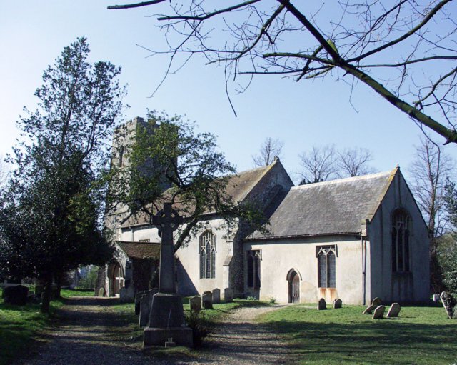
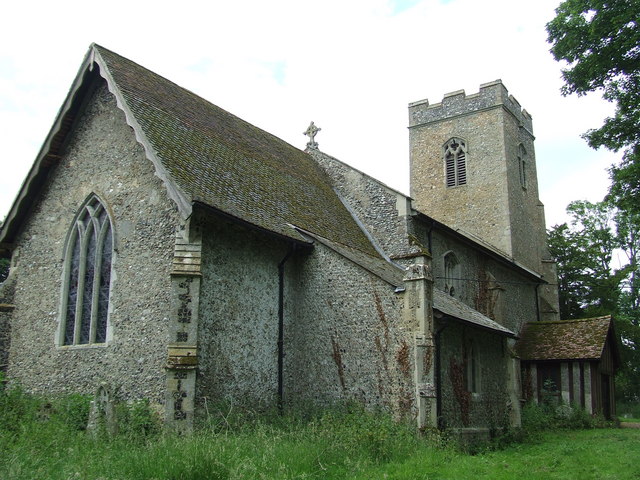
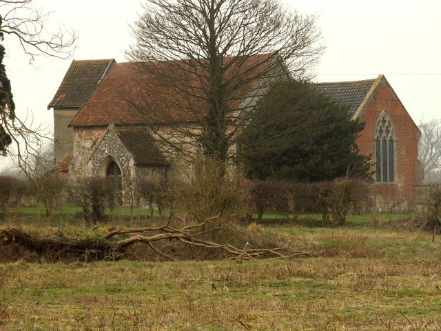
The heart of the parish is the village of Bedingfield, which has a rich history dating back to medieval times. The village is home to a handful of historic buildings, including the Grade II listed St. Mary's Church, which dates back to the 14th century. The church features stunning architectural details and houses several notable medieval brasses.

Despite its small size, Bedingfield offers a tight-knit community atmosphere with a strong sense of local pride. The village has a small village hall that serves as a focal point for community events and gatherings. Residents can also enjoy a peaceful and tranquil lifestyle, away from the hustle and bustle of larger towns and cities.

Overall, Bedingfield is a charming and idyllic rural parish in Suffolk, offering a close-knit community, beautiful countryside scenery, and a slice of English village life.

If you have any feedback on the listing, please let us know in the comments section below.

Bedingfield Images

Images are sourced within 2km of 52.266844/1.197883 or Grid Reference TM1868. Thanks to Geograph Open Source API. All images are credited.

Cereal crop beside Eye Road
Minor road towards Thorndon
Eye Road (B1077)
Eye Road (B1077)
Church of St Mary, Bedingfield <span class="nowrap"><a title="https://historicengland.org.uk/listing/the-list/list-entry/1213550?section=official-list-entry" rel="nofollow ugc noopener" href="https://historicengland.org.uk/listing/the-list/list-entry/1213550?section=official-list-entry">Link</a><img style="margin-left:2px;" alt="External link" title="External link - shift click to open in new window" src="https://s1.geograph.org.uk/img/external.png" width="10" height="10"/></span>
Church of St Mary, Bedingfield
Interior of Church of St Mary, Bedingfield <span class="nowrap"><a title="https://historicengland.org.uk/listing/the-list/list-entry/1213550?section=official-list-entry" rel="nofollow ugc noopener" href="https://historicengland.org.uk/listing/the-list/list-entry/1213550?section=official-list-entry">Link</a><img style="margin-left:2px;" alt="External link" title="External link - shift click to open in new window" src="https://s1.geograph.org.uk/img/external.png" width="10" height="10"/></span>
Interior of Church of St Mary, Bedingfield
Church of St Mary, Bedingfield <span class="nowrap"><a title="https://historicengland.org.uk/listing/the-list/list-entry/1213550?section=official-list-entry" rel="nofollow ugc noopener" href="https://historicengland.org.uk/listing/the-list/list-entry/1213550?section=official-list-entry">Link</a><img style="margin-left:2px;" alt="External link" title="External link - shift click to open in new window" src="https://s1.geograph.org.uk/img/external.png" width="10" height="10"/></span>
Church of St Mary, Bedingfield
Bedingfield War Memorial <span class="nowrap"><a title="https://historicengland.org.uk/listing/the-list/list-entry/1452103?section=official-list-entry" rel="nofollow ugc noopener" href="https://historicengland.org.uk/listing/the-list/list-entry/1452103?section=official-list-entry">Link</a><img style="margin-left:2px;" alt="External link" title="External link - shift click to open in new window" src="https://s1.geograph.org.uk/img/external.png" width="10" height="10"/></span>
Bedingfield War Memorial
Bedingfield
Bedingfield
Footpath at Kenton This footpath leads to others as it approaches Moat Farm.
Footpath at Kenton
This footpath leads to others as it approaches Moat Farm.
These buildings stand by Oak Farm, near Kenton According to the O/S map these buildings are part of, what is known as, Station Croft. It looks like they may be disused.
These buildings stand by Oak Farm, near Kenton
According to the O/S map these buildings are part of, what is known as, Station Croft. It looks like they may be disused.
Cottages by Fleming's Hall
Hall Road, looking towards Bedingfield
St. Mary's church at Bedingfield This view of the 14th century church, is from Manor Farm. Inside the church there is a splendid double-hammerbeam roof.
St. Mary's church at Bedingfield
This view of the 14th century church, is from Manor Farm. Inside the church there is a splendid double-hammerbeam roof.
A view of Park Farm
A view of Park Farm
Thatched cottage at Southolt
Road from Kenton to Bedingfield
Footpath just west of Bedingfield
Footpath To The Church Footpath through a wheat field leading to the church of All Saints Kenton, Suffolk.
Footpath To The Church
Footpath through a wheat field leading to the church of All Saints Kenton, Suffolk.
Show me another place!

Bedingfield is located at Grid Ref: TM1868 (Lat: 52.266844, Lng: 1.197883)

Administrative County: Suffolk

District: Mid Suffolk

Police Authority: Suffolk

What 3 Words

///dodges.cheerily.marinated. Near Debenham, Suffolk

Nearby Locations

Bedingfield

Related Wikis

Southolt

Southolt is a village and civil parish in Suffolk, about 4+1⁄2 miles (7 km) southeast of Eye, on the road between Bedingfield and Worlingworth. == History... ==

Bedingfield

Bedingfield is a village and civil parish in the Mid Suffolk district of Suffolk, England. Rishangles and Southolt were included in the population at the...

Kenton railway station (Suffolk)

Kenton was a railway station on the Mid-Suffolk Light Railway. The station was located a mile north of the hamlet of Kenton. == History == Opened by the...

Rishangles

Rishangles is a village and civil parish in the Mid Suffolk district of Suffolk in eastern England. The place-name 'Rishangles' is first attested in the...

Aspall and Thorndon railway station

Aspall and Thorndon was a railway station on the Mid-Suffolk Light Railway. This station was located with Aspall to the south, Debenham 2.5 miles further...

Kenton, Suffolk

Kenton is a village and civil parish in the Mid Suffolk district of Suffolk in eastern England. Located 1.9 miles to the north-east of Debenham, in 2005...

Aspall, Suffolk

Aspall is a village and civil parish in the Mid Suffolk district of Suffolk, England. According to the 2001 census it had a population of 52, and estimated...

Redlingfield

Redlingfield is a village and civil parish in the Mid Suffolk district of Suffolk in eastern England. Located around six miles south-east of Diss, in 2011...

Have you been to Bedingfield?

Leave your review of Bedingfield below (or comments, questions and feedback).