Barrowden

Civil Parish in Rutland

England

Barrowden

The churchyard, Barrowden Looking across the Welland valley. The bridge across the river on the former railway visible in the centre of the picture.
The churchyard, Barrowden Credit: Jonathan Thacker

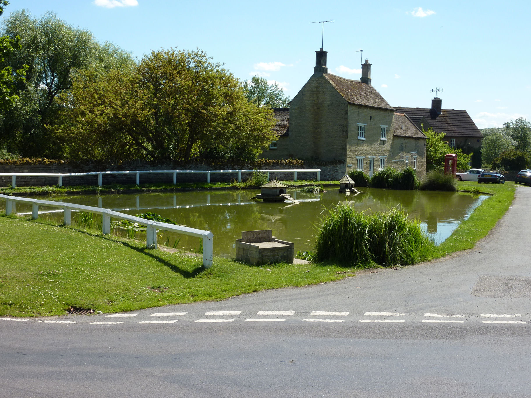
Barrowden is a civil parish located in the county of Rutland, England. It is a small and picturesque village situated approximately 8 miles east of Oakham, the county town. With a population of around 600 residents, Barrowden retains a close-knit and friendly community atmosphere.

The village is rich in history and boasts several historical buildings that date back to the medieval period. The centerpiece of Barrowden is the All Saints Church, which stands proudly at the heart of the village. This beautiful church features stunning stained glass windows and a tall spire that can be seen from miles around.

Barrowden is surrounded by stunning countryside, with rolling hills and scenic views in every direction. The village is located close to Eyebrook Reservoir, a popular spot for fishing and birdwatching. The surrounding area offers ample opportunities for outdoor activities such as walking, cycling, and horse riding.

The community in Barrowden is vibrant and active, with various clubs and societies catering to different interests. The village organizes regular events and activities, including a summer fete, art exhibitions, and a Christmas market.

Despite its small size, Barrowden is well-served by amenities. The village has a primary school, a village shop, a pub, and a post office, providing essential services for its residents. For further amenities, the nearby towns of Oakham and Uppingham offer a wider range of shops, restaurants, and leisure facilities.

Overall, Barrowden is a charming and idyllic village that offers a peaceful rural lifestyle while still providing access to essential amenities and a strong sense of community.

If you have any feedback on the listing, please let us know in the comments section below.

Barrowden Images

Images are sourced within 2km of 52.591115/-0.608133 or Grid Reference SK9400. Thanks to Geograph Open Source API. All images are credited.

The churchyard, Barrowden Looking across the Welland valley. The bridge across the river on the former railway visible in the centre of the picture.
The churchyard, Barrowden
Looking across the Welland valley. The bridge across the river on the former railway visible in the centre of the picture.
Wakerley, St John the Baptist
Wakerley Bridge This is one of the ancient bridges across the Welland, and the river marks the boundary between Rutland and Northamptonshire, Barrowden being in Rutland, and Wakerley in Northamptonshire.

The bridge dates from the 14th century, and was widened to its present width in 1793.  (Civil Engineering Heritage: Eastern & Central England
1994, E. A. Labrum, SBN 07277 1970 X)

This is a scheduled ancient monument (see <span class="nowrap"><a title="https://historicengland.org.uk/listing/the-list/list-entry/1003639" rel="nofollow ugc noopener" href="https://historicengland.org.uk/listing/the-list/list-entry/1003639">Link</a><img style="margin-left:2px;" alt="External link" title="External link - shift click to open in new window" src="https://s1.geograph.org.uk/img/external.png" width="10" height="10"/></span> ).

Half of it is a grade II listed building.  The listing at <span class="nowrap"><a title="https://historicengland.org.uk/listing/the-list/list-entry/1073960" rel="nofollow ugc noopener" href="https://historicengland.org.uk/listing/the-list/list-entry/1073960">Link</a><img style="margin-left:2px;" alt="External link" title="External link - shift click to open in new window" src="https://s1.geograph.org.uk/img/external.png" width="10" height="10"/></span> is titled "Bridge (That Part In Barrowden C Parish), Wakerley Road"
Wakerley Bridge
This is one of the ancient bridges across the Welland, and the river marks the boundary between Rutland and Northamptonshire, Barrowden being in Rutland, and Wakerley in Northamptonshire. The bridge dates from the 14th century, and was widened to its present width in 1793. (Civil Engineering Heritage: Eastern & Central England 1994, E. A. Labrum, SBN 07277 1970 X) This is a scheduled ancient monument (see LinkExternal link ). Half of it is a grade II listed building. The listing at LinkExternal link is titled "Bridge (That Part In Barrowden C Parish), Wakerley Road"
Bridge over the Welland The bridge is described in Civil Engineering Heritage: Eastern & Central England, E. A. Labrum, 1994 where it says

"A five-arch stone bridge carrying a minor road, typical of such bridges from the 14th century. Since the bridge's widening in 1793, the arch shapes are different on the upstream side from those on the downstream side.
The original arches are the downstream ones — pointed, with chamfered arch rings. Upstream they are segmental.
The spans vary from 9ft 10in to 11ft 4in. The piers are 6ft wide and the bridge is 81ft long. The 1793 work added 2ft to the bridge's width to make the present dimension of 12ft between the stone parapets.
There are cutwaters on both sides and a carved head on the keystone of the second arch from the north end."

This is a scheduled ancient monument (see <span class="nowrap"><a title="https://historicengland.org.uk/listing/the-list/list-entry/1003639" rel="nofollow ugc noopener" href="https://historicengland.org.uk/listing/the-list/list-entry/1003639">Link</a><img style="margin-left:2px;" alt="External link" title="External link - shift click to open in new window" src="https://s1.geograph.org.uk/img/external.png" width="10" height="10"/></span> ) although the listing there lacks anything like the detail quoted above.
Bridge over the Welland
The bridge is described in Civil Engineering Heritage: Eastern & Central England, E. A. Labrum, 1994 where it says "A five-arch stone bridge carrying a minor road, typical of such bridges from the 14th century. Since the bridge's widening in 1793, the arch shapes are different on the upstream side from those on the downstream side. The original arches are the downstream ones — pointed, with chamfered arch rings. Upstream they are segmental. The spans vary from 9ft 10in to 11ft 4in. The piers are 6ft wide and the bridge is 81ft long. The 1793 work added 2ft to the bridge's width to make the present dimension of 12ft between the stone parapets. There are cutwaters on both sides and a carved head on the keystone of the second arch from the north end." This is a scheduled ancient monument (see LinkExternal link ) although the listing there lacks anything like the detail quoted above.
The River Welland The river seen from the parapet of <a href="https://www.geograph.org.uk/photo/7193606">SP9599 : Wakerley Bridge</a>.  The Welland is the county boundary, so we have Rutland on the left and Northamptonshire on the right.
The River Welland
The river seen from the parapet of SP9599 : Wakerley Bridge. The Welland is the county boundary, so we have Rutland on the left and Northamptonshire on the right.
The river from the bridge The view from the parapet of <a href="https://www.geograph.org.uk/photo/7193606">SP9599 : Wakerley Bridge</a>. The Welland is the county boundary, so we have Northamptonshire on the left and Rutland on the right.
The river from the bridge
The view from the parapet of SP9599 : Wakerley Bridge. The Welland is the county boundary, so we have Northamptonshire on the left and Rutland on the right.
A bit of a struggle I had to climb over this stile to take the image in <a href="https://www.geograph.org.uk/photo/7193612">SP9599 : Bridge over the Welland</a>.  I must be getting old, but it was rather a stretch.  This is an essential obstacle on the path called the Rutland Round.

There is a cunning lift-gate on the right to allow dogs through.
A bit of a struggle
I had to climb over this stile to take the image in SP9599 : Bridge over the Welland. I must be getting old, but it was rather a stretch. This is an essential obstacle on the path called the Rutland Round. There is a cunning lift-gate on the right to allow dogs through.
A field in Rutland The long distance path called the Rutland Round passes through this field.
A field in Rutland
The long distance path called the Rutland Round passes through this field.
A scheduled ancient monument Between Barrowden and Wakerley is one of the ancient bridges across the Welland, recently restored by Jason "the mason"  Henfrey who said “The work also included the creation of special hides for bats which have been cut into the back of new stone before being placed into the bridge. These hides replace gaps, now repaired, which bats had made their home. The new bat hides have been marked with a stone masonry mark resembling a bat.”  Although the river marks the boundary with Northamptonshire, Rutland county council assumes responsibility for the bridge and carried out the recent restoration.

This is a scheduled ancient monument (see <span class="nowrap"><a title="https://historicengland.org.uk/listing/the-list/list-entry/1003639" rel="nofollow ugc noopener" href="https://historicengland.org.uk/listing/the-list/list-entry/1003639">Link</a><img style="margin-left:2px;" alt="External link" title="External link - shift click to open in new window" src="https://s1.geograph.org.uk/img/external.png" width="10" height="10"/></span> ).

Half of it is a grade II listed building.  The listing at <span class="nowrap"><a title="https://historicengland.org.uk/listing/the-list/list-entry/1073960" rel="nofollow ugc noopener" href="https://historicengland.org.uk/listing/the-list/list-entry/1073960">Link</a><img style="margin-left:2px;" alt="External link" title="External link - shift click to open in new window" src="https://s1.geograph.org.uk/img/external.png" width="10" height="10"/></span> is titled "Bridge (That Part In Barrowden C Parish), Wakerley Road"
A scheduled ancient monument
Between Barrowden and Wakerley is one of the ancient bridges across the Welland, recently restored by Jason "the mason" Henfrey who said “The work also included the creation of special hides for bats which have been cut into the back of new stone before being placed into the bridge. These hides replace gaps, now repaired, which bats had made their home. The new bat hides have been marked with a stone masonry mark resembling a bat.” Although the river marks the boundary with Northamptonshire, Rutland county council assumes responsibility for the bridge and carried out the recent restoration. This is a scheduled ancient monument (see LinkExternal link ). Half of it is a grade II listed building. The listing at LinkExternal link is titled "Bridge (That Part In Barrowden C Parish), Wakerley Road"
St Peter's church, Barrowden A fien medieval church with a fourteenth century tower and spire <span class="nowrap"><a title="https://historicengland.org.uk/listing/the-list/list-entry/1361433?section=official-list-entry" rel="nofollow ugc noopener" href="https://historicengland.org.uk/listing/the-list/list-entry/1361433?section=official-list-entry">Link</a><img style="margin-left:2px;" alt="External link" title="External link - shift click to open in new window" src="https://s1.geograph.org.uk/img/external.png" width="10" height="10"/></span>
St Peter's church, Barrowden
A fien medieval church with a fourteenth century tower and spire LinkExternal link
Churchyard and barn, Barrowden The barn is listed <span class="nowrap"><a title="https://historicengland.org.uk/listing/the-list/list-entry/1361413?section=official-list-entry" rel="nofollow ugc noopener" href="https://historicengland.org.uk/listing/the-list/list-entry/1361413?section=official-list-entry">Link</a><img style="margin-left:2px;" alt="External link" title="External link - shift click to open in new window" src="https://s1.geograph.org.uk/img/external.png" width="10" height="10"/></span>
Churchyard and barn, Barrowden
The barn is listed LinkExternal link
Church Farmhouse, Barrowden Largely of the sixteenth and seventeenth centuries <span class="nowrap"><a title="https://historicengland.org.uk/listing/the-list/list-entry/1073985?section=official-list-entry" rel="nofollow ugc noopener" href="https://historicengland.org.uk/listing/the-list/list-entry/1073985?section=official-list-entry">Link</a><img style="margin-left:2px;" alt="External link" title="External link - shift click to open in new window" src="https://s1.geograph.org.uk/img/external.png" width="10" height="10"/></span>
Church Farmhouse, Barrowden
Largely of the sixteenth and seventeenth centuries LinkExternal link
Carey's House, Barrowden Largely of 1834 <span class="nowrap"><a title="https://historicengland.org.uk/listing/the-list/list-entry/1176903?section=official-list-entry" rel="nofollow ugc noopener" href="https://historicengland.org.uk/listing/the-list/list-entry/1176903?section=official-list-entry">Link</a><img style="margin-left:2px;" alt="External link" title="External link - shift click to open in new window" src="https://s1.geograph.org.uk/img/external.png" width="10" height="10"/></span>
Carey's House, Barrowden
Largely of 1834 LinkExternal link
Grass field, Barrowden
Long track heading north-west toward the Welland Valley Leaving the tracks of the Spanhoe airfield, this long farm track heads north-west toward the Harringworth-Wakerley road
Long track heading north-west toward the Welland Valley
Leaving the tracks of the Spanhoe airfield, this long farm track heads north-west toward the Harringworth-Wakerley road
Four structures in the Welland Valley, west of Wakerley These curious structures, situated next to the line of an old railway track immediately west of Wakerley, are the remains of calcining kilns at the short-lived Wakerley iron ore quarries, which were active only from 1916-21 as the ore was of a lower quality than had been hoped. The village website assumed a connection with the steel industry at Corby:
<span class="nowrap"><a title="http://www.any-village.com/UK/England/Northamptonshire/Wakerley/home.aspx" rel="nofollow ugc noopener" href="http://www.any-village.com/UK/England/Northamptonshire/Wakerley/home.aspx">Link</a><img style="margin-left:2px;" alt="External link" title="External link - shift click to open in new window" src="https://s1.geograph.org.uk/img/external.png" width="10" height="10"/></span>. However, there was no direct rail link to Corby, and according to the industrial historian E S Tonks, Wakerley quarry was owned by the Partington Iron & Steel Co, the ore going to its Irlam Steel Works in Manchester. Calcining at the quarry reduced the volume of the ore and made it cheaper to transport. (Thanks to John Sutton and Katy Walters for providing this information).
Four structures in the Welland Valley, west of Wakerley
These curious structures, situated next to the line of an old railway track immediately west of Wakerley, are the remains of calcining kilns at the short-lived Wakerley iron ore quarries, which were active only from 1916-21 as the ore was of a lower quality than had been hoped. The village website assumed a connection with the steel industry at Corby: LinkExternal link. However, there was no direct rail link to Corby, and according to the industrial historian E S Tonks, Wakerley quarry was owned by the Partington Iron & Steel Co, the ore going to its Irlam Steel Works in Manchester. Calcining at the quarry reduced the volume of the ore and made it cheaper to transport. (Thanks to John Sutton and Katy Walters for providing this information).
Show me another place!

Barrowden is located at Grid Ref: SK9400 (Lat: 52.591115, Lng: -0.608133)

Unitary Authority: Rutland

Police Authority: Leicestershire

What 3 Words

///bossy.uses.unusable. Near Morcott, Rutland

Nearby Locations

Barrowden Barrowden

Related Wikis

St Peter's Church, Barrowden

St Peter's Church is a Church of England parish church in Barrowden, Rutland. It is a Grade II* listed building. == History == Parts of the church date...

Barrowden

Barrowden is a village in Rutland in the East Midlands of England. The village's name means 'burial-mound hill'. There are a number of barrows in the...

Wakerley and Barrowden railway station

Wakerley and Barrowden railway station is a former railway station in Wakerley, Northamptonshire, England which also served the nearby village of Barrowden...

Wakerley

Wakerley is a linear village and civil parish in the county of Northamptonshire, England. Forming part of North Northamptonshire, Wakerley is close to...

Nearby Amenities

Located within 500m of 52.591115,-0.608133
Barrowden
Is In Country: UK
Is In County: Rutland
Place: village
Source Name: photograph
Wikidata: Q2201545
Lat/Long: 52.5913531/-0.6020109
Pub
Exeter Arms
Addr City: Oakham
Addr Country: GB
Addr Housenumber: 28
Addr Postcode: LE15 8EQ
Addr Street: Main Street
Addr Village: Barrowden
Fhrs Authority: Rutland
Fhrs Id: 1153472
Fhrs Local Authority Id: 100012
Website: https://exeterarmsbarrowden.co.uk/
Wikidata: Q26594263
Lat/Long: 52.5904844/-0.6042666
Phone
Booth: K6
Covered: booth
Disused Amenity: telephone
Emergency: phone
Listed Status: Grade II
Man Made: telephone_box
Old Phone: +44 1572 747800
Lat/Long: 52.58962/-0.6047529
Turning Circle
Lat/Long: 52.5898636/-0.6066949
Church Farm
Place: farm
Source: Bing
Lat/Long: 52.5892039/-0.6067424
Durant Farm
Place: farm
Source: Bing
Lat/Long: 52.5900048/-0.6070354
Generator Method: photovoltaic
Generator Output Electricity: yes
Generator Solar Modules: 5
Generator Source: solar
Generator Type: solar_photovoltaic_panel
Location: roof
Power: generator
Lat/Long: 52.5903529/-0.6082164
Bench: yes
Leisure: picnic_table
Lat/Long: 52.5899784/-0.604173
Bench: yes
Leisure: picnic_table
Lat/Long: 52.5900476/-0.6042306
Information: guidepost
Note: old fashioned finger post road sign
Tourism: information
Lat/Long: 52.5902244/-0.6045404
Waste Basket
Lat/Long: 52.5899167/-0.6041716
Bench
Lat/Long: 52.5901163/-0.6045672
The data included in this document is from www.openstreetmap.org. The data is made available under ODbL.

Have you been to Barrowden?

Leave your review of Barrowden below (or comments, questions and feedback).