Barrow Gurney

Civil Parish in Somerset

England

Barrow Gurney

Barrow Reservoir
Barrow Reservoir Credit: Adrian and Janet Quantock

Barrow Gurney is a civil parish located in Somerset, England. Situated about 6 miles southwest of Bristol, it covers an area of around 2.5 square miles. The parish is bordered by the Bristol Channel to the west and Long Ashton to the north.

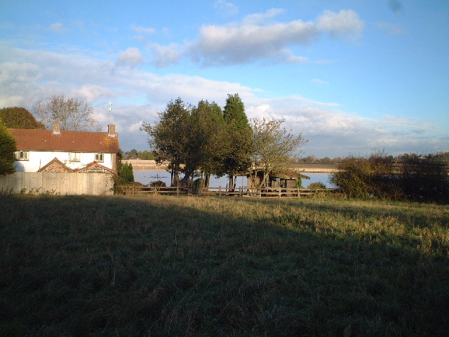
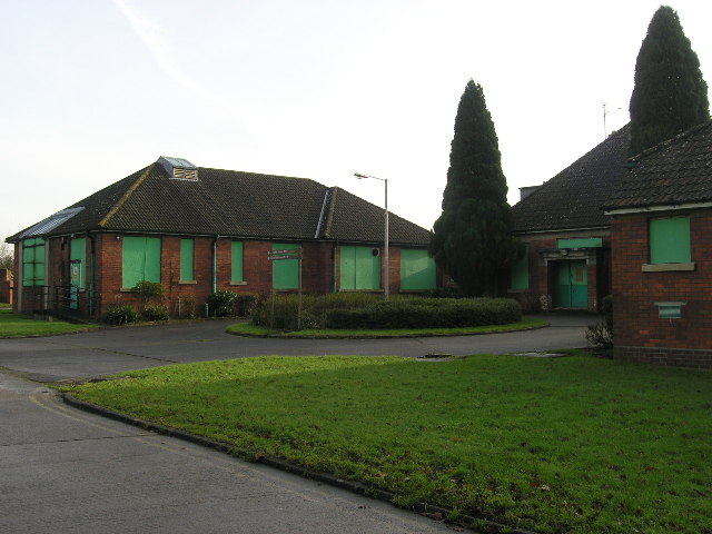
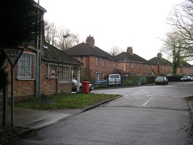
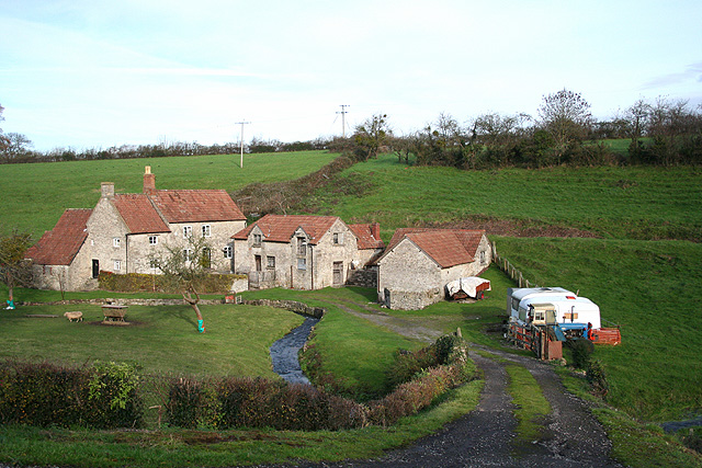
The village of Barrow Gurney is the main settlement within the parish. It is a small and picturesque village with a population of around 200 people. The architecture of the village reflects its long history, with some buildings dating back to the 16th century. The centerpiece of the village is the Church of St. Mary, which dates back to the 13th century and is a Grade II listed building.

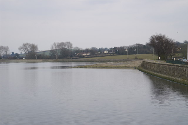
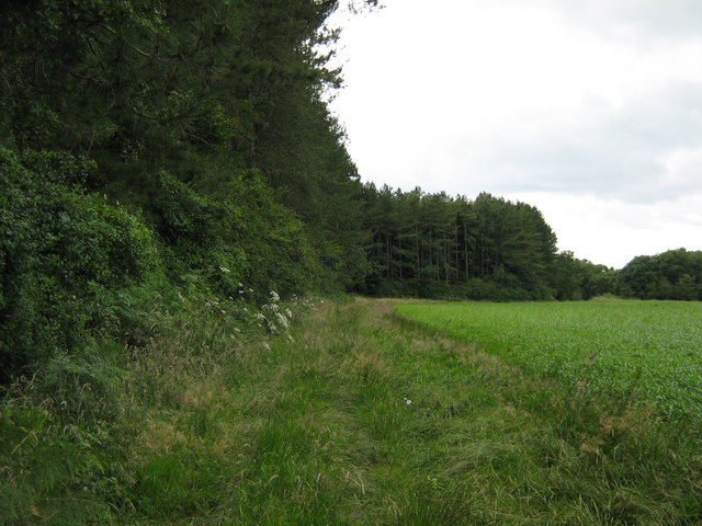
The landscape of Barrow Gurney is predominantly rural, with open fields and farmland surrounding the village. The parish is known for its natural beauty and offers stunning views of the surrounding countryside. It is also home to Barrow Reservoir, a small lake that serves as a local wildlife habitat and offers recreational activities such as fishing.

Barrow Gurney is well-connected to the nearby city of Bristol and other neighboring towns. The A38 road runs through the parish, providing easy access to the wider road network. There are also regular bus services that connect the village to Bristol and other nearby towns.

Overall, Barrow Gurney is a charming and peaceful rural parish that offers a tranquil escape from the hustle and bustle of city life. Its rich history, natural beauty, and convenient location make it an attractive place to live or visit.

If you have any feedback on the listing, please let us know in the comments section below.

Barrow Gurney Images

Images are sourced within 2km of 51.406224/-2.680808 or Grid Reference ST5267. Thanks to Geograph Open Source API. All images are credited.

Barrow Reservoir
Barrow Reservoir
Barrow Gurney: millpond at Lower Barrow Mill On the Land Yeo, by the B3130 from Chew Magna and Winford to Wraxall and Nailsea. The watermill was rebuilt in 1909 when owned by the Gibbs family of Tyntesfield – the house now owned by the National Trust. It retains an internal 14’ diameter overshot waterwheel used until the 1950s but the mill is not open to the public. This was at one time the lowest of three watermills at Barrow Gurney
Barrow Gurney: millpond at Lower Barrow Mill
On the Land Yeo, by the B3130 from Chew Magna and Winford to Wraxall and Nailsea. The watermill was rebuilt in 1909 when owned by the Gibbs family of Tyntesfield – the house now owned by the National Trust. It retains an internal 14’ diameter overshot waterwheel used until the 1950s but the mill is not open to the public. This was at one time the lowest of three watermills at Barrow Gurney
Barrow Hospital Due to close in a few months many of the buildings of this Psychiatric Hospital have been boarded up for many years. This shows "South Side" with the courtyard to the former Day Hospital. All due to be redeveloped when the site is sold.
Barrow Hospital
Due to close in a few months many of the buildings of this Psychiatric Hospital have been boarded up for many years. This shows "South Side" with the courtyard to the former Day Hospital. All due to be redeveloped when the site is sold.
Barrow Hospital - "Staff Cottages" The main road from Wild Country Lane has a row of semi-detached houses leading to the main Lodge gates (far left). These houses are all in private ownership (probably many are ex-staff) and are likely to survive longer than the hospital buildings when the site is redeveloped following the hospital's closure in Spring 2006
Barrow Hospital - "Staff Cottages"
The main road from Wild Country Lane has a row of semi-detached houses leading to the main Lodge gates (far left). These houses are all in private ownership (probably many are ex-staff) and are likely to survive longer than the hospital buildings when the site is redeveloped following the hospital's closure in Spring 2006
Looking over the Barrow Tanks towards Bristol
Towards Dundry and the twin radio masts
Across the tanks towards Long Ashton
Hartcliffe Rocks Note the level landfill at the  base of the rocks
Hartcliffe Rocks
Note the level landfill at the base of the rocks
Hartcliffe Rock This must have been quite imposing before the landfill was laid
Hartcliffe Rock
This must have been quite imposing before the landfill was laid
Barrow Lodge Entrance to Barrow Court.
Barrow Lodge
Entrance to Barrow Court.
Barrow Hill Field
Barrow Hill Field
Barrow Reservoir Number 3
Barrow Reservoir
Number 3
Barrow Gurney: Upper Barrow Mill A public footpath runs past the property to Windmill Hill and Redwood Farm. In addition to three watermills the parish appears to have had two medieval or post-medieval windmills. Possibly the parish's proximity to Bristol created extra demand. Behind the buildings on the right, at roof level, can be seen the line of the former mill leat, which would have powered an overshot waterwheel by the side of the building in the middle of the group. Milling ceased sometime between 1910 and 1935
Barrow Gurney: Upper Barrow Mill
A public footpath runs past the property to Windmill Hill and Redwood Farm. In addition to three watermills the parish appears to have had two medieval or post-medieval windmills. Possibly the parish's proximity to Bristol created extra demand. Behind the buildings on the right, at roof level, can be seen the line of the former mill leat, which would have powered an overshot waterwheel by the side of the building in the middle of the group. Milling ceased sometime between 1910 and 1935
Footpath to Barrow Court Looking towards Barrow Court and parkland.
Footpath to Barrow Court
Looking towards Barrow Court and parkland.
Barrow Court Mostly 16th to 18th century, with a 12th century portion remaining from an old nunnery. Acquired in 1880 and restored by Henry Gibbs of Tyntesfield. Now divided into private residences.
Barrow Court
Mostly 16th to 18th century, with a 12th century portion remaining from an old nunnery. Acquired in 1880 and restored by Henry Gibbs of Tyntesfield. Now divided into private residences.
Barrow Hill path Public footpath dividing a field and small forestry plantation.
Barrow Hill path
Public footpath dividing a field and small forestry plantation.
Show me another place!

Barrow Gurney is located at Grid Ref: ST5267 (Lat: 51.406224, Lng: -2.680808)

Unitary Authority: North Somerset

Police Authority: Avon and Somerset

What 3 Words

///wings.tone.gains. Near Winford, Somerset

Related Wikis

Barrow Gurney Nunnery

Barrow Gurney Nunnery (also called Minchin Barrow) was established around 1200 in Barrow Gurney Somerset, England. The Benedictine convent was founded...

Barrow Gurney

Barrow Gurney is a village and civil parish in Somerset, England, situated in the unitary authority of North Somerset on the B3130, midway between the...
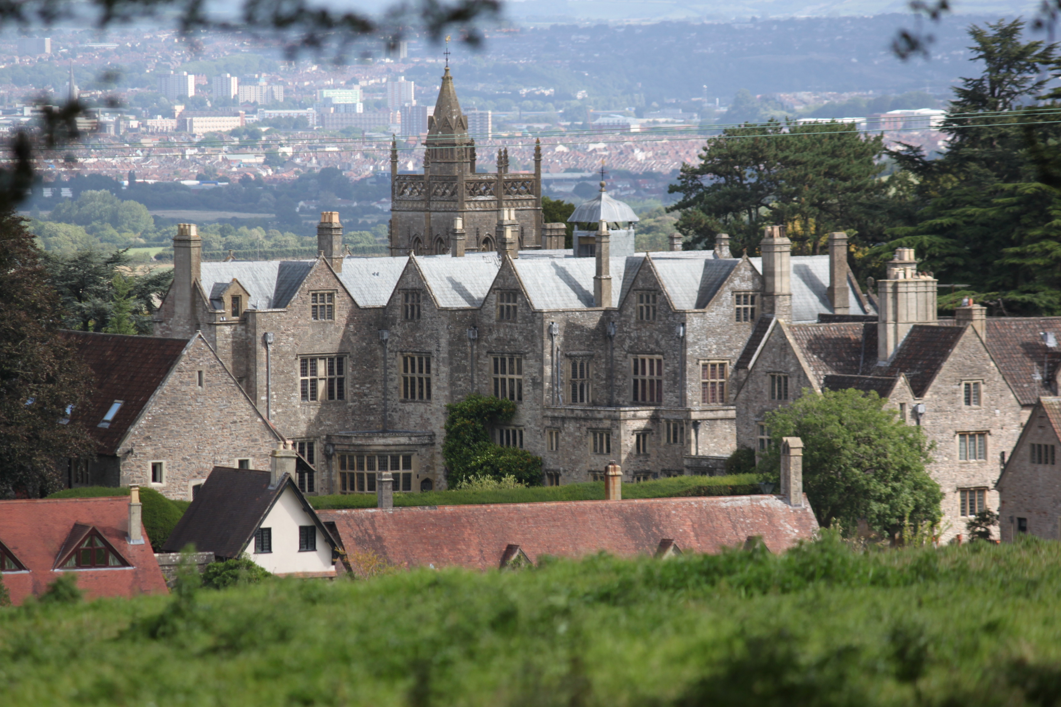
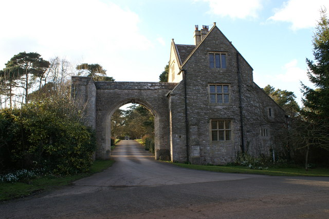
Barrow Court

Barrow Court is a manor house in Barrow Gurney, Somerset, England. The site was originally Barrow Gurney Nunnery and was rebuilt in the 16th and 19th centuries...

Barrow Gurney Reservoirs

Barrow Gurney Reservoirs (grid reference ST5468) (also known as Barrow Gurney Tanks or Barrow Tanks) are three artificial reservoirs for drinking water...

Nearby Amenities

Located within 500m of 51.406224,-2.680808
Barrow Gurney
Place: village
Wikidata: Q2172204
Lat/Long: 51.408983/-2.6775563
Traffic Calming: choker
Lat/Long: 51.4101554/-2.6792211
Historic: memorial
Memorial: war_memorial
Lat/Long: 51.4079316/-2.6748222
Barrier: bollard
Lat/Long: 51.4083567/-2.6763836
Barrier: bollard
Lat/Long: 51.4083433/-2.6763702
Barrier: bollard
Lat/Long: 51.4083307/-2.6763594
Barrier: yes
Lat/Long: 51.4055379/-2.6762779
Post Box
Post Box Type: wall
Royal Cypher: EIIR
Royal Cypher Wikidata: Q33102113
Lat/Long: 51.40892/-2.6775563
Public Bookcase
Booth: K6
Disused Amenity: telephone
Man Made: telephone_box
Mapillary: 384046070141304
Public Bookcase Type: phone_box
Survey Date: 2021-08-16
Lat/Long: 51.408961/-2.67759
Brand: National Grid
Brand Wikidata: Q1465461
Material: wood
Operator: National Grid Electricity Distribution Plc
Operator Old: Western Power Distribution
Operator Wikidata: Q7988183
Owner: National Grid Electricity Distribution (South West) Plc
Owner Wikidata: Q114397866
Power: pole
Lat/Long: 51.4085574/-2.6749305
Brand: National Grid
Brand Wikidata: Q1465461
Material: wood
Operator: National Grid Electricity Distribution Plc
Operator Old: Western Power Distribution
Operator Wikidata: Q7988183
Owner: National Grid Electricity Distribution (South West) Plc
Owner Wikidata: Q114397866
Power: pole
Lat/Long: 51.406428/-2.686567
Brand: National Grid
Brand Wikidata: Q1465461
Material: wood
Operator: National Grid Electricity Distribution Plc
Operator Old: Western Power Distribution
Operator Wikidata: Q7988183
Owner: National Grid Electricity Distribution (South West) Plc
Owner Wikidata: Q114397866
Power: pole
Lat/Long: 51.4056872/-2.6876652
Brand: National Grid
Brand Wikidata: Q1465461
Material: wood
Operator: National Grid Electricity Distribution Plc
Operator Old: Western Power Distribution
Operator Wikidata: Q7988183
Owner: National Grid Electricity Distribution (South West) Plc
Owner Wikidata: Q114397866
Power: pole
Lat/Long: 51.4069811/-2.6857499
Brand: National Grid
Brand Wikidata: Q1465461
Material: wood
Operator: National Grid Electricity Distribution Plc
Operator Old: Western Power Distribution
Operator Wikidata: Q7988183
Owner: National Grid Electricity Distribution (South West) Plc
Owner Wikidata: Q114397866
Power: pole
Lat/Long: 51.4076269/-2.684774
Brand: National Grid
Brand Wikidata: Q1465461
Material: wood
Operator: National Grid Electricity Distribution Plc
Operator Old: Western Power Distribution
Operator Wikidata: Q7988183
Owner: National Grid Electricity Distribution (South West) Plc
Owner Wikidata: Q114397866
Power: pole
Lat/Long: 51.4083781/-2.683679
Brand: National Grid
Brand Wikidata: Q1465461
Material: wood
Operator: National Grid Electricity Distribution Plc
Operator Old: Western Power Distribution
Operator Wikidata: Q7988183
Owner: National Grid Electricity Distribution (South West) Plc
Owner Wikidata: Q114397866
Power: pole
Lat/Long: 51.4090549/-2.6826634
Brand: National Grid
Brand Wikidata: Q1465461
Material: wood
Operator: National Grid Electricity Distribution Plc
Operator Old: Western Power Distribution
Operator Wikidata: Q7988183
Owner: National Grid Electricity Distribution (South West) Plc
Owner Wikidata: Q114397866
Power: pole
Lat/Long: 51.4097626/-2.6815685
Entrance: yes
Lat/Long: 51.4076581/-2.6757045
Defibrillator
Defibrillator Location: outside Barrow Gurney Village Hall
Emergency: defibrillator
Indoor: no
Ref GB The Circuit: E72A9494-72AA-407D-B6DC-AD2F009EF8BA
Lat/Long: 51.4076745/-2.6756891
Bench
Backrest: yes
Lat/Long: 51.4078574/-2.6755974
Bench
Backrest: yes
Lat/Long: 51.408934/-2.6775629
Board Type: notice
Information: board
Operator: Barrow Gurney Parish Council
Tourism: information
Lat/Long: 51.4089344/-2.6775855
Leisure: pitch
Sport: table_tennis
Lat/Long: 51.4082752/-2.6760413
The data included in this document is from www.openstreetmap.org. The data is made available under ODbL.

Have you been to Barrow Gurney?

Leave your review of Barrow Gurney below (or comments, questions and feedback).