Barrington

Civil Parish in Somerset South Somerset

England

Barrington

Westmoor Canal This is the disused canal just west of its western terminal at Westport. It also acts as the Westmoor Catchwater drain.
Westmoor Canal Credit: Nigel Mykura

Barrington is a civil parish located in the county of Somerset, England. Situated in the picturesque region of South Somerset, it covers an area of approximately 1,250 acres. The village of Barrington serves as the administrative center of the parish.

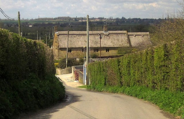
Barrington is surrounded by stunning natural beauty, with rolling hills, lush green fields, and charming countryside views. The River Parrett flows through the parish, further adding to its scenic appeal and providing recreational opportunities for residents and visitors alike.

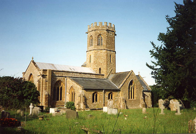
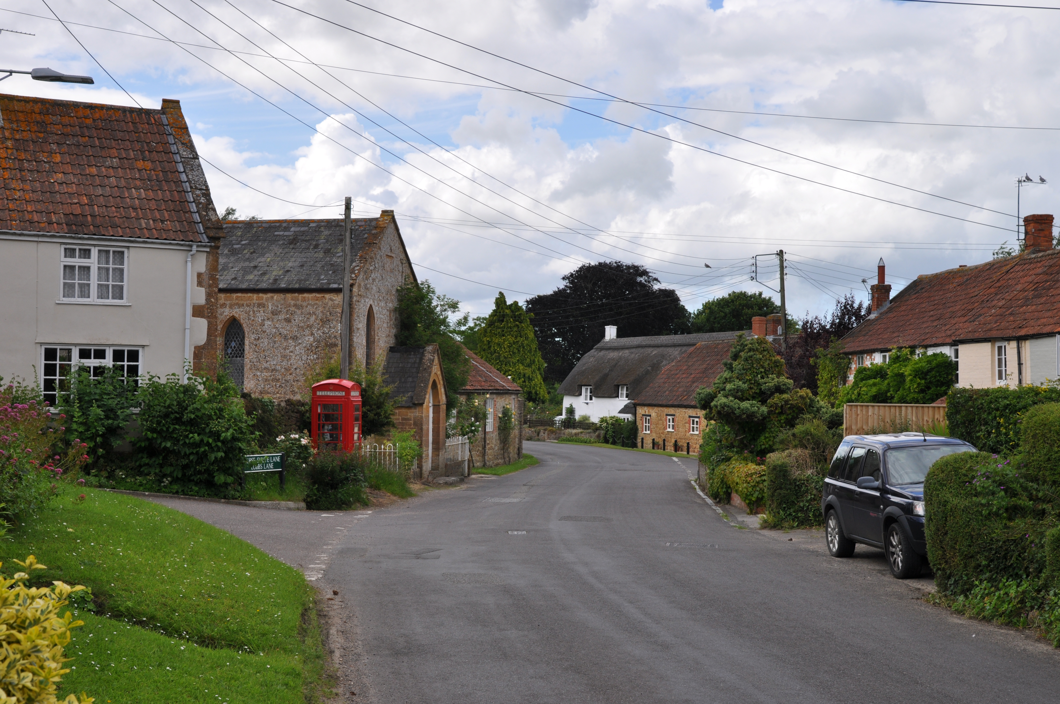
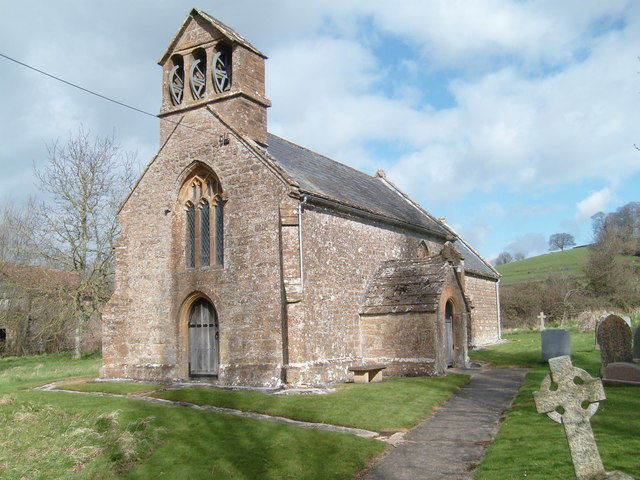
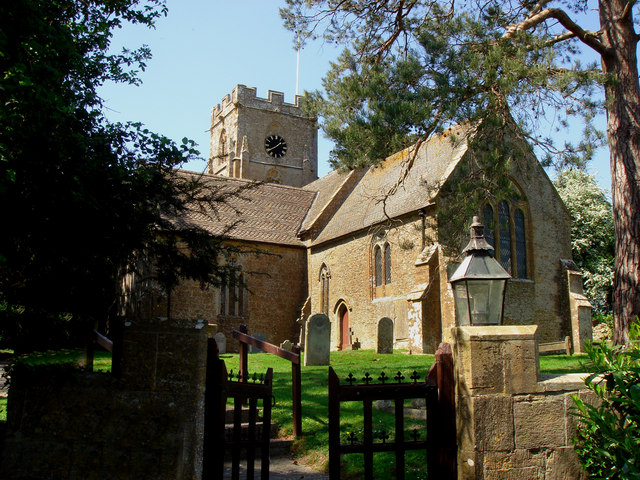
The village itself is small and quaint, with a population of around 400 people. It boasts a rich history that dates back centuries, evident in its traditional architecture and historic landmarks. One notable feature is the 13th-century Church of St. Mary the Virgin, which stands as a prominent landmark in the area.

Despite its small size, Barrington is a close-knit community with a strong sense of community spirit. The village hosts various social events and activities throughout the year, fostering a sense of camaraderie among its residents.

In terms of amenities, Barrington offers limited but essential facilities. It is home to a village hall, which serves as a venue for community gatherings and events. Additionally, there is a primary school nearby, ensuring that local children have access to education within the parish.

Barrington's peaceful and idyllic setting, combined with its rich history and sense of community, make it an attractive place to live for those seeking a tranquil rural lifestyle in Somerset.

If you have any feedback on the listing, please let us know in the comments section below.

Barrington Images

Images are sourced within 2km of 50.965496/-2.866567 or Grid Reference ST3918. Thanks to Geograph Open Source API. All images are credited.

Westmoor Canal This is the disused canal just west of its western terminal at Westport. It also acts as the Westmoor Catchwater drain.
Westmoor Canal
This is the disused canal just west of its western terminal at Westport. It also acts as the Westmoor Catchwater drain.
Higher Burrow Farmhouse "C16/C17" <span class="nowrap"><a title="http://webapp1.somerset.gov.uk/her/details.asp?prn=22418" rel="nofollow ugc noopener" href="http://webapp1.somerset.gov.uk/her/details.asp?prn=22418">Link</a><img style="margin-left:2px;" alt="External link" title="External link - shift click to open in new window" src="https://s1.geograph.org.uk/img/external.png" width="10" height="10"/></span> . Smartly thatched and with mullioned windows. Seen from the same spot as <a href="https://www.geograph.org.uk/photo/3471840">ST4019 : New Road</a>.
Higher Burrow Farmhouse
"C16/C17" LinkExternal link . Smartly thatched and with mullioned windows. Seen from the same spot as ST4019 : New Road.
Barrington Court The Tudor manor house.
Barrington Court
The Tudor manor house.
Stocklinch Ottersey church Remote from its village
Stocklinch Ottersey church
Remote from its village
Barrington: church St Mary’s church stands above much of the village and dates from the 13th century. With an octagonal crossing tower and transepts the church was nevertheless a subsidiary foundation to South Petherton
Barrington: church
St Mary’s church stands above much of the village and dates from the 13th century. With an octagonal crossing tower and transepts the church was nevertheless a subsidiary foundation to South Petherton
Ilminster, Barrington Court A quaint photograph of roses round the door on some of the outbuildings
Ilminster, Barrington Court
A quaint photograph of roses round the door on some of the outbuildings
Ilminster, Barrington Court Garden Lovely gardens and water features are prominent in this National Trust Garden.
Ilminster, Barrington Court Garden
Lovely gardens and water features are prominent in this National Trust Garden.
Strode House, Barrington Court from the Garden The garden at Barrington Court was inspired by Gertrude Jekyll. See <span class="nowrap"><a title="http://www.nationaltrust.org.uk/main/w-vh/w-visits/w-findaplace/w-barringtoncourt/w-barrington_court-a_brief_history.htm" rel="nofollow ugc noopener" href="http://www.nationaltrust.org.uk/main/w-vh/w-visits/w-findaplace/w-barringtoncourt/w-barrington_court-a_brief_history.htm">Link</a><img style="margin-left:2px;" alt="External link" title="External link - shift click to open in new window" src="https://s1.geograph.org.uk/img/external.png" width="10" height="10"/></span>
Strode House, Barrington Court from the Garden
The garden at Barrington Court was inspired by Gertrude Jekyll. See LinkExternal link
Puckington: Gummer’s Lane A track and public footpath to Stocklinch. Possibly an old way as it defines the parish boundary with Stocklinch. Looking south east
Puckington: Gummer’s Lane
A track and public footpath to Stocklinch. Possibly an old way as it defines the parish boundary with Stocklinch. Looking south east
Barrington Cricket Field Barrington Cricket Field adjacent to Barrington Court
Barrington Cricket Field
Barrington Cricket Field adjacent to Barrington Court
St Andrews Church Puckington A lovely church set well back from the road, easily missed.
St Andrews Church Puckington
A lovely church set well back from the road, easily missed.
St Andrews Church Puckington
Church Notice Board Puckington
Manor Farmhouse Puckington Manor Farmhouse Puckington adjacent to the church, was possibly the vicarage at one time
Manor Farmhouse Puckington
Manor Farmhouse Puckington adjacent to the church, was possibly the vicarage at one time
Refurbished bridge over the Westport canal at Westport From the sign, it has probably been 'improved' to take vastly more weight than was dreampt of when the canal was built.
Refurbished bridge over the Westport canal at Westport
From the sign, it has probably been 'improved' to take vastly more weight than was dreampt of when the canal was built.
Derelict Westport canal at Westport
Strode House, Barrington Court Strode House, built by William Strode in 1647 as stables for Barrington Court, converted to domestic use by Forbes in 1921-5.
Strode House, Barrington Court
Strode House, built by William Strode in 1647 as stables for Barrington Court, converted to domestic use by Forbes in 1921-5.
Through the gateway Barrington Court gardens
Show me another place!

Barrington is located at Grid Ref: ST3918 (Lat: 50.965496, Lng: -2.866567)

Administrative County: Somerset

District: South Somerset

Police Authority: Avon and Somerset

What 3 Words

///muscular.mixing.interview. Near South Petherton, Somerset

Related Wikis

Nearby Amenities

Located within 500m of 50.965496,-2.866567
Power: pole
Source: bing
Transformer: distribution
Lat/Long: 50.9696972/-2.8678259
Power: pole
Source: bing
Lat/Long: 50.9695236/-2.8663561
Power: pole
Source: bing
Lat/Long: 50.9693243/-2.8647307
Power: pole
Source: bing
Lat/Long: 50.9683868/-2.8624722
Power: pole
Source: bing
Lat/Long: 50.9691385/-2.8632662
Power: pole
Source: bing
Lat/Long: 50.9666926/-2.8622738
Power: pole
Source: bing
Lat/Long: 50.9674156/-2.8611016
Power: pole
Source: bing
Lat/Long: 50.9662838/-2.8629363
Power: pole
Source: bing
Lat/Long: 50.9660507/-2.8633252
Material: wood
Power: pole
Source: bing
Voltage: 11000
Lat/Long: 50.9621828/-2.8621725
Power: pole
Source: bing
Lat/Long: 50.9650661/-2.8649281
Power: pole
Source: bing
Lat/Long: 50.9632246/-2.8631696
Power: pole
Source: bing
Lat/Long: 50.964174/-2.8640762
Power: pole
Source: bing
Lat/Long: 50.9654257/-2.8643444
Power: pole
Source: bing
Lat/Long: 50.9641774/-2.8663936
Power: pole
Source: bing
Lat/Long: 50.9635456/-2.8674129
Power: pole
Source: bing
Lat/Long: 50.9628665/-2.8685045
Power: pole
Source: bing
Lat/Long: 50.9618698/-2.870138
Power: pole
Source: bing
Lat/Long: 50.9623597/-2.8693588
The data included in this document is from www.openstreetmap.org. The data is made available under ODbL.

Have you been to Barrington?

Leave your review of Barrington below (or comments, questions and feedback).