Barnoldswick

Civil Parish in Yorkshire Pendle

England

Barnoldswick

Toposcope in Letcliffe Park With a commanding view over the town of Barnoldswick.
Toposcope in Letcliffe Park Credit: Oliver Dixon

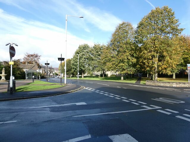
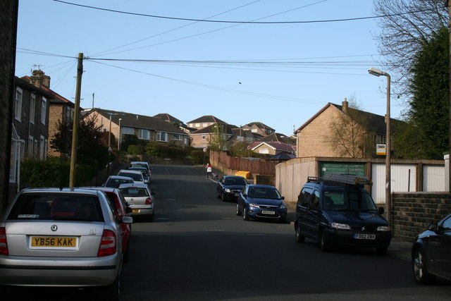
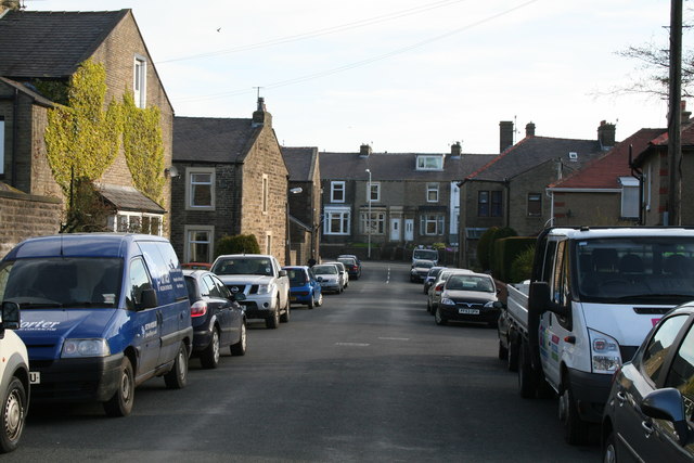
Barnoldswick, located in the county of Yorkshire, is a civil parish with a rich historical background. Situated near the border of Lancashire, the town lies within the borough of Pendle. With a population of around 11,000, Barnoldswick is known for its picturesque scenery, blending natural beauty with industrial heritage.

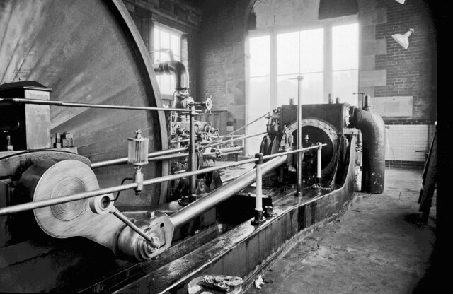
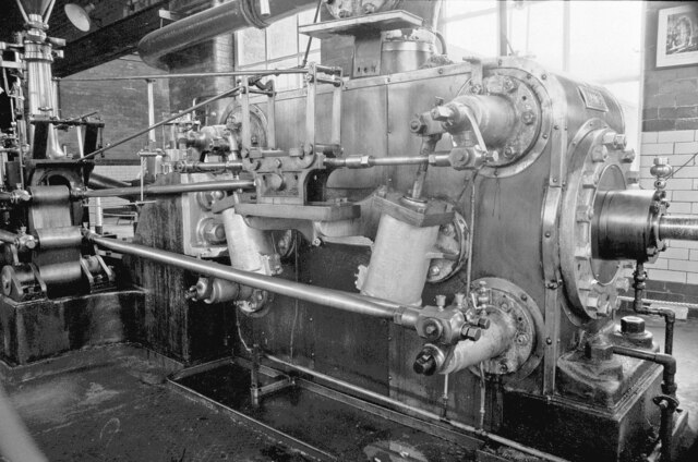
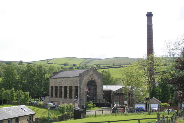
The town dates back to the Anglo-Saxon period and was historically a hub for textile manufacturing. Barnoldswick played a significant role during the Industrial Revolution and was renowned for its cotton mills and textile production. Today, remnants of this industrial past can still be seen in the town's architecture.

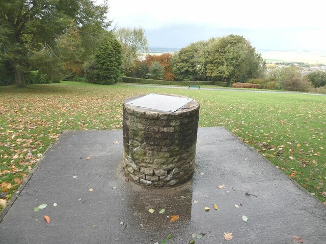
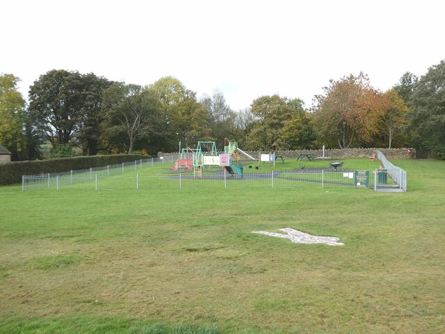
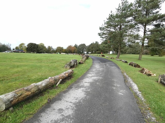
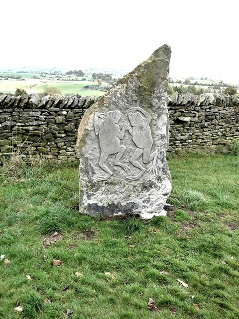
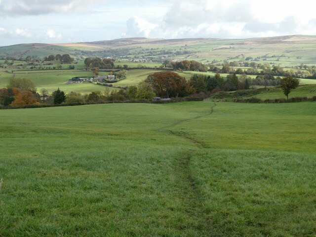
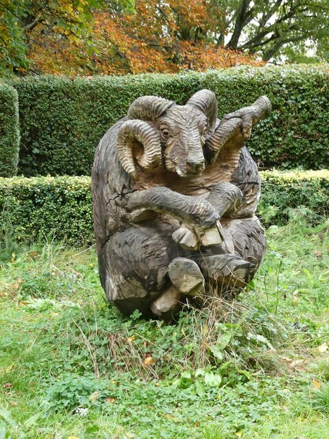
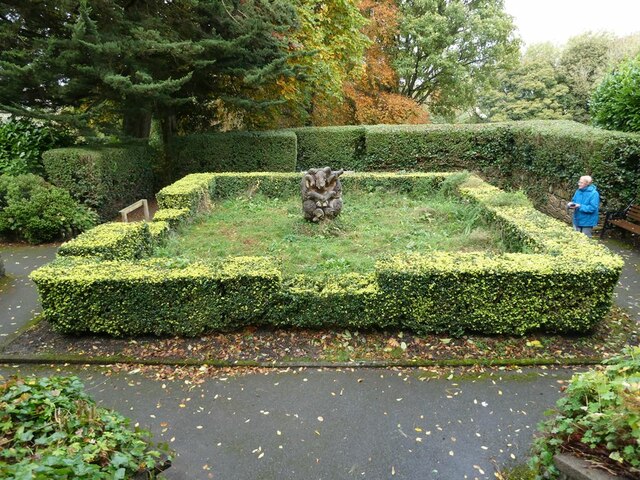
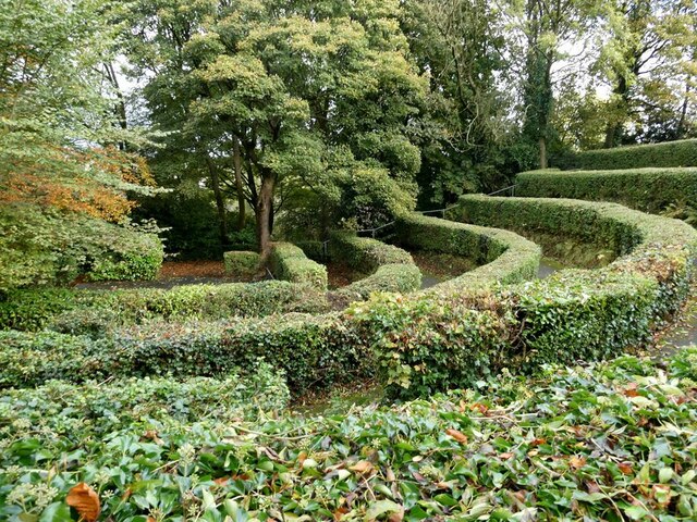
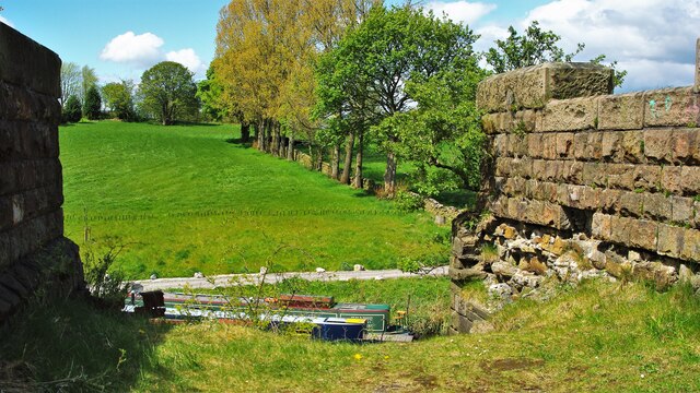
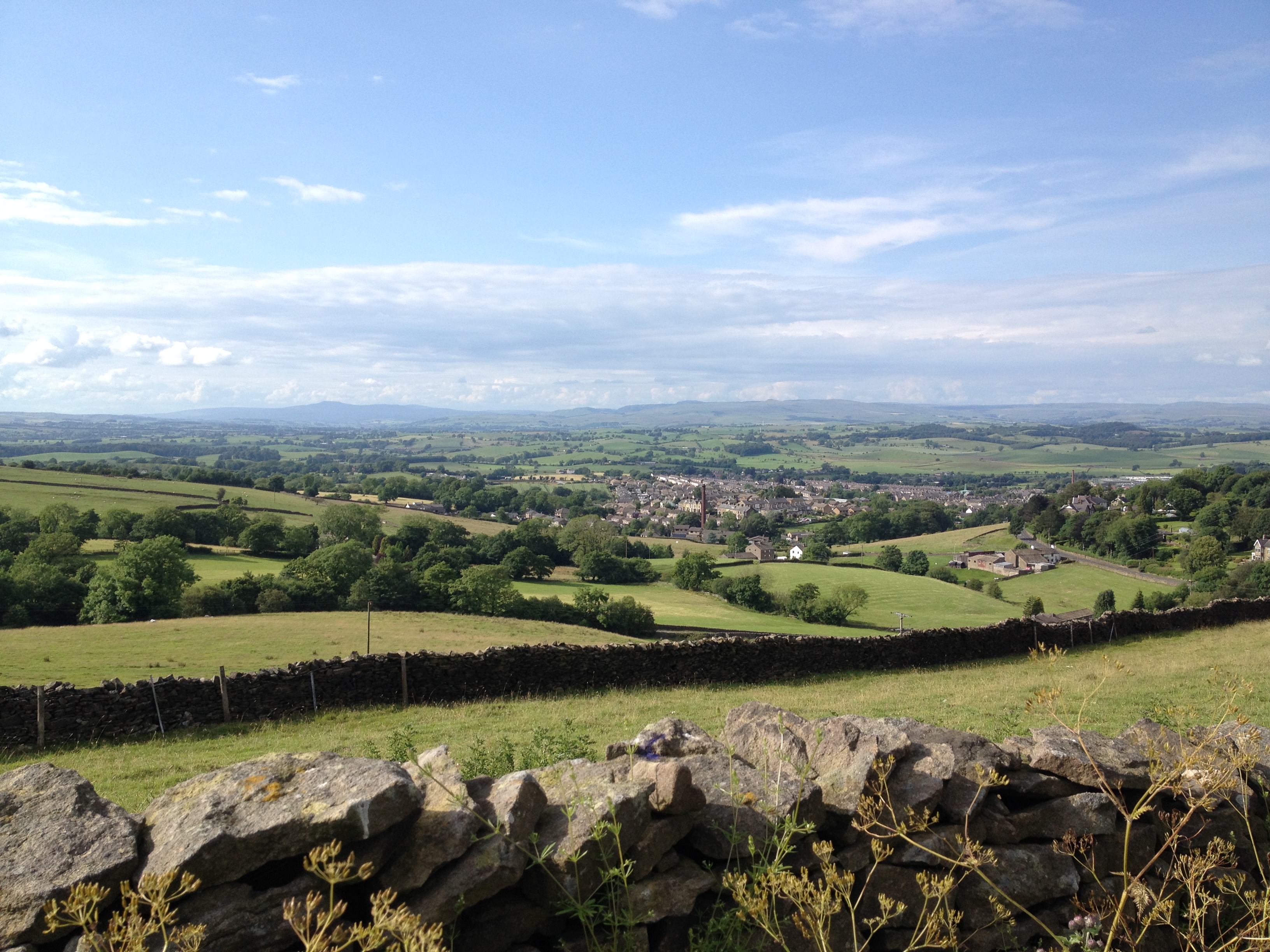
Barnoldswick is surrounded by stunning countryside, making it an ideal destination for outdoor enthusiasts. The nearby Yorkshire Dales National Park offers breathtaking landscapes, including rolling hills, rivers, and charming villages. The Leeds and Liverpool Canal also passes through the town, providing opportunities for leisurely walks and boating.

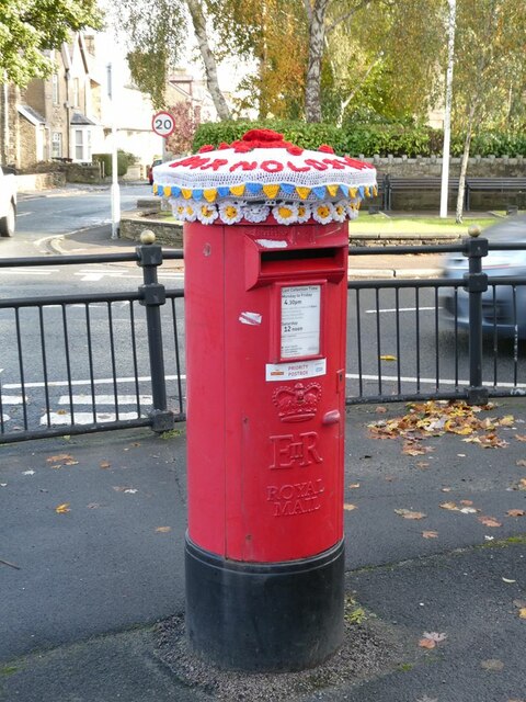
The town center boasts a mix of traditional and modern amenities. Local shops, cafes, and restaurants offer a variety of goods and services to both residents and visitors. Barnoldswick is also home to several historical landmarks, such as the St. Mary-le-Ghyll Church, which dates back to the 15th century.

In terms of transportation, Barnoldswick is well-connected to neighboring towns and cities. The town is situated near the A56 road, providing convenient access to destinations throughout Yorkshire and Lancashire. Additionally, regular bus services operate in the area, linking Barnoldswick to nearby towns and cities.

Overall, Barnoldswick is a charming civil parish that combines its industrial heritage with natural beauty, making it an appealing destination for history buffs and nature lovers alike.

If you have any feedback on the listing, please let us know in the comments section below.

Barnoldswick Images

Images are sourced within 2km of 53.920215/-2.184069 or Grid Reference SD8847. Thanks to Geograph Open Source API. All images are credited.

Toposcope in Letcliffe Park With a commanding view over the town of Barnoldswick.
Toposcope in Letcliffe Park
With a commanding view over the town of Barnoldswick.
Play area in Letlcliffe Park With the No. 3 Shadow Man sculpture let into the grass in the foreground.
Play area in Letlcliffe Park
With the No. 3 Shadow Man sculpture let into the grass in the foreground.
"No. 3 Shadow Man" Ingenious horizontal artwork by Stathis Dimitriadis, comprising a mosaic of coloured and lettered bricks or tiles in the form of a human outline. Part of the Pendle Sculpture Trail which, from its original site in Barley, was extended in 2019 to Letcliffe Park in Barnoldswick.
"No. 3 Shadow Man"
Ingenious horizontal artwork by Stathis Dimitriadis, comprising a mosaic of coloured and lettered bricks or tiles in the form of a human outline. Part of the Pendle Sculpture Trail which, from its original site in Barley, was extended in 2019 to Letcliffe Park in Barnoldswick.
Roadway in Letcliffe Park Attractive hilltop park managed by Barnoldswick Town Council.
Roadway in Letcliffe Park
Attractive hilltop park managed by Barnoldswick Town Council.
"Frogspell" Relief sculpture by Tilly Dagnell. Part of the Pendle Sculpture Trail which, from its original site in Barley, was extended in 2019 to Letcliffe Park in Barnoldswick.
"Frogspell"
Relief sculpture by Tilly Dagnell. Part of the Pendle Sculpture Trail which, from its original site in Barley, was extended in 2019 to Letcliffe Park in Barnoldswick.
Field and path to the east of Letcliffe Park
"Tower of Barlick" Spectacular sculpture by Jack Boutet. Firmly anchored by stays to the apex to stop it from blowing/falling over. Part of the Pendle Sculpture Trail which, from its original site in Barley, was extended in 2019 to Letcliffe Park in Barnoldswick.
"Tower of Barlick"
Spectacular sculpture by Jack Boutet. Firmly anchored by stays to the apex to stop it from blowing/falling over. Part of the Pendle Sculpture Trail which, from its original site in Barley, was extended in 2019 to Letcliffe Park in Barnoldswick.
A corner of Letcliffe Country Park An attractive hilltop park managed by Barnoldswick Town Council.
A corner of Letcliffe Country Park
An attractive hilltop park managed by Barnoldswick Town Council.
"Stolen Mutton" Interesting and spectacular wooden carved sculpture by Thompson Dagnell. Part of the Pendle Sculpture Trail which, from its original site in Barley, was extended in 2019 to Letcliffe Country Park in Barnoldswick.
"Stolen Mutton"
Interesting and spectacular wooden carved sculpture by Thompson Dagnell. Part of the Pendle Sculpture Trail which, from its original site in Barley, was extended in 2019 to Letcliffe Country Park in Barnoldswick.
Parterre in Letcliffe Country Park In the centre of the square stands the "Stolen Mutton" sculpture, seen in closeup in <a href="https://www.geograph.org.uk/photo/7002301">SD8746 : "Stolen Mutton"</a>.
Parterre in Letcliffe Country Park
In the centre of the square stands the "Stolen Mutton" sculpture, seen in closeup in SD8746 : "Stolen Mutton".
Bandstand in Letcliffe Country Park No ordinary bandstand, this. There is no roofed structure as one would expect, just a focal paved areas overlooked by an auditorium consisting of a quadrant of terraces separated by privet hedges. Whether it is actually used for live performances is not known.
Bandstand in Letcliffe Country Park
No ordinary bandstand, this. There is no roofed structure as one would expect, just a focal paved areas overlooked by an auditorium consisting of a quadrant of terraces separated by privet hedges. Whether it is actually used for live performances is not known.
A very pretty postbox Standing by the crossroads in the centre of Barnoldswick.
A very pretty postbox
Standing by the crossroads in the centre of Barnoldswick.
Crossroads in the centre of Barnoldswick.
Course of Former Railway The branch line to Barnoldswick left this high embankment to cross the Leeds and Liverpool Canal and run parallel with the line of trees and on to its destination
Course of Former Railway
The branch line to Barnoldswick left this high embankment to cross the Leeds and Liverpool Canal and run parallel with the line of trees and on to its destination
Bancroft Mill Engine Seen at the beginning on this engine's period in preservation after the weaving shed closed in 1978 and was subsequently demolished leaving just the power plant. The engine was built by William Roberts of Nelson and commissioned in 1920. It is a horizontal cross compound with rope drive to a second motion shaft that passed into the weaving shed. This view is from the crank end of the low-pressure side.
Bancroft Mill Engine
Seen at the beginning on this engine's period in preservation after the weaving shed closed in 1978 and was subsequently demolished leaving just the power plant. The engine was built by William Roberts of Nelson and commissioned in 1920. It is a horizontal cross compound with rope drive to a second motion shaft that passed into the weaving shed. This view is from the crank end of the low-pressure side.
Bancroft Mill Engine Bancroft Mill was a cotton weaving shed that opened in 1920 and was closed in 1978. The shed was demolished but the engine house, boiler houses and a garage remained on site along with the chimney. The shed was driven by a horizontal cross compound steam engine with Corliss valves and rope drive. This view shows the high-pressure cylinder.
Bancroft Mill Engine
Bancroft Mill was a cotton weaving shed that opened in 1920 and was closed in 1978. The shed was demolished but the engine house, boiler houses and a garage remained on site along with the chimney. The shed was driven by a horizontal cross compound steam engine with Corliss valves and rope drive. This view shows the high-pressure cylinder.
Barnoldswick:  Harper Street Looking southwest from its junction with Federation Street.
Barnoldswick: Harper Street
Looking southwest from its junction with Federation Street.
Barnoldswick: Harper Street Looking northeast from its junction with Federation Street
Barnoldswick: Harper Street
Looking northeast from its junction with Federation Street
Show me another place!

Barnoldswick is located at Grid Ref: SD8847 (Lat: 53.920215, Lng: -2.184069)

Division: West Riding

Administrative County: Lancashire

District: Pendle

Police Authority: Lancashire

What 3 Words

///august.mysteries.door. Near Barnoldswick, Lancashire

Related Wikis

Barnoldswick railway station

Barnoldswick railway station was the only railway station on the Midland Railway's 1-mile-64-chain (2.9 km) long Barnoldswick Branch in the West Riding...

West Craven

West Craven is an area in the east of Lancashire, England in the far northern part of the borough of Pendle. Historically the area was within the ancient...

Barnoldswick Town F.C.

Barnoldswick Town Football Club is a football club based in Barnoldswick, Lancashire, England. They are currently members of the North West Counties League...

Barnoldswick

Barnoldswick (pronounced ) is a market town and civil parish in the Borough of Pendle, in the administrative county of Lancashire, England. It is within...

Little Cut

The Little Cut, also known as the Rain Hall Rock Branch or the Rain Hall Rock Canal, was a short canal connecting the Leeds and Liverpool Canal at Barnoldswick...

West Craven High School, Barnoldswick

West Craven High School is a mixed 11 to 16 comprehensive school in Barnoldswick, Lancashire, England. == School history == Funding to update the school...

Bancroft Shed

Bancroft Shed was a weaving shed in Barnoldswick, Lancashire, England, situated on the road to Skipton. Construction was started in 1914 and the shed was...

Church of St Mary le Ghyll, Barnoldswick

The Church of St Mary le Ghyll (also known as St Mary-le-Gill) is in Ghyll Lane, Barnoldswick, Lancashire, England. It is an active Anglican parish church...

Nearby Amenities

Located within 500m of 53.920215,-2.184069
Barnoldswick
Loc Name: Barlick
Place: town
Wikidata: Q2049578
Wikipedia: en:Barnoldswick
Lat/Long: 53.9170798/-2.187322
Barnoldswick
Abandoned Railway: station
Railway: site
Source: npe
Lat/Long: 53.9168293/-2.185758
Mini Roundabout
Direction: clockwise
Lat/Long: 53.9186935/-2.1886923
Traffic Signals
Traffic Signals Direction: both
Lat/Long: 53.9160535/-2.1851525
Noexit: yes
Lat/Long: 53.9202138/-2.1885014
Telephone
Booth: KX100
Covered: booth
Lat/Long: 53.9169731/-2.1870132
Power: substation
Substation: minor_distribution
Lat/Long: 53.9188182/-2.188247
Toilets
Female: yes
Wheelchair: no
Lat/Long: 53.9228814/-2.1873855
Source: bing
Lat/Long: 53.919693/-2.1881088
Disused Amenity: post_office
Source: OS_OpenData_StreetView
Lat/Long: 53.9223183/-2.1831745
Crossing
Crossing: zebra
Kerb: lowered
Tactile Paving: yes
Lat/Long: 53.9188095/-2.1884641
Crossing
Crossing: zebra
Kerb: lowered
Tactile Paving: yes
Lat/Long: 53.918862/-2.1888615
War Memorial
Historic: memorial
Lat/Long: 53.9172139/-2.1864552
Bus Stop
Roundell Road
Bench: no
Bin: no
Bus: yes
Naptan AtcoCode: 2500IMG1594
Naptan NaptanCode: landtmgd
Public Transport: platform
Shelter: no
Lat/Long: 53.9221503/-2.1832109
Bus Stop
Roundell Road
Naptan AtcoCode: 2500LAA08232
Naptan NaptanCode: lanjwapd
Public Transport: platform
Lat/Long: 53.9222068/-2.1828087
Bus Stop
Wellhouse Road
Bench: no
Bin: no
Bus: yes
Naptan AtcoCode: 2500DCL711
Naptan NaptanCode: landmwaw
Public Transport: platform
Shelter: no
Lat/Long: 53.920363/-2.1859749
Bus Stop
Wellhouse Road
Departures Board: none
Naptan AtcoCode: 250013839
Naptan NaptanCode: lanamdwd
Public Transport: platform
Lat/Long: 53.9198086/-2.1865052
Bus Stop
Lower North Avenue
Departures Board: timetable
Naptan AtcoCode: 25001900
Naptan NaptanCode: lanatjaw
Public Transport: platform
Lat/Long: 53.9192295/-2.1878127
Bus Stop
Lower North Avenue
Naptan AtcoCode: 2500LAA07169
Naptan NaptanCode: langwpta
Public Transport: platform
Lat/Long: 53.9190503/-2.1879447
Bus Stop
Station Road
Bus: yes
Naptan AtcoCode: 25001026
Naptan NaptanCode: lanadgpj
Public Transport: platform
Lat/Long: 53.9170236/-2.1871994
Crossing
Button Operated: yes
Crossing: traffic_signals
Crossing Island: no
Crossing Markings: dots
Crossing Ref: puffin
Kerb: lowered
Tactile Paving: yes
Traffic Signals Sound: yes
Traffic Signals Vibration: no
Lat/Long: 53.9169547/-2.1865943
Give Way
Direction: backward
Lat/Long: 53.9206069/-2.1855866
Noexit: yes
Lat/Long: 53.9215864/-2.185985
Noexit: yes
Lat/Long: 53.9201501/-2.1886147
Bus Stop
Silentnight
Bus: yes
Public Transport: platform
Shelter: yes
Lat/Long: 53.9176966/-2.1784848
Noexit: yes
Lat/Long: 53.9182406/-2.1859294
Noexit: yes
Lat/Long: 53.9185155/-2.1853648
Noexit: yes
Lat/Long: 53.9186733/-2.1851264
Noexit: yes
Lat/Long: 53.9183792/-2.1856533
Noexit: yes
Lat/Long: 53.9181041/-2.186212
Coates
Place: locality
Lat/Long: 53.9230316/-2.1783321
Parking Space
Capacity: 1
Parking Space: disabled
Lat/Long: 53.9216443/-2.1836069
Parking Space
Capacity: 1
Parking Space: disabled
Lat/Long: 53.9215946/-2.1834904
Toilets
Male: yes
Wheelchair: no
Lat/Long: 53.9228615/-2.1873644
Toilets
Unisex: yes
Wheelchair: yes
Lat/Long: 53.9228732/-2.1874635
Post Box
Lat/Long: 53.9169415/-2.1794499
Bus Stop
Coates Estate
Bus: yes
Public Transport: platform
Shelter: no
Lat/Long: 53.9221698/-2.177839
Bus Stop
Silentnight
Bus: yes
Naptan AtcoCode: 2500LAA16279
Public Transport: platform
Shelter: no
Lat/Long: 53.9177742/-2.1785379
Bus Stop
Brogden Street
Bus: yes
Public Transport: platform
Shelter: no
Lat/Long: 53.9211053/-2.1900109
Bicycle Parking
Access: yes
Bicycle Parking: stands
Capacity: 8
Covered: no
Fee: no
Lat/Long: 53.9163979/-2.1858212
Traffic Signals
Traffic Signals: signal
Lat/Long: 53.9216771/-2.1838557
Post Box
Operator: Royal Mail
Operator Wikidata: Q638098
Post Box Type: pillar
Lat/Long: 53.917/-2.1867471
Bench
Backrest: yes
Lat/Long: 53.9171432/-2.1866112
Camera Mount: pole
Man Made: surveillance
Surveillance Type: camera
Lat/Long: 53.9186513/-2.1885623
Street Lamp
Lat/Long: 53.9170577/-2.1878039
Bus Stop
Fernlea Avenue
Bench: yes
Bin: yes
Bus: yes
Departures Board: timetable
Public Transport: platform
Shelter: yes
Lat/Long: 53.9173298/-2.1874231
Flag Type: municipal
Lit: yes
Man Made: flagpole
Operator: Barnoldswick Town Council
Lat/Long: 53.9171277/-2.1866363
Barrier: lift_gate
Lift Gate Type: single
Lat/Long: 53.9171983/-2.187759
Post Box
Operator: Royal Mail
Operator Wikidata: Q638098
Post Box Type: wall
Lat/Long: 53.9194116/-2.1875812
Post Box
Operator: Royal Mail
Operator Wikidata: Q638098
Post Box Type: pillar
Lat/Long: 53.9222618/-2.1830266
The data included in this document is from www.openstreetmap.org. The data is made available under ODbL.

Have you been to Barnoldswick?

Leave your review of Barnoldswick below (or comments, questions and feedback).