Barningham

Civil Parish in Yorkshire

England

Barningham

Moorland descending to pool The pool is on Barningham Moor and is seen looking downhill from the route of a bridleway of which there is little evidence on the ground.
The distant high ground is the moorland ridge forming the watershed between Teesdale (this side) and Weardale, beyond.
Moorland descending to pool Credit: Trevor Littlewood

Barningham is a civil parish located in the county of Yorkshire, England. It is situated in the Richmondshire district, in the northern part of the county. The parish covers an area of approximately 6.2 square miles and has a population of around 200 residents.

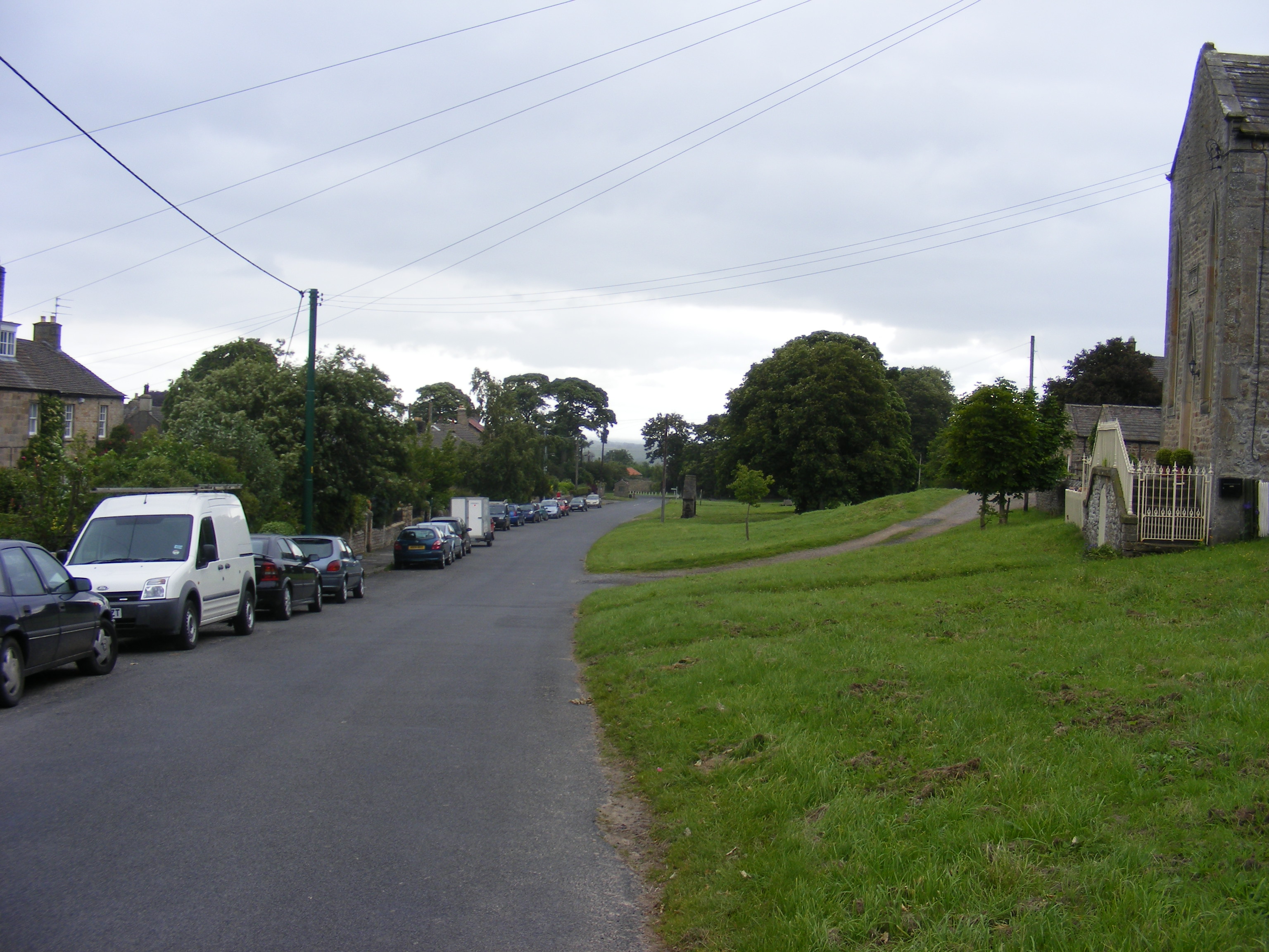
Barningham is a rural village with a rich history dating back to the medieval period. It is known for its picturesque landscape, surrounded by rolling hills and farmland. The village itself is characterized by its traditional stone houses and buildings, reflecting its historic past.

The parish is home to St. Michael and All Angels Church, a grade II listed building that dates back to the 12th century. The church is an important architectural landmark in the area and attracts visitors interested in its historical and cultural significance.

Barningham offers a peaceful and tranquil environment for its residents, with plenty of opportunities for outdoor activities such as hiking, cycling, and horseback riding. The surrounding countryside provides stunning views and is a popular destination for nature lovers and tourists.

Despite its small size, the village has a strong sense of community, with various local events and activities organized throughout the year. Barningham also has a primary school and a village hall, which serve as important gathering places for the residents.

Overall, Barningham is a charming and idyllic rural parish, offering a close-knit community and beautiful natural surroundings.

If you have any feedback on the listing, please let us know in the comments section below.

Barningham Images

Images are sourced within 2km of 54.482553/-1.894996 or Grid Reference NZ0609. Thanks to Geograph Open Source API. All images are credited.

Moorland descending to pool The pool is on Barningham Moor and is seen looking downhill from the route of a bridleway of which there is little evidence on the ground.
The distant high ground is the moorland ridge forming the watershed between Teesdale (this side) and Weardale, beyond.
Moorland descending to pool
The pool is on Barningham Moor and is seen looking downhill from the route of a bridleway of which there is little evidence on the ground. The distant high ground is the moorland ridge forming the watershed between Teesdale (this side) and Weardale, beyond.
Simple grouse butt close to Barningham The butt is one of a line south-west of the village and is just a section of stone wall. Many, more sophisticated butts are circular so as to enclose the party within and often sunken into the ground.
Simple grouse butt close to Barningham
The butt is one of a line south-west of the village and is just a section of stone wall. Many, more sophisticated butts are circular so as to enclose the party within and often sunken into the ground.
Beck, Ford, Footbridge and Aqueduct,  Barningham Moor The white structure crossing the beck is a small plastic pipe aqueduct on wooden supports which takes water to a feed pond for the water garden at Barningham Park. The beck is unnamed on OS maps, one of a multitude of watercourses draining the moor.
Beck, Ford, Footbridge and Aqueduct, Barningham Moor
The white structure crossing the beck is a small plastic pipe aqueduct on wooden supports which takes water to a feed pond for the water garden at Barningham Park. The beck is unnamed on OS maps, one of a multitude of watercourses draining the moor.
Track on Barningham, Moor
Boardwalk To Access Grouse Butts ON Barningham Moor
Grouse Butts, Barningham Moor
Barningham Moor
Barningham Moor
Scale Knoll Gill Numerous small streams run off the moors into Scale Knoll Gill, the main source though comes from an unnamed tarn, created by digging out the peat to add diversity to the moorland ecosystem. The image looks up the course of the stream hidden within the moorland grasses towards the outlet from the tarn.
Scale Knoll Gill
Numerous small streams run off the moors into Scale Knoll Gill, the main source though comes from an unnamed tarn, created by digging out the peat to add diversity to the moorland ecosystem. The image looks up the course of the stream hidden within the moorland grasses towards the outlet from the tarn.
Haythwaite Farm
Haythwaite Farm
Cowclose Lake Through The Trees The lake is a popular angling spot and part of the ruins of adjacent Cowclose House have been rebuilt as a fishing bothy.
Cowclose Lake Through The Trees
The lake is a popular angling spot and part of the ruins of adjacent Cowclose House have been rebuilt as a fishing bothy.
Bragg House Bragg House is an isolated property on the north side of Barningham Moor.
Small, fenced enclosures such as that near to the camera are common on moorland, their purpose being to keep livestock away from dangerous locations such as bogs and mine shafts; it's not clear that there's any such threat in this case.
Bragg House
Bragg House is an isolated property on the north side of Barningham Moor. Small, fenced enclosures such as that near to the camera are common on moorland, their purpose being to keep livestock away from dangerous locations such as bogs and mine shafts; it's not clear that there's any such threat in this case.
Haythwaite Haythwaite is a fairly remote farm at the end of a minor public road on the north side of Barningham Moor.
Haythwaite
Haythwaite is a fairly remote farm at the end of a minor public road on the north side of Barningham Moor.
Grouse butts close to Cathaw Plantation Two of a line of recently built butts beside a dry stone wall. Trees of Cathaw Plantation are on the opposite side of the wall.
Grouse butts close to Cathaw Plantation
Two of a line of recently built butts beside a dry stone wall. Trees of Cathaw Plantation are on the opposite side of the wall.
Reservoir on Barningham Moor The reservoir lies south-east of Haythwaite; its water is impounded by a dam at its west side.
Reservoir on Barningham Moor
The reservoir lies south-east of Haythwaite; its water is impounded by a dam at its west side.
Small ruin in stream groove on Barningham Moor A view near to west from a hill road across the groove of Wash Beck where there's a small ruined structure, perhaps a sheep pen.
Trees of Stang Forest are in the distance.
Small ruin in stream groove on Barningham Moor
A view near to west from a hill road across the groove of Wash Beck where there's a small ruined structure, perhaps a sheep pen. Trees of Stang Forest are in the distance.
Sheep grazing beyond moorland groove The shallow groove is on Barningham Moor.
The 'smudge' above the sheep looking like cloud is actually thin smoke being blown over from a moorland fire, presumably  early heather burning.
The trees forming an almost continuous band in the middle distance are in the Stang Forest.
Sheep grazing beyond moorland groove
The shallow groove is on Barningham Moor. The 'smudge' above the sheep looking like cloud is actually thin smoke being blown over from a moorland fire, presumably early heather burning. The trees forming an almost continuous band in the middle distance are in the Stang Forest.
Rudimentary ladder stile over wall This newly erected stile and others similar to it are in place not for walkers but for grouse shooting - there are equally simple shooting stances along the wall. One of the two buildings seen distantly across the moor is a shooting hut.
Rudimentary ladder stile over wall
This newly erected stile and others similar to it are in place not for walkers but for grouse shooting - there are equally simple shooting stances along the wall. One of the two buildings seen distantly across the moor is a shooting hut.
Ruins of Cowclose House The single-storey, mainly ruined building lies to the north of Barningham Moor. The southern end appears to be well-roofed and an archaeological survey reports it to be in use as a fishing shelter. That same report tells that the building is an example of a Yorkshire longhouse and that it's grade II listed - <span class="nowrap"><a title="https://www.ecus-archaeology.co.uk/cowclose-house-barningham-building-survey" rel="nofollow ugc noopener" href="https://www.ecus-archaeology.co.uk/cowclose-house-barningham-building-survey">Link</a><img style="margin-left:2px;" alt="External link" title="External link - shift click to open in new window" src="https://s1.geograph.org.uk/img/external.png" width="10" height="10"/></span> .
Ruins of Cowclose House
The single-storey, mainly ruined building lies to the north of Barningham Moor. The southern end appears to be well-roofed and an archaeological survey reports it to be in use as a fishing shelter. That same report tells that the building is an example of a Yorkshire longhouse and that it's grade II listed - LinkExternal link .
Show me another place!

Barningham is located at Grid Ref: NZ0609 (Lat: 54.482553, Lng: -1.894996)

Division: North Riding

Unitary Authority: County Durham

Police Authority: Durham

What 3 Words

///meanwhile.shelved.golf. Near Barningham, Co. Durham

Nearby Locations

Barningham

Related Wikis

Milbank Arms, Barningham

The Milbank Arms is a Grade II listed public house at Barningham, County Durham. Built in the early 19th century, it spent a period as a hotel before converting...

Brignall Banks

Brignall Banks is a Site of Special Scientific Interest in the Teesdale district of south-west County Durham, England. It consists of a narrow belt of...

Barningham Park

Barningham Park is a Grade II* listed country house and 7,000 acre estate located in the village of Barningham, County Durham (formerly the North Riding...

Barningham, County Durham

Barningham is a village in County Durham, in the Pennines of England. == History == Barningham is listed in the Domesday Book under the Gilling Wapentake...

Scargill, County Durham

Scargill is a hamlet in the Pennines of England, situated close to the River Greta. The population taken at the 2011 Census was less than 100. Details...

Brignall

Brignall village is located in an elevated position adjacent to the River Greta, about 2 km upstream from Greta Bridge. The village is within the Teesdale...

Newsham, Richmondshire

Newsham is a village and civil parish in the Richmondshire district of North Yorkshire, England. The village is 8 miles (13 km) north west of Richmond...
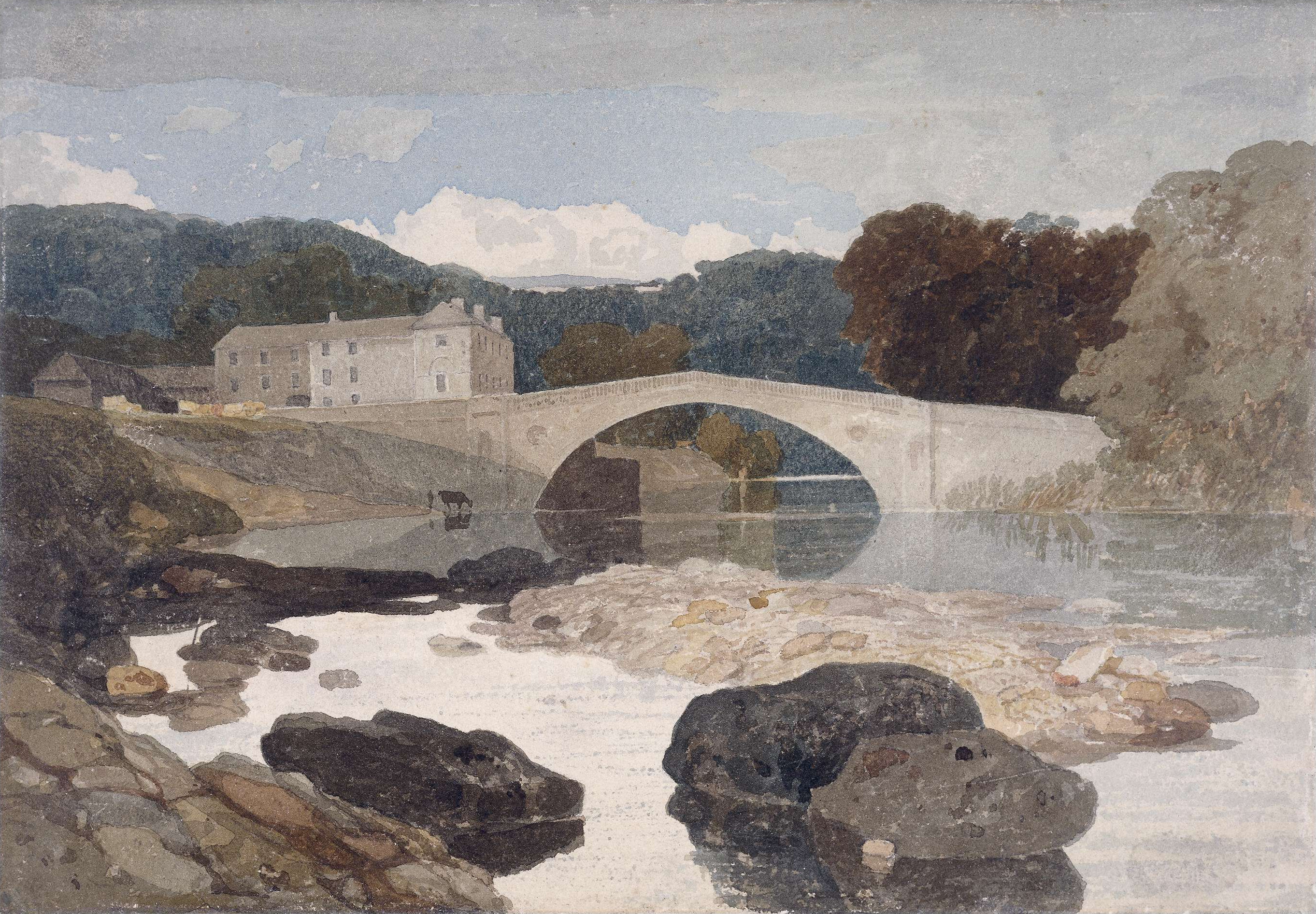
Greta Bridge

Greta Bridge is a village on the River Greta in County Durham, England. == Geography and administration == Greta Bridge lies in the Pennine hills near...

Nearby Amenities

Located within 500m of 54.482553,-1.894996
Barrier: entrance
Lat/Long: 54.4835618/-1.8918854
Hunting Stand
Hunting Stand: grouse_butt
Lat/Long: 54.4786719/-1.8914321
Hunting Stand
Hunting Stand: grouse_butt
Lat/Long: 54.4836709/-1.8884441
Hunting Stand
Hunting Stand: grouse_butt
Lat/Long: 54.4833258/-1.8881907
Hunting Stand
Hunting Stand: grouse_butt
Lat/Long: 54.4829565/-1.8879063
Hunting Stand
Hunting Stand: grouse_butt
Lat/Long: 54.4825654/-1.8876167
Hunting Stand
Hunting Stand: grouse_butt
Lat/Long: 54.4822966/-1.8874021
Moorcock Farm
Addr City: Richmond
Addr Postcode: DL11 7DY
Place: farm
Source Name: OS_OpenData_StreetView
Source Postcode: CodePoint Open
Lat/Long: 54.4831474/-1.8973289
The data included in this document is from www.openstreetmap.org. The data is made available under ODbL.

Have you been to Barningham?

Leave your review of Barningham below (or comments, questions and feedback).