Barlow
Civil Parish in Derbyshire North East Derbyshire
England
Barlow
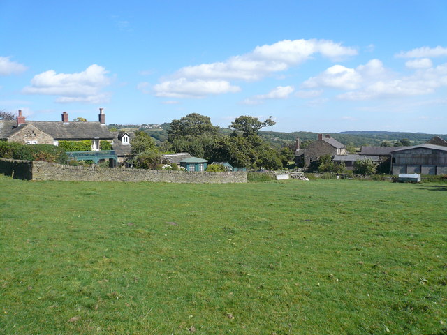
![Guide Stoop, Eastmoor On the Northern apex of the triangular plot that encompasses Cornerstone Farm, bounded by Clodhall Lane and the B5060. This guide stone / milestone was erected in 1743 before the era of the Chesterfield and Hernstone Lane Head Turnpike Trust. There is a cancelled benchmark on the Northern face.
Inscription: Bake / well / Road / 1743 // [?] / Middle / ton / Road / [bm] // Dron / field / Road
Grade II listed, Nᴼ. 1291930
Milestone Society National ID: DE_XBRA01](https://s1.geograph.org.uk/geophotos/07/40/06/7400645_18eed8e6.jpg)
Barlow is a civil parish located in the district of North East Derbyshire, in the county of Derbyshire, England. It is situated about 5 miles southeast of the town of Chesterfield and covers an area of approximately 4.5 square miles. The parish is surrounded by beautiful countryside and is part of the Peak District National Park, known for its stunning landscapes and outdoor recreational opportunities.
Barlow is a small and historic village with a population of around 800 residents. It has a rich history dating back to the medieval period, with several listed buildings and structures still standing today. The village is known for its charming rural character, with traditional stone-built cottages, a village green, and a picturesque church dating back to the 12th century.
The local economy of Barlow is mainly based on agriculture and tourism. The village is a popular destination for tourists, nature enthusiasts, and hikers, as it offers easy access to the stunning Peak District countryside. Visitors can enjoy scenic walks, cycling routes, and the opportunity to explore the nearby Chatsworth House, one of England's most famous stately homes.
Barlow has a strong sense of community, with various local events and activities taking place throughout the year. The village has a primary school, a village hall, a post office, and a pub, providing essential amenities for its residents.
Overall, Barlow is a charming and idyllic village nestled within the beautiful Derbyshire countryside, offering a peaceful and picturesque setting for both residents and visitors alike.
If you have any feedback on the listing, please let us know in the comments section below.
Barlow Images
Images are sourced within 2km of 53.261243/-1.556372 or Grid Reference SK2973. Thanks to Geograph Open Source API. All images are credited.


Barlow is located at Grid Ref: SK2973 (Lat: 53.261243, Lng: -1.556372)
Administrative County: Derbyshire
District: North East Derbyshire
Police Authority: Derbyshire
What 3 Words
///shuffles.flute.donation. Near Baslow, Derbyshire
Related Wikis
Birchen Edge
Birchen Edge is a gritstone rock face in the Peak District, England, popular with walkers and novice climbers as most of the climbing routes are in the...

North East Derbyshire (UK Parliament constituency)
North East Derbyshire is a constituency created in 1885 represented in the House of Commons of the UK Parliament since 2017 by Lee Rowley of the Conservative...

Barlow Woodseats Hall
Barlow Woodseats Hall is a Grade II* listed manor house situated at Barlow Woodseats, on the edge of the village of Barlow, in Derbyshire. It remains the...
Unthank, Derbyshire
Unthank is a hamlet in the North East Derbyshire district of Derbyshire, England. It is sited on a narrow lane on the southern slopes of the Cordwell Valley...

Barbrook One
Barbrook One (grid reference SK27857558) is a stone circle on Ramsley Moor in the Peak District. == Description == "Barbrook No. 1" is an embanked stone...

Gardom's Edge
Gardom's Edge is a rocky outcrop near Baslow in Derbyshire, England. The shelf between Gardom's Edge and Birchen Edge is now moorland used for grazing...

Brampton, North East Derbyshire
Brampton is a civil parish in North East Derbyshire, England, with a population of 1,201 in 2011. Lying 130 miles (210 km) north west of London, 20 miles...

Ingmanthorpe, Derbyshire
Ingmanthorpe is a hamlet in Brampton, Derbyshire, England. Ingmanthorpe is located on the B6050 road some 3 miles (4.8 km) west of the town of Chesterfield...
Related Videos

Peak District - Castleton Walk - Solo Travels - Hiking Weekend - Hostel Stay
hikingadventures #solotravel #hostel.
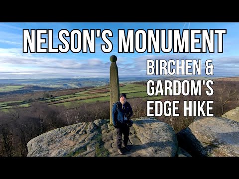
Hiking to Nelson's Monument in the Peak District | Breathtaking Views & History!
This was my solo adventure hiking to Nelson's monument in the beautiful Peak District. Taking in Birchen Edge and Gardom Edge ...
Barbrook One | Peak District | Solo Hiking
Where To Go In Peak District: Barbrook Stone Circle | Solo Hiking Get the same gear as me for shooting vlogs: DJI Drones: DJI ...
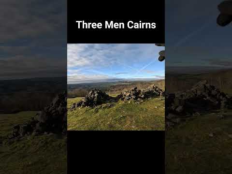
Three Men Cairns on Gardom's Edge Peak District #shorts #peakdistrict #hiking
A short clip form my recent hike along Birchen and Gardom's edges. These are the Three Men cairns at the end of Gardom's Edge.
Nearby Amenities
Located within 500m of 53.261243,-1.556372Have you been to Barlow?
Leave your review of Barlow below (or comments, questions and feedback).