Barley

Civil Parish in Hertfordshire North Hertfordshire

England

Barley

The Fox & Hounds Pub - Barley, Hertfordshire This pub was built in the 17th century. Its very interesting gantry sign is one of only two remaining in Hertfordshire.
The Fox & Hounds Pub - Barley, Hertfordshire Credit: Catherine Edwards

Barley is a civil parish located in the county of Hertfordshire, England. Situated approximately 10 miles southwest of the county town of Hertford, Barley is a small village with a population of around 600 people. The parish covers an area of approximately 4 square miles and is surrounded by picturesque countryside.

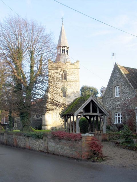
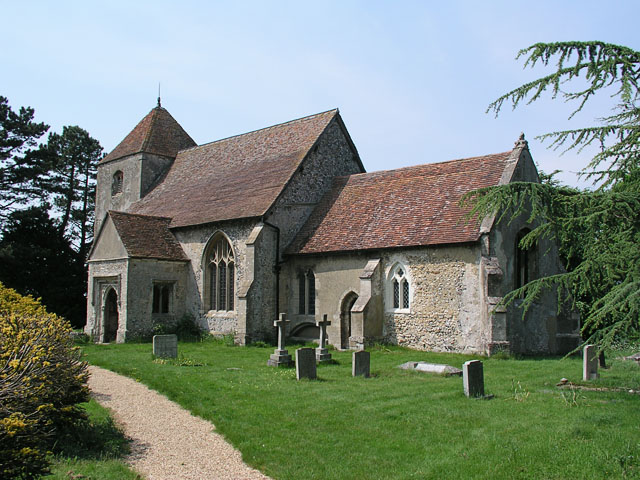
The village of Barley is known for its charming and quaint atmosphere, with many historic buildings and traditional thatched cottages lining its streets. The centerpiece of the village is the 14th-century parish church, St. Margaret of Antioch, which boasts a striking tower and stained glass windows.

Despite its small size, Barley offers a range of amenities to its residents. These include a primary school, a village hall, a pub, and a post office. The village also has several sports clubs, including cricket and football teams, providing recreational activities for the community.

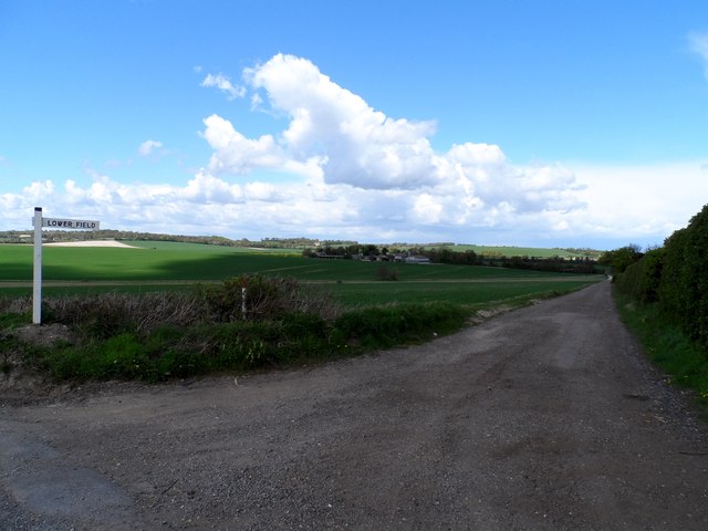
Barley is surrounded by beautiful countryside, making it a popular destination for outdoor enthusiasts. The village is located near the northern edge of the Chiltern Hills, a designated Area of Outstanding Natural Beauty. This allows residents and visitors to enjoy scenic walks, cycling routes, and horse riding trails. Nearby attractions include the Icknield Way Trail, Therfield Heath, and Royston Cave.

Overall, Barley is a charming and picturesque village, offering a tranquil and idyllic lifestyle for its residents, with easy access to both rural and urban amenities.

If you have any feedback on the listing, please let us know in the comments section below.
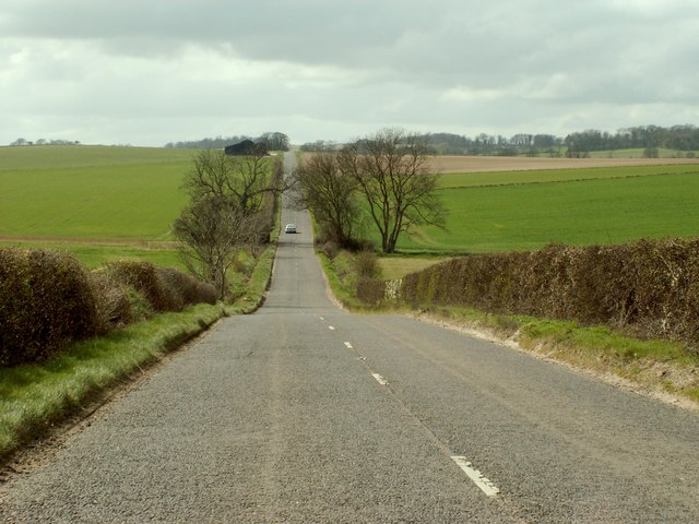
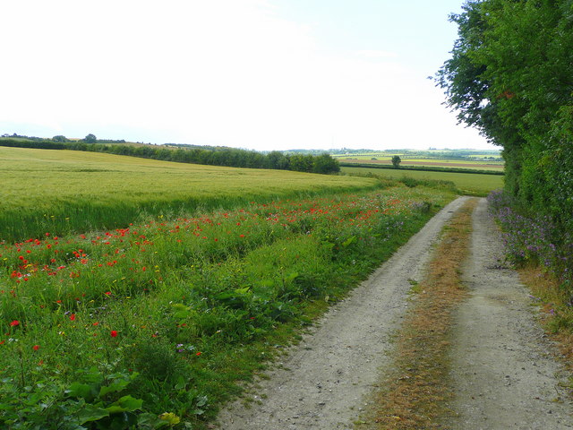
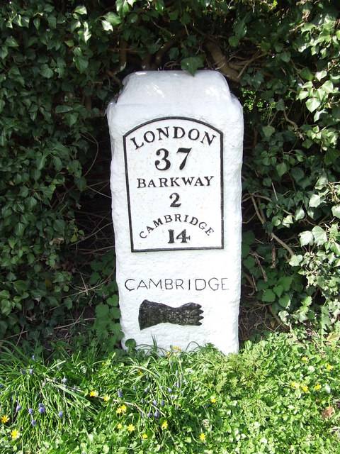
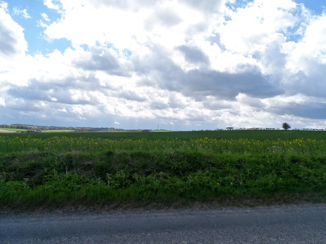
Barley Images

Images are sourced within 2km of 52.029199/0.036401 or Grid Reference TL3938. Thanks to Geograph Open Source API. All images are credited.

The Fox & Hounds Pub - Barley, Hertfordshire This pub was built in the 17th century. Its very interesting gantry sign is one of only two remaining in Hertfordshire.
The Fox & Hounds Pub - Barley, Hertfordshire
This pub was built in the 17th century. Its very interesting gantry sign is one of only two remaining in Hertfordshire.
Bogmoor Road Bogmoor Road leaves the B1368 Cambridge Road at Barkway Hill
Bogmoor Road
Bogmoor Road leaves the B1368 Cambridge Road at Barkway Hill
Footpath to Smith's End Farm
Barley fields are forever These fields are adjacent to the village of Barley!
Barley fields are forever
These fields are adjacent to the village of Barley!
Cambridge Road south of Barley
The B.1039, heading towards Royston
The B.1039 between Barley and Royston
Entrance to the eastern section of Newsells Park Stud
Part of the small village of Newsells
Track and barley field Yes it is barley at Barley!
Track and barley field
Yes it is barley at Barley!
Track and footpath to Barley Looking south-east from the B1039 near Royston.
Track and footpath to Barley
Looking south-east from the B1039 near Royston.
Old Milestone Old milestone on the B1368 at Barley, Hertfordshire. For close up view see <a title="https://www.geograph.org.uk/photo/1792432" href="https://www.geograph.org.uk/photo/1792432">Link</a> and for more info see <span class="nowrap"><a title="http://milestones.megalithia.com/sites/tl398383.htm" rel="nofollow ugc noopener" href="http://milestones.megalithia.com/sites/tl398383.htm">Link</a><img style="margin-left:2px;" alt="External link" title="External link - shift click to open in new window" src="https://s1.geograph.org.uk/img/external.png" width="10" height="10"/></span> do look at their home page.
Old Milestone
Old milestone on the B1368 at Barley, Hertfordshire. For close up view see Link and for more info see LinkExternal link do look at their home page.
Old Milestone Old milestone on the B1368 at Barley, Hertfordshire. For overall view see <a title="https://www.geograph.org.uk/photo/1792426" href="https://www.geograph.org.uk/photo/1792426">Link</a> and for more info see <span class="nowrap"><a title="http://milestones.megalithia.com/sites/tl398383.htm" rel="nofollow ugc noopener" href="http://milestones.megalithia.com/sites/tl398383.htm">Link</a><img style="margin-left:2px;" alt="External link" title="External link - shift click to open in new window" src="https://s1.geograph.org.uk/img/external.png" width="10" height="10"/></span> do look at their home page.
Old Milestone
Old milestone on the B1368 at Barley, Hertfordshire. For overall view see Link and for more info see LinkExternal link do look at their home page.
Old Milestone Old milestone on the B1368 near to Newsells, Hertfordshire. For close up view see <a title="https://www.geograph.org.uk/photo/1792471" href="https://www.geograph.org.uk/photo/1792471">Link</a> and for more info see <span class="nowrap"><a title="http://milestones.megalithia.com/sites/missing.php?site_status=offmap&site_ngr=TL391366&site_name=Newsells&site_surveyed=2001" rel="nofollow ugc noopener" href="http://milestones.megalithia.com/sites/missing.php?site_status=offmap&site_ngr=TL391366&site_name=Newsells&site_surveyed=2001">Link</a><img style="margin-left:2px;" alt="External link" title="External link - shift click to open in new window" src="https://s1.geograph.org.uk/img/external.png" width="10" height="10"/></span> do look at their home page.
Old Milestone
Old milestone on the B1368 near to Newsells, Hertfordshire. For close up view see Link and for more info see LinkExternal link do look at their home page.
Old Milestone Old milestone on the B1368 near to Newsells, Hertfordshire. For overall view see <a title="https://www.geograph.org.uk/photo/1792462" href="https://www.geograph.org.uk/photo/1792462">Link</a> and for more info see <span class="nowrap"><a title="http://milestones.megalithia.com/sites/missing.php?site_status=offmap&site_ngr=TL391366&site_name=Newsells&site_surveyed=2001" rel="nofollow ugc noopener" href="http://milestones.megalithia.com/sites/missing.php?site_status=offmap&site_ngr=TL391366&site_name=Newsells&site_surveyed=2001">Link</a><img style="margin-left:2px;" alt="External link" title="External link - shift click to open in new window" src="https://s1.geograph.org.uk/img/external.png" width="10" height="10"/></span> do look at their home page.
Old Milestone
Old milestone on the B1368 near to Newsells, Hertfordshire. For overall view see Link and for more info see LinkExternal link do look at their home page.
Farm land adjacent to B1039 There is very little oil seed rape around this year apparently because of the unusually cold weather in March. The crop here is not as advanced as it usually is at this time of year. The transmitter mast near to Barkway (2.5 miles away) is visible in the distance.
Farm land adjacent to B1039
There is very little oil seed rape around this year apparently because of the unusually cold weather in March. The crop here is not as advanced as it usually is at this time of year. The transmitter mast near to Barkway (2.5 miles away) is visible in the distance.
Isolated barn and B1039
Track to Lowerfield Lower Field on the sign post but Lowerfield on the O.S. map.
Track to Lowerfield
Lower Field on the sign post but Lowerfield on the O.S. map.
Show me another place!

Barley is located at Grid Ref: TL3938 (Lat: 52.029199, Lng: 0.036401)

Administrative County: Hertfordshire

District: North Hertfordshire

Police Authority: Hertfordshire

What 3 Words

///geology.washing.plod. Near Royston, Hertfordshire

Nearby Locations

Barley Barley

Related Wikis

Barley, Hertfordshire

Barley is a village and civil parish in the district of North Hertfordshire, England. According to the 2001 census, it has a population of 659, increasing...
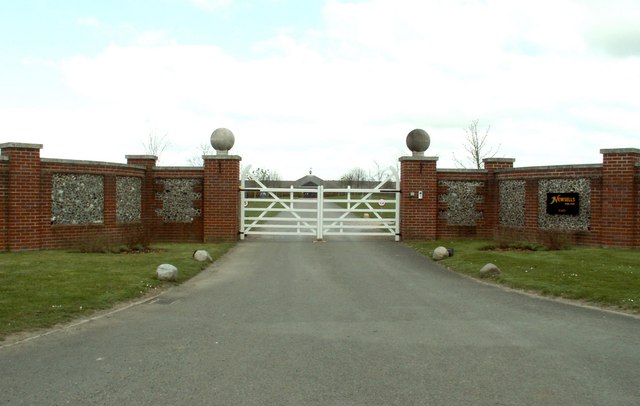
Newsells Park

Newsells Park is a country house and estate at Barkway in Hertfordshire. == History == The estate and the original manor house, built in the late 17th...

Great Chishill

Great Chishill is a village and former civil parish, now in the parish of Great and Little Chishill, in the South Cambridgeshire district, in the county...

Little Chishill

Little Chishill is a village and former civil parish, now in the parish of Great and Little Chishill, in the South Cambridgeshire district, in the county...

Barkway Chalk Pit

Barkway Chalk Pit is a small (0.3 hectare) nature reserve in Barkway in North Hertfordshire. It was managed by the Herts and Middlesex Wildlife Trust...

RAF Barkway

Royal Air Force Barkway or more simply RAF Barkway was one of the smallest Royal Air Force stations in the United Kingdom. It was a Communications Station...

River Quin

The River Quin is a small watercourse which rises near Barkway in north east Hertfordshire, England. The river is fed by a number of sources including...

Barkway

Barkway is a long-established village and civil parish in the North Hertfordshire district of Hertfordshire, England, about five miles south-east of...

Nearby Amenities

Located within 500m of 52.029199,0.036401
Barley
Created By: Potlatch 0.4a
Is In: Hertfordshire,England,UK
Place: village
Wikidata: Q4861153
Lat/Long: 52.0278442/0.0404716
Doctors
Barley Surgery
Healthcare: doctor
Lat/Long: 52.0297807/0.0379159
Barrier: cattle_grid
Lat/Long: 52.0292676/0.0414505
Parking
Lat/Long: 52.0271923/0.0409853
Bus Stop
Draytons Garage
Bus: yes
Naptan AtcoCode: 210021103940
Naptan Bearing: N
Naptan BusStopType: CUS
Naptan CommonName: Draytons Garage
Naptan Crossing: opp Draytons Garage
Naptan Indicator: opp
Naptan Landmark: opp Draytons Garage
Naptan NaptanCode: hrtgjtaw
Naptan ShortCommonName: NA
Naptan Street: High Street
Naptan Verified: no
Public Transport: platform
Source: naptan_import
Lat/Long: 52.0294981/0.0381585
Bus Stop
St Margaret of Antioch Church
Bus: yes
Naptan AtcoCode: 210021103965
Naptan Bearing: NE
Naptan BusStopType: CUS
Naptan CommonName: St Margaret of Antioch Church
Naptan Crossing: Barley C P First School
Naptan Indicator: opp
Naptan Landmark: Barley C P First School
Naptan NaptanCode: hrtgjtdg
Naptan ShortCommonName: NA
Naptan Street: Church End
Naptan Verified: no
Public Transport: platform
Source: naptan_import
Lat/Long: 52.0266271/0.0411367
Bus Stop
High Street
Bus: yes
Naptan AtcoCode: 210021103970
Naptan Bearing: NW
Naptan BusStopType: CUS
Naptan CommonName: High Street
Naptan Crossing: Cambridge Road
Naptan Indicator: NE-bound
Naptan Landmark: Cambridge Road
Naptan NaptanCode: hrtgjtdj
Naptan ShortCommonName: NA
Naptan Street: Picknage Road
Naptan Verified: no
Public Transport: platform
Source: naptan_import
Lat/Long: 52.0316319/0.0398226
Bus Stop
Richmond's Garage
Bus: yes
Fixme: Survey; move this stop to its location proper
Naptan AtcoCode: 210021103980
Naptan Bearing: NE
Naptan BusStopType: CUS
Naptan CommonName: Richmond's Garage
Naptan Crossing: Richmond's Garage
Naptan Indicator: adj
Naptan Landmark: Richmond's Garage
Naptan NaptanCode: hrtgjptd
Naptan ShortCommonName: NA
Naptan Street: High Street
Naptan Verified: no
Public Transport: platform
Source: naptan_import
Lat/Long: 52.0262752/0.0380886
Bus Stop
St Margaret of Antioch Church
Bus: yes
Naptan AtcoCode: 210021104375
Naptan Bearing: SW
Naptan BusStopType: CUS
Naptan CommonName: St Margaret of Antioch Church
Naptan Crossing: opp Town House
Naptan Indicator: adj
Naptan Landmark: opp Town House
Naptan NaptanCode: hrtgjpjt
Naptan ShortCommonName: NA
Naptan Street: Church End
Naptan Verified: no
Public Transport: platform
Source: naptan_import
Lat/Long: 52.0265724/0.0411779
Bus Stop
High Street
Bus: yes
Naptan AtcoCode: 210021104390
Naptan Bearing: SE
Naptan BusStopType: CUS
Naptan CommonName: High Street
Naptan Crossing: Cambridge Road
Naptan Indicator: SE-bound
Naptan Landmark: Cambridge Road
Naptan NaptanCode: hrtgjpma
Naptan ShortCommonName: NA
Naptan Street: Picknage Road
Naptan Verified: no
Public Transport: platform
Source: naptan_import
Lat/Long: 52.0316168/0.0400217
Bus Stop
Draytons Garage
Bus: yes
Naptan AtcoCode: 210021104395
Naptan Bearing: S
Naptan BusStopType: CUS
Naptan CommonName: Draytons Garage
Naptan Crossing: Draytons Garage
Naptan Indicator: adj
Naptan Landmark: Draytons Garage
Naptan NaptanCode: hrtgjpmd
Naptan ShortCommonName: NA
Naptan Street: High Street
Naptan Verified: no
Public Transport: platform
Source: naptan_import
Lat/Long: 52.0296288/0.0382993
Bus Stop
Richmond's Garage
Bus: yes
Naptan AtcoCode: 210021104440
Naptan Bearing: SW
Naptan BusStopType: CUS
Naptan CommonName: Richmond's Garage
Naptan Crossing: Crossways
Naptan Indicator: opp
Naptan Landmark: Crossways
Naptan NaptanCode: hrtgjpmt
Naptan ShortCommonName: NA
Naptan Street: London Road
Naptan Verified: no
Public Transport: platform
Source: naptan_import
Lat/Long: 52.0261282/0.0382714
Bench
Lat/Long: 52.0328164/0.0375078
Bench
Lat/Long: 52.0259461/0.0368469
Post Box
Church End, Barley
Collection Times: Mo-Fr 16:30; Sa 10:00
Description: At left-side driveway wall, just west of the Post Office (which is in a barn)/Church End
Post Box Type: lamp
Ref: SG8 10
Lat/Long: 52.0269777/0.041998
Power: pole
Lat/Long: 52.0249865/0.0386854
Milestone
Historic: milestone
Note Ref: 14 miles to Cambridge.
Operator: Trinity Hall, Cambridge
Ref: 14
Source: survey
Wikidata: Q26678789
Lat/Long: 52.0258481/0.0366068
Historic: memorial
Memorial: war_memorial
Lat/Long: 52.0261336/0.0383933
Public Bookcase
Barley Book Box
Booth: K6
Disused Amenity: telephone
Man Made: telephone_box
Public Bookcase Type: phone_box
Lat/Long: 52.026746/0.0383571
Post Box
Post Box Type: pillar
Lat/Long: 52.0270247/0.0383214
Entrance: main
Lat/Long: 52.0271003/0.0424111
Bench
Material: wood
Source: GPS, observation
Lat/Long: 52.0309714/0.0308347
Post Office
Brand: Post Office
Brand Wikidata: Q1783168
Opening Hours: Mo-Th 09:00-16:00; Fr 09:00-13:00
Operator: Londis
Ref Pol Id: 217
Lat/Long: 52.0271319/0.0423548
The data included in this document is from www.openstreetmap.org. The data is made available under ODbL.

Have you been to Barley?

Leave your review of Barley below (or comments, questions and feedback).