Bamburgh

Civil Parish in Northumberland

England

Bamburgh

Sheep Grazing near the Links Road Car Park
Sheep Grazing near the Links Road Car Park Credit: David Dixon

Bamburgh is a civil parish located in the county of Northumberland, England. Situated on the northeast coast of England, it is known for its picturesque seaside location and rich historical heritage. The parish covers an area of approximately 4.5 square miles and is home to a population of around 500 people.

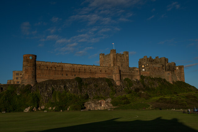
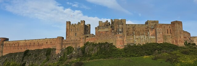
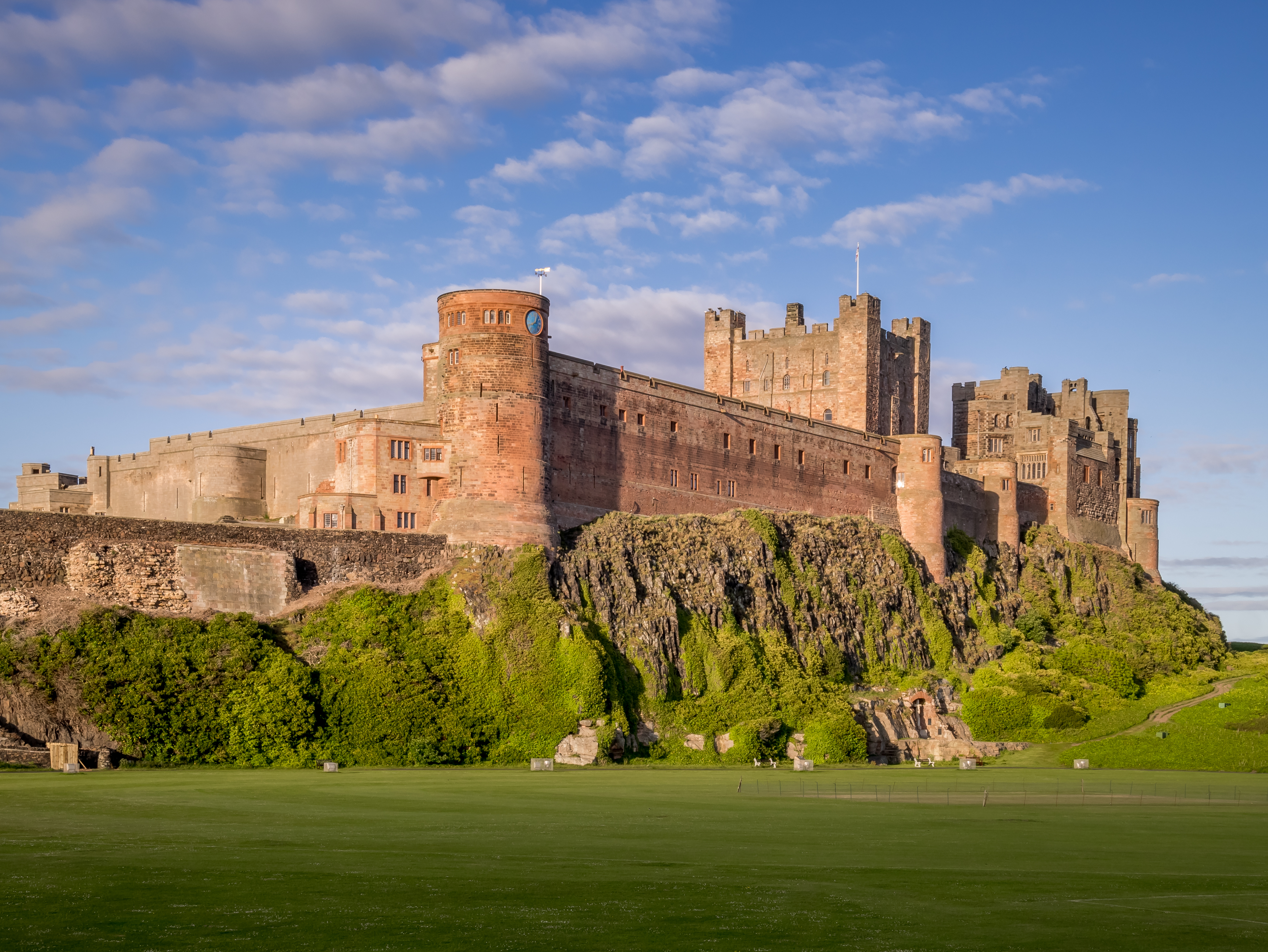
The village of Bamburgh is dominated by its iconic castle, one of the most impressive in the country. This medieval fortress overlooks the stunning Bamburgh Beach and the North Sea, offering breathtaking views to visitors. The castle has a history dating back over 1,400 years and was once the royal seat of the Kings of Northumbria. Today, it is open to the public and houses a museum showcasing its fascinating past.

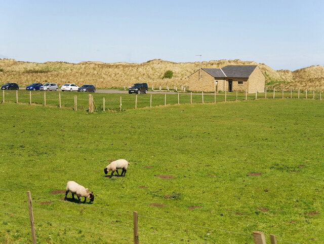
Aside from its castle, Bamburgh is also renowned for its sandy beaches, which stretch for miles along the coast. These beaches are popular with locals and tourists alike, offering opportunities for sunbathing, picnicking, and water sports such as surfing and windsurfing.

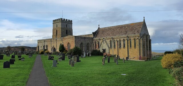
The village itself has a charming and quaint atmosphere, with traditional stone houses and narrow streets. It boasts a range of amenities including shops, cafes, and pubs, providing visitors with a taste of local Northumbrian hospitality.

Bamburgh is also a popular destination for nature lovers, as it is surrounded by beautiful countryside and nature reserves. The Farne Islands, located just off the coast, are a haven for birdwatching enthusiasts and offer boat trips to observe the rich marine wildlife.

Overall, Bamburgh is a captivating destination that combines history, natural beauty, and a warm community spirit, making it a must-visit location for visitors to Northumberland.

If you have any feedback on the listing, please let us know in the comments section below.
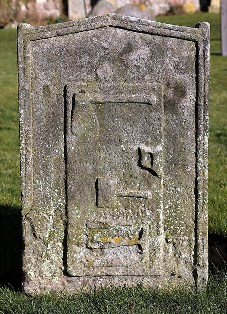
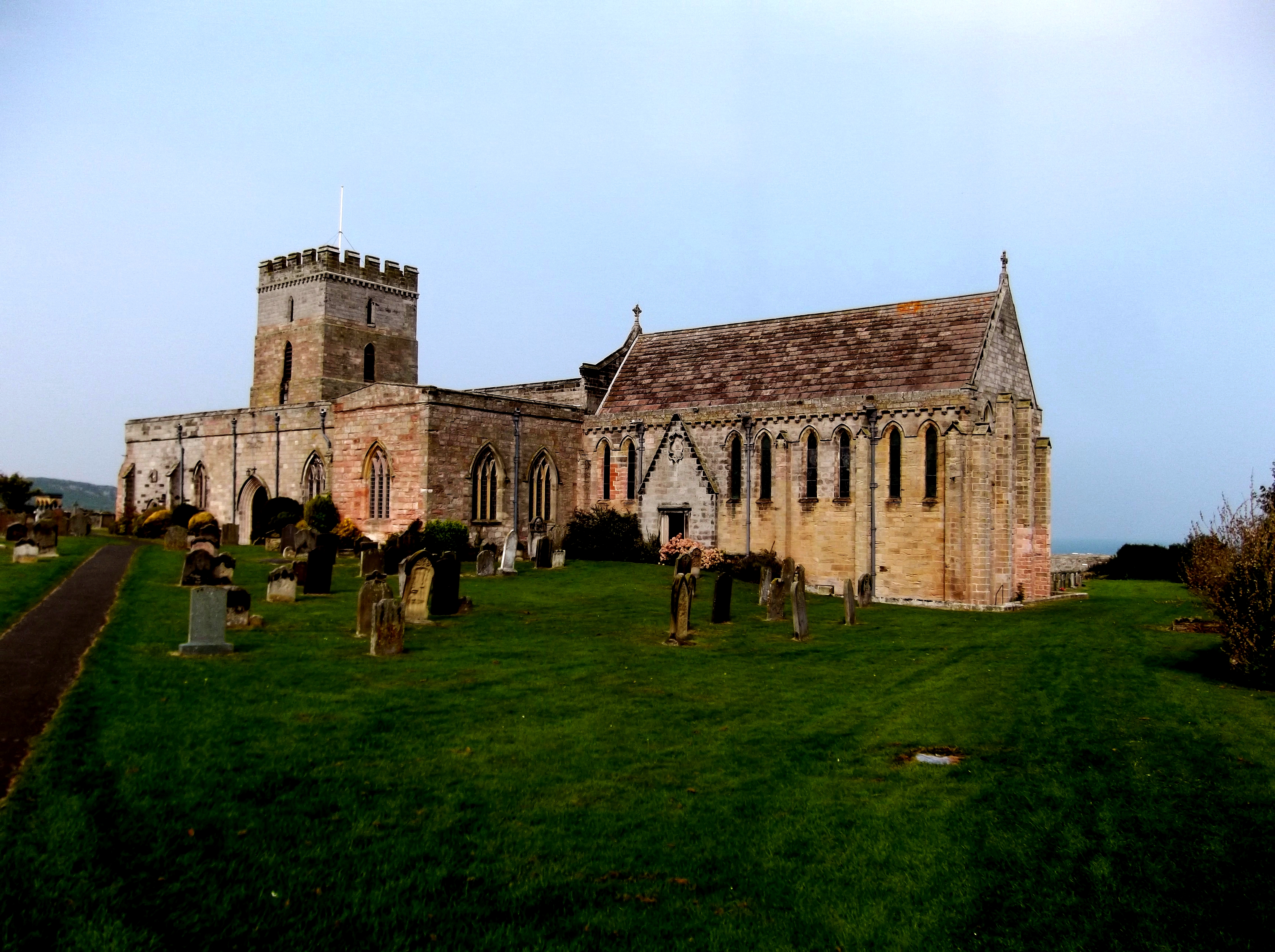
Bamburgh Images

Images are sourced within 2km of 55.598631/-1.722245 or Grid Reference NU1733. Thanks to Geograph Open Source API. All images are credited.

Sheep Grazing near the Links Road Car Park
End of Parking Area on the B1342 near to Budle
Church of St. Aidan, Church Street, Bamburgh This Grade I Listed Building dates back to the 12th century and was subsequently added to/altered/renovated over the years.
Church of St. Aidan, Church Street, Bamburgh
This Grade I Listed Building dates back to the 12th century and was subsequently added to/altered/renovated over the years.
Bamburgh Castle, Bamburgh There is evidence of a castle having stood on this dolerite outcrop dating back to medieval times although the core of the present building was built during Norman times. After a chequered history of ownership, the castle was bought by Victorian Industrialist Lord Armstrong in 1894, and it is still owned by the Armstrong family. It is a Grade I Listed Building.
Bamburgh Castle, Bamburgh
There is evidence of a castle having stood on this dolerite outcrop dating back to medieval times although the core of the present building was built during Norman times. After a chequered history of ownership, the castle was bought by Victorian Industrialist Lord Armstrong in 1894, and it is still owned by the Armstrong family. It is a Grade I Listed Building.
Coastal Defences, Bamburgh As fears of invasion grew during World War II, a variety of defences were installed along the Northumberland coast, including these concrete anti-tank cubes. Whilst many of the anti-tank cubes, similar to these, are now partially buried in the sand, these are in much the same position as when first placed here. In recent years they have been creatively altered to two dice, two Rubik's Cubes and another more romantic one bearing a couple of hearts. The two dice have lost much of their colour since Andrew Curtis wandered this way back in June 2010 <a title="https://www.geograph.org.uk/photo/1913855" href="https://www.geograph.org.uk/photo/1913855">Link</a>
Coastal Defences, Bamburgh
As fears of invasion grew during World War II, a variety of defences were installed along the Northumberland coast, including these concrete anti-tank cubes. Whilst many of the anti-tank cubes, similar to these, are now partially buried in the sand, these are in much the same position as when first placed here. In recent years they have been creatively altered to two dice, two Rubik's Cubes and another more romantic one bearing a couple of hearts. The two dice have lost much of their colour since Andrew Curtis wandered this way back in June 2010 Link
Bamburgh Lighthouse Bamburgh Lighthouse (also known as Blackrocks Point Lighthouse) was built by Trinity House in 1910 to guide shipping both passing along the Northumberland coast and in the waters around the Farne Islands. It was extensively modernised in 1975 and is now monitored from the Trinity House Operations and Planning Centre in Harwich. Routine maintenance is carried out by a local attendant. It is the most northerly land-based lighthouse in England.
Bamburgh Lighthouse
Bamburgh Lighthouse (also known as Blackrocks Point Lighthouse) was built by Trinity House in 1910 to guide shipping both passing along the Northumberland coast and in the waters around the Farne Islands. It was extensively modernised in 1975 and is now monitored from the Trinity House Operations and Planning Centre in Harwich. Routine maintenance is carried out by a local attendant. It is the most northerly land-based lighthouse in England.
St Aidan's Church, Bamburgh According to Bede, St Aidan built a wooden church outside the castle wall, on the site of the current church, in AD 635, and he died here in AD 652; (a wooden beam preserved inside the church is traditionally said to be the one on which he rested as he died). The present church dates from the late 12th century. After the Reformation, St Aidan's became the parish church for the village but its maintenance was neglected, by 1600, it was in poor condition. Repairs were eventually completed, including significant restorations during the 1800s, the last one in 1895.

<span class="nowrap"><a title="https://en.wikipedia.org/wiki/St_Aidan%27s_Church,_Bamburgh" rel="nofollow ugc noopener" href="https://en.wikipedia.org/wiki/St_Aidan%27s_Church,_Bamburgh">Link</a><img style="margin-left:2px;" alt="External link" title="External link - shift click to open in new window" src="https://s1.geograph.org.uk/img/external.png" width="10" height="10"/></span>
St Aidan's Church, Bamburgh
According to Bede, St Aidan built a wooden church outside the castle wall, on the site of the current church, in AD 635, and he died here in AD 652; (a wooden beam preserved inside the church is traditionally said to be the one on which he rested as he died). The present church dates from the late 12th century. After the Reformation, St Aidan's became the parish church for the village but its maintenance was neglected, by 1600, it was in poor condition. Repairs were eventually completed, including significant restorations during the 1800s, the last one in 1895. LinkExternal link
Bamburgh Castle <span class="nowrap"><a title="https://en.wikipedia.org/wiki/Bamburgh_Castle" rel="nofollow ugc noopener" href="https://en.wikipedia.org/wiki/Bamburgh_Castle">Link</a><img style="margin-left:2px;" alt="External link" title="External link - shift click to open in new window" src="https://s1.geograph.org.uk/img/external.png" width="10" height="10"/></span>
Bamburgh Castle
Bamburgh Castle This view never disappoints, always different, yet always the same.
Bamburgh Castle
This view never disappoints, always different, yet always the same.
Lonsdale Hill, Northumberland Looking south over pastureland from the vicinity of Lonsdales Hill in the direction of Shada Plantation.
Lonsdale Hill, Northumberland
Looking south over pastureland from the vicinity of Lonsdales Hill in the direction of Shada Plantation.
Bamburgh Castle, Northumberland The view of the imposing Banburgh Castle. A castle has been on this site since the 6th century, now the oldest part is Norman with much restoration work undertaken in the 18th and 19th centuries.
Bamburgh Castle, Northumberland
The view of the imposing Banburgh Castle. A castle has been on this site since the 6th century, now the oldest part is Norman with much restoration work undertaken in the 18th and 19th centuries.
Bamburgh Castle, Northumberland A view of the 18th century windmill to the western edge of Bamburgh Castle.
Bamburgh Castle, Northumberland
A view of the 18th century windmill to the western edge of Bamburgh Castle.
Bamburgh, Northumberland Pastureland to the west of Bamburgh Castle.
Bamburgh, Northumberland
Pastureland to the west of Bamburgh Castle.
Bamburgh, Northumberland A view of the St Aidan's church which has a rich history believed to date back to the 600's, the present church dates from the 12th century.
Bamburgh, Northumberland
A view of the St Aidan's church which has a rich history believed to date back to the 600's, the present church dates from the 12th century.
Blackrocks Point Lighthouse Beyond Harkess Rocks.
Lindisfarne Castle on Holy Island is on the horizon.
Blackrocks Point Lighthouse
Beyond Harkess Rocks. Lindisfarne Castle on Holy Island is on the horizon.
Dunes below The Wynding With Bamburgh Castle beyond and visitors strolling along the vast beach.
Dunes below The Wynding
With Bamburgh Castle beyond and visitors strolling along the vast beach.
An 18th century symbolic gravestone at St Aidans’s Churchyard, Bamburgh The carvings of an axe, saw, mallet, chisel and hammer indicates that this is the grave of a carpenter.
An 18th century symbolic gravestone at St Aidans’s Churchyard, Bamburgh
The carvings of an axe, saw, mallet, chisel and hammer indicates that this is the grave of a carpenter.
Walking on Bamburgh Beach Inner Farne is in the background.
Walking on Bamburgh Beach
Inner Farne is in the background.
Show me another place!

Bamburgh is located at Grid Ref: NU1733 (Lat: 55.598631, Lng: -1.722245)

Unitary Authority: Northumberland

Police Authority: Northumbria

What 3 Words

///patching.rashers.reseller. Near Bamburgh, Northumberland

Nearby Locations

Bamburgh

Related Wikis

Nearby Amenities

Located within 500m of 55.598631,-1.722245
Barrier: stile
Lat/Long: 55.600959/-1.7263198
Material: wood
Power: pole
Lat/Long: 55.6009106/-1.7283417
Material: wood
Power: pole
Lat/Long: 55.5996448/-1.7246129
Material: wood
Power: pole
Lat/Long: 55.5992452/-1.7234532
Material: wood
Power: pole
Lat/Long: 55.5988638/-1.7223232
Material: wood
Power: pole
Lat/Long: 55.5976833/-1.718841
Material: wood
Power: pole
Lat/Long: 55.5968321/-1.7163751
Material: wood
Power: pole
Lat/Long: 55.6005477/-1.727262
Material: wood
Power: pole
Lat/Long: 55.5980772/-1.7200142
Material: wood
Power: pole
Lat/Long: 55.6000925/-1.7259341
Material: wood
Power: pole
Lat/Long: 55.5984612/-1.7211466
Material: wood
Power: pole
Lat/Long: 55.5972493/-1.7175855
The data included in this document is from www.openstreetmap.org. The data is made available under ODbL.

Have you been to Bamburgh?

Leave your review of Bamburgh below (or comments, questions and feedback).