Balk

Civil Parish in Yorkshire Hambleton

England

Balk

Thorn Hill farm Farm and nearby pylon in Thirkleby parish.
Thorn Hill farm Credit: Gordon Hatton

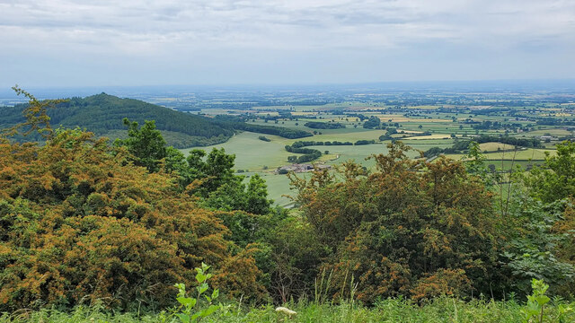
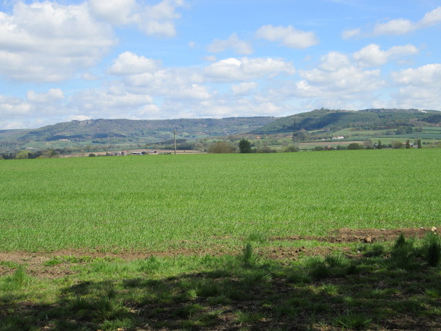
Balk is a civil parish located in the county of Yorkshire in England. It is situated within the Craven district, approximately 3 miles southeast of the market town of Settle. The parish covers an area of around 3.5 square miles and is surrounded by picturesque countryside, offering stunning views of the Yorkshire Dales.

Balk is a small and close-knit community with a population of around 200 residents. The parish consists of a scattering of charming stone-built houses and cottages, giving it a quintessential rural English village feel. The area is known for its peaceful and tranquil atmosphere, making it an ideal destination for those seeking a quiet and idyllic retreat.

The village is predominantly agricultural, with farming being the primary occupation of the local residents. The fertile land in the area supports livestock rearing and the cultivation of crops. Agriculture has been the backbone of the community for generations, contributing to the preservation of the traditional rural way of life.

Despite its small size, Balk offers a range of amenities to its residents. These include a village hall, a local pub, and a primary school, ensuring that the community's needs are met. The village is also in close proximity to Settle, where residents can access a wider range of services and amenities.

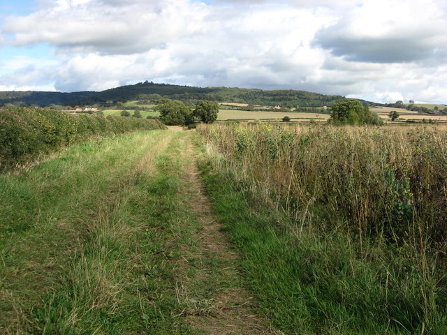
Balk's location in the Yorkshire Dales National Park makes it an attractive destination for outdoor enthusiasts. The area offers numerous opportunities for walking, hiking, and exploring the beautiful countryside. The village is also within easy reach of popular tourist attractions such as Malham Cove and Ingleborough, further enhancing its appeal to visitors.

If you have any feedback on the listing, please let us know in the comments section below.

Balk Images

Images are sourced within 2km of 54.222826/-1.269464 or Grid Reference SE4781. Thanks to Geograph Open Source API. All images are credited.
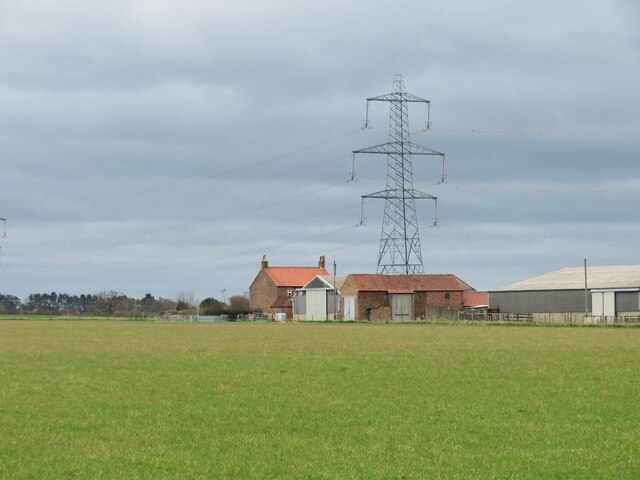
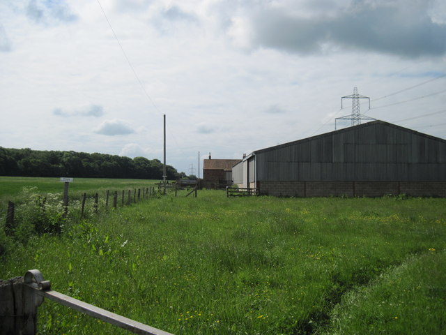
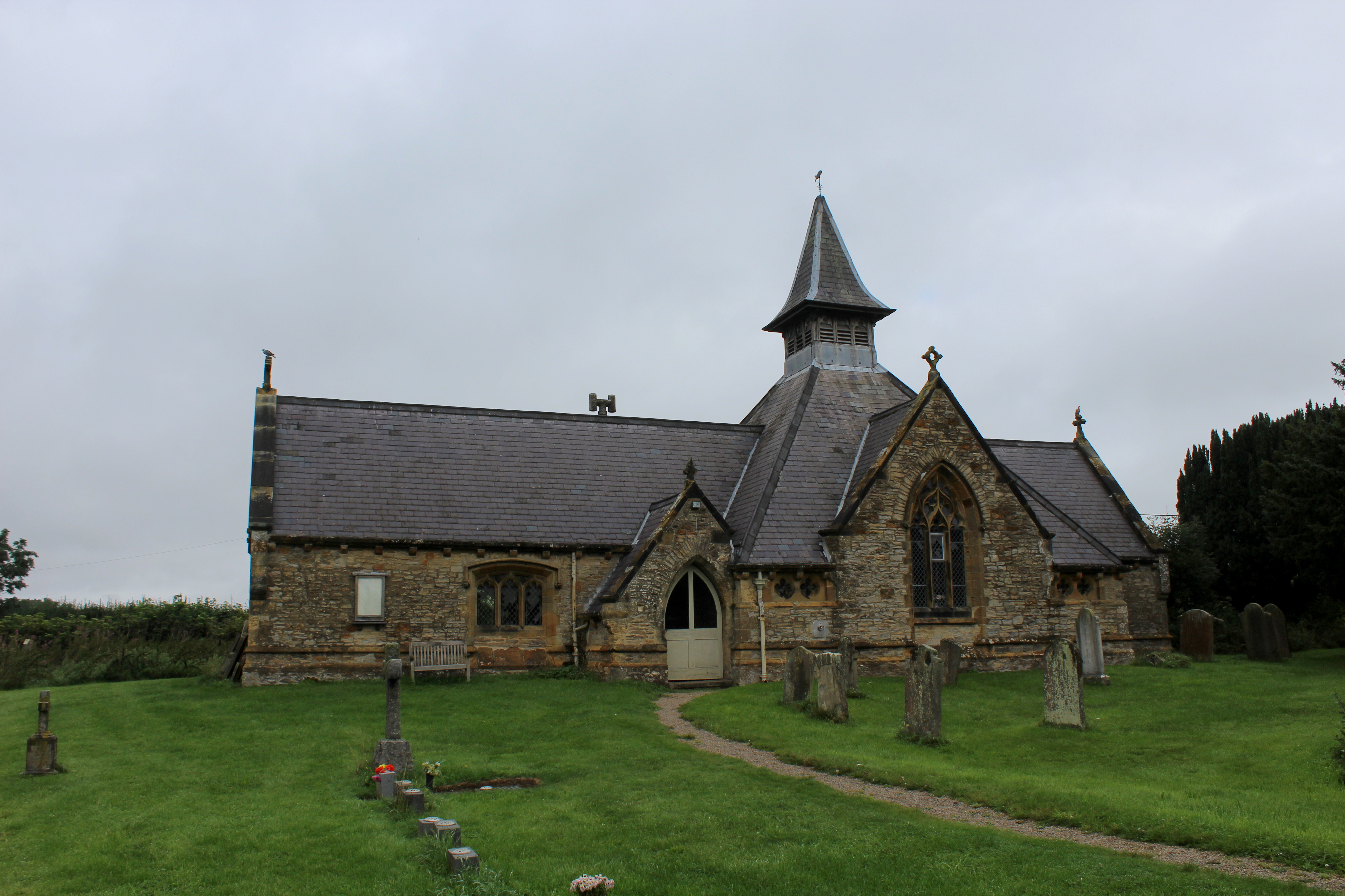
Thorn Hill farm Farm and nearby pylon in Thirkleby parish.
Thorn Hill farm
Farm and nearby pylon in Thirkleby parish.
Osgoodby Grange Farm The present farm appears to be on land once owned by Byland Abbey which had a grange [farm] here during the medieval period, whilst there is record of some of the land being transferred to Richard Askywith in 1532. To the north and east of the farm buildings there's still evidence of old ridge and furrow in the fields which could date back to medieval times.
Osgoodby Grange Farm
The present farm appears to be on land once owned by Byland Abbey which had a grange [farm] here during the medieval period, whilst there is record of some of the land being transferred to Richard Askywith in 1532. To the north and east of the farm buildings there's still evidence of old ridge and furrow in the fields which could date back to medieval times.
Rivet benchmark on Sutton Bridge Ordnance Survey rivet benchmark on the south parapet of Sutton Bridge, Sutton under Whitestonecliffe. The bridge carries the A170 over Sutton Beck. For a wider view see <a href="https://www.geograph.org.uk/photo/7442785">SE4882 : Sutton Beck from Sutton Bridge</a>

Rivet benchmark levelled at 72.262m above Newlyn Datum, verified 1967
Rivet benchmark on Sutton Bridge
Ordnance Survey rivet benchmark on the south parapet of Sutton Bridge, Sutton under Whitestonecliffe. The bridge carries the A170 over Sutton Beck. For a wider view see SE4882 : Sutton Beck from Sutton Bridge Rivet benchmark levelled at 72.262m above Newlyn Datum, verified 1967
Sutton Beck from Sutton Bridge Sutton Beck flows under Sutton Bridge in the village of Sutton under Whitestonecliffe. There is an Ordnance Survey rivet benchmark on the south parapet of the bridge. <a href="https://www.geograph.org.uk/photo/7442781">SE4882 : Rivet benchmark on Sutton Bridge</a> The well maintained land and wooden footbridge beyond the road bridge are private.
Sutton Beck from Sutton Bridge
Sutton Beck flows under Sutton Bridge in the village of Sutton under Whitestonecliffe. There is an Ordnance Survey rivet benchmark on the south parapet of the bridge. SE4882 : Rivet benchmark on Sutton Bridge The well maintained land and wooden footbridge beyond the road bridge are private.
Sutton Bridge parapet and the A170 Sutton Bridge carries the usually busy A170 over Sutton Beck at Sutton under Whitestonecliffe. There is an Ordnance Survey rivet benchmark on the south parapet <a href="https://www.geograph.org.uk/photo/7442781">SE4882 : Rivet benchmark on Sutton Bridge</a>
Sutton Bridge parapet and the A170
Sutton Bridge carries the usually busy A170 over Sutton Beck at Sutton under Whitestonecliffe. There is an Ordnance Survey rivet benchmark on the south parapet SE4882 : Rivet benchmark on Sutton Bridge
Old milepost This North Riding CC milepost is on the A170 about 20m from the village sign at the east end of Sutton-under-Whitestonecliffe.   It was cast by F Mattison & Co. of Bedale which is cast inside the lhs.   The mileposts on this route were refurbished at Cleveland Corrosion in Staithes in 2005.   NRYCC is on the bevel with the Y larger than the other letters.   It is Grade II listed 1150812.
Old milepost
This North Riding CC milepost is on the A170 about 20m from the village sign at the east end of Sutton-under-Whitestonecliffe. It was cast by F Mattison & Co. of Bedale which is cast inside the lhs. The mileposts on this route were refurbished at Cleveland Corrosion in Staithes in 2005. NRYCC is on the bevel with the Y larger than the other letters. It is Grade II listed 1150812.
"Finest View in England" Just a few minutes' walk from the Sutton Bank National Park Centre, there is what is called the "Finest View in England" - an excellent view from Sutton Bank all the way to Yorkshire Dales.
"Finest View in England"
Just a few minutes' walk from the Sutton Bank National Park Centre, there is what is called the "Finest View in England" - an excellent view from Sutton Bank all the way to Yorkshire Dales.
Lane to Abbot’s Close
A170 near Sutton-Under-Whitestonecliffe
Bridleway East of Thorn Hill Looking along the bridleway east of Thorn Hill, Hood Hill in the distance.
Bridleway East of Thorn Hill
Looking along the bridleway east of Thorn Hill, Hood Hill in the distance.
Bridleway  Junction Turn left for West Park Farm straight on for Thirkleby
Bridleway Junction
Turn left for West Park Farm straight on for Thirkleby
Thorn  Hill  Farm  with  Spring  Wood  beyond
Thorn Hill Farm with Spring Wood beyond
Bridleway  to  Mill  View Turn right for Thirkleby  Mill, left for Thirkleby at the junction
Bridleway to Mill View
Turn right for Thirkleby Mill, left for Thirkleby at the junction
Balk  Beck On the footpath to Balk, there is a good footbridge here not shown on O/S map
Balk Beck
On the footpath to Balk, there is a good footbridge here not shown on O/S map
North of Thirkleby Looking towards Sutton Bank & Hood Hill.
North of Thirkleby
Looking towards Sutton Bank & Hood Hill.
Bagby International Airfield See: <span class="nowrap"><a title="http://www.bagby-airfield.co.uk/" rel="nofollow ugc noopener" href="http://www.bagby-airfield.co.uk/">Link</a><img style="margin-left:2px;" alt="External link" title="External link - shift click to open in new window" src="https://s1.geograph.org.uk/img/external.png" width="10" height="10"/></span>
Bagby International Airfield
See: LinkExternal link
Bagby International Airfield View from the clubhouse.
See: <span class="nowrap"><a title="http://www.bagby-airfield.co.uk/" rel="nofollow ugc noopener" href="http://www.bagby-airfield.co.uk/">Link</a><img style="margin-left:2px;" alt="External link" title="External link - shift click to open in new window" src="https://s1.geograph.org.uk/img/external.png" width="10" height="10"/></span>
Bagby International Airfield
View from the clubhouse. See: LinkExternal link
Show me another place!

Balk is located at Grid Ref: SE4781 (Lat: 54.222826, Lng: -1.269464)

Division: North Riding

Administrative County: North Yorkshire

District: Hambleton

Police Authority: North Yorkshire

What 3 Words

///activity.situates.router. Near Thirsk, North Yorkshire

Related Wikis

Balk, North Yorkshire

Balk is a hamlet and civil parish in the former Hambleton District of North Yorkshire, England, just east of Thirsk. In the 2001 census the parish had...

St Mary's Church, Bagby

St Mary's Church is the parish church of Bagby, a village in North Yorkshire, in England. A chapel in Bagby was recorded in the Domesday Book, and again...

Sutton-under-Whitestonecliffe

Sutton-under-Whitestonecliffe is a village and civil parish in North Yorkshire, England. Historically part of the North Riding of Yorkshire, it is situated...

Bagby

Bagby is a village and civil parish in the former Hambleton District of North Yorkshire, England, 3 miles (5 km) south-east of Thirsk. The parish had a...

Nearby Amenities

Located within 500m of 54.222826,-1.269464
Power: tower
Lat/Long: 54.2198085/-1.2683438
Power: tower
Lat/Long: 54.2216206/-1.2688433
Power: tower
Lat/Long: 54.2234911/-1.2693597
Power: tower
Lat/Long: 54.2251977/-1.270203
Power: tower
Lat/Long: 54.2268442/-1.271058
Balk
Place: hamlet
Wikidata: Q2209004
Wikipedia: en:Balk, North Yorkshire
Lat/Long: 54.2214293/-1.2723805
Mini Roundabout
Lat/Long: 54.2231809/-1.2758088
Note: Not really a place
Source: survey
Lat/Long: 54.2209374/-1.274106
Post Box
Post Box Type: lamp
Lat/Long: 54.2208606/-1.2736603
Leisure: playground
Lat/Long: 54.2219688/-1.2767848
The data included in this document is from www.openstreetmap.org. The data is made available under ODbL.

Have you been to Balk?

Leave your review of Balk below (or comments, questions and feedback).