Bagendon

Civil Parish in Gloucestershire Cotswold

England

Bagendon

Dry stone walling This was taken at the junction of the A417 and the Itlay road before the A417 was dual carriageway Sadle all me work is no longer there as this was all demolished for the new road.
Dry stone walling Credit: norman hyett

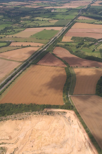
Bagendon is a civil parish located in the county of Gloucestershire, England. Situated approximately 5 miles south of the market town of Cirencester, it covers an area of about 900 acres. The parish is predominantly rural and is surrounded by picturesque countryside, with the Cotswold Hills to the east and the River Churn flowing through its western boundary.

The village of Bagendon itself is small, with a population of around 200 people. It is characterized by a mix of traditional limestone cottages and more modern buildings. The parish is known for its historic significance, with evidence of human activity dating back to the Neolithic period. There are several ancient sites within the area, including an Iron Age fort and a Roman villa.

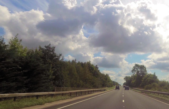
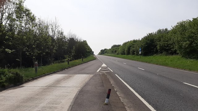
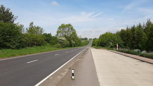
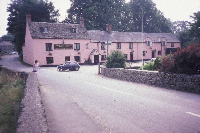
The village is well-connected, with good road links to nearby towns and cities. The A417 road runs through the parish, providing easy access to Cirencester, Swindon, and Cheltenham. Despite its rural location, Bagendon benefits from amenities such as a village hall and a pub, which serves as a social hub for the community.

The surrounding countryside offers plenty of opportunities for outdoor activities, including walking, cycling, and horse riding. Bagendon is also located close to the Cotswold Water Park, a popular leisure destination with numerous lakes and nature reserves.

Overall, Bagendon provides a tranquil and picturesque setting for those seeking a rural lifestyle, while still being within easy reach of nearby towns and amenities.

If you have any feedback on the listing, please let us know in the comments section below.

Bagendon Images

Images are sourced within 2km of 51.760254/-1.987812 or Grid Reference SP0006. Thanks to Geograph Open Source API. All images are credited.

Dry stone walling This was taken at the junction of the A417 and the Itlay road before the A417 was dual carriageway Sadle all me work is no longer there as this was all demolished for the new road.
Dry stone walling
This was taken at the junction of the A417 and the Itlay road before the A417 was dual carriageway Sadle all me work is no longer there as this was all demolished for the new road.
A417 crossing Welsh Way near Dartley
Daglingworth Junction Southbound A417
Daglingworth Junction
Southbound A417
Old Milestone by the A417, north of Daglingworth Metal plate attached to stone post by the A417, in parish of DAGLINGWORTH (COTSWOLD District), near Itlay turn (southbound carriageway), by the road . Cirencester iron plate, erected by the Cirencester to Birdlip turnpike trust in the 19th century. For a more recent image see <a href="https://www.geograph.org.uk/photo/6988499">SO9906 : Old Milestone, A417, near Daglingworth</a>

Inscription reads:-
CIREN.R
3
GLOSTER
14 

Grade II listed. List Entry Number: 1090206
<span class="nowrap"><a title="https://historicengland.org.uk/listing/the-list/list-entry/1090206" rel="nofollow ugc noopener" href="https://historicengland.org.uk/listing/the-list/list-entry/1090206">Link</a><img style="margin-left:2px;" alt="External link" title="External link - shift click to open in new window" src="https://s1.geograph.org.uk/img/external.png" width="10" height="10"/></span>

Milestone Society National ID: GL_LG93.
Old Milestone by the A417, north of Daglingworth
Metal plate attached to stone post by the A417, in parish of DAGLINGWORTH (COTSWOLD District), near Itlay turn (southbound carriageway), by the road . Cirencester iron plate, erected by the Cirencester to Birdlip turnpike trust in the 19th century. For a more recent image see SO9906 : Old Milestone, A417, near Daglingworth Inscription reads:- CIREN.R 3 GLOSTER 14 Grade II listed. List Entry Number: 1090206 LinkExternal link Milestone Society National ID: GL_LG93.
A417 Ermin Way and Daglingworth Quarry: aerial 2019
A417 Ermine Way and Daglingworth Quarry: aerial 2019
A417 southbound at Duntisbourne An empty road on the Friday morning in early May 2020.
A417 southbound at Duntisbourne
An empty road on the Friday morning in early May 2020.
Empty A417 Looking north towards Gloucester mid-morning Friday 8th May 2020.
Empty A417
Looking north towards Gloucester mid-morning Friday 8th May 2020.
Daglingworth quarry An image taken from the same position as one by my daughter 14 years ago.
The quarry is reportedly to continue in use until 2042.
Daglingworth quarry
An image taken from the same position as one by my daughter 14 years ago. The quarry is reportedly to continue in use until 2042.
An inn at North Cerney
Former Roman Road near Cirencester A view south-east along Ermin Street with Cirencester Parish Church in the distance. In Roman times, Cirencester was the second largest city in Britain and centre of a road network.
Former Roman Road near Cirencester
A view south-east along Ermin Street with Cirencester Parish Church in the distance. In Roman times, Cirencester was the second largest city in Britain and centre of a road network.
Old Water Wheel in Bagendon This water wheel is located in the farm next to St. Margaret's Church in Bagendon. It was once used to work a cider press, but now water extraction has dried up the springs that used to drive it.
Old Water Wheel in Bagendon
This water wheel is located in the farm next to St. Margaret's Church in Bagendon. It was once used to work a cider press, but now water extraction has dried up the springs that used to drive it.
Telephone Exchange at North Cerney.
Bathurst Arms and village street, North Cerney.
North Cerney's cricket ground. On a bit of a slope!
North Cerney's cricket ground.
On a bit of a slope!
Lane approaching Woodmancote from the south. A late autumn scene.
Lane approaching Woodmancote from the south.
A late autumn scene.
A gate and footpath with a fine view of Merchants Downs.
Country lane near Bagendon House.
Show me another place!

Bagendon is located at Grid Ref: SP0006 (Lat: 51.760254, Lng: -1.987812)

Administrative County: Gloucestershire

District: Cotswold

Police Authority: Gloucestershire

What 3 Words

///abacus.bookcases.arranges. Near Stratton, Gloucestershire

Related Wikis

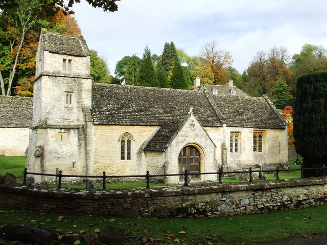
Church of St Margaret, Bagendon

The Anglican Church of St Margaret at Bagendon in the Cotswold District of Gloucestershire, England was built in the 12th century. It is a grade I listed...

Bagendon

Bagendon is a village and civil parish in the Cotswold district of Gloucestershire, England, about four miles north of Cirencester. According to the 2001...

A417 road

The A417 is a main road in England running from Streatley, Berkshire to Hope under Dinmore, Herefordshire. It is best known for its section between Cirencester...

North Cerney

North Cerney is a village and civil parish in the English county of Gloucestershire, and lies within the Cotswolds, a range of hills designated an Area...

Woodmancote, Cirencester

Woodmancote is a Cotswolds village near Cirencester, Gloucestershire, England. The village lies just off the A435. The village is 0.2 square miles (52...

Daglingworth

Daglingworth is a Gloucestershire village in the valley of the River Dunt, near the A417 road connecting Gloucester and Cirencester. As with many smaller...

Church of the Holy Rood , Daglingworth

The Anglican Church of the Holy Rood at Daglingworth in the Cotswold District of Gloucestershire, England was built in the 11th century. It is a Grade...

St Michael's Church, Duntisbourne Rouse

St Michael's Church is an Anglican church in the Cotswold village of Duntisbourne Rouse, Gloucestershire, England. It dates from no later than the 11th...

Nearby Amenities

Located within 500m of 51.760254,-1.987812
Bagendon
Created By: Potlatch 0.10b
Place: village
Source: NPE
Lat/Long: 51.7583226/-1.9841045
Bus Stop
St Margaret's Church
Bus: yes
Naptan AtcoCode: 1600GL5483
Naptan Bearing: SE
Naptan CommonName: St Margaret's Church
Naptan NaptanCode: glodwpga
Naptan Street: Main Street
Naptan Verified: no
Public Transport: platform
Source: naptan_import
Lat/Long: 51.758571/-1.9854678
Bus Stop
St Margaret's Church
Bus: yes
Naptan AtcoCode: 1600GL5484
Naptan Bearing: NW
Naptan CommonName: St Margaret's Church
Naptan NaptanCode: glodwpdw
Naptan Street: Main Street
Naptan Verified: no
Public Transport: platform
Source: naptan_import
Lat/Long: 51.758544/-1.9855258
Bus Stop
Bagendon House
Bus: yes
Naptan AtcoCode: 1600GLC617
Naptan Bearing: SE
Naptan CommonName: Bagendon House
Naptan NaptanCode: glodwmtw
Naptan Street: Upper End
Naptan Verified: no
Public Transport: platform
Source: naptan_import
Lat/Long: 51.7609841/-1.9916514
Bus Stop
Bagendon House
Bus: yes
Naptan AtcoCode: 1600GLC618
Naptan Bearing: NW
Naptan CommonName: Bagendon House
Naptan NaptanCode: glodwmtp
Naptan Street: Upper End
Naptan Verified: no
Public Transport: platform
Source: naptan_import
Lat/Long: 51.7609003/-1.9916976
Natural: spring
Source: OS 1:25k
Lat/Long: 51.757924/-1.9912158
Telephone
HE Ref: 1390962
Booth: K6
Covered: booth
Listed Status: Grade II
Phone: +44 1285 831353
Lat/Long: 51.7581102/-1.98481
Poles: bipole
Power: pole
Source: bing
Transformer: distribution
Lat/Long: 51.7583792/-1.9897056
Power: pole
Source: bing
Lat/Long: 51.7586449/-1.9888768
Power: pole
Source: bing
Transformer: distribution
Lat/Long: 51.7587196/-1.9864118
Power: pole
Source: bing
Lat/Long: 51.7586781/-1.9879326
Power: pole
Source: bing
Lat/Long: 51.7566517/-1.9874364
Power: pole
Source: bing
Lat/Long: 51.7579957/-1.9877663
Power: pole
Source: bing
Lat/Long: 51.7573316/-1.9876108
Power: pole
Source: bing
Lat/Long: 51.7558664/-1.9875477
The data included in this document is from www.openstreetmap.org. The data is made available under ODbL.

Have you been to Bagendon?

Leave your review of Bagendon below (or comments, questions and feedback).