Badgeworth

Civil Parish in Gloucestershire Tewkesbury

England

Badgeworth

Crickley Hill Car Park
Crickley Hill Car Park Credit: Matthew Chadwick

Badgeworth is a civil parish located in the county of Gloucestershire, England. Situated in the South West of the country, it lies approximately 10 miles northeast of the city of Gloucester. The parish covers an area of around 7 square miles and is home to a population of roughly 500 residents.

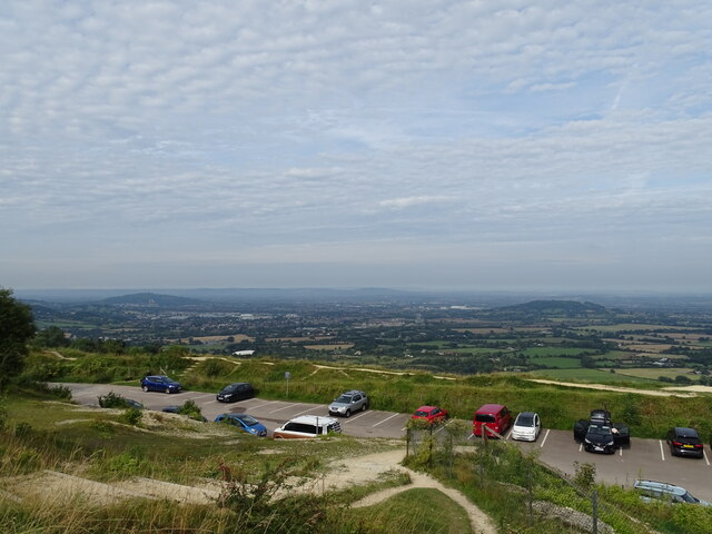
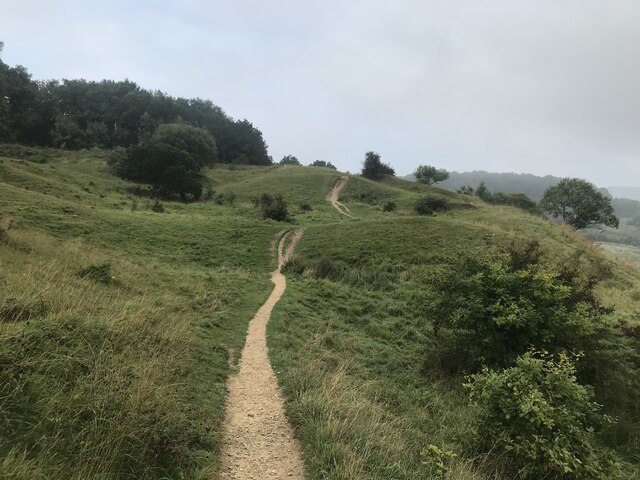
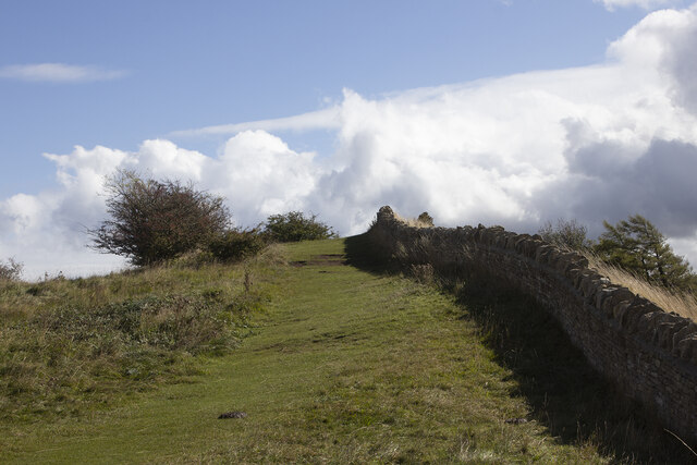
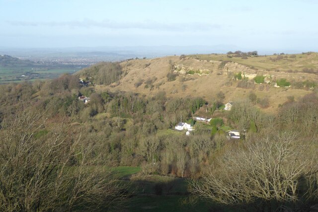
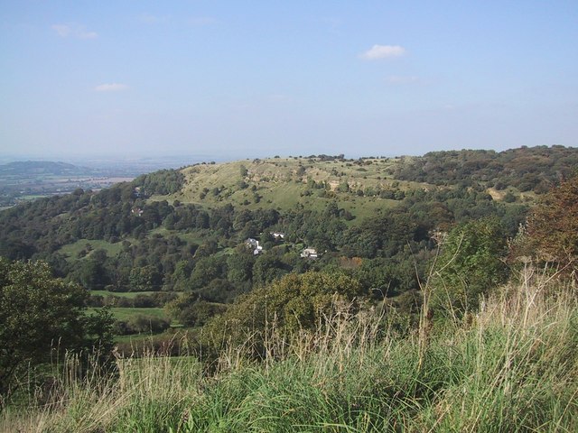
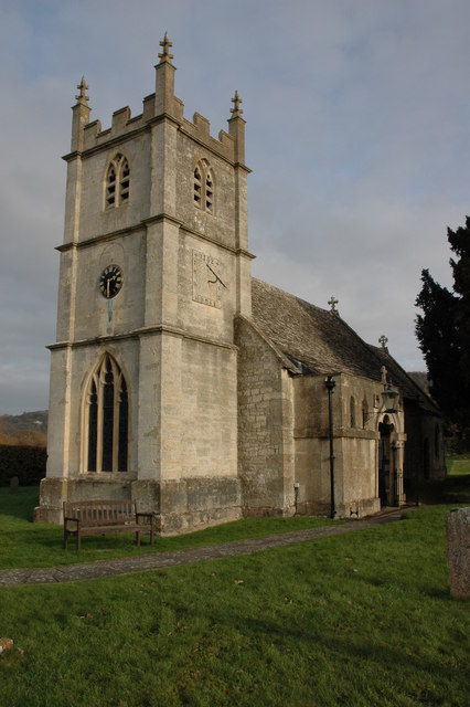
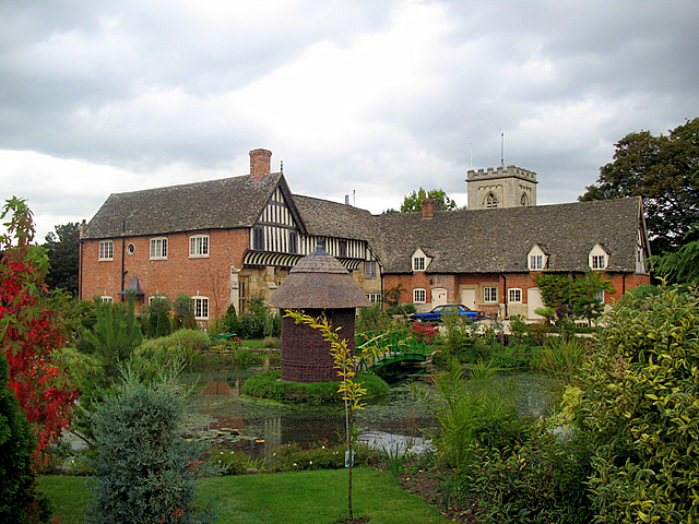
The village of Badgeworth is nestled in the picturesque Cotswold Hills, offering stunning views of the surrounding countryside. It is characterized by its charming stone-built houses and traditional English architecture. The parish also includes the hamlets of Shurdington and Bentham.

Historically, Badgeworth was primarily an agricultural community, with farming being a significant part of the local economy. However, in recent years, the village has seen a shift towards a more residential focus, as more people choose to reside in this peaceful countryside setting while commuting to nearby towns and cities for work.

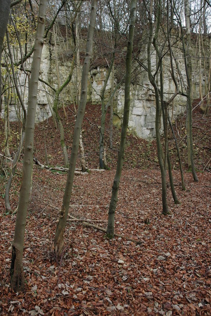
Badgeworth is well-served by amenities such as a local primary school, a village hall, and a pub, providing a sense of community for its residents. The parish is also surrounded by several nature reserves and green spaces, offering ample opportunities for outdoor activities such as walking, hiking, and cycling.

Transport links in Badgeworth are convenient, with easy access to major roads such as the M5 and A417, connecting the village to nearby towns and cities. The closest railway stations are located in Cheltenham and Gloucester, both of which offer regular services to major destinations across the country.

Overall, Badgeworth is a tranquil and picturesque civil parish that offers a peaceful countryside lifestyle while still being within close proximity to urban amenities and transport links.

If you have any feedback on the listing, please let us know in the comments section below.
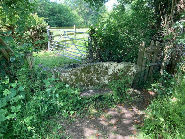
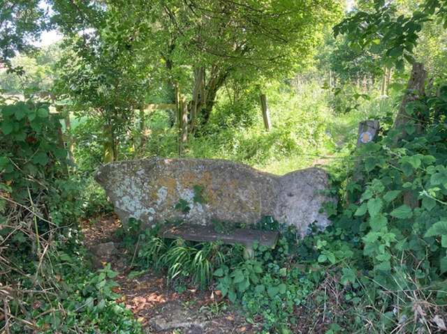
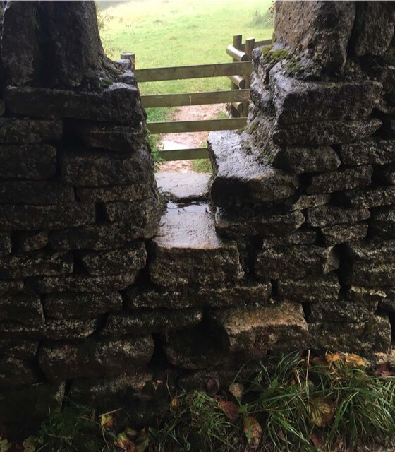
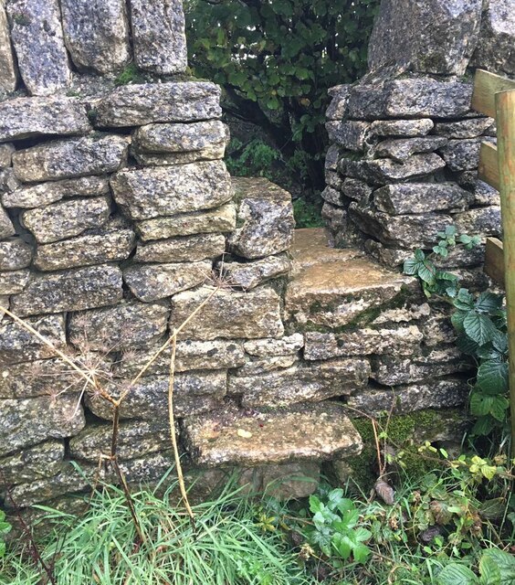
Badgeworth Images

Images are sourced within 2km of 51.850548/-2.126755 or Grid Reference SO9116. Thanks to Geograph Open Source API. All images are credited.

Crickley Hill Car Park
Rough land by the Cotswold Way
Crickley Hill
Crickley Hill
Boundary Stone, Peak Plantation, Birdlip At the stile and apex of the boundary. Cowley (inc Birdlip) is to the SE, Badgeworth is N, S & W. There is no visible inscription but other Boundary Stones along the ridge bear the letters C M & 1857. See other stones along the ridge <a title="https://www.geograph.org.uk/discuss/index.php?&action=vthread&forum=11&topic=32582" href="https://www.geograph.org.uk/discuss/index.php?&action=vthread&forum=11&topic=32582">Link</a>

Milestone Society National ID: GL_BADCOW05pb
Boundary Stone, Peak Plantation, Birdlip
At the stile and apex of the boundary. Cowley (inc Birdlip) is to the SE, Badgeworth is N, S & W. There is no visible inscription but other Boundary Stones along the ridge bear the letters C M & 1857. See other stones along the ridge Link Milestone Society National ID: GL_BADCOW05pb
Crickley Hill Crickley Hill viewed from the Wake Barrow viewpoint. The Malvern Hills are on the distant horizon.
Crickley Hill
Crickley Hill viewed from the Wake Barrow viewpoint. The Malvern Hills are on the distant horizon.
The A417 The A417 viewed from the Barrow Wake viewpoint.
The A417
The A417 viewed from the Barrow Wake viewpoint.
Stone Stile, Witcombe On Gloucestershire footpaths ABA68 & ABA66, 115 yards from the Cirencester Road, Ermin Way. The view from the other side is <a href="https://www.geograph.org.uk/photo/7198210">SO9015 : Stone Stile, Witcombe</a>.
Stone Stile, Witcombe
On Gloucestershire footpaths ABA68 & ABA66, 115 yards from the Cirencester Road, Ermin Way. The view from the other side is SO9015 : Stone Stile, Witcombe.
Stone Stile, Witcombe On Gloucestershire footpaths ABA68 & ABA66, 115 yards from the Cirencester Road, Ermin Way. The view from the other side is <a href="https://www.geograph.org.uk/photo/7198209">SO9015 : Stone Stile, Witcombe</a>.
Stone Stile, Witcombe
On Gloucestershire footpaths ABA68 & ABA66, 115 yards from the Cirencester Road, Ermin Way. The view from the other side is SO9015 : Stone Stile, Witcombe.
Crickley Hill viewed from Barrow Wake
Vale of Gloucester viewed from Crickley Hill
The Vale of Gloucester Looking northwest from Crickley Hill, this is the countryside between Cheltenham and Gloucester. The Malvern Hills are nearly 30km away on the horizon.
The Vale of Gloucester
Looking northwest from Crickley Hill, this is the countryside between Cheltenham and Gloucester. The Malvern Hills are nearly 30km away on the horizon.
Car park at the Crickley Hill Country Park
Stone Stile, Ullenwood GS7600 Not on a public right of way, but off bridleway ACO17. This view is from the track, the view from the field is <a href="https://www.geograph.org.uk/photo/7218499">SO9015 : Stone Stile, Ullenwood GS7600</a>.
Stone Stile, Ullenwood GS7600
Not on a public right of way, but off bridleway ACO17. This view is from the track, the view from the field is SO9015 : Stone Stile, Ullenwood GS7600.
Stone Stile, Ullenwood GS7600 Not on a public right of way, but off bridleway ACO17. This view is from the field, the view from the track is <a href="https://www.geograph.org.uk/photo/7218497">SO9015 : Stone Stile, Ullenwood GS7600</a>.
Stone Stile, Ullenwood GS7600
Not on a public right of way, but off bridleway ACO17. This view is from the field, the view from the track is SO9015 : Stone Stile, Ullenwood GS7600.
Stone Stile, Birdlip On Gloucestershire footpath ABA94 below Crickley Hill looking NE. The view back is <a href="https://www.geograph.org.uk/photo/7317486">SO9216 : Stone Stile, Birdlip</a>.
Stone Stile, Birdlip
On Gloucestershire footpath ABA94 below Crickley Hill looking NE. The view back is SO9216 : Stone Stile, Birdlip.
Stone Stile, Birdlip On Gloucestershire footpath ABA94 below Crickley Hill looking SW. The view NE is <a href="https://www.geograph.org.uk/photo/7317485">SO9216 : Stone Stile, Birdlip</a>.
Stone Stile, Birdlip
On Gloucestershire footpath ABA94 below Crickley Hill looking SW. The view NE is SO9216 : Stone Stile, Birdlip.
View from Shurdington Hill (1) Looking south west towards Little Shurdington. Churchdown Hill is in the distance.
View from Shurdington Hill (1)
Looking south west towards Little Shurdington. Churchdown Hill is in the distance.
View from Shurdington Hill (2) Looking west, Shurdington to the right and Churchdown Hill in the distance.
View from Shurdington Hill (2)
Looking west, Shurdington to the right and Churchdown Hill in the distance.
Show me another place!

Badgeworth is located at Grid Ref: SO9116 (Lat: 51.850548, Lng: -2.126755)

Administrative County: Gloucestershire

District: Tewkesbury

Police Authority: Gloucestershire

What 3 Words

///stealthier.masterpiece.covenants. Near Shurdington, Gloucestershire

Nearby Locations

Badgeworth Bentham

Related Wikis

Henley Bank High School

Henley Bank High School is an 11 to 18 academy in Gloucester, England. It is sponsored by the Greenshaw Learning Trust. In January 2018, the school was...

Brockworth

Brockworth is a village and parish in the Borough of Tewkesbury, Gloucestershire, England, situated on the old Roman road that connects the City of Gloucester...

Crickley Hill and Barrow Wake

Crickley Hill and Barrow Wake (grid reference SO929161 & grid reference SO931154) is a 56.8-hectare (140-acre) biological and geological Site of Special...

Shurdington

Shurdington is a village near Cheltenham in Gloucestershire, England. The area constitutes a civil parish within the Borough of Tewkesbury. It is located...

Great Witcombe

Great Witcombe is a village and civil parish 5 miles (8 km) south east of Gloucester, in the Tewkesbury district, in the county of Gloucestershire, England...

The Air Balloon, Birdlip

The Air Balloon is a road junction and former pub Birdlip, Gloucestershire, England. The junction is on the A417 at a significant congestion point. The...

Brockworth Court

Brockworth Court is a Tudor house in the village of Brockworth, Gloucestershire, England. Dating from the 16th century, it is a Grade II* listed building...

Knap House Quarry, Birdlip

Knap House Quarry, Birdlip (grid reference SO925147) is a 1.80-hectare (4.4-acre) geological Site of Special Scientific Interest in Gloucestershire, notified...

Nearby Amenities

Located within 500m of 51.850548,-2.126755
Bentham
Is In: Gloucestershire, England, UK
Place: hamlet
Lat/Long: 51.8497321/-2.1265516
Barrier: stile
Foot: designated
Lat/Long: 51.8531129/-2.123135
Post Box
Collection Times: Mo-Fr 17:00; Sa 08:00
Post Box Type: lamp
Ref: GL51 80
Royal Cypher: EIIR
Royal Cypher Wikidata: Q33102113
Source: survey and photo
Lat/Long: 51.8509411/-2.1267125
Windy Farm
Landuse: farm
Note Retag: CS #48756035
Source: OS OpenData StreetView
Lat/Long: 51.8512433/-2.1263636
Barrier: stile
Lat/Long: 51.8512864/-2.120907
Barrier: stile
Note: Not really a stile, more of climbable bit of fence but it is the public footpath.
Lat/Long: 51.8501536/-2.1213719
Barrier: stile
Lat/Long: 51.8524619/-2.1204961
Barrier: stile
Lat/Long: 51.8524154/-2.120495
Barrier: kissing_gate
Source: survey
Lat/Long: 51.8492224/-2.1209562
Barrier: stile
Dog: yes
Lat/Long: 51.8494114/-2.1335508
Barrier: stile
Lat/Long: 51.8506006/-2.1306279
Gate
Ele: 75.829
Lat/Long: 51.8514977/-2.1270902
Barrier: stile
Lat/Long: 51.8512374/-2.1267909
Barrier: stile
Lat/Long: 51.8506131/-2.1305945
Barrier: stile
Lat/Long: 51.8541619/-2.1253688
Barrier: stile
Lat/Long: 51.8532306/-2.1256358
Barrier: stile
Lat/Long: 51.8532397/-2.1256258
Barrier: stile
Lat/Long: 51.8516381/-2.1259917
Information: guidepost
Tourism: information
Lat/Long: 51.8515626/-2.1260959
Shurdington Nurseries
Shop: plant_nursery
Source: survey
Source Name: OS_OpenData_StreetView
Lat/Long: 51.8548536/-2.1248783
Urrist Barn
Building: ruins
Historic: ruins
Lat/Long: 51.8532749/-2.1235204
Barrier: stile
Foot: designated
Lat/Long: 51.8541198/-2.1225239
Barrier: kissing_gate
Foot: designated
Lat/Long: 51.8495199/-2.1234092
Barrier: kissing_gate
Foot: designated
Lat/Long: 51.848187/-2.1275573
Barrier: stile
Foot: designated
Lat/Long: 51.847206/-2.1283686
Turning Loop
Lat/Long: 51.8502589/-2.1279542
Bentham
Place: village
Source: OS_OpenMap_Local
Lat/Long: 51.8496941/-2.1236569
Elm Farm
Location Transition: yes
Power: pole
Transformer: distribution
Voltage Primary: 11000
Lat/Long: 51.8507719/-2.1265022
Power: pole
Lat/Long: 51.8515224/-2.1278889
Power: pole
Lat/Long: 51.8521362/-2.1286453
Stoneleigh
Power: pole
Transformer: distribution
Voltage Primary: 11000
Lat/Long: 51.8526544/-2.1295881
Power: pole
Lat/Long: 51.8525769/-2.1291818
Power: pole
Lat/Long: 51.8531469/-2.1303579
Power: pole
Lat/Long: 51.8538477/-2.1311814
Power: pole
Lat/Long: 51.8546247/-2.1237892
Urrist Barn Field
Power: pole
Transformer: distribution
Voltage Primary: 11000
Lat/Long: 51.854671/-2.1249774
The data included in this document is from www.openstreetmap.org. The data is made available under ODbL.

Have you been to Badgeworth?

Leave your review of Badgeworth below (or comments, questions and feedback).