Axmouth

Civil Parish in Devon East Devon

England

Axmouth

Anyone lost a pink hat? A pink hat adorns a marker post for the South West Coast Path.
A geocache is currently located in the small windswept tree.
Anyone lost a pink hat? Credit: Anthony Vosper

Axmouth is a charming civil parish located in the county of Devon, England. Situated on the stunning Jurassic Coast, it is nestled between the towns of Seaton and Lyme Regis. The parish covers an area of approximately 6.5 square miles and has a population of around 400 residents.

The village of Axmouth offers a delightful blend of historical charm and natural beauty. It is home to several listed buildings, including St. Michael's Church, which dates back to the 12th century. The church features a striking Norman tower and is known for its beautiful stained glass windows.

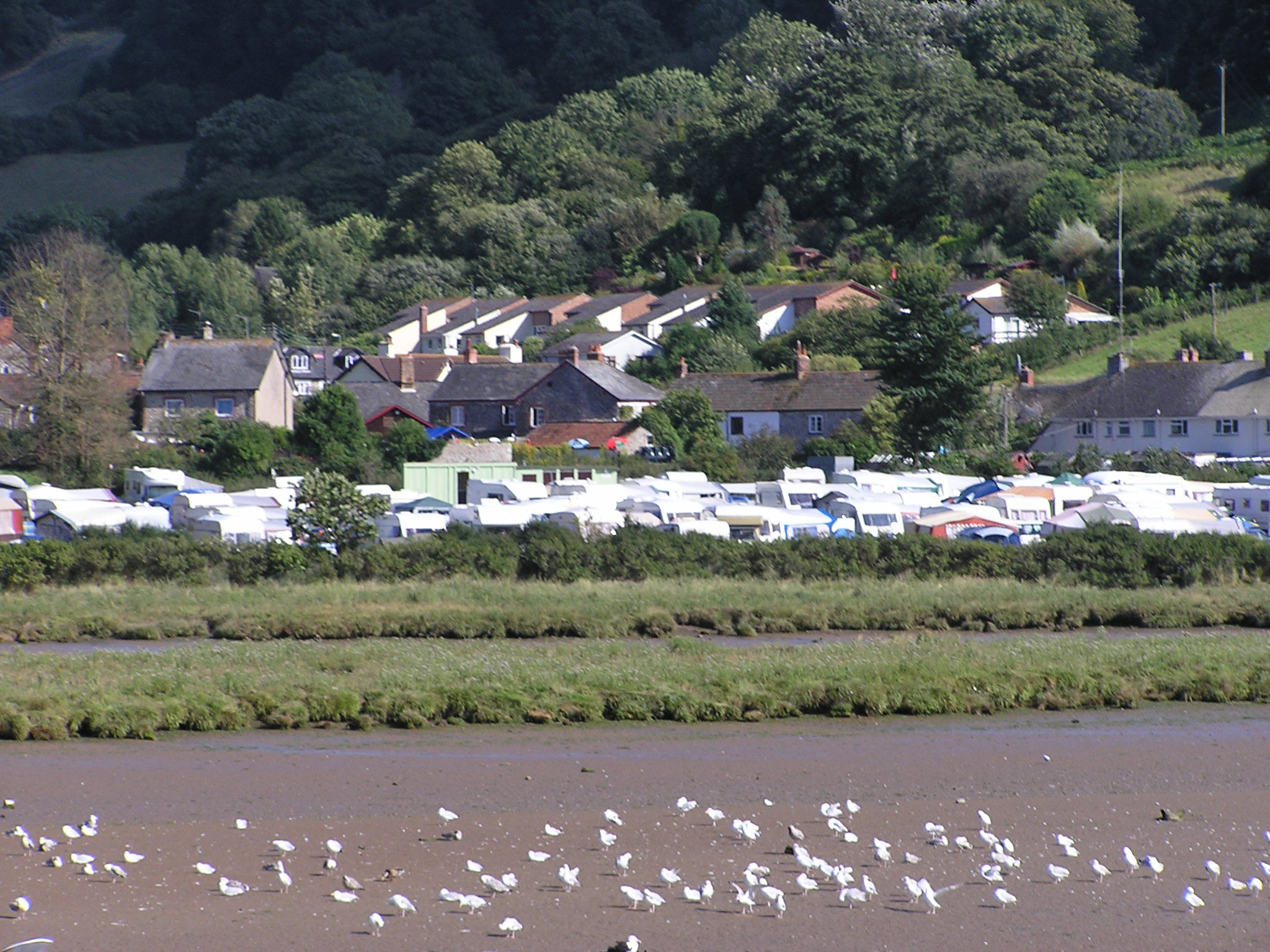
One of the highlights of Axmouth is its picturesque harbour, which has a rich maritime heritage. The harbour was once a bustling port, serving as an important trading hub for the region. Today, it provides a tranquil spot for a leisurely stroll or a peaceful picnic.

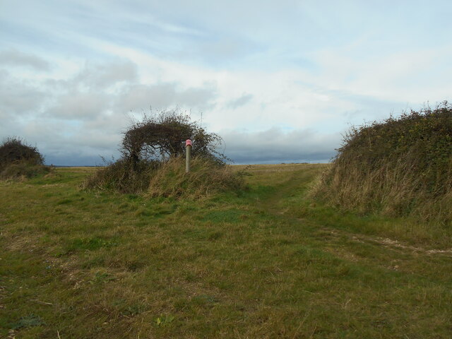
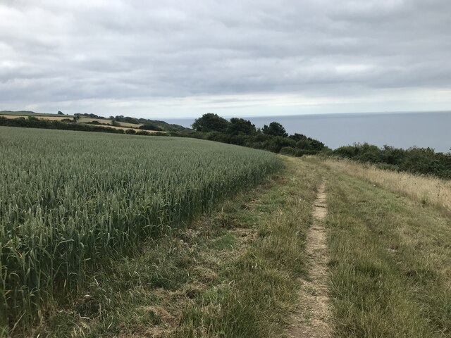
Nature enthusiasts will be delighted by the abundance of natural beauty in Axmouth. The village is surrounded by lush countryside, rolling hills, and breathtaking coastal scenery. It offers easy access to the East Devon Area of Outstanding Natural Beauty, providing ample opportunities for hiking, birdwatching, and exploring the diverse flora and fauna of the region.

Axmouth is also conveniently located near several popular attractions. The popular seaside town of Seaton is just a short distance away, offering a range of amenities, including shops, restaurants, and a sandy beach. The nearby Seaton Tramway is a popular tourist attraction, allowing visitors to enjoy a scenic ride on a vintage tram along the stunning Axe Valley.

In conclusion, Axmouth is a charming and historic civil parish that offers a delightful blend of natural beauty, historical landmarks, and easy access to nearby attractions. It is a hidden gem on the Jurassic Coast that is sure to captivate visitors with its timeless appeal.

If you have any feedback on the listing, please let us know in the comments section below.

Axmouth Images

Images are sourced within 2km of 50.715689/-3.031551 or Grid Reference SY2791. Thanks to Geograph Open Source API. All images are credited.

Anyone lost a pink hat? A pink hat adorns a marker post for the South West Coast Path.
A geocache is currently located in the small windswept tree.
Anyone lost a pink hat?
A pink hat adorns a marker post for the South West Coast Path. A geocache is currently located in the small windswept tree.
A South East view Looking South East along the South West Coast path.
A South East view
Looking South East along the South West Coast path.
Signboard on the coast path
Coast path at The Landslip
Wheat field on the South West Coast Path
Tram No. 14 at Axmouth Loop Seaton Tramway Car No.14 approaching the loop at Axmouth.  It was a party special for young ladies who were going to a 'Fairy Party' at Colyton.
Tram No. 14 at Axmouth Loop
Seaton Tramway Car No.14 approaching the loop at Axmouth. It was a party special for young ladies who were going to a 'Fairy Party' at Colyton.
Boundary Stone, River Axe Right on the edge of the tidal stretch of the river. The 1903 map shows a BS as close to this location as possible (from the moving tram). The tramway dates from 1970, built on the line of the L & S W R Seaton Branch track.

 Milestone Society National ID: DV_SEAAXM01bm
Boundary Stone, River Axe
Right on the edge of the tidal stretch of the river. The 1903 map shows a BS as close to this location as possible (from the moving tram). The tramway dates from 1970, built on the line of the L & S W R Seaton Branch track. Milestone Society National ID: DV_SEAAXM01bm
Church street junction The building on the right has an OS Flush Bracket low down on the left.
Church street junction
The building on the right has an OS Flush Bracket low down on the left.
The South West Coast Path Viewed at the point where it passes Axe Cliff Golf Course, club house and car park.
The South West Coast Path
Viewed at the point where it passes Axe Cliff Golf Course, club house and car park.
Foot path across the golf course The South West Coast path crosses the Axe Cliff golf course.
Foot path across the golf course
The South West Coast path crosses the Axe Cliff golf course.
Stoney Cross  Situated on Barn Close Lane. Part of the South West Coast Path.
Stoney Cross
Situated on Barn Close Lane. Part of the South West Coast Path.
A private home The Axmouth Baptist chapel built in 1861 has now been tastefully turned into a private dwelling.
A private home
The Axmouth Baptist chapel built in 1861 has now been tastefully turned into a private dwelling.
A stile at Stoney Cross On a footpath joining Barn Close lane to Stepps Road.
A stile at Stoney Cross
On a footpath joining Barn Close lane to Stepps Road.
Footpath on Stepps Lane Providing a short cut to Barn Close Lane.
Footpath on Stepps Lane
Providing a short cut to Barn Close Lane.
Coldwell Lane Terrace The telephone box, no longer in use has been turned into a small library.
Coldwell Lane Terrace
The telephone box, no longer in use has been turned into a small library.
Mixed houses on Chapel street A number of dwellings following the valley and chousesourse of the road.
Mixed houses on Chapel street
A number of dwellings following the valley and chousesourse of the road.
Axmouth from Black Hole Marsh Nature Reserve Looking across the River Axe from one of the hides. The Seaton Tramway runs past on its way north (left) to Colyton.
Axmouth from Black Hole Marsh Nature Reserve
Looking across the River Axe from one of the hides. The Seaton Tramway runs past on its way north (left) to Colyton.
Four way signpost
Four way signpost
Show me another place!

Axmouth is located at Grid Ref: SY2791 (Lat: 50.715689, Lng: -3.031551)

Administrative County: Devon

District: East Devon

Police Authority: Devon & Cornwall

What 3 Words

///relieves.stutter.intruders. Near Colyton, Devon

Related Wikis

Hawkesdown Hill

Hawkesdown Hill is an Iron Age Hill fort close to Axmouth in Devon situated on a prominent hillside above the Axe Estuary. It is approximately 130 metres...

Stedcombe House

Stedcombe House is a country house in the civil parish of Axmouth, in the East Devon district, in the county of Devon, England. It is recorded in the National...

Axmouth

Axmouth is a village, civil parish and former manor in the East Devon district of Devon, England, near the mouth of the River Axe. The village itself...

Axmouth to Lyme Regis Undercliffs

The Axmouth to Lyme Regis Undercliffs, also often referred to in the singular as the Undercliff, is a 5-mile (8.0 km) long landscape feature, National...

Nearby Amenities

Located within 500m of 50.715689,-3.031551
Springhead Cross
Junction: yes
Lat/Long: 50.712479/-3.030434
The data included in this document is from www.openstreetmap.org. The data is made available under ODbL.

Have you been to Axmouth?

Leave your review of Axmouth below (or comments, questions and feedback).