Austhorpe

Civil Parish in Yorkshire Leeds

England

Austhorpe

Garforth station: road bridge The bridge was built in the early 1830s to the designs of engineer James Walker to carry the Aberford Road (now A642) over the Leeds-Selby railway line adjacent to Garforth station. Listed at Grade II (list entry 1419088) as "an original ... distinctive, single-span overbridge with unprecedented span of 60ft (18.2m) ... demonstrating a high level of craftsmanship in its construction, detailing, and dressing" (the same notes apply to other similar bridges on the line). The flat arch is certainly remarkable.
Garforth station: road bridge Credit: Stephen Craven

Austhorpe is a civil parish located in the City of Leeds metropolitan borough, in the county of West Yorkshire, England. Situated approximately 5 miles east of Leeds city centre, Austhorpe is a small residential area with a population of around 2,500.

The parish is bordered by the areas of Cross Gates to the west, Colton to the east, and Halton to the north. It covers an area of about 2.5 square miles and consists mainly of suburban housing, with some green spaces and a few small industrial areas.

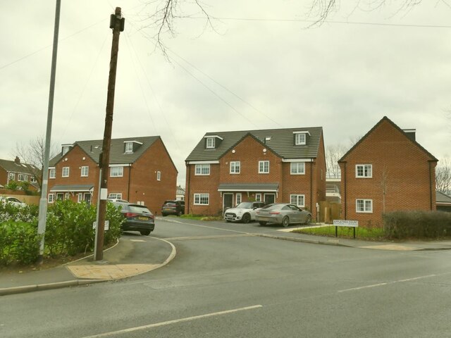
Austhorpe has a rich history, with evidence of human settlement in the area dating back to the Bronze Age. Today, the parish is primarily residential, with a mix of housing styles including detached houses, semi-detached houses, and some apartment buildings. The area is known for its quiet and peaceful atmosphere, making it an attractive place to live for families and professionals alike.

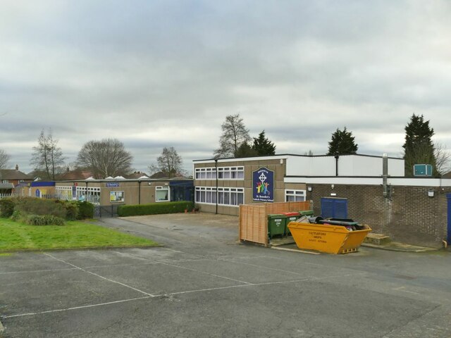
The parish has a number of amenities for its residents, including a primary school, a community center, and a local pub. There are also several parks and green spaces in the area, providing opportunities for outdoor activities and leisure.

Transportation links in Austhorpe are good, with regular bus services connecting the area to Leeds city center and surrounding areas. The nearby M1 and M62 motorways also provide easy access to other parts of Yorkshire and beyond.

If you have any feedback on the listing, please let us know in the comments section below.

Austhorpe Images

Images are sourced within 2km of 53.795991/-1.41331 or Grid Reference SE3833. Thanks to Geograph Open Source API. All images are credited.

Garforth station: road bridge The bridge was built in the early 1830s to the designs of engineer James Walker to carry the Aberford Road (now A642) over the Leeds-Selby railway line adjacent to Garforth station. Listed at Grade II (list entry 1419088) as "an original ... distinctive, single-span overbridge with unprecedented span of 60ft (18.2m) ... demonstrating a high level of craftsmanship in its construction, detailing, and dressing" (the same notes apply to other similar bridges on the line). The flat arch is certainly remarkable.
Garforth station: road bridge
The bridge was built in the early 1830s to the designs of engineer James Walker to carry the Aberford Road (now A642) over the Leeds-Selby railway line adjacent to Garforth station. Listed at Grade II (list entry 1419088) as "an original ... distinctive, single-span overbridge with unprecedented span of 60ft (18.2m) ... demonstrating a high level of craftsmanship in its construction, detailing, and dressing" (the same notes apply to other similar bridges on the line). The flat arch is certainly remarkable.
St Benedict's Catholic Primary School, Garforth On Station Fields.
St Benedict's Catholic Primary School, Garforth
On Station Fields.
Rear of Garforth Academy The secondary school <a href="https://www.geograph.org.uk/photo/7081402">SE4032 : Garforth Academy</a> was formerly called Garforth Community College.
Rear of Garforth Academy
The secondary school SE4032 : Garforth Academy was formerly called Garforth Community College.
Leyland House, Selby Road, Garforth According to one local history website <span class="nowrap"><a title="https://www.ianatkinson.net/garforth/photos/selby-road.htm" rel="nofollow ugc noopener" href="https://www.ianatkinson.net/garforth/photos/selby-road.htm">Link</a><img style="margin-left:2px;" alt="External link" title="External link - shift click to open in new window" src="https://s1.geograph.org.uk/img/external.png" width="10" height="10"/></span> , the original 17th century house on this site was called Hawkshaw House, after Fletcher Samuel Hawkshaw, and was a private school in the 19th century, later renamed Leyland House and eventually being demolished in 2006. If the building shown here is a modern (post 2006) replacement, then it's certainly in a traditional style. An agent's website describes it as "a prestigious five-bedroom property customised to a high specification internally ... with extensive grounds, stables and gardens."
Leyland House, Selby Road, Garforth
According to one local history website LinkExternal link , the original 17th century house on this site was called Hawkshaw House, after Fletcher Samuel Hawkshaw, and was a private school in the 19th century, later renamed Leyland House and eventually being demolished in 2006. If the building shown here is a modern (post 2006) replacement, then it's certainly in a traditional style. An agent's website describes it as "a prestigious five-bedroom property customised to a high specification internally ... with extensive grounds, stables and gardens."
Westbourne House, Selby Road, Garforth Currently occupied by a firm of solicitors; road widening has claimed most of the original front garden.
Westbourne House, Selby Road, Garforth
Currently occupied by a firm of solicitors; road widening has claimed most of the original front garden.
Garforth Academy Formerly Garforth Community College, now part of the Delta Academy Trust
Garforth Academy
Formerly Garforth Community College, now part of the Delta Academy Trust
Zebra crossing on Lidgett Lane Near the Garforth Academy <a href="https://www.geograph.org.uk/photo/7081402">SE4032 : Garforth Academy</a>.
Zebra crossing on Lidgett Lane
Near the Garforth Academy SE4032 : Garforth Academy.
Strawberry Fields Primary School, Garforth
Garforth Police Station, Lidgett Lane
64 Lidgett Lane The house bears a date of 1999 but is traditional in style.
64 Lidgett Lane
The house bears a date of 1999 but is traditional in style.
The Coach House, Lidgett Lane A care home.
The Coach House, Lidgett Lane
A care home.
Post box on Lidgett Lane The school sign refers to Strawberry Fields primary school.
Post box on Lidgett Lane
The school sign refers to Strawberry Fields primary school.
Lidgett House, Lidgett Lane This seems to be one of those properties with a large number of businesses using it as a registered address.
Lidgett House, Lidgett Lane
This seems to be one of those properties with a large number of businesses using it as a registered address.
Appletree Court, Lidgett Lane A small modern housing development.
Appletree Court, Lidgett Lane
A small modern housing development.
New housing, Lidgett Lane An apartment block on the corner of Beech Grove Avenue.
New housing, Lidgett Lane
An apartment block on the corner of Beech Grove Avenue.
Nisa Local, Main Street, Garforth See also <a href="https://www.geograph.org.uk/photo/5010464">SE4033 : Nisa local - Main Street</a>.  An old map shows this as 'UDC [Urban District Council] offices'.
Nisa Local, Main Street, Garforth
See also SE4033 : Nisa local - Main Street. An old map shows this as 'UDC [Urban District Council] offices'.
Business park, Church Lane, Garforth
Garforth Cricket Club Surprisingly close to the town centre.
Garforth Cricket Club
Surprisingly close to the town centre.
Show me another place!

Austhorpe is located at Grid Ref: SE3833 (Lat: 53.795991, Lng: -1.41331)

Division: West Riding

Administrative County: West Yorkshire

District: Leeds

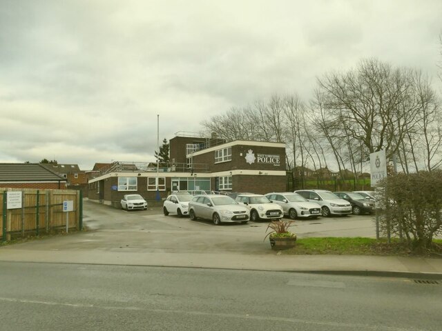
Police Authority: West Yorkshire

What 3 Words

///manifests.formation.trial. Near Garforth, West Yorkshire

Nearby Locations

Carr Wood Austhorpe

Related Wikis

Brown Moor

Brown Moor is an area in the metropolitan borough of the City of Leeds in West Yorkshire, England, east of Austhorpe and north of Colton. The M1 motorway...

Thorpe Park Leeds

Thorpe Park Leeds or simply Thorpe Park is a business park located near Brown Moor, Leeds, West Yorkshire, England. Companies that are headquartered in...

Thorpe Park railway station

Thorpe Park is a proposed railway station, to be sited in the Thorpe Park area to the east of Leeds, England on the Selby Line. The station is not related...

Barnbow

Barnbow was a small settlement situated near the city of Leeds in the township and parish of Barwick in Elmet. The site is noted as the location of a munitions...

Garforth Academy

Garforth Academy (formerly known as Garforth Comprehensive School until September 1992 and Garforth Community College until November 2010) is a secondary...

SLP College

SLP College is an independent, co-educational performing arts college based in Garforth near Leeds, West Yorkshire, England. == Overview == In 1974 Sandra...

Masters Performing Arts College

Masters Performing Arts College is an independent dance/musical theatre college based in the town of Rayleigh in Essex, England. == Training == Key areas...

Garforth

Garforth () is a town in the metropolitan borough of the City of Leeds, West Yorkshire, England. It sits in the Garforth and Swillington ward of Leeds...

Nearby Amenities

Located within 500m of 53.795991,-1.41331
Motorway Junction
Austhorpe
Name Signed: no
Ref: 46
Lat/Long: 53.7995475/-1.4144888
Barrier: stile
Material: wood
Stile: stepover
Lat/Long: 53.7958932/-1.420165
Crossing
Crossing: unmarked
Crossing Island: no
Crossing Markings: no
Tactile Paving: yes
Lat/Long: 53.7963888/-1.4204789
Design: h-frame
Material: wood
Power: tower
Lat/Long: 53.7924728/-1.4150908
Design: h-frame
Material: wood
Power: tower
Lat/Long: 53.7957746/-1.4195915
Design: h-frame
Material: wood
Power: tower
Lat/Long: 53.7946434/-1.4180519
Design: h-frame
Location Transition: yes
Material: wood
Power: tower
Lat/Long: 53.7962403/-1.4197686
Design: h-frame
Material: wood
Power: tower
Lat/Long: 53.7935153/-1.4165982
Crossing
Crossing: unmarked
Crossing Island: no
Crossing Markings: no
Tactile Paving: yes
Lat/Long: 53.7967322/-1.4195072
Parking
Lat/Long: 53.7969854/-1.4192211
Crossing
Crossing: unmarked
Crossing Island: no
Crossing Markings: no
Tactile Paving: yes
Lat/Long: 53.7963291/-1.4200926
Crossing
Button Operated: yes
Crossing: traffic_signals
Crossing Island: no
Crossing Markings: dots
Tactile Paving: yes
Traffic Signals Vibration: yes
Lat/Long: 53.796977/-1.4197108
Material: wood
Power: pole
Lat/Long: 53.7982409/-1.406785
Traffic Signals
Traffic Signals: signal
Traffic Signals Direction: forward
Lat/Long: 53.7969056/-1.4198648
Traffic Signals
Traffic Signals: signal
Traffic Signals Direction: forward
Lat/Long: 53.7970939/-1.4196232
The data included in this document is from www.openstreetmap.org. The data is made available under ODbL.

Have you been to Austhorpe?

Leave your review of Austhorpe below (or comments, questions and feedback).