Brightwell-cum-Sotwell

Settlement in Berkshire South Oxfordshire

England

Brightwell-cum-Sotwell

Sires Hill at Brightwell Cum Sotwell village boundary
Sires Hill at Brightwell Cum Sotwell village boundary Credit: Colin Pyle

Brightwell-cum-Sotwell is a charming and picturesque village located in the county of Berkshire, England. Situated just south of the historic town of Wallingford, the village is nestled in the stunning countryside of the Thames Valley.

The village is formed by the merging of two ancient settlements, Brightwell and Sotwell, which have been inhabited since prehistoric times. Today, it is home to a population of around 1,300 residents who enjoy a peaceful and close-knit community.

One of the most striking features of Brightwell-cum-Sotwell is its beautiful architecture. The village is characterized by a mix of historic thatched cottages, timber-framed houses, and elegant Georgian buildings, which provide a glimpse into its rich heritage.

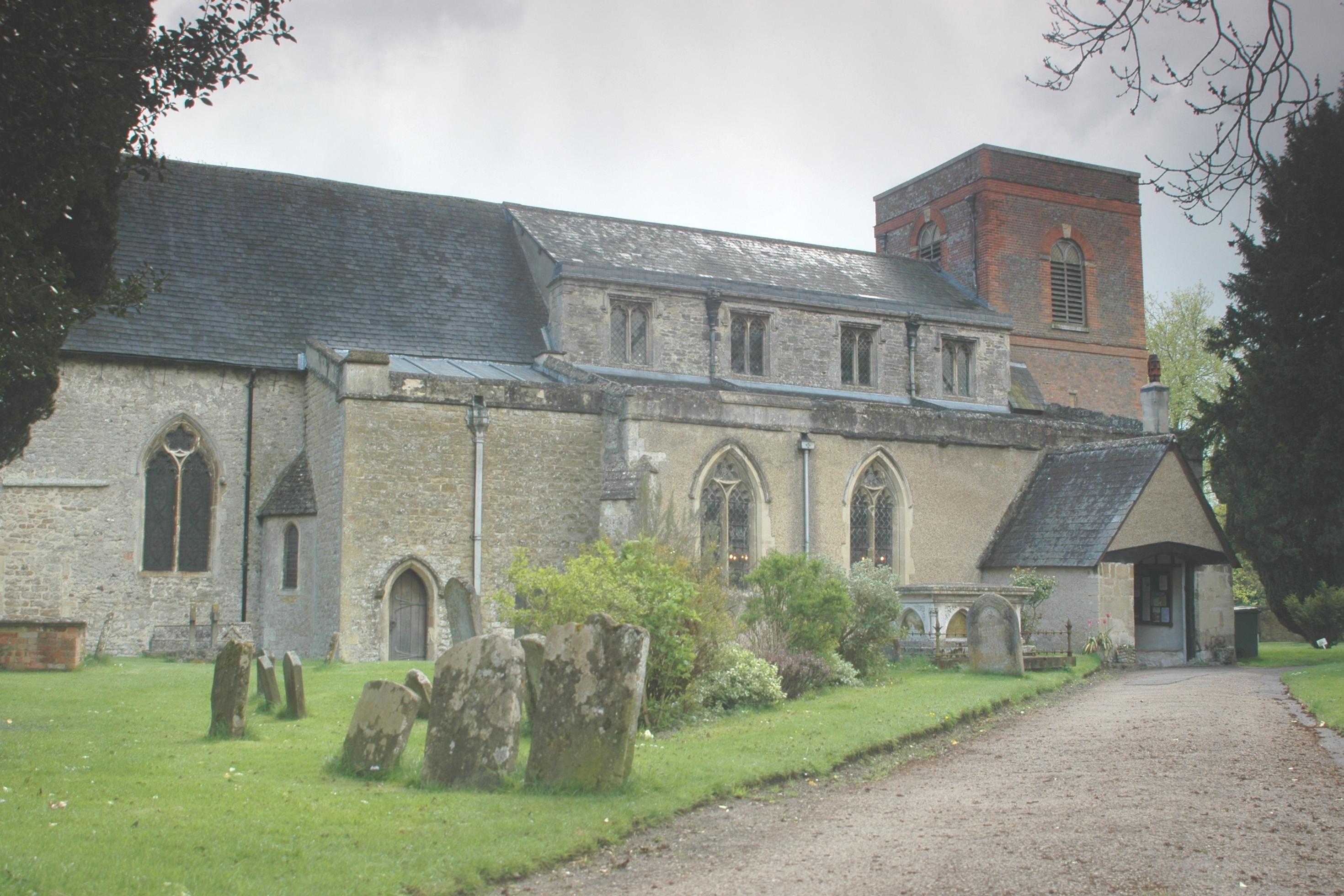
The centerpiece of the village is St. Agatha's Church, a Grade I listed building that dates back to the 12th century. Its impressive Norman tower and intricate stained glass windows attract visitors from far and wide.

The village is also renowned for its natural beauty. It is surrounded by lush green fields, rolling hills, and meandering footpaths, making it a haven for nature lovers and walkers. The nearby River Thames adds to the idyllic scenery, providing opportunities for boating and fishing.

Brightwell-cum-Sotwell boasts a vibrant community spirit, with a range of amenities and activities for residents. These include a village hall, a primary school, a post office, a local pub, and a cricket club. Regular events and gatherings, such as the annual village fete, bring the community together and foster a strong sense of belonging.

In summary, Brightwell-cum-Sotwell is a picturesque village in Berkshire, known for its historic architecture, natural beauty, and strong community spirit. It offers a tranquil and idyllic setting for residents and visitors alike.

If you have any feedback on the listing, please let us know in the comments section below.

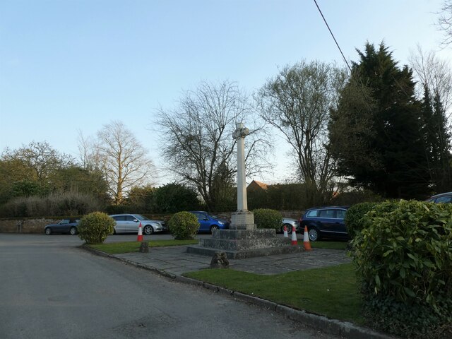
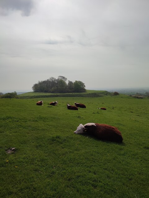
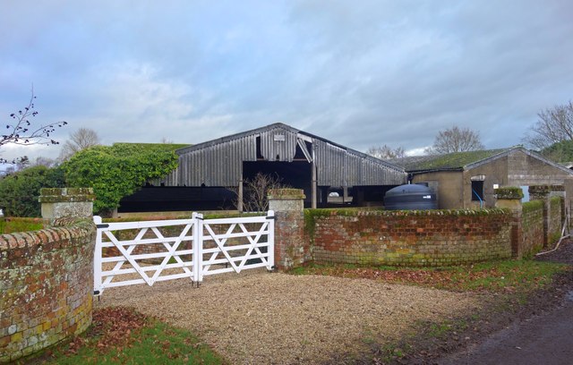
Brightwell-cum-Sotwell Images

Images are sourced within 2km of 51.613445/-1.165454 or Grid Reference SU5790. Thanks to Geograph Open Source API. All images are credited.

Sires Hill at Brightwell Cum Sotwell village boundary
A4130 High Road
A4130 High Road
St Agatha, Brightwell-cum-Sotwell: late March 2022
Brightwell-cum-Sotwell: looking towards the phone box from the pub
The New Cemetery (1)
The New Cemetery (2) The CWGC grave of Sgt Reginald Whichello <span class="nowrap"><a title="https://www.cwgc.org/find-records/find-war-dead/casualty-details/2436266/reginald-whichello/" rel="nofollow ugc noopener" href="https://www.cwgc.org/find-records/find-war-dead/casualty-details/2436266/reginald-whichello/">Link</a><img style="margin-left:2px;" alt="External link" title="External link - shift click to open in new window" src="https://s1.geograph.org.uk/img/external.png" width="10" height="10"/></span>
The New Cemetery (2)
The CWGC grave of Sgt Reginald Whichello LinkExternal link
The New Cemetery (3) The CWGC grave of Reba Joyce Williams <span class="nowrap"><a title="https://www.cwgc.org/find-records/find-war-dead/casualty-details/2436267/reba-joyce-williams/" rel="nofollow ugc noopener" href="https://www.cwgc.org/find-records/find-war-dead/casualty-details/2436267/reba-joyce-williams/">Link</a><img style="margin-left:2px;" alt="External link" title="External link - shift click to open in new window" src="https://s1.geograph.org.uk/img/external.png" width="10" height="10"/></span>
The New Cemetery (3)
The CWGC grave of Reba Joyce Williams LinkExternal link
Brightwell-cum-Sotwell Village Shop: late March 2022
Brightwell-cum-Sotwell War Memorial: late March 2022
St Agatha, Brightwell-cum-Sotwell: churchyard (a)
St Agatha, Brightwell-cum-Sotwell: churchyard (b)
The Red Lion, Brightwell-cum-Sotwell This attractive village pub dates back to the mid 16th-Century.
The Red Lion, Brightwell-cum-Sotwell
This attractive village pub dates back to the mid 16th-Century.
Castle Hill, Wittenham Clumps
The A4130, Brightwell-cum-Sotwell This bypasses the village.
The A4130, Brightwell-cum-Sotwell
This bypasses the village.
New Houses With Cars 10 months on from the unfinished buildings shown in <a href="https://www.geograph.org.uk/photo/6665651">SU5989 : A Brand New Road</a> and the scaffolding has gone, the houses have acquired residents and cars are parked neatly in front.
New Houses With Cars
10 months on from the unfinished buildings shown in SU5989 : A Brand New Road and the scaffolding has gone, the houses have acquired residents and cars are parked neatly in front.
Thank You from St Edward The entrance to a new housing development off Wallingford by pass.
St Edward is obviously in the building trade these days.
Thank You from St Edward
The entrance to a new housing development off Wallingford by pass. St Edward is obviously in the building trade these days.
Gate and Barns, Mackney Lane Barns at Sherwood Farm, Mackney. The gates lead to Sherwood House. The name is carved into the stone bit at the top of the gate pillars, but is  rather encrusted with lichen so that you have to get quite close to read it.
Gate and Barns, Mackney Lane
Barns at Sherwood Farm, Mackney. The gates lead to Sherwood House. The name is carved into the stone bit at the top of the gate pillars, but is rather encrusted with lichen so that you have to get quite close to read it.
20 MPH past the ditch The 20 mph limit has been introduced in many towns and villages in recent years.
It has the effect of getting most people to do around 25 - 27 ish, which is less than the previous often exceeded 30 limit, so a result I guess.
The stream is one of the mass of small semi natural drains and ditches which make up the untidy watercourse known as the Mackney Brook.
20 MPH past the ditch
The 20 mph limit has been introduced in many towns and villages in recent years. It has the effect of getting most people to do around 25 - 27 ish, which is less than the previous often exceeded 30 limit, so a result I guess. The stream is one of the mass of small semi natural drains and ditches which make up the untidy watercourse known as the Mackney Brook.
Show me another place!

Brightwell-cum-Sotwell is located at Grid Ref: SU5790 (Lat: 51.613445, Lng: -1.165454)

Administrative County: Oxfordshire

District: South Oxfordshire

Police Authority: Thames Valley

What 3 Words

///titles.ejects.warping. Near Wallingford, Oxfordshire

Nearby Locations

Brightwell-cum-Sotwell

Related Wikis

Brightwell Castle

Brightwell Castle was in the village of Brightwell-cum-Sotwell, between the towns of Didcot and Wallingford (grid reference SU578908), now in Oxfordshire...
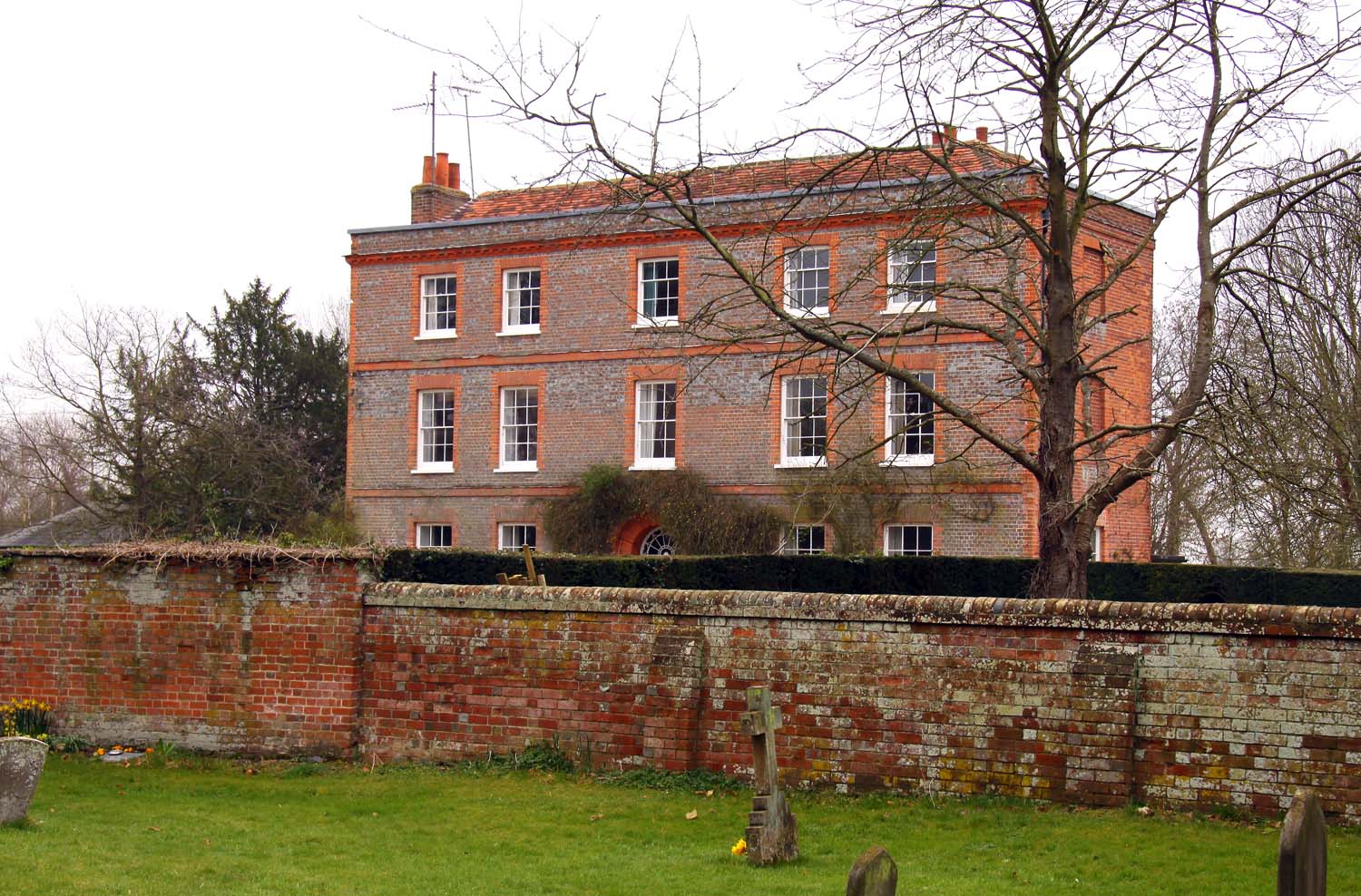
Brightwell Manor

Brightwell Manor is a country house in the village of Brightwell-cum-Sotwell, Oxfordshire, England. The back dates to around the mid-seventeenth century...

Brightwell-cum-Sotwell

Brightwell-cum-Sotwell is a twin-village and civil parish in the Upper Thames Valley in South Oxfordshire. It lies between Didcot to the west and the historic...
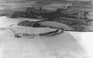
Brightwell Barrow

Brightwell Barrow is a Bronze Age round barrow in the civil parish of Brightwell-cum-Sotwell in the English county of Oxfordshire (formerly Berkshire)...
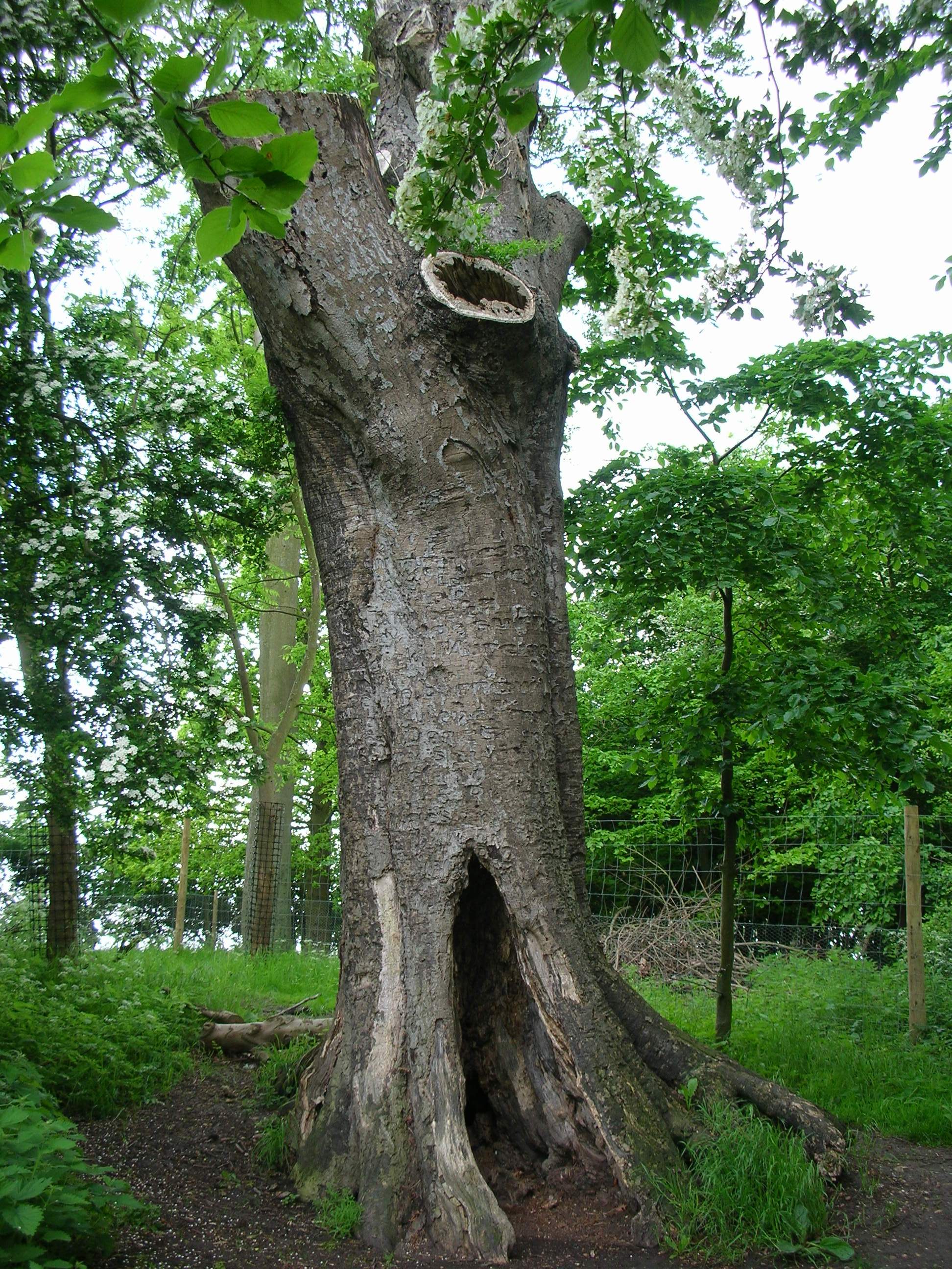
The Poem Tree

The Poem Tree was a beech tree with a poem carved into it by Joseph Tubb, located on Castle Hill at Wittenham Clumps in Oxfordshire, England. The tree...

Wittenham Clumps

Wittenham Clumps are a pair of wooded chalk hills in the Thames Valley, in the civil parish of Little Wittenham, in the historic county of Berkshire, although...

Little Wittenham SSSI

Little Wittenham SSSI is a 68.9-hectare (170-acre) biological Site of Special Scientific Interest north-east of Didcot in Oxfordshire. It is also a Special...

Wallingford & Crowmarsh F.C.

Wallingford & Crowmarsh Football Club is a football club based in Wallingford, Oxfordshire, England. They are currently members of the Combined Counties...

Nearby Amenities

Located within 500m of 51.613445,-1.165454
Brightwell-cum-Sotwell
Place: village
Lat/Long: 51.614172/-1.1587216
Pub
The Red Lion
Opening Hours: Mo-Fr 12:00-15:00,18:00-23:00; Sa 12:00-24:00, Su 12:00-22:30
Outdoor Seating: yes
Smoking: outside
Wikidata: Q26312457
Lat/Long: 51.6123918/-1.1607872
Barrier: bollard
Lat/Long: 51.6177761/-1.1665343
Barrier: bollard
Lat/Long: 51.6177784/-1.1662222
Barrier: bollard
Lat/Long: 51.6177179/-1.1658759
Crossing
Bicycle: yes
Crossing: unmarked
Crossing Island: no
Foot: yes
Horse: no
Kerb: lowered
Tactile Paving: no
Lat/Long: 51.617834/-1.1665435
Bus Stop
War Memorial
Bench: no
Naptan AtcoCode: 340000135MEM
Naptan Bearing: E
Naptan CommonName: War Memorial
Naptan Indicator: Opposite
Naptan Landmark: War Memorial
Naptan NaptanCode: oxfamjpj
Naptan Street: West End
Naptan Verified: no
Shelter: no
Source: naptan_import
Tactile Paving: no
Lat/Long: 51.6135596/-1.1655068
War Memorial
Naptan AtcoCode: 340000135OUT
Naptan Bearing: W
Naptan BusStopType: CUS
Naptan CommonName: War Memorial
Naptan Indicator: Outside
Naptan Landmark: War Memorial
Naptan NaptanCode: oxfgjwdj
Naptan Street: West End
Naptan Verified: no
Source: naptan_import
Lat/Long: 51.6134611/-1.1655367
Bus Stop
Church Lane
Naptan AtcoCode: 340002047HRC
Naptan Bearing: W
Naptan BusStopType: CUS
Naptan CommonName: Church Lane
Naptan Indicator: Corner
Naptan Landmark: Opp Bus Shelter
Naptan NaptanCode: oxfgdgtw
Naptan Street: Church Lane
Naptan Verified: no
Public Transport: platform
Source: naptan_import
Lat/Long: 51.6170706/-1.1631998
Bus Stop
Church Lane
Bench: no
Naptan AtcoCode: 340002047OPP
Naptan Bearing: E
Naptan CommonName: Church Lane
Naptan Indicator: Opposite
Naptan Landmark: Bus Shelter
Naptan NaptanCode: oxfatgmj
Naptan Street: Church Lane
Naptan Verified: no
Public Transport: platform
Shelter: yes
Source: naptan_import
Tactile Paving: no
Lat/Long: 51.6170822/-1.1629589
Bus Stop
Red Lion PH
Bench: no
Naptan AtcoCode: 340002048OPP
Naptan Bearing: E
Naptan CommonName: Red Lion PH
Naptan Indicator: Opposite
Naptan Landmark: Red Lion
Naptan NaptanCode: oxfawadm
Naptan Street: Brightwell Street
Naptan Verified: no
Shelter: no
Source: naptan_import
Tactile Paving: no
Lat/Long: 51.6125061/-1.1606251
Didcot Road
Naptan AtcoCode: 340002049OPP
Naptan Bearing: E
Naptan BusStopType: CUS
Naptan CommonName: Didcot Road
Naptan Indicator: Opp No 10
Naptan Landmark: No 10
Naptan NaptanCode: oxfawadg
Naptan Street: Didcot Road
Naptan Verified: no
Source: naptan_import
Lat/Long: 51.6152347/-1.1692817
Bus Stop
Didcot Road
Bench: no
Naptan AtcoCode: 340002049OUT
Naptan Bearing: W
Naptan CommonName: Didcot Road
Naptan Indicator: Outside No 10
Naptan Landmark: No 10
Naptan NaptanCode: oxfgjwdg
Naptan Street: Didcot Road
Naptan Verified: no
Shelter: no
Source: naptan_import
Tactile Paving: no
Lat/Long: 51.6152136/-1.1693855
Turning Circle
Turning Circle: knuckle
Lat/Long: 51.6161089/-1.162442
Barrier: stile
Lat/Long: 51.6091293/-1.1652645
Barrier: stile
Lat/Long: 51.609176/-1.1652592
Material: wood
Power: pole
Source: Bing
Lat/Long: 51.6173887/-1.162338
Material: wood
Power: pole
Source: Bing
Lat/Long: 51.6171122/-1.1614422
Red Telephone Box
Booth: K6
Description: K6 Telephone Box
Disused Amenity: telephone
Man Made: telephone_box
Note: No telelphone. Used only to display local artist's artwork
Tourism: gallery
Lat/Long: 51.6124401/-1.1605249
Village Store and Post Office
Name 1: Post Office
Shop: yes
Lat/Long: 51.6141649/-1.1656125
Post Box
Collection Times: Mo-Fr 16:45; Sa 07:00
Operator: Royal Mail
Post Box Mounting: brick_pillar
Post Box Type: wall
Ref: OX10 1100
Royal Cypher: EIIR
Royal Cypher Wikidata: Q33102113
Lat/Long: 51.6123286/-1.1602063
Community Centre
Stewart Village Hall
Community Centre: village_hall
Opening Hours Signed: no
Website: http://stewartvillagehall.btck.co.uk/
Lat/Long: 51.6139501/-1.1658135
Defibrillator
Emergency: defibrillator
Indoor: no
Lat/Long: 51.6140741/-1.1657755
Give Way
Lat/Long: 51.6126375/-1.1586948
Barrier: cycle_barrier
Lat/Long: 51.6133828/-1.1649968
Give Way
Source: Bing
Lat/Long: 51.6123623/-1.160609
Give Way
Lat/Long: 51.6135271/-1.1654077
Barrier: cycle_barrier
Lat/Long: 51.6135989/-1.16494
Barrier: cycle_barrier
Lat/Long: 51.6136837/-1.1644748
Give Way
Lat/Long: 51.6178084/-1.1649335
Give Way
Lat/Long: 51.617541/-1.1649885
Barrier: bollard
Lat/Long: 51.6177155/-1.1663377
Post Box
Post Box Type: lamp
Lat/Long: 51.6133886/-1.1650289
Bench
Lat/Long: 51.6136065/-1.1654734
Fixme: solar panel?
Lat/Long: 51.6168782/-1.1631407
Direction: 95
Generator Method: photovoltaic
Generator Output Electricity: yes
Generator Solar Modules: 16
Generator Source: solar
Generator Type: solar_photovoltaic_panel
Location: roof
Power: generator
Lat/Long: 51.6151425/-1.1632386
Direction: 135
Fixme: survey for panel count
Generator Method: photovoltaic
Generator Output Electricity: yes
Generator Solar Modules: 12
Generator Source: solar
Generator Type: solar_photovoltaic_panel
Location: roof
Power: generator
Lat/Long: 51.613814/-1.16375
Fixme: solar panels?
Lat/Long: 51.612404/-1.1584439
Post Office
Brightwell Post Office
Addr Postcode: OX10 0RY
Brand: Post Office
Brand Wikidata: Q1783168
Ref Pol Id: 135634
Lat/Long: 51.6141868/-1.1655708
The data included in this document is from www.openstreetmap.org. The data is made available under ODbL.

Have you been to Brightwell-cum-Sotwell?

Leave your review of Brightwell-cum-Sotwell below (or comments, questions and feedback).