Aston le Walls

Civil Parish in Northamptonshire

England

Aston le Walls

Footpath towards Calves Close Spinney
Footpath towards Calves Close Spinney Credit: Philip Jeffrey

Aston le Walls is a civil parish located in the county of Northamptonshire in England. It is situated about 5 miles southeast of the town of Daventry and covers an area of approximately 1,500 acres. The parish is composed of Aston le Walls village, along with a few surrounding hamlets and farmsteads.

The village itself is small and picturesque, with a population of around 200 residents. It is characterized by its charming thatched cottages, well-manicured gardens, and a sense of tranquility. The local community is tight-knit and friendly, making Aston le Walls a welcoming place for residents and visitors alike.

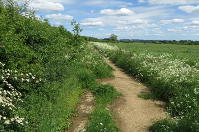
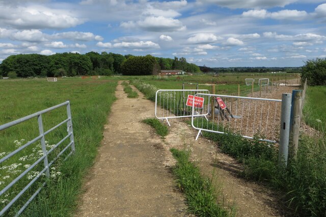
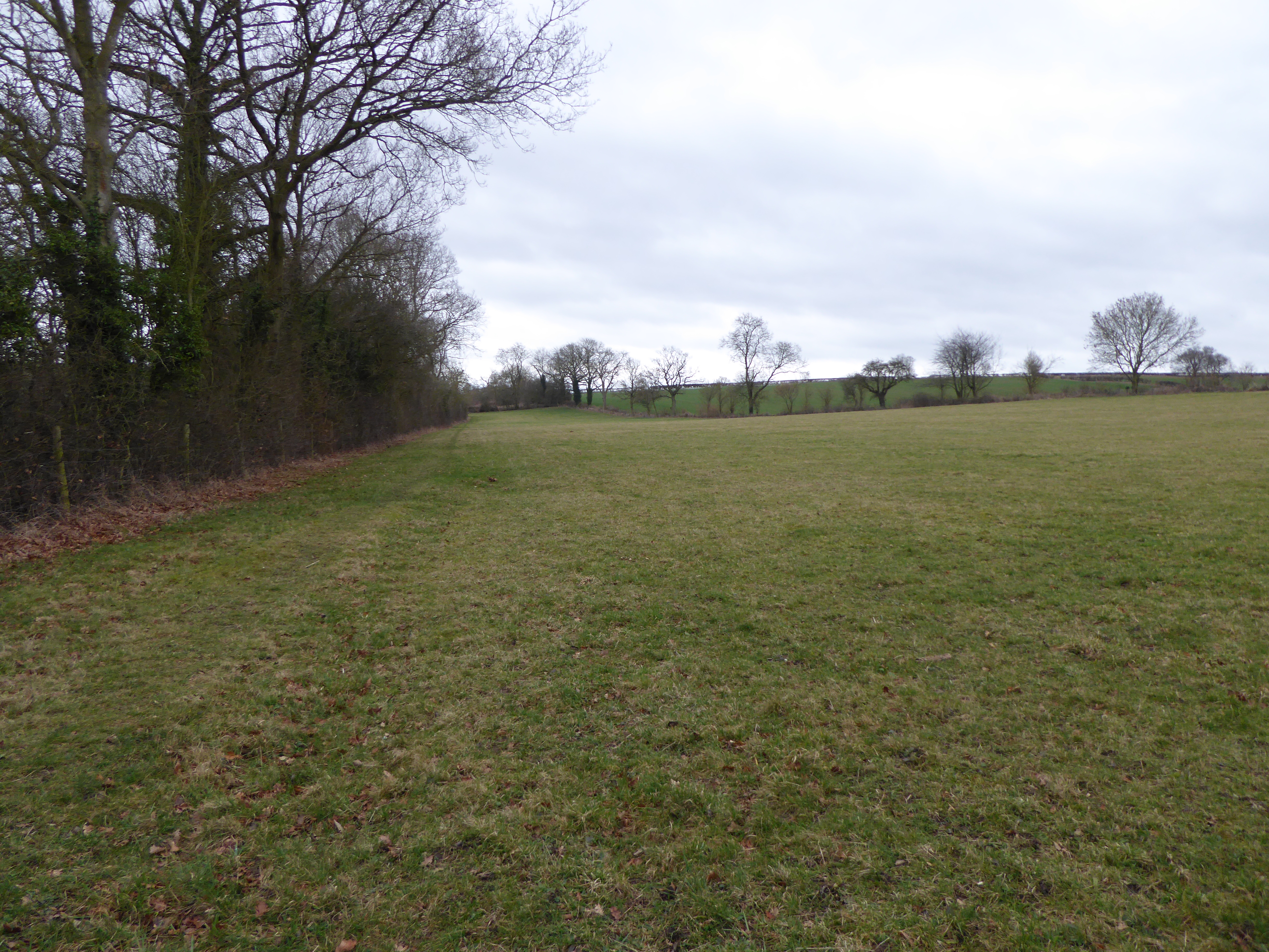
The parish is surrounded by beautiful countryside, offering scenic views and ample opportunities for outdoor activities. There are several footpaths and bridleways that crisscross the area, allowing for pleasant walks, horse riding, and cycling. The landscape is predominantly agricultural, with rolling fields and pockets of woodland.

Aston le Walls is home to the popular Aston le Walls Equestrian Centre, which hosts regular horse trials and other equestrian events. The center attracts competitors from all over the country and has excellent facilities for training and boarding horses.

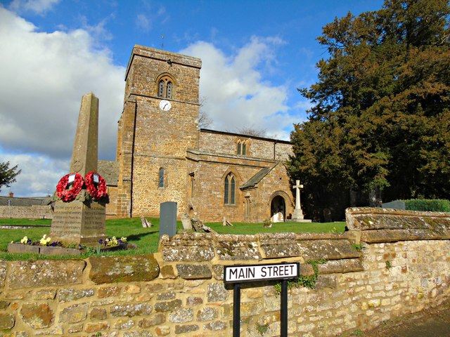
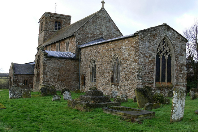
The parish also has a village hall, serving as a hub for local events and community gatherings. Additionally, there is a small church, St. Leonard's, dating back to the 12th century, which adds historical and architectural interest to the area.

Overall, Aston le Walls is a picturesque and peaceful civil parish, offering a rural escape with its stunning countryside, friendly community, and a range of outdoor activities to enjoy.

If you have any feedback on the listing, please let us know in the comments section below.

Aston le Walls Images

Images are sourced within 2km of 52.152476/-1.282078 or Grid Reference SP4950. Thanks to Geograph Open Source API. All images are credited.

Footpath towards Calves Close Spinney
Another HS2 footpath diversion near Calves Spinney
Boddington Reservoir Pumping Station Reservoir feeds the Oxford Canal.
Boddington Reservoir Pumping Station
Reservoir feeds the Oxford Canal.
Old Direction Sign - Signpost in Aston le Walls, Northants No finial - 3 arms; Northants concrete by the UC road, in parish of Aston le Walls (South Northamptonshire District), Aston le Walls, junction of Appletree Lane with Main Street, behind stone wall next to farm gate.

To be surveyed

Milestone Society National ID: NR_SP4950
Old Direction Sign - Signpost in Aston le Walls, Northants
No finial - 3 arms; Northants concrete by the UC road, in parish of Aston le Walls (South Northamptonshire District), Aston le Walls, junction of Appletree Lane with Main Street, behind stone wall next to farm gate. To be surveyed Milestone Society National ID: NR_SP4950
Farmland, Chipping Warden Winter barley and an oak on the western side of Welsh Road.
Farmland, Chipping Warden
Winter barley and an oak on the western side of Welsh Road.
Farmland, Aston le Walls Looking down over wheat from the A361.
Farmland, Aston le Walls
Looking down over wheat from the A361.
Farmland, Aston le Walls A footpath through wheat to the north of the old Chipping Warden Airfield.
Farmland, Aston le Walls
A footpath through wheat to the north of the old Chipping Warden Airfield.
Farmland, Aston le Walls A crop of barley on flat land below the hill at Appletree.
Farmland, Aston le Walls
A crop of barley on flat land below the hill at Appletree.
Farmland, Aston le Walls A crop of wheat to the south of the former railway.
Farmland, Aston le Walls
A crop of wheat to the south of the former railway.
Farmland, Boddington Sheep grazing to the south of the road between Lower Boddington and Aston le Walls.
Farmland, Boddington
Sheep grazing to the south of the road between Lower Boddington and Aston le Walls.
Farmland, Aston le Walls Cattle in pasture beside the bridleway between Aston le Walls and Byfield.
Farmland, Aston le Walls
Cattle in pasture beside the bridleway between Aston le Walls and Byfield.
Aston Le Walls Church
HS2 effects The end of a footpath where it joins an unclassified road south west of Lower Boddington. The metal gates and wooden fencing are all new, and previously this was an entirely open field entrance. In the past walkers using this footpath would have followed its existing route across this and other fields without being constricted into a narrow channel. This footpath currently joins the road at the same place as where HS2 is planned to cross it. A similar wooden fencing channel has been constructed on a footpath where it joins an unclassified road north east of Greatworth. Likewise this is another place where HS2 will cross an unclassified road.
HS2 effects
The end of a footpath where it joins an unclassified road south west of Lower Boddington. The metal gates and wooden fencing are all new, and previously this was an entirely open field entrance. In the past walkers using this footpath would have followed its existing route across this and other fields without being constricted into a narrow channel. This footpath currently joins the road at the same place as where HS2 is planned to cross it. A similar wooden fencing channel has been constructed on a footpath where it joins an unclassified road north east of Greatworth. Likewise this is another place where HS2 will cross an unclassified road.
A361 towards Daventry
Westhorp Lane leading off A361 up the hill towards Boddington Reservoir.
Westhorp
Lane leading off A361 up the hill towards Boddington Reservoir.
Aston-le-Walls Entrance to Redhill Farm
Aston-le-Walls
Entrance to Redhill Farm
Aston-le-Walls Field and Redhill Wood on the corner of A361 and Welsh Road.
Aston-le-Walls
Field and Redhill Wood on the corner of A361 and Welsh Road.
Show me another place!

Aston le Walls is located at Grid Ref: SP4950 (Lat: 52.152476, Lng: -1.282078)

Unitary Authority: West Northamptonshire

Police Authority: Northamptonshire

What 3 Words

///tinny.reserves.rashers. Near Claydon, Oxfordshire

Related Wikis

Aston le Walls

Aston le Walls is a village and civil parish in West Northamptonshire, England, close by the border with Oxfordshire. The village is about 9 miles (14...

RAF Chipping Warden

Royal Air Force Chipping Warden or more simply RAF Chipping Warden was a Royal Air Force station located 6 miles (10 km) north-east of Banbury near the...

Chipping Warden

Chipping Warden is a village and former civil parish, now in the parish of Chipping Warden and Edgcote, in the West Northamptonshire district, in the ceremonial...

Lower Boddington

Lower Boddington is a village and former civil parish, now in the parish of Boddington, in the West Northamptonshire district, in the ceremonial county...

Byfield Pool

Byfield Pool is a 4 hectare nature reserve west of Byfield in Northamptonshire. It was managed by the Wildlife Trust for Bedfordshire, Cambridgeshire and...

Boddington Meadow

Boddington Meadow is a 2.3-hectare (5.7-acre) nature reserve east of Upper Boddington in Northamptonshire. It is managed by the Wildlife Trust for Bedfordshire...

Prescote

Prescote is a hamlet and civil parish about 4 miles (6.4 km) north of Banbury in Oxfordshire. Its boundaries are the River Cherwell in the southeast, a...

Boddington, Northamptonshire

Boddington is a civil parish in West Northamptonshire, England, about 5 miles (8 km) north-east of Banbury off the A361 road. The parish includes the villages...

Nearby Amenities

Located within 500m of 52.152476,-1.282078
Post Box
Brand: Royal Mail
Brand Wikidata: Q638098
Brand Wikipedia: en:Royal Mail
Operator: Royal Mail
Operator Wikidata: Q638098
Post Box Type: lamp
Ref: NN11 172
Lat/Long: 52.1537363/-1.2752544
Telephone
Lat/Long: 52.1537632/-1.2751813
Power: pole
Lat/Long: 52.1556872/-1.2779698
Power: pole
Lat/Long: 52.1551314/-1.2786582
Power: pole
Lat/Long: 52.1549021/-1.277142
Power: pole
Lat/Long: 52.155021/-1.2779344
Power: pole
Lat/Long: 52.1559641/-1.2777043
Valley View Farm
Addr City: Daventry
Addr Country: GB
Addr Postcode: NN11 6TN
Addr Street: Appletree Road
Addr Village: Aston-le-Walls
Fhrs Authority: West Northamptonshire
Fhrs Id: 1541214
Fhrs Local Authority Id: FR/000002391
Place: farm
Lat/Long: 52.1503045/-1.2785771
Direction: 215
Generator Method: photovoltaic
Generator Output Electricity: yes
Generator Solar Modules: 10
Generator Source: solar
Generator Type: solar_photovoltaic_panel
Location: roof
Power: generator
Lat/Long: 52.1547083/-1.2767253
Historic: memorial
Memorial: war_memorial
Lat/Long: 52.1531327/-1.2773001
Barrier: stile
Bicycle: no
Foot: designated
Horse: no
Material: wood
Motor Vehicle: no
Stile: stepover
Lat/Long: 52.1518396/-1.2767715
Crossing
Lat/Long: 52.1519067/-1.276673
Crossing
Lat/Long: 52.1518329/-1.2767525
The data included in this document is from www.openstreetmap.org. The data is made available under ODbL.

Have you been to Aston le Walls?

Leave your review of Aston le Walls below (or comments, questions and feedback).