Askham

Civil Parish in Westmorland Eden

England

Askham

Cattle, Riddingleys Top
Cattle, Riddingleys Top Credit: Ian Taylor

Askham is a civil parish located in the county of Westmorland, England. Situated in the Eden District, it lies approximately 13 miles east of Penrith and 25 miles southwest of Carlisle. The village is nestled within the Lake District National Park, an area renowned for its stunning natural beauty.

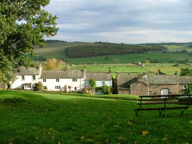
Askham can trace its history back to the Roman era, with evidence of a Roman fort discovered nearby. The village itself is characterized by its charming and traditional architecture, with many buildings constructed from local red sandstone. The Church of St. Peter, a Grade I listed building, stands as a prominent feature in the village, dating back to the 12th century.

The parish is home to a small population, with a strong sense of community. Facilities in the village include a primary school, a village hall, and a post office. The village is also well-known for its two country pubs, which offer a warm welcome to locals and visitors alike.

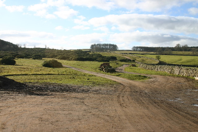
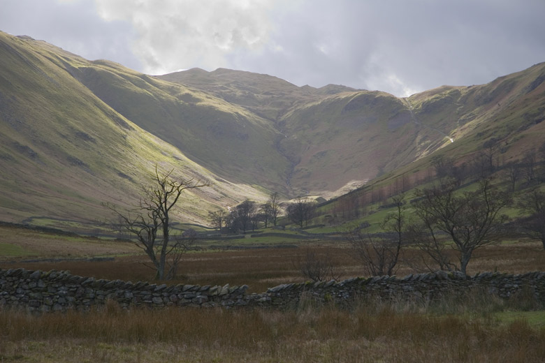
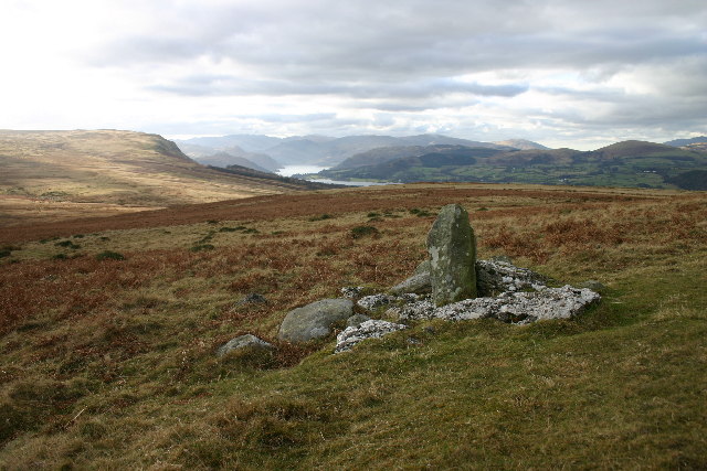
The natural surroundings of Askham offer a wealth of outdoor activities for residents and tourists. The nearby Lowther Castle and Gardens provide a picturesque setting for leisurely walks, while Haweswater Reservoir and Ullswater Lake offer opportunities for boating, fishing, and hiking.

Overall, Askham is a tranquil and picturesque village, offering a peaceful retreat for those seeking to immerse themselves in the beauty of the Lake District.

If you have any feedback on the listing, please let us know in the comments section below.
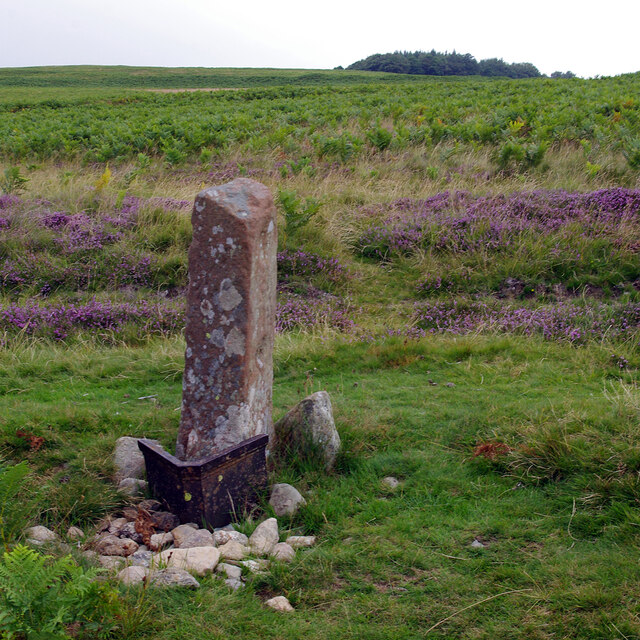
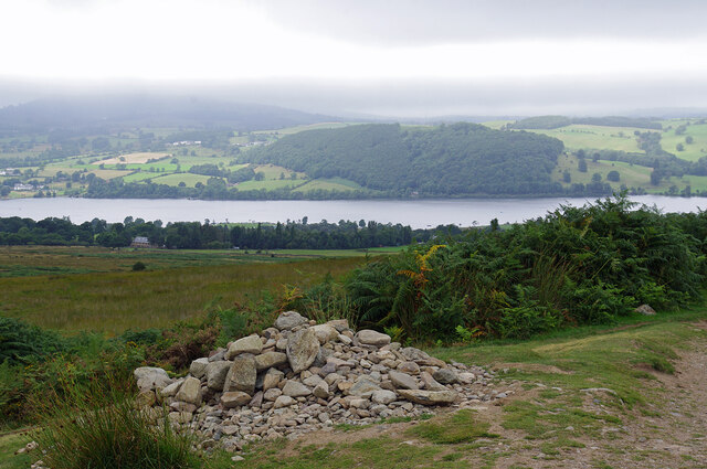
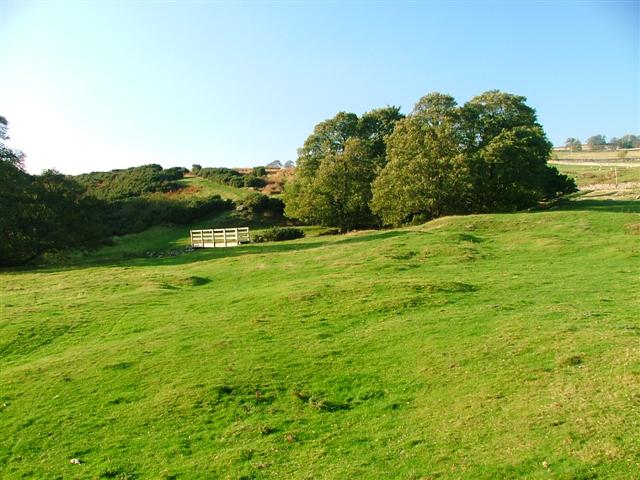
Askham Images

Images are sourced within 2km of 54.589414/-2.782603 or Grid Reference NY4921. Thanks to Geograph Open Source API. All images are credited.

Cattle, Riddingleys Top
Finger post, Riddingleys Top
Fell ponies, Riddingleys Top
Boundary stone, Ketley Gate See <a href="https://www.geograph.org.uk/photo/6462500">NY4822 : Old Boundary Marker</a> for more information.
Boundary stone, Ketley Gate
See NY4822 : Old Boundary Marker for more information.
Cairn below Heughscar Hill
Cairn circle, Moor Divock
Cop Stone, Moor Divock
Old Boundary Marker on Heughscar Hill Parish Boundary Marker 150 metres south of the top of Heughscar Hill. On the boundary of Barton and Askham parishes. See also <a title="https://www.geograph.org.uk/photo/3191051" href="https://www.geograph.org.uk/photo/3191051">Link</a> and <a title="https://www.geograph.org.uk/photo/5906270" href="https://www.geograph.org.uk/photo/5906270">Link</a>.

Milestone Society National ID: WE_BART06pb
Old Boundary Marker on Heughscar Hill
Parish Boundary Marker 150 metres south of the top of Heughscar Hill. On the boundary of Barton and Askham parishes. See also Link and Link. Milestone Society National ID: WE_BART06pb
Old Boundary Marker at Threepow Raise Parish Boundary Marker at Threepow Raise, 720 metres southwest of Ketley Gate. On the boundary of Barton and Askham parishes. Inscribed L on its east face.

Milestone Society National ID: WE_BART10pb
Old Boundary Marker at Threepow Raise
Parish Boundary Marker at Threepow Raise, 720 metres southwest of Ketley Gate. On the boundary of Barton and Askham parishes. Inscribed L on its east face. Milestone Society National ID: WE_BART10pb
Footbridge Over Heltondale Beck
Heltonhead Looking down the unclassified road to Helton.
Heltonhead
Looking down the unclassified road to Helton.
Helton Village Green
Path Meeting above Askham The bridleway to the right leads onto Askham Fell.
Path Meeting above Askham
The bridleway to the right leads onto Askham Fell.
Mini Reservoir Shown as just a small square on the OS map, this is clearly constructed and has an outflow but none in - being on limestone it is probably a modified rising.
Mini Reservoir
Shown as just a small square on the OS map, this is clearly constructed and has an outflow but none in - being on limestone it is probably a modified rising.
Farmland Between Plantations Grazed by sheep. There are gamebird rearing pens in the woods to the right.
Farmland Between Plantations
Grazed by sheep. There are gamebird rearing pens in the woods to the right.
Mirebank Plantation On the open, wild fells above Askham, this straight-sided plantation looks very out-of-place.
Mirebank Plantation
On the open, wild fells above Askham, this straight-sided plantation looks very out-of-place.
Ponies on Rough Land The grazing here is too poor to support ponies and horses, hence the hay feed. The area is criss-crossed with bridleways, and riding is a popular pastime and industry here.
Ponies on Rough Land
The grazing here is too poor to support ponies and horses, hence the hay feed. The area is criss-crossed with bridleways, and riding is a popular pastime and industry here.
Show me another place!

Askham is located at Grid Ref: NY4921 (Lat: 54.589414, Lng: -2.782603)

Administrative County: Cumbria

District: Eden

Police Authority: Cumbria

What 3 Words

///custard.sunflower.strays. Near Penrith, Cumbria

Related Wikis

Boredale Hause

Boredale Hause is a mountain pass between Place Fell and Angletarn Pikes in the east of the English Lake District. It links the Patterdale and Boredale...

Heughscar Hill

Heughscar Hill is a hill in the east of the English Lake District, east of Ullswater and north of High Street, Cumbria. It is the subject of a chapter...

Helton, Cumbria

Helton is a village in the Eden district, in the English county of Cumbria. It is about a mile south of the village of Askham. Circa 1870, it had a population...

Askham, Cumbria

Askham is a village and civil parish in the Eden district of Cumbria, England. It is in the historic county of Westmorland. According to the 2001 census...

Barton and Pooley Bridge

Barton and Pooley Bridge is a civil parish in Eden District, Cumbria, England. The parish is on the edge of the Lake District National Park, and had a...

Whale, Cumbria

Whale is a hamlet in the Westmorland and Furness unitary authority area, Cumbria, England. Historically in Westmorland, it is about a mile south of the...

West Ward Rural District

West Ward was a rural district of the administrative county of Westmorland. The area was directly based on the former West Ward rural sanitary district...

Askham Hall

Askham Hall is a country house near Askham in Cumbria. It is a Grade I listed building. == History == A peel tower was built on the site during the 14th...

Nearby Amenities

Located within 500m of 54.589414,-2.782603
Natural: sinkhole
Lat/Long: 54.5858044/-2.7823572
Wofa Holes
Natural: sinkhole
Note: Numerous natural sinkholes/Shake holes
Lat/Long: 54.5888226/-2.7900168
Natural: sinkhole
Lat/Long: 54.5866387/-2.7871125
Natural: sinkhole
Note: Numerous natural sinkholes/Shake holes
Lat/Long: 54.5910638/-2.788816
The Riggs
Place: locality
Lat/Long: 54.5899637/-2.7776236
Stone Carving/Artwork
Historic: archaeological_site
Lat/Long: 54.5905549/-2.7859005
Natural: sinkhole
Lat/Long: 54.5914722/-2.7879817
Natural: sinkhole
Lat/Long: 54.5916617/-2.7882915
Natural: sinkhole
Lat/Long: 54.5920207/-2.7885497
Natural: sinkhole
Lat/Long: 54.5910134/-2.7873792
Natural: sinkhole
Lat/Long: 54.5906045/-2.7886874
Natural: sinkhole
Lat/Long: 54.5903452/-2.7886013
Natural: sinkhole
Lat/Long: 54.5897069/-2.7885153
Natural: sinkhole
Lat/Long: 54.5897867/-2.7891005
Natural: sinkhole
Lat/Long: 54.5893778/-2.7893071
Natural: sinkhole
Lat/Long: 54.5891683/-2.7900644
Natural: sinkhole
Lat/Long: 54.5889888/-2.7901333
Natural: sinkhole
Lat/Long: 54.5878765/-2.789446
Natural: sinkhole
Lat/Long: 54.5878586/-2.7891063
Natural: sinkhole
Lat/Long: 54.5888605/-2.7882521
Natural: sinkhole
Lat/Long: 54.5889798/-2.7886844
Natural: sinkhole
Lat/Long: 54.5886756/-2.7876964
Natural: sinkhole
Lat/Long: 54.5885742/-2.7861217
Natural: sinkhole
Lat/Long: 54.5881389/-2.7854836
Natural: sinkhole
Lat/Long: 54.5881031/-2.7859879
Natural: sinkhole
Lat/Long: 54.5888008/-2.7869245
Natural: sinkhole
Lat/Long: 54.5871072/-2.7875523
Natural: sinkhole
Lat/Long: 54.5875843/-2.7894563
Natural: sinkhole
Lat/Long: 54.5909655/-2.789693
Abandoned: yes
Archaeological Site: lime_kiln
Historic: archaeological_site
Ruins: yes
Lat/Long: 54.5908594/-2.7765851
Natural: sinkhole
Lat/Long: 54.5852783/-2.7802828
Natural: sinkhole
Lat/Long: 54.5855221/-2.7803593
Natural: sinkhole
Lat/Long: 54.5857992/-2.7803115
Natural: sinkhole
Lat/Long: 54.5857604/-2.7806558
Natural: sinkhole
Lat/Long: 54.5856884/-2.7811339
Natural: sinkhole
Lat/Long: 54.5854723/-2.7806653
Natural: sinkhole
Lat/Long: 54.5851232/-2.7816981
Natural: sinkhole
Lat/Long: 54.5851619/-2.7822145
Natural: sinkhole
Lat/Long: 54.5855554/-2.7824727
Natural: sinkhole
Lat/Long: 54.5857216/-2.7828839
Natural: sinkhole
Lat/Long: 54.5875771/-2.7804808
Natural: sinkhole
Lat/Long: 54.5870195/-2.7802627
Archaeological Site: tumulus
Historic: archaeological_site
Wikidata: Q66625354
Lat/Long: 54.5875987/-2.7818431
Archaeological Site: tumulus
Historic: archaeological_site
Lat/Long: 54.5905668/-2.7810354
Natural: sinkhole
Lat/Long: 54.5879331/-2.7862218
Natural: sinkhole
Lat/Long: 54.5877334/-2.785311
Natural: sinkhole
Lat/Long: 54.5874303/-2.7862771
Natural: sinkhole
Lat/Long: 54.5877833/-2.7866464
Archaeological Site: tumulus
Historic: archaeological_site
Wikidata: Q17643445
Lat/Long: 54.5901122/-2.7819081
Archaeological Site: tumulus
Historic: archaeological_site
Wikidata: Q17643524
Lat/Long: 54.5923066/-2.7860132
Natural: sinkhole
Lat/Long: 54.5885847/-2.7816241
Natural: sinkhole
Lat/Long: 54.5886206/-2.7822956
Natural: sinkhole
Lat/Long: 54.5888817/-2.7830467
Natural: sinkhole
Lat/Long: 54.5898826/-2.7877793
Natural: sinkhole
Lat/Long: 54.5904389/-2.7876541
Natural: sinkhole
Lat/Long: 54.5902212/-2.7888542
Natural: sinkhole
Lat/Long: 54.5900035/-2.7892194
Natural: sinkhole
Lat/Long: 54.5895924/-2.7844191
Natural: sinkhole
Lat/Long: 54.5898342/-2.7838243
Natural: sinkhole
Lat/Long: 54.5876453/-2.7833129
Natural: sinkhole
Lat/Long: 54.5875486/-2.7838765
Natural: sinkhole
Lat/Long: 54.5872099/-2.7835425
Natural: sinkhole
Lat/Long: 54.5873611/-2.7833234
Natural: sinkhole
Lat/Long: 54.5868592/-2.7835425
Natural: sinkhole
Lat/Long: 54.5861396/-2.7804119
Natural: sinkhole
Lat/Long: 54.5863634/-2.7792431
Natural: sinkhole
Lat/Long: 54.5862908/-2.7786587
Natural: sinkhole
Lat/Long: 54.5862545/-2.7781891
The data included in this document is from www.openstreetmap.org. The data is made available under ODbL.

Have you been to Askham?

Leave your review of Askham below (or comments, questions and feedback).