Askerswell

Civil Parish in Dorset West Dorset

England

Askerswell

St. Michael and All Angels, Askerswell, Dorset The church body was built in 1858 and replaced the dilapidated early 15th-century building of c1403. The tower is original.
St. Michael and All Angels, Askerswell, Dorset Credit: Ray Jennings

Askerswell is a civil parish located in the county of Dorset, England. Situated in the picturesque region of West Dorset, Askerswell is surrounded by rolling hills and beautiful countryside. The parish covers an area of approximately 4 square miles and is home to a small population.

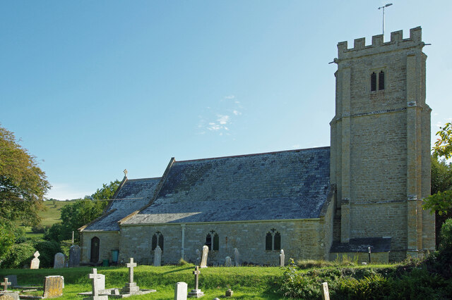
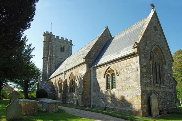
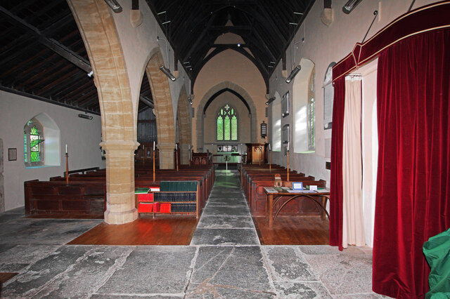
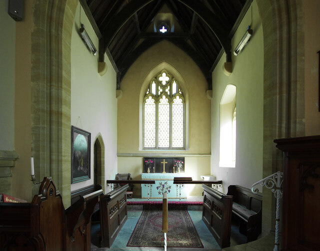
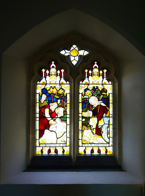
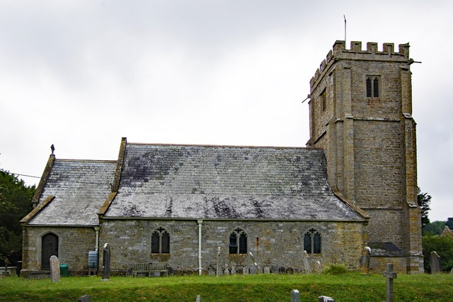
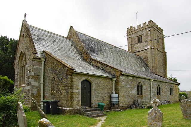
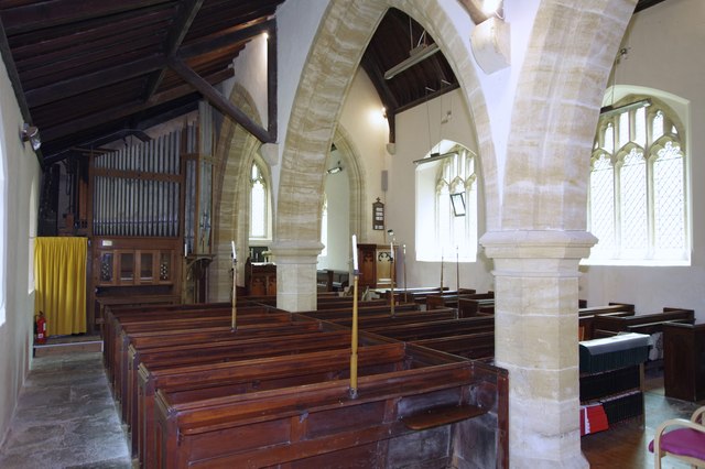
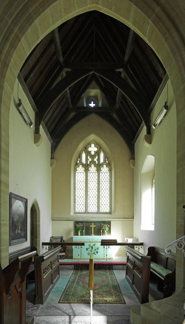
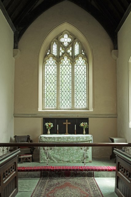
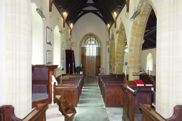
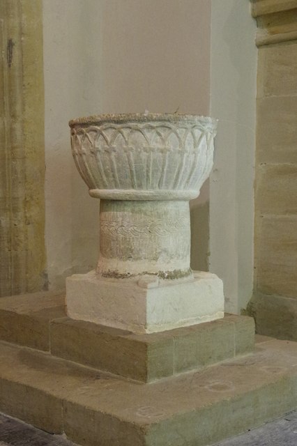
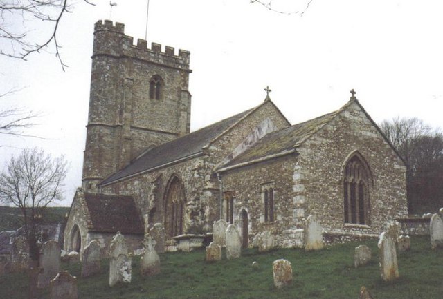
The village of Askerswell itself is a charming and traditional English village, with a quaint and peaceful atmosphere. It features a cluster of period stone cottages, many of which date back to the 17th and 18th centuries, adding to its historic charm. The village also boasts a Grade I listed church, St. Michael's, which dates back to the 12th century and is a significant architectural landmark in the area.

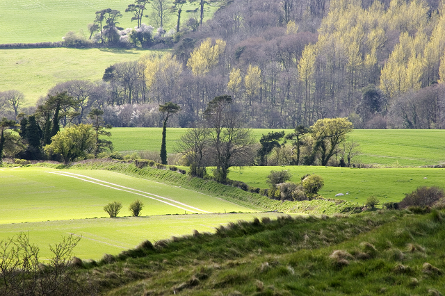
The parish is primarily an agricultural area, with farmland dominating the landscape. Agriculture has been a key industry in Askerswell for centuries, and it continues to play an important role in the local economy. The parish is known for its fertile soil, which is ideal for farming.

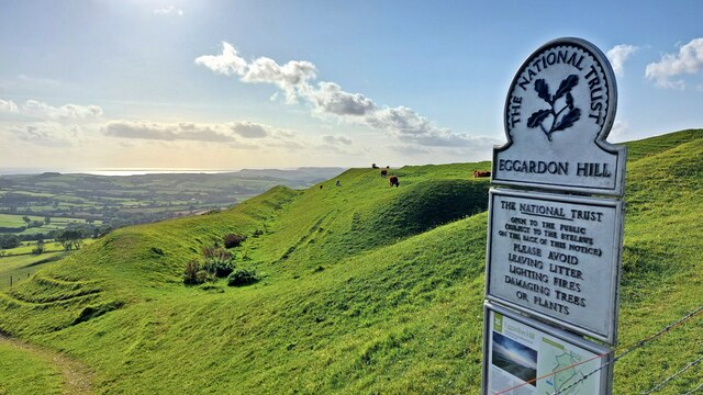
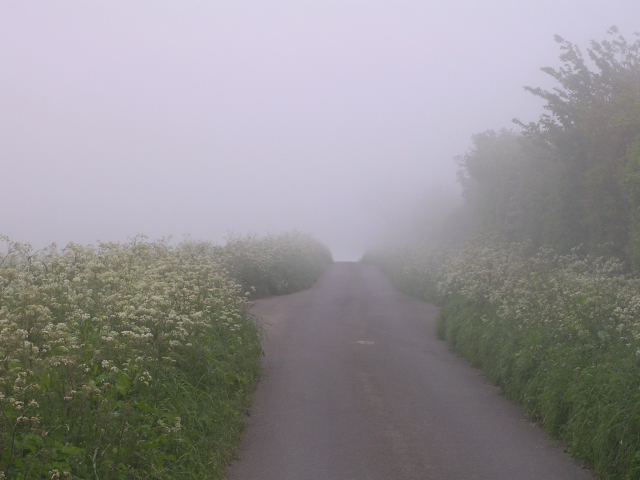
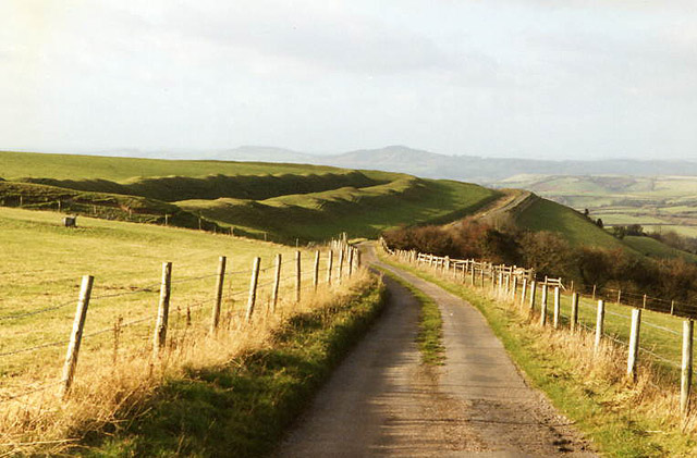
The surrounding countryside offers breathtaking views and is popular with walkers and nature enthusiasts. There are several footpaths and bridleways that crisscross the area, providing opportunities for exploration and outdoor activities.

Despite its small size, Askerswell is a close-knit community with a strong sense of community spirit. The village hosts various events and activities throughout the year, bringing residents together and fostering a sense of belonging.

In summary, Askerswell is a tranquil and picturesque civil parish in Dorset, characterized by its historic village, agricultural landscape, and natural beauty.

If you have any feedback on the listing, please let us know in the comments section below.

Askerswell Images

Images are sourced within 2km of 50.738592/-2.659942 or Grid Reference SY5393. Thanks to Geograph Open Source API. All images are credited.

St. Michael and All Angels, Askerswell, Dorset The church body was built in 1858 and replaced the dilapidated early 15th-century building of c1403. The tower is original.
St. Michael and All Angels, Askerswell, Dorset
The church body was built in 1858 and replaced the dilapidated early 15th-century building of c1403. The tower is original.
St. Michael and All Angels, Askerswell, Dorset
St. Michael and All Angels, Askerswell, Dorset A North wall window
St. Michael and All Angels, Askerswell, Dorset
A North wall window
Old Milestone by the A35, Askerswell Carved stone post by the A35, in parish of ASKERSWELL (WEST DORSET District), opposite road to Askerswell, just prior to lay-by, on South side of road. Dorset 1 (limestone), erected by the Harnham, Blandford & Dorchester Turnpike Trust in the 19th century. 

Inscription reads:-
5
Bridport
Dorchester
10
Carved benchmark on bottom right of front face. 

Milestone Society National ID: DO_BPDO05.
Old Milestone by the A35, Askerswell
Carved stone post by the A35, in parish of ASKERSWELL (WEST DORSET District), opposite road to Askerswell, just prior to lay-by, on South side of road. Dorset 1 (limestone), erected by the Harnham, Blandford & Dorchester Turnpike Trust in the 19th century. Inscription reads:- 5 Bridport Dorchester 10 Carved benchmark on bottom right of front face. Milestone Society National ID: DO_BPDO05.
Eggardon Hill Eggardon Hill is a prehistoric hill fort built on chalk uplands.  The highest point stands at 252 metres above sea level and offers outstanding views to the Jurassic Coast.  The southern half of the site is owned by the National Trust.
Eggardon Hill
Eggardon Hill is a prehistoric hill fort built on chalk uplands. The highest point stands at 252 metres above sea level and offers outstanding views to the Jurassic Coast. The southern half of the site is owned by the National Trust.
St Michael and All Angels, Askerswell, Dorset The church body was built in 1858 and replaced the dilapidated early 15th-century building of c1403. The tower is original.
St Michael and All Angels, Askerswell, Dorset
The church body was built in 1858 and replaced the dilapidated early 15th-century building of c1403. The tower is original.
St Michael and All Angels, Askerswell, Dorset A view across the church from the North aisle.
St Michael and All Angels, Askerswell, Dorset
A view across the church from the North aisle.
St Michael and All Angels, Askerswell, Dorset The Chancel.
St Michael and All Angels, Askerswell, Dorset
The Chancel.
St Michael and All Angels, Askerswell, Dorset The Sanctuary.
St Michael and All Angels, Askerswell, Dorset
The Sanctuary.
St Michael and All Angels, Askerswell, Dorset The Nave, looking Westward.
St Michael and All Angels, Askerswell, Dorset
The Nave, looking Westward.
St Michael and All Angels, Askerswell, Dorset A late-Norman font c1154 with some fine carving.
St Michael and All Angels, Askerswell, Dorset
A late-Norman font c1154 with some fine carving.
From Eggardon Hill Fort looking East Mid afternoon in early spring. A view from the top of Eggardon Hill looking west towards Askerswell.
From Eggardon Hill Fort looking East
Mid afternoon in early spring. A view from the top of Eggardon Hill looking west towards Askerswell.
Looking east along the Roman Road at Two Gates The thick fog in this photo was coming in from the sea (to the right) and making driving on this narrow (but straight) road quite difficult. It had been sunny only a few hours earlier, which shows how quickly the weather can change on this high ground (238m above sea level). The Roman road eventually leads to Dorchester.
Looking east along the Roman Road at Two Gates
The thick fog in this photo was coming in from the sea (to the right) and making driving on this narrow (but straight) road quite difficult. It had been sunny only a few hours earlier, which shows how quickly the weather can change on this high ground (238m above sea level). The Roman road eventually leads to Dorchester.
Eggardon hillfort Rampart of hill fort visible by minor road running north west to Powerstock
Eggardon hillfort
Rampart of hill fort visible by minor road running north west to Powerstock
Milestone on A35 between Bridport & Dorchester Near Askerswell
Milestone on A35 between Bridport & Dorchester
Near Askerswell
Show me another place!

Askerswell is located at Grid Ref: SY5393 (Lat: 50.738592, Lng: -2.659942)

Administrative County: Dorset

District: West Dorset

Police Authority: Dorset

What 3 Words

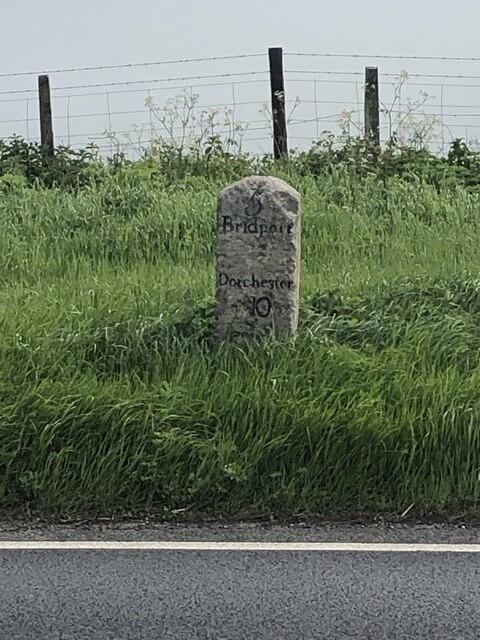
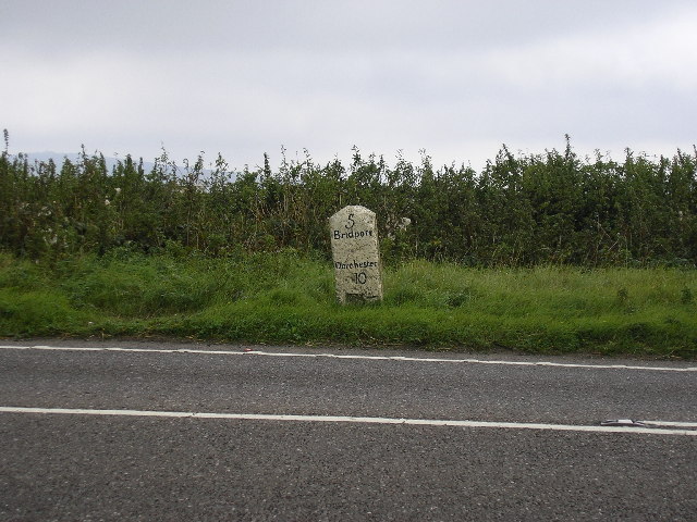
///format.woven.campsites. Near Bridport, Dorset

Nearby Locations

Askerswell

Related Wikis

Askerswell

Askerswell () is a small village and civil parish in the county of Dorset in southwest England. It is sited on the small River Asker. It lies 11 miles...
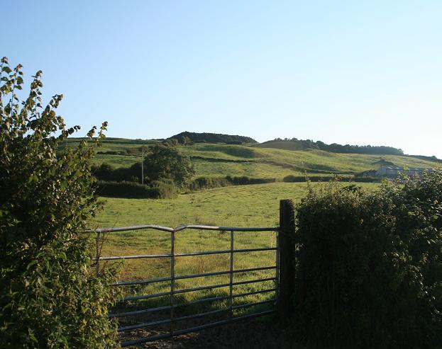
Eggardon Hill

Eggardon Hill is a prehistoric hillfort on a hill in Dorset, England. It is located on chalk uplands approximately four miles to the east of the town of...

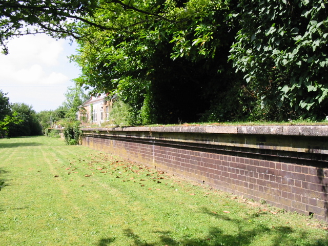
Powerstock railway station

Powerstock was a railway station on the Bridport Railway in the west of the English county of Dorset. The station served the villages of Powerstock, and...

Chilcombe

Chilcombe is a hamlet and civil parish in Dorset, England, situated in the Dorset unitary authority administrative area about 4 miles (6.4 km) east of...

Uploders

Uploders is a small village in Dorset, England. It consists mainly of houses, and has a pub, the Crown, a Grade II listed Methodist chapel and a playing...

Shipton Hill Settlement

The Shipton Hill Settlement is an archaeological site, a defended settlement of the Iron Age, near Shipton Gorge in Dorset, England. It is a scheduled...

West Compton, Dorset

West Compton is a hamlet and civil parish in the county of Dorset, England. It lies in western Dorset, about 7 miles to the east of the town of Bridport...

Litton Cheney

Litton Cheney is a village and civil parish in the county of Dorset in south-west England. It lies 9 miles (14 km) west of the county town Dorchester....

Nearby Amenities

Located within 500m of 50.738592,-2.659942
Design: barrel
Power: tower
Lat/Long: 50.738104/-2.6654516
Design: barrel
Power: tower
Lat/Long: 50.7374038/-2.6629343
Design: barrel
Power: tower
Lat/Long: 50.7356118/-2.6563186
Material: wood
Power: pole
Source: bing
Lat/Long: 50.7343158/-2.659398
Material: wood
Power: pole
Source: bing
Lat/Long: 50.7346517/-2.6607136
Material: wood
Power: pole
Source: bing
Lat/Long: 50.7351989/-2.6630779
Material: wood
Power: pole
Source: bing
Lat/Long: 50.7355573/-2.6644895
Material: wood
Power: pole
Source: bing
Lat/Long: 50.7400017/-2.6640555
Material: wood
Power: pole
Source: bing
Lat/Long: 50.740618/-2.6640555
Material: wood
Power: pole
Source: bing
Lat/Long: 50.741372/-2.6640621
Material: wood
Power: pole
Source: bing
Lat/Long: 50.7416623/-2.6649808
Material: wood
Power: pole
Source: bing
Lat/Long: 50.7420645/-2.6640935
Material: wood
Power: pole
Source: bing
Lat/Long: 50.742471/-2.6631668
The data included in this document is from www.openstreetmap.org. The data is made available under ODbL.

Have you been to Askerswell?

Leave your review of Askerswell below (or comments, questions and feedback).