Ashford

Civil Parish in Devon North Devon

England

Ashford

Cutting on dismantled railway at Penhill The old railway line along the edge of the Taw estuary now carries the South West Coast Path and the Tarka Trail.  It is also very popular as a cycle path.
Cutting on dismantled railway at Penhill Credit: Tony Atkin

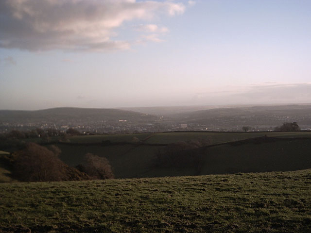
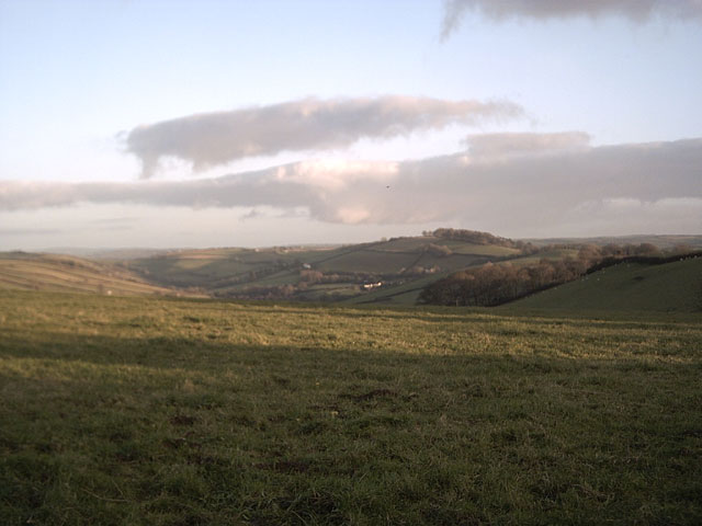
Ashford is a civil parish located in the county of Devon, England. Situated in the South Hams district, Ashford is a small and picturesque village that offers a tranquil and idyllic setting for residents and visitors alike. The parish covers an area of approximately 5 square kilometers.

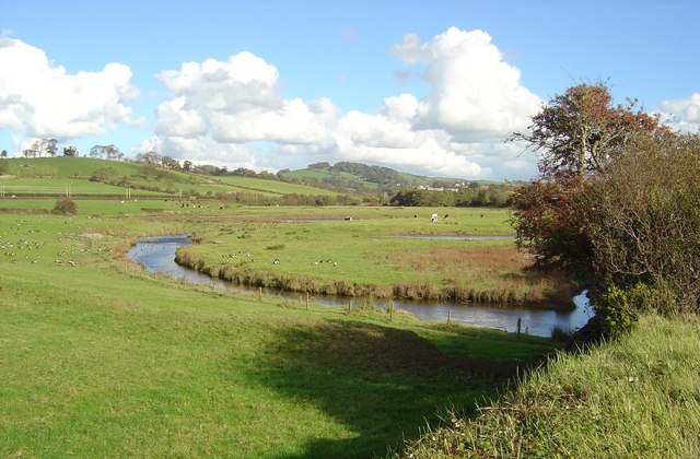
The village is surrounded by stunning natural beauty, with rolling hills, lush fields, and meandering rivers. It is located near the Dartmoor National Park, providing ample opportunities for outdoor activities and exploring the countryside. The nearby River Avon also offers opportunities for fishing and boating.

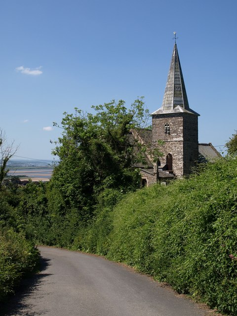
Ashford is a close-knit community with a population of around 400 people. The village is home to a number of historic buildings, including the Grade II listed St. Peter's Church, which dates back to the 15th century. The church is known for its beautiful stained glass windows and intricate stone carvings.

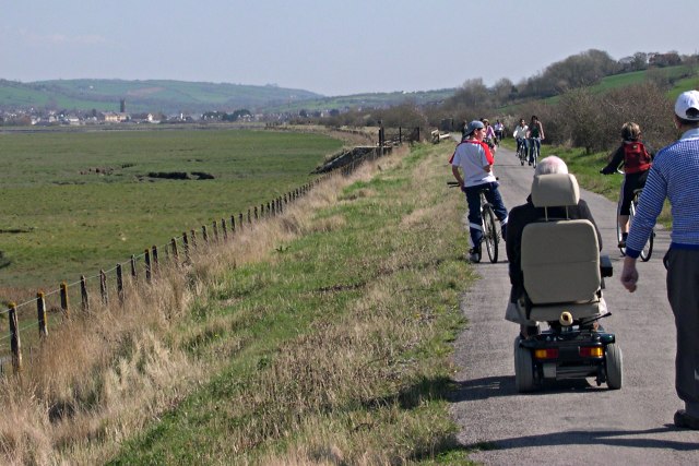
The village has a primary school, providing education for local children, and there are several small businesses and shops serving the community. Ashford also has a village hall which hosts various events and activities throughout the year, fostering a sense of community spirit.

Overall, Ashford is a charming and peaceful village that offers a retreat from the hustle and bustle of city life. With its natural beauty, historic buildings, and strong community spirit, it is a place that attracts those seeking a slower pace of life and a connection to the countryside.

If you have any feedback on the listing, please let us know in the comments section below.
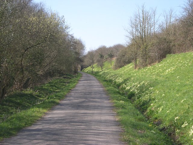
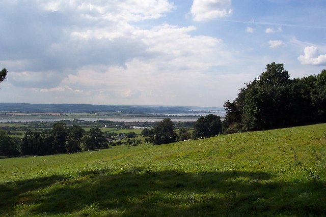
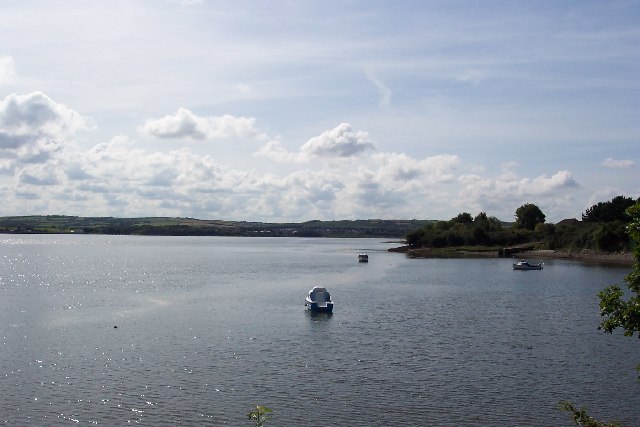
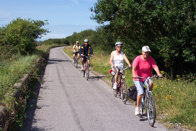
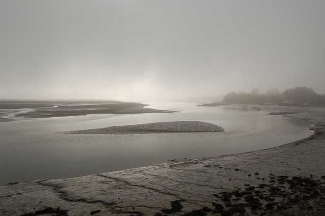
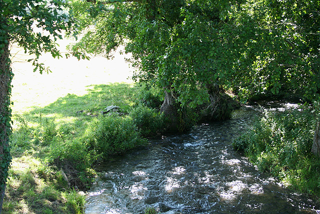
Ashford Images

Images are sourced within 2km of 51.094234/-4.097272 or Grid Reference SS5334. Thanks to Geograph Open Source API. All images are credited.

Cutting on dismantled railway at Penhill The old railway line along the edge of the Taw estuary now carries the South West Coast Path and the Tarka Trail.  It is also very popular as a cycle path.
Cutting on dismantled railway at Penhill
The old railway line along the edge of the Taw estuary now carries the South West Coast Path and the Tarka Trail. It is also very popular as a cycle path.
Shelter on Tarka Trail between Fremington and Barnstaple This intriguing shelter has been defaced by spray-can artists.
Shelter on Tarka Trail between Fremington and Barnstaple
This intriguing shelter has been defaced by spray-can artists.
Near Barnstaple, North Devon A view looking south west from Bradiford over the estuary of the River Taw.
Near Barnstaple, North Devon
A view looking south west from Bradiford over the estuary of the River Taw.
Anchored on the Taw The River Taw, taken from the Tarka Trail cycle path near Heanton Court.
Anchored on the Taw
The River Taw, taken from the Tarka Trail cycle path near Heanton Court.
Tarka Trail cycle path near Barnstaple The Tarka Trail cycle path looking towards Barnstaple from near Strand House. The cycle path uses the course of the old Ilfracombe to Barnstaple railway, which here also forms the sea wall.
Tarka Trail cycle path near Barnstaple
The Tarka Trail cycle path looking towards Barnstaple from near Strand House. The cycle path uses the course of the old Ilfracombe to Barnstaple railway, which here also forms the sea wall.
Cyclists on the Tarka Trail This photograph is a bit of a cheat. I wanted a picture of a big group of cyclists but the lady in the front came along well ahead of her friends. So I took two pictures and assembled them together. Unfortunately my cut and paste missed part of the shadow of the front bike wheel!
Cyclists on the Tarka Trail
This photograph is a bit of a cheat. I wanted a picture of a big group of cyclists but the lady in the front came along well ahead of her friends. So I took two pictures and assembled them together. Unfortunately my cut and paste missed part of the shadow of the front bike wheel!
View of Barnstaple from Prixford Taken from the road near the Varley Farm turning.
View of Barnstaple from Prixford
Taken from the road near the Varley Farm turning.
Farmland near Springfield Cross Looking towards Shirwell Cross.
Farmland near Springfield Cross
Looking towards Shirwell Cross.
Folly on Poleshill Taken from the end of Poleshill Lane.
Folly on Poleshill
Taken from the end of Poleshill Lane.
View of Barnstaple from Poleshill Lane Codden Hill <a href="https://www.geograph.org.uk/gridref/SS5829">SS5829</a> in the distance.
View of Barnstaple from Poleshill Lane
Codden Hill SS5829 in the distance.
View of Bradiford from Poleshill Lane
Taw Estuary and South West Coastpath The Tarka Trail / South West Coastpath near where Bradiford Water joins the River Taw.
Taw Estuary and South West Coastpath
The Tarka Trail / South West Coastpath near where Bradiford Water joins the River Taw.
Bradiford Water Bird Reserve, Barnstaple Water meadows, scrapes and ponds just before confluence of Bradiford Water and River Taw. Situated at west end of Pottington Industrial Estate, Barnstaple. Image taken from the Tarka Trail (old trackbed of the Barnstaple to Ilfracombe Railway) looking east with Roborough (iron age fort) in far background.
Bradiford Water Bird Reserve, Barnstaple
Water meadows, scrapes and ponds just before confluence of Bradiford Water and River Taw. Situated at west end of Pottington Industrial Estate, Barnstaple. Image taken from the Tarka Trail (old trackbed of the Barnstaple to Ilfracombe Railway) looking east with Roborough (iron age fort) in far background.
A Path for Everybody For most of its length around the Taw estuary, the path which constitutes part of the Southwest Coast Path and the Tarka Trail is built along disused railway lines and surfaced as a cycle track making it suitable for anyone to use.
A Path for Everybody
For most of its length around the Taw estuary, the path which constitutes part of the Southwest Coast Path and the Tarka Trail is built along disused railway lines and surfaced as a cycle track making it suitable for anyone to use.
River Taw nr Barnstaple. Image taken from the Tarka Trail on the north bank of the river, looking downstream (west) towards Penhill Marshes.
River Taw nr Barnstaple.
Image taken from the Tarka Trail on the north bank of the river, looking downstream (west) towards Penhill Marshes.
Misty morning on the River Taw Misty morning on the River Taw looking from the Tarka Trail.
Misty morning on the River Taw
Misty morning on the River Taw looking from the Tarka Trail.
Heanton Punchardon: towards the Taw estuary Looking south with Fremington Quay just visible on the far bank of the river – at SS515332
Heanton Punchardon: towards the Taw estuary
Looking south with Fremington Quay just visible on the far bank of the river – at SS515332
Heanton Punchardon: Knowl Water At Knowlwater Bridge, looking west, downstream. A lively tributary of the river Caen, itself a tributary of the Taw
Heanton Punchardon: Knowl Water
At Knowlwater Bridge, looking west, downstream. A lively tributary of the river Caen, itself a tributary of the Taw
Show me another place!

Ashford is located at Grid Ref: SS5334 (Lat: 51.094234, Lng: -4.097272)

Administrative County: Devon

District: North Devon

Police Authority: Devon & Cornwall

What 3 Words

///strutted.locked.repelled. Near Barnstaple, Devon

Nearby Locations

Ashford

Related Wikis

Ashford, North Devon

Ashford is a village and civil parish in the North Devon district of Devon, England. According to the 2011 census it had a population of 267.This Ashford...

Braunton Road rail accident

The Braunton Road railway accident occurred on 1 January 1910 in England. The Lynton & Barnstaple Railway maintained an exemplary safety record throughout...

Pilton West

Pilton West is a rural civil parish of North Devon, Devon, England, immediately north-west of the suburb of Pilton in the town of Barnstaple. The parish...

Bradiford

Bradiford is a village in Devon, England.

Related Videos

The Legendary Grand Tour 2023 - The Big last day Bank Holiday Monday #smallcarsbighearts #chsw

A warm welcome to the AW Services YouTube channel. Today is the big last day of the Legendary Grand Tour & North Devon's ...

Reika's and Bella's trip to Mannings pit.

We thought we would meet up with a friend and have a picnic, but it rained most of the day, so we build a fire and set up camp lol.

Nearby Amenities

Located within 500m of 51.094234,-4.097272
Post Box
Operator: Royal Mail
Operator Wikidata: Q638098
Post Box Type: lamp
Ref: EX31 39
Royal Cypher: EIIR
Royal Cypher Wikidata: Q33102113
Lat/Long: 51.0941174/-4.1043179
Barrier: cycle_barrier
Lat/Long: 51.0942487/-4.1042896
Telephone
Booth: K6
Covered: booth
Lat/Long: 51.0940192/-4.1043922
Ashford
Place: village
Lat/Long: 51.0983083/-4.0946191
West Ashford
Place: locality
Lat/Long: 51.0976076/-4.1019362
Generator Method: photovoltaic
Generator Output Electricity: yes
Generator Source: solar
Generator Type: solar_photovoltaic_panel
Location: roof
Power: generator
Lat/Long: 51.0964188/-4.0935061
Generator Method: photovoltaic
Generator Output Electricity: yes
Generator Source: solar
Generator Type: solar_photovoltaic_panel
Location: roof
Power: generator
Lat/Long: 51.0962976/-4.0942571
Generator Method: photovoltaic
Generator Output Electricity: yes
Generator Source: solar
Generator Type: solar_photovoltaic_panel
Location: roof
Power: generator
Lat/Long: 51.0967052/-4.0945977
Generator Method: photovoltaic
Generator Output Electricity: yes
Generator Source: solar
Generator Type: solar_photovoltaic_panel
Location: roof
Power: generator
Lat/Long: 51.0970101/-4.0948552
Generator Method: photovoltaic
Generator Output Electricity: yes
Generator Source: solar
Generator Type: solar_photovoltaic_panel
Location: roof
Power: generator
Lat/Long: 51.0970101/-4.0949223
Generator Method: photovoltaic
Generator Output Electricity: yes
Generator Source: solar
Generator Type: solar_photovoltaic_panel
Location: roof
Power: generator
Lat/Long: 51.0966462/-4.0951771
Generator Method: photovoltaic
Generator Output Electricity: yes
Generator Source: solar
Generator Type: solar_photovoltaic_panel
Location: roof
Power: generator
Lat/Long: 51.0968063/-4.0957216
Generator Method: photovoltaic
Generator Output Electricity: yes
Generator Source: solar
Generator Type: solar_photovoltaic_panel
Location: roof
Power: generator
Lat/Long: 51.0968282/-4.0958932
Generator Method: photovoltaic
Generator Output Electricity: yes
Generator Source: solar
Generator Type: solar_photovoltaic_panel
Location: roof
Power: generator
Lat/Long: 51.0968804/-4.0965611
Generator Method: photovoltaic
Generator Output Electricity: yes
Generator Source: solar
Generator Type: solar_photovoltaic_panel
Location: roof
Power: generator
Lat/Long: 51.096722/-4.0970251
Generator Method: photovoltaic
Generator Output Electricity: yes
Generator Source: solar
Generator Type: solar_photovoltaic_panel
Location: roof
Power: generator
Lat/Long: 51.0973992/-4.0961534
Generator Method: photovoltaic
Generator Output Electricity: yes
Generator Source: solar
Generator Type: solar_photovoltaic_panel
Location: roof
Power: generator
Lat/Long: 51.0977681/-4.0950081
Generator Method: photovoltaic
Generator Output Electricity: yes
Generator Source: solar
Generator Type: solar_photovoltaic_panel
Location: roof
Power: generator
Lat/Long: 51.097763/-4.0949008
Generator Method: photovoltaic
Generator Output Electricity: yes
Generator Source: solar
Generator Type: solar_photovoltaic_panel
Location: roof
Power: generator
Lat/Long: 51.0978523/-4.0942812
Generator Method: photovoltaic
Generator Output Electricity: yes
Generator Source: solar
Generator Type: solar_photovoltaic_panel
Location: roof
Power: generator
Lat/Long: 51.0977361/-4.09349
Generator Method: photovoltaic
Generator Output Electricity: yes
Generator Source: solar
Generator Type: solar_photovoltaic_panel
Location: roof
Power: generator
Lat/Long: 51.0986136/-4.0973604
Generator Method: photovoltaic
Generator Output Electricity: yes
Generator Source: solar
Generator Type: solar_photovoltaic_panel
Location: roof
Power: generator
Lat/Long: 51.0982572/-4.0999541
Generator Method: photovoltaic
Generator Output Electricity: yes
Generator Source: solar
Generator Type: solar_photovoltaic_panel
Location: roof
Power: generator
Lat/Long: 51.0971051/-4.0984843
Generator Method: photovoltaic
Generator Output Electricity: yes
Generator Source: solar
Generator Type: solar_photovoltaic_panel
Location: roof
Power: generator
Lat/Long: 51.0973628/-4.0980953
Generator Method: photovoltaic
Generator Output Electricity: yes
Generator Source: solar
Generator Type: solar_photovoltaic_panel
Location: roof
Power: generator
Lat/Long: 51.0973274/-4.098275
Generator Method: photovoltaic
Generator Output Electricity: yes
Generator Source: solar
Generator Type: solar_photovoltaic_panel
Location: roof
Power: generator
Lat/Long: 51.0970765/-4.0977654
Bus Stop
Bus: yes
Public Transport: platform
Lat/Long: 51.093582/-4.1033045
The data included in this document is from www.openstreetmap.org. The data is made available under ODbL.

Have you been to Ashford?

Leave your review of Ashford below (or comments, questions and feedback).