Ashby with Oby

Civil Parish in Norfolk Great Yarmouth

England

Ashby with Oby

Clippersby Drainage Mill near Upton Green
Clippersby Drainage Mill near Upton Green Credit: Tom Page

Ashby with Oby is a civil parish located in the county of Norfolk, England. It is situated in the South Norfolk district and covers an area of approximately 4.5 square miles. The parish is made up of two small villages, Ashby and Oby, which are located about 2 miles apart.

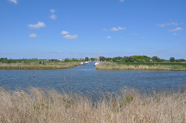
Ashby is the larger of the two villages and is home to a population of around 300 residents. It is a picturesque village with charming traditional cottages and houses. The village is surrounded by beautiful countryside, offering stunning views of the Norfolk Broads and the River Bure, which flows nearby.

Oby, on the other hand, is a smaller village with a population of around 60 residents. It is a tranquil and peaceful village, known for its unspoiled natural beauty. The village is characterized by its quaint cottages and farmland, making it an ideal location for those seeking rural living.

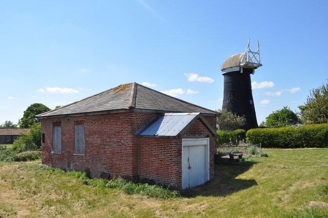
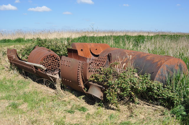
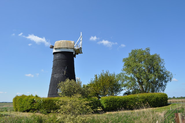
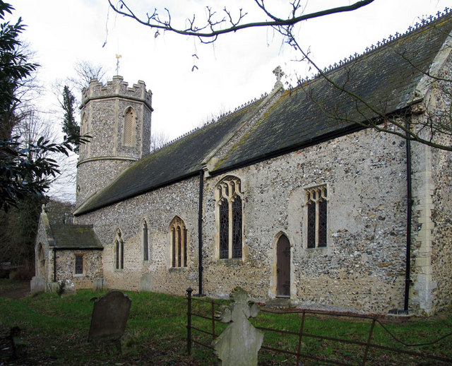
Both villages offer a range of amenities and facilities for its residents. These include a local pub, a village hall, and a church. The area is also well-known for its agricultural heritage, with many farms and agricultural businesses in the vicinity.

Ashby with Oby is a popular destination for nature lovers and outdoor enthusiasts. The Norfolk Broads National Park, which is a renowned wetland area, is easily accessible from the parish. It offers opportunities for boating, fishing, wildlife spotting, and scenic walks.

Overall, Ashby with Oby is a charming civil parish that offers a peaceful rural lifestyle, stunning natural scenery, and a strong sense of community.

If you have any feedback on the listing, please let us know in the comments section below.

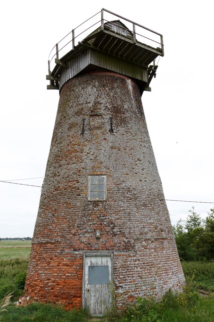
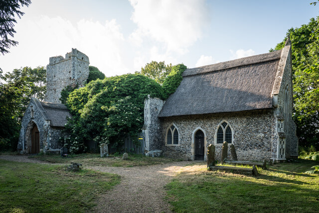
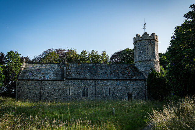
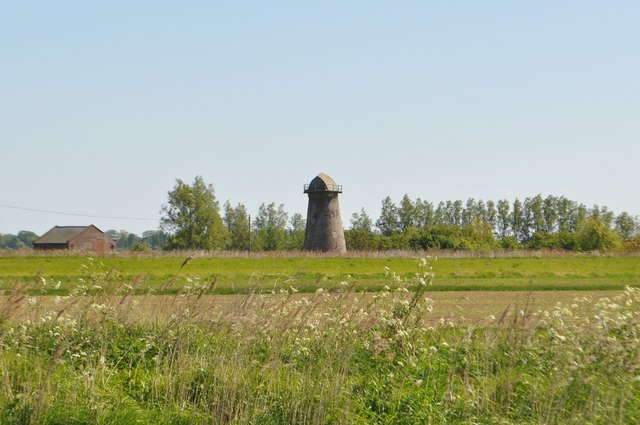
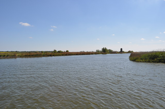
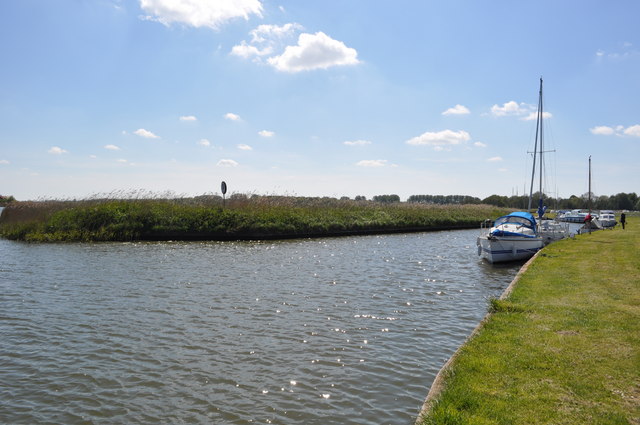
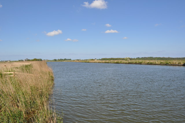
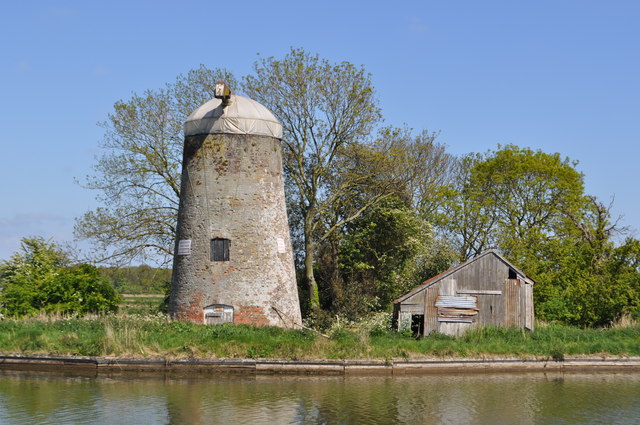
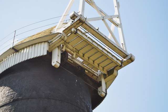
Ashby with Oby Images

Images are sourced within 2km of 52.669441/1.571635 or Grid Reference TG4113. Thanks to Geograph Open Source API. All images are credited.

Clippersby Drainage Mill near Upton Green
St Edmund The King Martyr Thatched Church, Thurne Parish church. Late C13 west tower, nave and chancel. Partly refenestrated C15. Restored 1853 ... Thatched roofs.
St Edmund The King Martyr Thatched Church, Thurne
Parish church. Late C13 west tower, nave and chancel. Partly refenestrated C15. Restored 1853 ... Thatched roofs.
All Saint's Church, Billockby The church dates from the 15th century. The roof of the nave collapsed in a storm on 15 July 1762; the nave and tower, of Perpendicular style, is in ruins. The nave is of knapped flint, and has large windows with remains of tracery. 

The chancel is known to have been in use in 1762. It was restored in 1872 and is still in regular use. It is of flint with ashlar dressings, and has a thatched roof.
All Saint's Church, Billockby
The church dates from the 15th century. The roof of the nave collapsed in a storm on 15 July 1762; the nave and tower, of Perpendicular style, is in ruins. The nave is of knapped flint, and has large windows with remains of tracery. The chancel is known to have been in use in 1762. It was restored in 1872 and is still in regular use. It is of flint with ashlar dressings, and has a thatched roof.
St. Peter's Church, Clippesby The church of St. Peter's at Clippesby is thought to date from Saxon times. Curiously however there is no mention of it in the Domesday Book. The round tower is certainly of Saxon construction as is a small (now sealed) window, whereas the North doorway with its characteristic zig-zag moulding is Norman.
St. Peter's Church, Clippesby
The church of St. Peter's at Clippesby is thought to date from Saxon times. Curiously however there is no mention of it in the Domesday Book. The round tower is certainly of Saxon construction as is a small (now sealed) window, whereas the North doorway with its characteristic zig-zag moulding is Norman.
Palmer's Mill - Upton Marshes A view of the hollow pump, still running (free wheeling). It was originally from Acle.
Palmer's Mill - Upton Marshes
A view of the hollow pump, still running (free wheeling). It was originally from Acle.
Palmer's Mill - Upton Marshes A view of the hollow pump, still running (free wheeling). It was originally from Acle.
Palmer's Mill - Upton Marshes
A view of the hollow pump, still running (free wheeling). It was originally from Acle.
Upton Dyke The mooring at Upton Dyke on the Norfolk broads, connected to the river Bure.
Upton Dyke
The mooring at Upton Dyke on the Norfolk broads, connected to the river Bure.
Palmer's Mill - Upton Marshes A view of the hollow pump, still running (free wheeling). It was originally from Acle.
Palmer's Mill - Upton Marshes
A view of the hollow pump, still running (free wheeling). It was originally from Acle.
Clippesby Drainage Mill See<a href="https://www.geograph.org.uk/photo/2194253">TG4012 : Clippesby drainage pump and pumphouse</a>, this view is from Upton Dyke.
Clippesby Drainage Mill
SeeTG4012 : Clippesby drainage pump and pumphouse, this view is from Upton Dyke.
River Bure at Upton The start of Upton Dyke is to the right, Clippesby mill is in the distance <a href="https://www.geograph.org.uk/photo/2194253">TG4012 : Clippesby drainage pump and pumphouse</a>.
River Bure at Upton
The start of Upton Dyke is to the right, Clippesby mill is in the distance TG4012 : Clippesby drainage pump and pumphouse.
Upton Dyke A view of the dyke, one of many on the broads used by industry but converted to mooring.
Upton Dyke
A view of the dyke, one of many on the broads used by industry but converted to mooring.
The River Bure A view of the river near Upton.
The River Bure
A view of the river near Upton.
Wiseman's Oby Mill A view of the derelict mill from the other side of the R.Bure
<a href="https://www.geograph.org.uk/photo/1110470">TG4013 : Wiseman's Oby Mill</a>
Wiseman's Oby Mill
A view of the derelict mill from the other side of the R.Bure TG4013 : Wiseman's Oby Mill
Dyke off the Bure A dyke is now used for mooring by pleasure craft.
Dyke off the Bure
A dyke is now used for mooring by pleasure craft.
Tall Mill Drainage Pumps The older wind pump is now accommodation, it retains it cap. The brick building is its replacement pump. Possibly once steam, a partly scrapped boiler is nearby.
Tall Mill Drainage Pumps
The older wind pump is now accommodation, it retains it cap. The brick building is its replacement pump. Possibly once steam, a partly scrapped boiler is nearby.
Partly Scrapped Boiler An old boiler or two are sited next to an old pump house. Where they are from is unknown to me.
Partly Scrapped Boiler
An old boiler or two are sited next to an old pump house. Where they are from is unknown to me.
Upton Black mill Upton Black mill - so called because its red-brick tower is tarred black. The mill has a boat-shaped cap which once had a gallery with a petticoat and a fan stage. A date stone set under a window facing the river indicates that the mill was built in 1800.
<a href="https://www.geograph.org.uk/photo/1110353">TG4014 : Modern pumping station</a>
Upton Black mill
Upton Black mill - so called because its red-brick tower is tarred black. The mill has a boat-shaped cap which once had a gallery with a petticoat and a fan stage. A date stone set under a window facing the river indicates that the mill was built in 1800. TG4014 : Modern pumping station
Upton Black mill - Cap A closeup of the cap mechanism, the screw was once powered by the fantail.
Upton Black mill - Cap
A closeup of the cap mechanism, the screw was once powered by the fantail.
Show me another place!

Ashby with Oby is located at Grid Ref: TG4113 (Lat: 52.669441, Lng: 1.571635)

Administrative County: Norfolk

District: Great Yarmouth

Police Authority: Norfolk

What 3 Words

///impressed.broads.keyboard. Near Acle, Norfolk

Nearby Locations

Ashby with Oby

Related Wikis

Ashby with Oby

Ashby with Oby is a civil parish in the English county of Norfolk, which is located some 5 km or 3 miles north of Acle and 15 km or 9 miles north-west...

Clippesby

Clippesby is a village and former civil parish, now in the parish of in Fleggburgh, in the Great Yarmouth district, in the county of Norfolk, England....

All Saints' Church, Billockby

All Saints' Church is an Anglican church, partly ruined, near the villages of Billockby and Fleggburgh, Norfolk, England. It is a Grade II listed building...

River Thurne

The River Thurne is a river in Norfolk, England in The Broads. Just 7 miles (11 km) long, it rises 2 miles (3.2 km) from the coast near Martham Broad and...

Nearby Amenities

Located within 500m of 52.669441,1.571635
The data included in this document is from www.openstreetmap.org. The data is made available under ODbL.

Have you been to Ashby with Oby?

Leave your review of Ashby with Oby below (or comments, questions and feedback).