Ashby Parkland
Civil Parish in Lincolnshire
England
Ashby Parkland
Ashby Parkland is a civil parish located in the county of Lincolnshire, England. It is situated in the West Lindsey district and covers an area of approximately 5.8 square kilometers. The parish is primarily rural in nature and is surrounded by picturesque countryside, offering stunning views and a tranquil atmosphere.
The small village of Ashby Parkland is the main settlement within the parish. It is home to a close-knit community, with a population of around 300 residents. The village boasts a charming character, with traditional stone-built houses and well-maintained gardens. The parish also has a church, which is a focal point for the community.
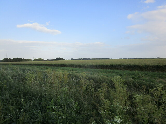
Ashby Parkland is known for its beautiful parkland areas, which provide ample opportunities for outdoor activities and leisurely walks. The parish is blessed with green spaces and open fields, making it an ideal location for nature lovers and those seeking a peaceful retreat. The surrounding landscapes are teeming with wildlife, including various bird species, making it a haven for birdwatchers.
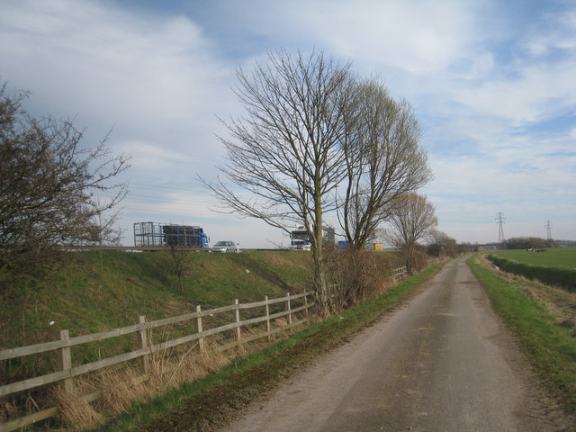
Despite its rural setting, Ashby Parkland benefits from good transport links. The nearby A15 road provides easy access to the neighboring towns of Lincoln and Scunthorpe. The village also has regular bus services, connecting residents to the wider region.
Overall, Ashby Parkland is a charming and idyllic civil parish, offering a high quality of life for its residents. With its stunning countryside, tight-knit community, and convenient location, it is a desirable place to live for those seeking a rural lifestyle.
If you have any feedback on the listing, please let us know in the comments section below.
Ashby Parkland Images
Images are sourced within 2km of 53.569187/-0.695035 or Grid Reference SE8608. Thanks to Geograph Open Source API. All images are credited.


Ashby Parkland is located at Grid Ref: SE8608 (Lat: 53.569187, Lng: -0.695035)
Unitary Authority: North Lincolnshire
Police Authority: Humberside
What 3 Words
///unfair.jungle.oasis. Near Scunthorpe, Lincolnshire
Nearby Locations
Related Wikis

Ashby Parkland
Ashby Parkland is a civil parish in North Lincolnshire, England. The parish was created on 1 April 2004 and was previously part of the Burringham parish...
John Leggott College
John Leggott College is a sixth form college on West Common Lane, in Old Brumby, Scunthorpe, North Lincolnshire, England. == History == === Technical... ===

Glanford Park
Glanford Park is a football stadium in Scunthorpe, Lincolnshire, England, and is the home of National League North team Scunthorpe United. Opened in 1988...
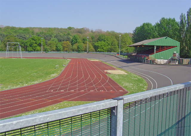
Quibell Park Stadium
Quibell Park Stadium is a multi-purpose stadium in Scunthorpe, North Lincolnshire, owned by North Lincolnshire Council, primarily used for athletics, cycling...
Melior Community Academy
Melior Community Academy is a coeducational secondary school with academy status, located in Scunthorpe, North Lincolnshire, England. The school is sponsored...
North Lindsey College
North Lindsey College is a further education college in Scunthorpe, North Lincolnshire, England, situated on the A18. == Structure == North Lindsey College...
Bottesford Town F.C.
Bottesford Town Football Club is a football club based in Bottesford, Lincolnshire, England. They are currently members of the Northern Counties East League...

Central Park, Scunthorpe
Central Park is the premier urban park in Scunthorpe, Lincolnshire, England. == History == The park was opened as part of the Festival of Britain to celebrate...
Have you been to Ashby Parkland?
Leave your review of Ashby Parkland below (or comments, questions and feedback).