Ash

Civil Parish in Surrey Guildford

England

Ash

Looking north-northeast in South Lane
Looking north-northeast in South Lane Credit: Basher Eyre

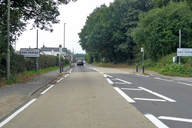
Ash is a civil parish located in the county of Surrey, England. Situated in the borough of Guildford, it lies approximately 40 miles southwest of central London. The parish covers an area of about 10 square miles and is bordered by the parishes of Tongham, Normandy, Ash Vale, and Ash Green.

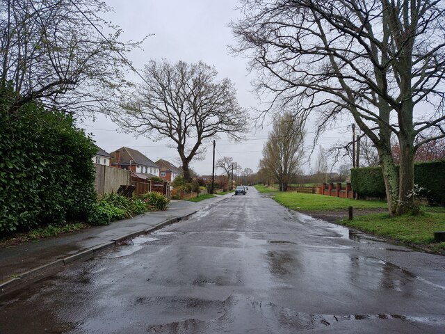
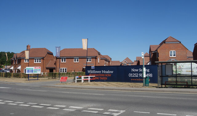
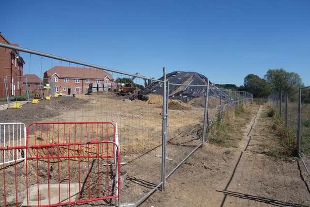
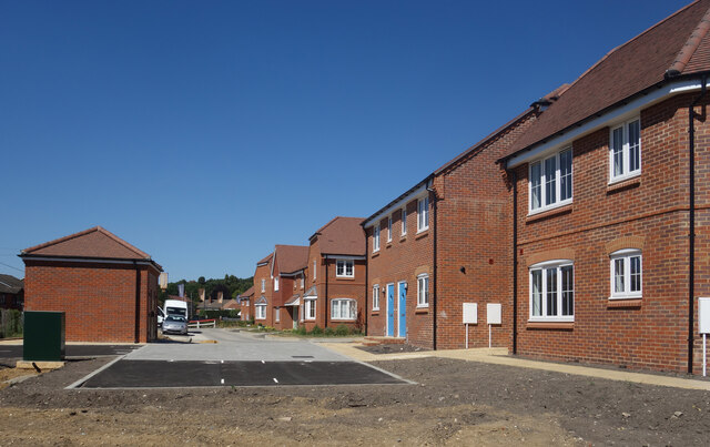
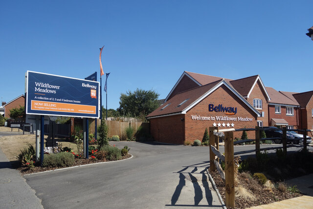
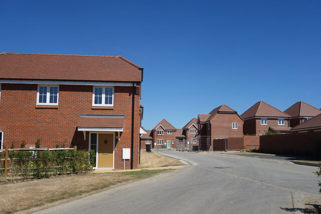
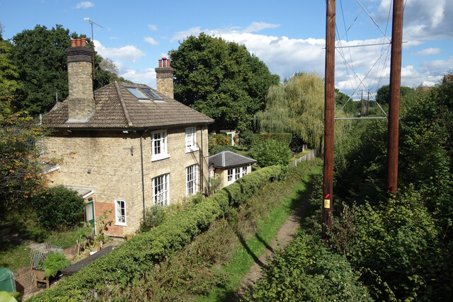
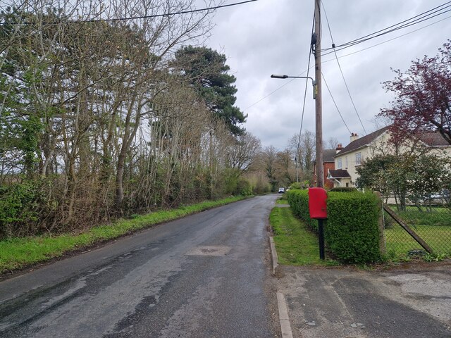
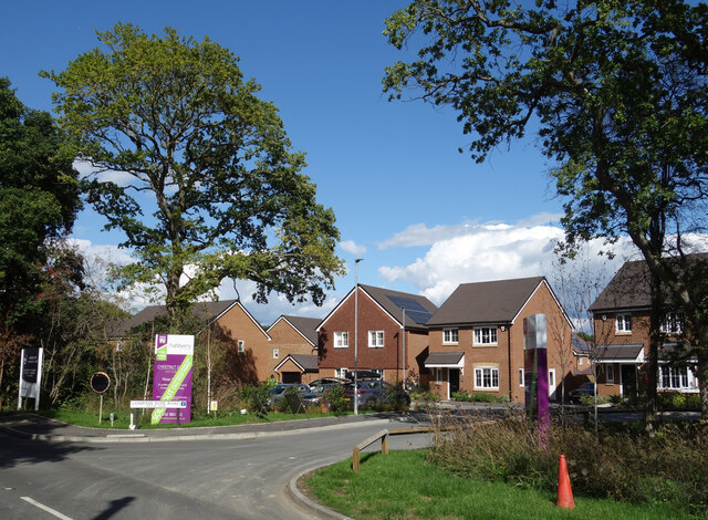
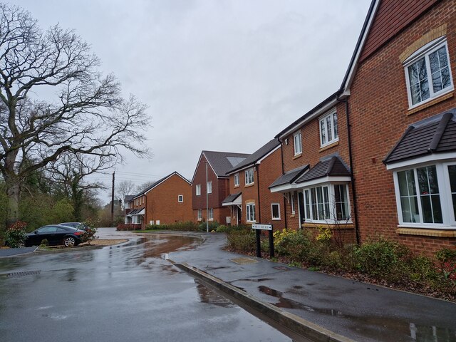
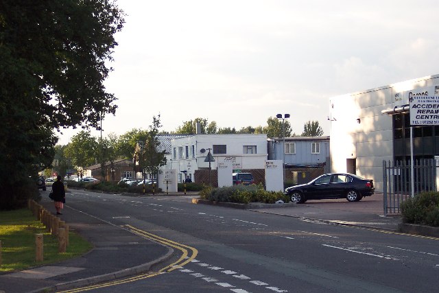
Ash is a predominantly residential area, with a population of around 7,500 people. It offers a mix of housing options, ranging from Victorian and Edwardian properties to more modern developments. The area is known for its leafy suburbs, attractive countryside, and well-kept gardens.

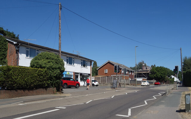
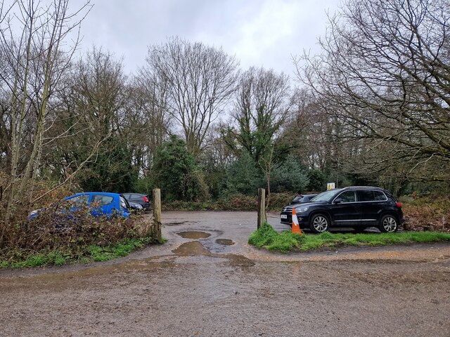
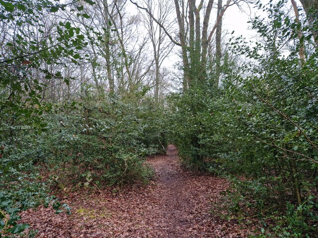
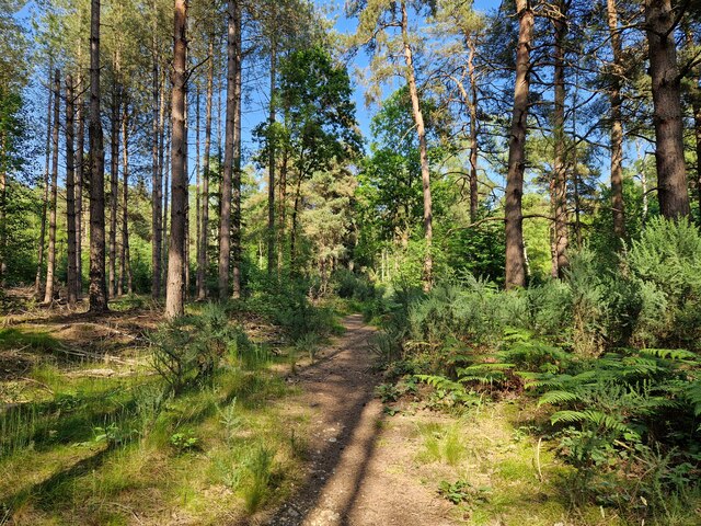
The parish is well-served by amenities and facilities. It has a primary school, a community centre, a library, and several parks and green spaces, including the popular Ash Ranges. The ranges, which cover a large area of heathland, are used by the military for training purposes but are also open to the public for recreational activities like walking, cycling, and horse riding.

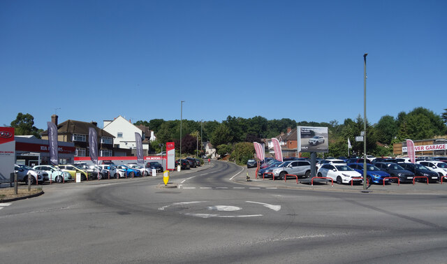
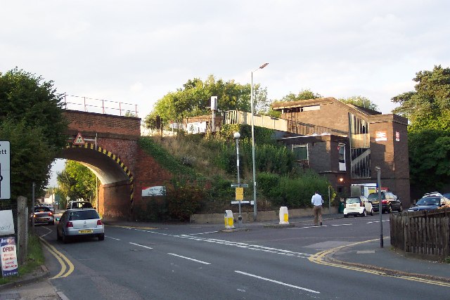
Transportation in Ash is convenient, with easy access to major roads like the A31 and A331, providing links to nearby towns and cities. The nearest railway station is Ash Vale, offering regular services to Guildford, Aldershot, and London Waterloo.

The parish is proud of its sense of community, with various events and activities organized throughout the year. These include the Ash Carnival, a popular annual event that brings residents together for a day of festivities, stalls, and entertainment.

Overall, Ash, Surrey is a sought-after residential area, offering a peaceful and picturesque environment within easy reach of urban amenities.

If you have any feedback on the listing, please let us know in the comments section below.

Ash Images

Images are sourced within 2km of 51.257731/-0.718589 or Grid Reference SU8951. Thanks to Geograph Open Source API. All images are credited.

Looking north-northeast in South Lane
A323 Guildford Road entering Ash Parish
Wildflower Meadow - Now Selling A new housing development off Guildford Road.
Not that there's much meadow left, or wildflowers come to that, but I'm sure they're very nice houses.
Wildflower Meadow - Now Selling
A new housing development off Guildford Road. Not that there's much meadow left, or wildflowers come to that, but I'm sure they're very nice houses.
Footpath past the building site A public footpath fenced off from where new houses are being built.
Footpath past the building site
A public footpath fenced off from where new houses are being built.
New Houses on Wildflower Meadow A nice rustic sounding name for this new extension to suburbia.
Taken from the footpath along the edge of the site.
New Houses on Wildflower Meadow
A nice rustic sounding name for this new extension to suburbia. Taken from the footpath along the edge of the site.
Car Sales at the Junction, Ash Cars for sale on both sides of Ash Hill Road.
Car Sales at the Junction, Ash
Cars for sale on both sides of Ash Hill Road.
Shops on Guildford Road A couple of local businesses, including a very welcome sandwich bar where I managed to get some lunch in a bit of a pub and shop free zone.
Shops on Guildford Road
A couple of local businesses, including a very welcome sandwich bar where I managed to get some lunch in a bit of a pub and shop free zone.
Welcome to Wildflower Meadows The northern entrance to a large new housing development, most of which is in SU9050.
Welcome to Wildflower Meadows
The northern entrance to a large new housing development, most of which is in SU9050.
New Houses near Ash Station
Site of Ash Green Station Beside an old railway route now used as a cycleway and path.
For more information see Ben Brooksbank's extensively researched picture <a href="https://www.geograph.org.uk/photo/3238103">SU9050 : Site of Ash Green station, 1990</a>
Site of Ash Green Station
Beside an old railway route now used as a cycleway and path. For more information see Ben Brooksbank's extensively researched picture SU9050 : Site of Ash Green station, 1990
Navigating northwards up the Basher (18) Car park in Nightingale Road
Navigating northwards up the Basher (18)
Car park in Nightingale Road
Navigating northwards up the Basher (19) Path eastwards from Chandlers Road to Stony Hill
Navigating northwards up the Basher (19)
Path eastwards from Chandlers Road to Stony Hill
Navigating northwards up the Bashire (17) Postbox in Ash Green Road
Navigating northwards up the Bashire (17)
Postbox in Ash Green Road
Navigating northwards up the Basher (20) The path to Scarp Hill
Navigating northwards up the Basher (20)
The path to Scarp Hill
Compass Rose Road, Ash Green A new housing development with a rather unusual street name.
Compass Rose Road, Ash Green
A new housing development with a rather unusual street name.
Navigating northwards up the Basher (16) Houses in Compass Rose Road
Navigating northwards up the Basher (16)
Houses in Compass Rose Road
Lysons Avenue industrial units Lysons Avenue is lined with light industrial units of all shapes, sizes, and designs. In age they range from possibly the 1930s (the white building in the centre) to the ultra-modern (on the right).
Lysons Avenue industrial units
Lysons Avenue is lined with light industrial units of all shapes, sizes, and designs. In age they range from possibly the 1930s (the white building in the centre) to the ultra-modern (on the right).
Ash Vale station and bridge The railway from Woking to Alton via Aldershot crosses the Ash to Frimley road on a high embankment, just by Ash Vale station. The station structure - comprising mostly a staircase leading to the platforms - is a less than elegant structure.
Ash Vale station and bridge
The railway from Woking to Alton via Aldershot crosses the Ash to Frimley road on a high embankment, just by Ash Vale station. The station structure - comprising mostly a staircase leading to the platforms - is a less than elegant structure.
Show me another place!

Ash is located at Grid Ref: SU8951 (Lat: 51.257731, Lng: -0.718589)

Administrative County: Surrey

District: Guildford

Police Authority: Surrey

What 3 Words

///flood.files.seated. Near Normandy, Surrey

Nearby Locations

Ash

Related Wikis

Lakeside Park, Guildford

Lakeside Park is a 14.7-hectare (36-acre) Local Nature Reserve west of Guildford in Surrey. It is owned and managed by Guildford Borough Council.The Blackwater...

Ash Cemetery, Surrey

Ash Cemetery, also known as Emery Gates Cemetery on Church Road is the burial ground for the village of Ash in Surrey, England. == History == At a meeting...
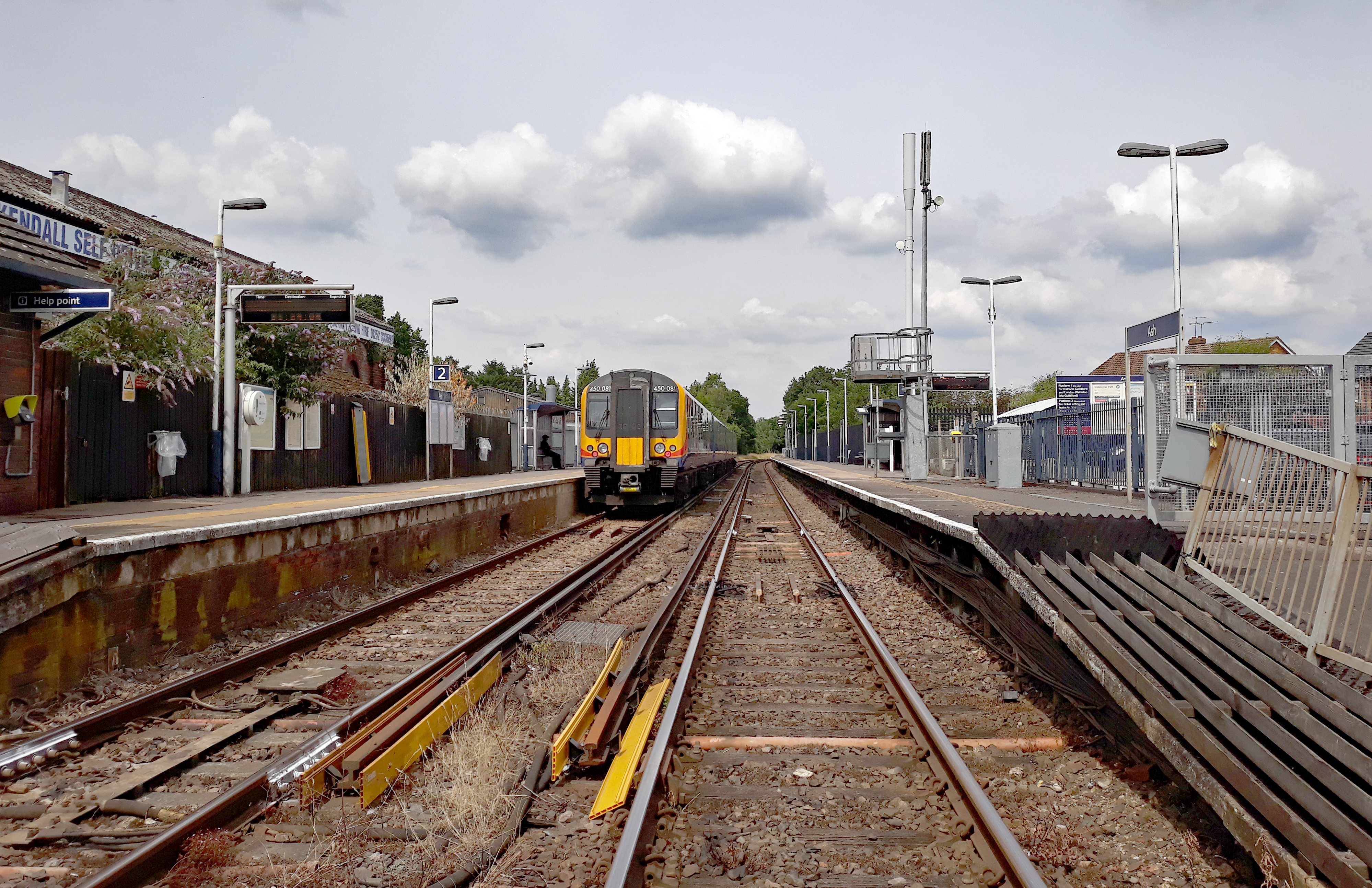
Ash railway station

Ash railway station serves the village of Ash in Surrey, England. The station is served by South Western Railway, who manage the station, and by Great...

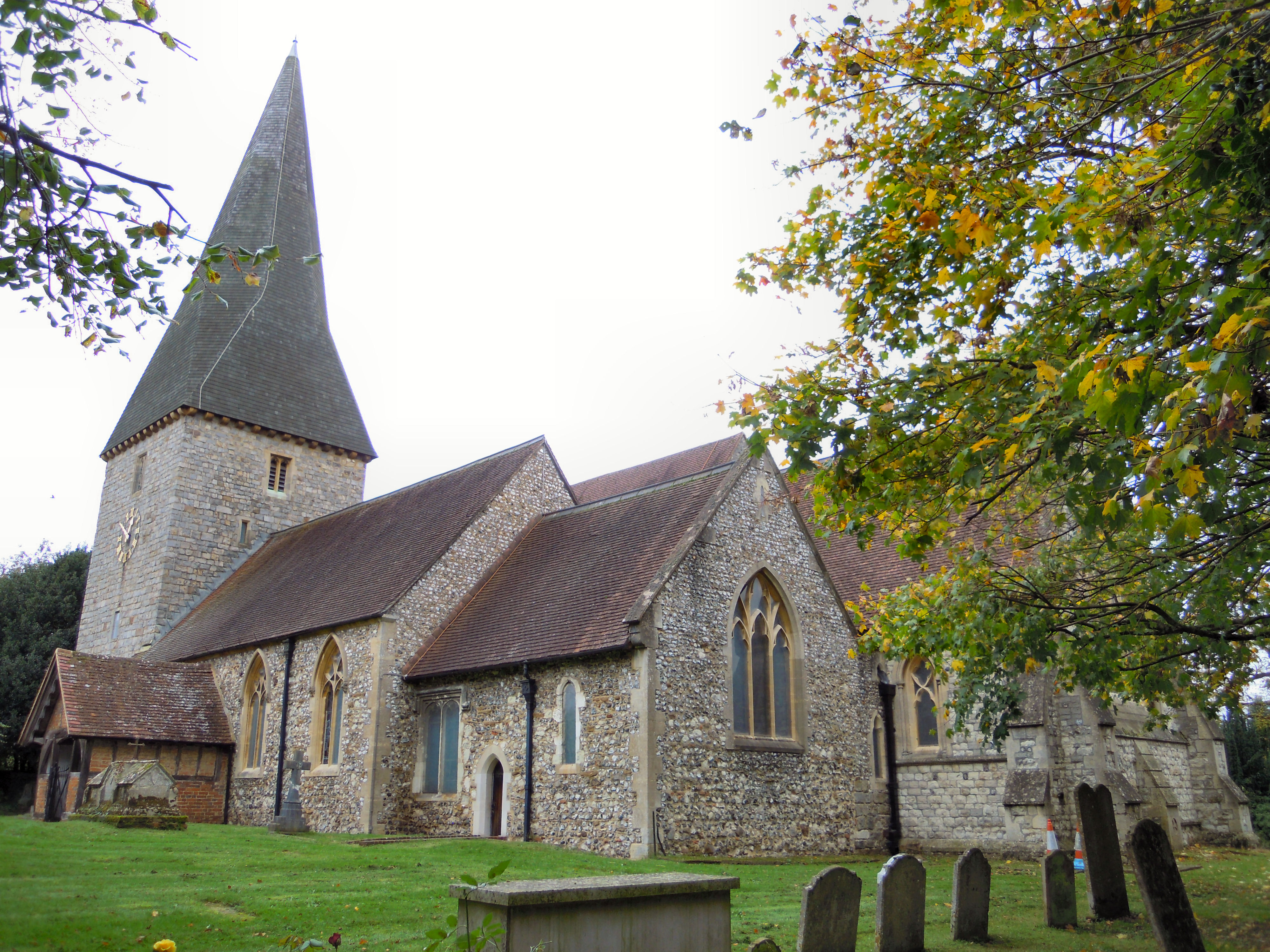
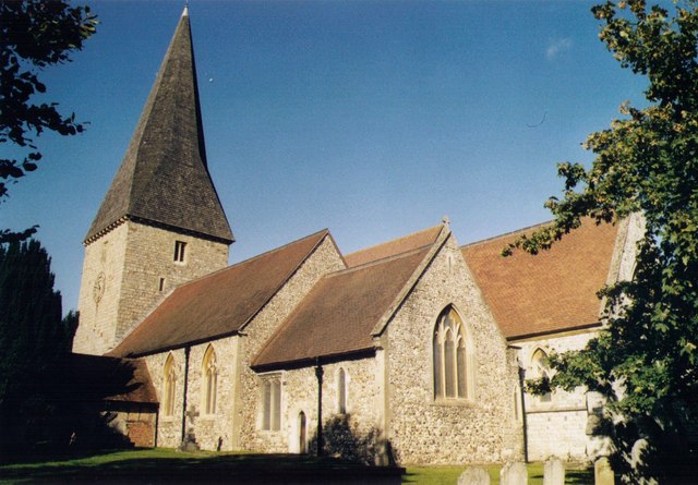
St Peter's church, Ash

St Peter's church is the Church of England parish church for the village of Ash in Surrey. Of 12th-century origin with later additions, the church has...

Ash, Surrey

Ash is a village and civil parish in the far west of the borough of Guildford, Surrey. Ash is on the eastern side of the River Blackwater, with a station...

Ash United F.C.

Ash United Football Club is a football club based in Ash, Surrey, England. They are currently members of the Wessex League Division One and play at Shawfields...

Ash Vale

Ash Vale is a village in the borough of Guildford in Surrey, England and the larger, northern settlement of the civil parish of Ash. It is 7 miles (11...

Ash Vale railway station

Ash Vale is a railway station serving the village of Ash Vale in Surrey, England. It is situated at the junction of the London to Alton line and the Ascot...

Nearby Amenities

Located within 500m of 51.257731,-0.718589
Railway: switch
Lat/Long: 51.2585513/-0.7238229
Surprise Hill
Natural: peak
Source: npe
Lat/Long: 51.2563755/-0.7124265
Ash Wharf
Place: locality
Source: npe
Lat/Long: 51.2579198/-0.7186041
Barrier: swing_gate
Lat/Long: 51.2540698/-0.7187705
War Memorial
Historic: memorial
Memorial: war_memorial
Lat/Long: 51.2547032/-0.715724
Ash Tennis Club
Charge: £1-£105 per annum
Check Date: 2023-09-29
Club: sport
Covered: no
Description: 3 x Tennis Courts. 1 floodlit. Membership required Coaching available
Fee: yes
Leisure: sports_centre
Lit: yes
Sport: tennis
Wheelchair: limited
Lat/Long: 51.2563342/-0.7168656
Parking
Access: private
Parking: surface
Lat/Long: 51.2589433/-0.7175853
Crossing
Crossing: uncontrolled
Crossing Island: yes
Kerb: lowered
Tactile Paving: yes
Lat/Long: 51.2569624/-0.7207826
Crossing
Crossing: uncontrolled
Crossing Island: yes
Kerb: lowered
Tactile Paving: yes
Lat/Long: 51.2567647/-0.7207413
Recycling
Location: overground
Recycling Cans: yes
Recycling Clothes: yes
Recycling Glass Bottles: yes
Recycling Paper: yes
Recycling Plastic: no
Recycling Plastic Packaging: yes
Recycling Shoes: yes
Recycling Type: container
Source: photo
Lat/Long: 51.2557752/-0.7172291
Bicycle Parking
Bicycle Parking: stands
Capacity: 6
Covered: no
Lat/Long: 51.2568111/-0.7195632
Advice
Citizens Advice Bureau
Lat/Long: 51.2570378/-0.7190772
The Ash Centre
Building: yes
Lat/Long: 51.25694/-0.7192614
Pharmacy
Lloyds Pharmacy
Addr City: Ash Vale
Addr Country: GB
Addr Postcode: GU12 5AZ
Addr Street: Wharf Road
Addr Unit: 11 The Parade
Brand: Lloyds Pharmacy
Brand Wikidata: Q6662870
Brand Wikipedia: en:LloydsPharmacy
Fhrs Authority: Guildford
Fhrs Id: 649797
Fhrs Local Authority Id: 4371
Healthcare: pharmacy
Opening Hours: Mo-Fr 09:00-13:00,14:00-17:00; Sa,Su off
Payment Cash: yes
Wheelchair: yes
Lat/Long: 51.257826/-0.7200327
Fast Food
Bo-Wah Fish Bar
Addr City: Ash Vale
Addr Country: GB
Addr Postcode: GU12 5AZ
Addr Street: Wharf Road
Addr Unit: 10 The Parade
Check Date Opening Hours: 2023-10-15
Cuisine: fish_and_chips
Diet Vegetarian: no
Fhrs Authority: Guildford
Fhrs Id: 649565
Fhrs Local Authority Id: 3549
Indoor Seating: no
Opening Hours: Mo-Sa 12:00-14:00,17:00-21:00; Su off
Outdoor Seating: no
Payment Cash: yes
Payment Credit Cards: no
Payment Debit Cards: no
Takeaway: only
Wheelchair: limited
Lat/Long: 51.2577374/-0.720112
Place Of Worship
Ash Vale Baptist Church
Check Date: 2023-10-15
Denomination: baptist
Religion: christian
Wheelchair: yes
Lat/Long: 51.2588975/-0.7186579
Clinic
Ash Vale Heath Centre
Building: yes
Check Date Opening Hours: 2023-06-10
Healthcare: clinic
Opening Hours: Mo,We,Fr 08:00-20:00; Tu,Th 08:00-18:30; PH,Sa,Su off
Wheelchair: yes
Lat/Long: 51.2595119/-0.717559
Social Facility
Abbeywood Residential Care Home
Addr City: Ash Vale
Addr Country: GB
Addr Postcode: GU12 5AX
Addr Street: Wharf Road
Building: yes
Fhrs Authority: Guildford
Fhrs Id: 1230562
Fhrs Local Authority Id: 11594
Social Facility: assisted_living
Lat/Long: 51.2591986/-0.7179373
Bicycle Parking
Bicycle Parking: stands
Capacity: 4
Covered: no
Lat/Long: 51.2592545/-0.7176766
Bicycle Parking
Bicycle Parking: stands
Capacity: 2
Covered: no
Lat/Long: 51.2593426/-0.7176707
Kerb: raised
Lat/Long: 51.2593324/-0.7213954
Barrier: bollard
Bollard: fixed
Lat/Long: 51.2593315/-0.7215064
Power: substation
Lat/Long: 51.2594397/-0.722153
Pub
The Admiral
Addr City: Ash Vale
Addr Country: GB
Addr Housenumber: 72
Addr Postcode: GU12 5HS
Addr Street: Vale Road
Fhrs Authority: Guildford
Fhrs Id: 1212659
Fhrs Local Authority Id: 11436
Indoor Seating: yes
Opening Hours: Su-Fr 12:00-22:00; Sa 12:00-23:00
Outdoor Seating: yes
Source: photo
Wheelchair: yes
Lat/Long: 51.2596138/-0.7225109
Barrier: bollard
Bicycle: yes
Bollard: fixed
Foot: yes
Motor Vehicle: no
Lat/Long: 51.2584906/-0.7240236
Barrier: bollard
Bollard: fixed
Foot: yes
Motor Vehicle: no
Lat/Long: 51.2594352/-0.7247839
Bus Stop
Napier Lane
Bench: yes
Bin: yes
Bus: yes
Lit: yes
Naptan AtcoCode: 40004407057A
Naptan Bearing: NE
Naptan CommonName: Napier Lane
Naptan Indicator: Just after
Naptan Landmark: Napier Lane
Naptan NaptanCode: surampjm
Naptan PlusbusZoneRef: ALDRSHT
Naptan Street: Vale Road
Naptan Verified: no
Public Transport: platform
Shelter: yes
Source: naptan_import
Tactile Paving: no
Lat/Long: 51.2600449/-0.7226457
Bus Stop
Napier Lane
Bench: yes
Bin: yes
Bus: yes
Lit: yes
Naptan AtcoCode: 40004407057B
Naptan Bearing: S
Naptan CommonName: Napier Lane
Naptan Indicator: Just Before
Naptan Landmark: Napier Lane
Naptan NaptanCode: surampjp
Naptan PlusbusZoneRef: ALDRSHT
Naptan Street: Vale Road
Naptan Verified: no
Public Transport: platform
Shelter: yes
Source: naptan_import
Tactile Paving: no
Lat/Long: 51.2602771/-0.722496
Bus Stop
Shawfield Road
Bench: yes
Bin: yes
Bus: yes
Lit: yes
Naptan AtcoCode: 40004407058A
Naptan Bearing: NE
Naptan CommonName: Shawfield Road
Naptan Indicator: NE-bound
Naptan Landmark: Shawfield Road
Naptan NaptanCode: surampjt
Naptan PlusbusZoneRef: ALDRSHT
Naptan Street: Shawfield Road
Naptan Verified: no
Public Transport: platform
Shelter: yes
Source: naptan_import
Tactile Paving: no
Lat/Long: 51.2563789/-0.7212713
Bus Stop
Shawfield Road
Bench: yes
Bin: yes
Bus: yes
Lit: yes
Naptan AtcoCode: 40004407058B
Naptan Bearing: SE
Naptan CommonName: Shawfield Road
Naptan Indicator: Just Before
Naptan Landmark: The Wharf
Naptan NaptanCode: surampmj
Naptan PlusbusZoneRef: ALDRSHT
Naptan Street: Vale Road
Naptan Verified: no
Public Transport: platform
Shelter: yes
Source: naptan_import
Tactile Paving: no
Lat/Long: 51.2570671/-0.7208795
Bus Stop
Council Offices
Bench: no
Bin: no
Bus: yes
Lit: no
Naptan AtcoCode: 40004407058C
Naptan Bearing: NW
Naptan CommonName: Council Offices
Naptan Indicator: adj
Naptan Landmark: Council Offices
Naptan NaptanCode: surampmp
Naptan PlusbusZoneRef: ALDRSHT
Naptan Street: Ash Hill Road
Naptan Verified: no
Public Transport: platform
Shelter: no
Source: naptan_import
Tactile Paving: no
Lat/Long: 51.25614/-0.7194758
Council Offices
Naptan AtcoCode: 40004407058D
Naptan Bearing: SE
Naptan BusStopType: CUS
Naptan CommonName: Council Offices
Naptan Indicator: Opp
Naptan Landmark: Council Offices
Naptan NaptanCode: surgpajd
Naptan Street: Ash Hill Road
Naptan Verified: no
Source: naptan_import
Lat/Long: 51.2561223/-0.7191861
Bus Stop
Victoria Hall
Bench: no
Bin: yes
Bus: yes
Lit: yes
Naptan AtcoCode: 40004407914A
Naptan Bearing: SE
Naptan CommonName: Victoria Hall
Naptan Indicator: Just after
Naptan Landmark: Victoria Hall
Naptan NaptanCode: surawgad
Naptan PlusbusZoneRef: ALDRSHT
Naptan Street: Ash Hill Road
Naptan Verified: no
Public Transport: platform
Shelter: no
Source: naptan_import
Tactile Paving: no
Lat/Long: 51.2550473/-0.7162781
Bus Stop
Victoria Hall
Bench: no
Bin: no
Bus: yes
Lit: yes
Naptan AtcoCode: 40004407914B
Naptan Bearing: NW
Naptan CommonName: Victoria Hall
Naptan Indicator: Just Before
Naptan Landmark: Victoria Hall
Naptan NaptanCode: surawgag
Naptan PlusbusZoneRef: ALDRSHT
Naptan Street: Ash Hill Road
Naptan Verified: no
Public Transport: platform
Shelter: no
Source: naptan_import
Tactile Paving: no
Lat/Long: 51.2547986/-0.7157405
Agisha food and wine
Check Date Opening Hours: 2023-09-29
Opening Hours: Mo-Su 07:00-22:00
Opening Hours Signed: no
Payment Cash: yes
Payment Credit Cards: yes
Payment Debit Cards: yes
Shop: convenience
Wheelchair: yes
Lat/Long: 51.256365/-0.7209735
Mini Roundabout
Direction: clockwise
Lat/Long: 51.2585854/-0.7229605
Parking
Access: customers
Capacity: 20
Fee: no
Parking: surface
Lat/Long: 51.25544/-0.7151183
Mini Roundabout
Direction: clockwise
Lat/Long: 51.2568842/-0.7206481
Crossing
Crossing: uncontrolled
Crossing Island: yes
Kerb: lowered
Tactile Paving: yes
Lat/Long: 51.2567926/-0.7204941
Crossing
Crossing: uncontrolled
Crossing Island: yes
Kerb: lowered
Tactile Paving: yes
Lat/Long: 51.2569678/-0.720539
Crossing
Crossing: unmarked
Crossing Markings: no
Kerb: lowered
Lat/Long: 51.257576/-0.7219603
Barrier: kerb
Kerb: lowered
Tactile Paving: yes
Lat/Long: 51.2568421/-0.7204709
Barrier: kerb
Kerb: lowered
Tactile Paving: yes
Lat/Long: 51.2568151/-0.7208062
Barrier: kerb
Kerb: lowered
Tactile Paving: yes
Lat/Long: 51.2567545/-0.7205567
Barrier: kerb
Kerb: lowered
Tactile Paving: yes
Lat/Long: 51.257013/-0.7206215
Barrier: kerb
Kerb: lowered
Tactile Paving: yes
Lat/Long: 51.2569071/-0.7208546
Barrier: kerb
Kerb: lowered
Tactile Paving: yes
Lat/Long: 51.2569263/-0.720483
Crossing
Crossing: uncontrolled
Crossing Island: yes
Kerb: lowered
Source: Bing
Tactile Paving: yes
Lat/Long: 51.259505/-0.7227119
Crossing
Crossing: uncontrolled
Crossing Island: yes
Kerb: lowered
Source: Bing
Tactile Paving: yes
Lat/Long: 51.2584659/-0.7229401
Crossing
Crossing: uncontrolled
Crossing Island: yes
Kerb: lowered
Source: Bing
Tactile Paving: yes
Lat/Long: 51.2586988/-0.7229094
Barrier: bollard
Bollard: fixed
Lat/Long: 51.2596897/-0.7245973
Aldershot South Junction
Railway: junction
Lat/Long: 51.2586573/-0.7238457
Crossing
Crossing: uncontrolled
Crossing Island: no
Kerb: lowered
Source: Surrey-Air_Survey
Tactile Paving: yes
Traffic Calming: table
Lat/Long: 51.2574911/-0.7200892
Crossing
Crossing: uncontrolled
Kerb: lowered
Source: Surrey-Air_Survey
Tactile Paving: yes
Traffic Calming: table
Lat/Long: 51.2575185/-0.7201592
Crossing
Crossing: unmarked
Crossing Island: yes
Crossing Markings: no
Kerb: lowered
Tactile Paving: yes
Lat/Long: 51.2585728/-0.7231389
Give Way
Lat/Long: 51.2564066/-0.7199068
Toilets
Access: yes
Changing Table: no
Fee: no
Toilets Disposal: flush
Wheelchair: yes
Lat/Long: 51.2566161/-0.7196449
Give Way
Source: Surrey-Air_Survey
Lat/Long: 51.2543064/-0.7142983
Ashvale Grocer
Addr City: Ash Vale
Addr Country: GB
Addr Housenumber: 8-12
Addr Postcode: GU12 5HJ
Addr Street: Vale Road
Fhrs Authority: Guildford
Fhrs Id: 1289259
Fhrs Local Authority Id: 11606
Opening Hours Signed: no
Payment Cash: yes
Payment Credit Cards: yes
Payment Debit Cards: yes
Shop: convenience
Wheelchair: limited
Lat/Long: 51.2575524/-0.7217047
Fast Food
Ash Vale Kebab House
Addr City: Ash
Addr Country: GB
Addr Housenumber: 248
Addr Postcode: GU12 5DJ
Addr Street: Shawfield Road
Check Date Opening Hours: 2024-01-14
Diet Vegetarian: no
Fhrs Authority: Guildford
Fhrs Id: 1035021
Fhrs Local Authority Id: 10547
Indoor Seating: no
Opening Hours: Mo-Su 07:00-22:00
Outdoor Seating: no
Payment Cash: yes
Payment Credit Cards: yes
Payment Debit Cards: yes
Takeaway: only
Wheelchair: limited
Lat/Long: 51.2565503/-0.7208088
Nails & Beauty
Check Date Opening Hours: 2023-06-07
Opening Hours: Mo-Th,Sa 09:30-18:00; Fr 09:30-19:00
Shop: beauty
Wheelchair: limited
Lat/Long: 51.2566191/-0.7207364
Fast Food
The Happy Garden
Addr City: Ash
Addr Country: GB
Addr Housenumber: 171-173
Addr Postcode: GU12 5DW
Addr Street: Ash Hill Road
Check Date Opening Hours: 2023-10-31
Diet Vegan: no
Diet Vegetarian: yes
Fhrs Authority: Guildford
Fhrs Id: 671694
Fhrs Local Authority Id: 5662
Indoor Seating: no
Opening Hours: We-Mo 17:00-22:30; Tu off; PH 17:00-22:30
Outdoor Seating: no
Payment Cash: yes
Payment Credit Cards: yes
Payment Debit Cards: yes
Takeaway: only
Wheelchair: limited
Lat/Long: 51.2566661/-0.720605
Bridges
Check Date Opening Hours: 2023-10-15
Office: estate_agent
Opening Hours Signed: no
Wheelchair: limited
Lat/Long: 51.2572117/-0.7205647
Fast Food
Spice of India
Addr City: Ash Vale
Addr Country: GB
Addr Postcode: GU12 5AZ
Addr Street: Wharf Road
Addr Unit: 2 The Parade
Check Date Opening Hours: 2023-10-15
Diet Vegan: no
Diet Vegetarian: yes
Fhrs Authority: Guildford
Fhrs Id: 649708
Fhrs Local Authority Id: 4224
Indoor Seating: yes
Opening Hours Signed: no
Outdoor Seating: no
Payment Cash: yes
Payment Credit Cards: yes
Payment Debit Cards: yes
Toilets: yes
Toilets Wheelchair: limited
Wheelchair: limited
Lat/Long: 51.2572687/-0.720503
K&S Hair Studio
Female: yes
Opening Hours: "appointment only"
Payment Credit Cards: yes
Payment Debit Cards: yes
Shop: hairdresser
Wheelchair: yes
Lat/Long: 51.2573225/-0.7204628
Cafe
Vale Cafe
Addr City: Ash Vale
Addr Country: GB
Addr Postcode: GU12 5AZ
Addr Street: Wharf Road
Addr Unit: 4 The Parade
Check Date Opening Hours: 2023-10-15
Diet Vegan: no
Diet Vegetarian: yes
Fhrs Authority: Guildford
Fhrs Id: 649564
Fhrs Local Authority Id: 3546
Indoor Seating: yes
Opening Hours: Mo-Sa 08:00-17:00; Su 09:00-15:30
Outdoor Seating: yes
Payment Cash: yes
Toilets: yes
Toilets Wheelchair: limited
Wheelchair: limited
Lat/Long: 51.2573896/-0.7203984
The Optical Centre
Opening Hours: "pre booked appointments only"
Payment Cash: yes
Shop: optician
Wheelchair: limited
Lat/Long: 51.2574433/-0.7203528
Betfred
Brand: Betfred
Brand Wikidata: Q4897425
Brand Wikipedia: en:Betfred
Opening Hours: Mo-Sa 08:00-21:00; Su 09:00-21:00
Payment Cash: yes
Shop: bookmaker
Wheelchair: yes
Lat/Long: 51.2574937/-0.7203099
Wick'd up Vapes
Opening Hours: Mo-Sa 09:30-18:00; Su off
Payment Credit Cards: yes
Payment Debit Cards: yes
Shop: e-cigarette
Wheelchair: limited
Lat/Long: 51.257544/-0.7202777
Tom Collins
Male: yes
Opening Hours: Mo 09:30-17:00; Tu,We,Sa 08:00-17:00; Th 09:30-17:00; Fr 09:00-17:00
Shop: hairdresser
Wheelchair: limited
Lat/Long: 51.257581/-0.7202455
RSPCA
Brand: RSPCA
Brand Wikidata: Q584819
Brand Wikipedia: en:Royal Society for the Prevention of Cruelty to Animals
Check Date Opening Hours: 2023-10-15
Opening Hours: Mo-Sa 09:00-16:00
Payment Cash: yes
Shop: charity
Wheelchair: limited
Lat/Long: 51.2576212/-0.720216
Christmas Bakery
Addr City: Ash Vale
Addr Country: GB
Addr Postcode: GU12 5AZ
Addr Street: Wharf Road
Addr Unit: 9A The Parade
Check Date Opening Hours: 2023-10-15
Fhrs Authority: Guildford
Fhrs Id: 1084207
Fhrs Local Authority Id: 10758
Indoor Seating: yes
Opening Hours: Mo 07:30-14:00; Tu-Fr 07:30-15:00; Sa 08:00-14:00; Su off
Outdoor Seating: no
Payment Credit Cards: yes
Payment Debit Cards: yes
Shop: bakery
Wheelchair: limited
Lat/Long: 51.2576649/-0.7201812
Enchanted Emporium of the Vale
Opening Hours: We,Su off; Mo,Tu,Th,Fr 10:00-15:00; Sa 09:00-14:00
Payment Credit Cards: yes
Payment Debit Cards: yes
Shop: gift
Wheelchair: limited
Lat/Long: 51.2576968/-0.720149
Covered: no
Leisure: picnic_table
Seats: 6
Lat/Long: 51.2553878/-0.7165987
Community Centre
Victoria Hall
Addr City: Ash
Addr Street: Ash Hill Road
Check Date Opening Hours: 2022-09-18
Opening Hours Signed: no
Website: http://www.ashvictoriahall.org.uk/
Wheelchair: yes
Lat/Long: 51.2552679/-0.7173095
Bench
Backrest: yes
Lat/Long: 51.2567098/-0.7206151
Bench
Backrest: yes
Lat/Long: 51.2567134/-0.7205487
Waste Basket
Lat/Long: 51.2567255/-0.7205823
Bench
Backrest: no
Material: wood
Lat/Long: 51.2570821/-0.7205581
Bench
Backrest: no
Material: wood
Lat/Long: 51.2570519/-0.7205936
Waste Basket
Lat/Long: 51.2570693/-0.7205744
Bench
Backrest: no
Material: wood
Lat/Long: 51.2571067/-0.7205608
Bench
Backrest: no
Material: wood
Lat/Long: 51.2570397/-0.7206249
Bench
Backrest: no
Colour: green
Material: steel
Lat/Long: 51.255669/-0.7175993
Covered: no
Leisure: picnic_table
Lat/Long: 51.2551526/-0.7161325
Bench
Backrest: no
Colour: green
Material: metal
Lat/Long: 51.255665/-0.7177344
Covered: no
Leisure: picnic_table
Lat/Long: 51.2553867/-0.7166299
Covered: no
Leisure: picnic_table
Lat/Long: 51.2552166/-0.7162886
Cut Throat Business
Check Date Opening Hours: 2023-01-23
Opening Hours Signed: no
Shop: hairdresser
Website: https://cutthroatbusiness.nearcut.com/
Wheelchair: yes
Lat/Long: 51.2560694/-0.7194181
Generator Method: photovoltaic
Generator Output Electricity: yes
Generator Source: solar
Generator Type: solar_photovoltaic_panel
Power: generator
Lat/Long: 51.2567701/-0.7192459
Barrier: swing_gate
Motor Vehicle: private
Lat/Long: 51.2552196/-0.7141012
Entrance: yes
Wheelchair: yes
Lat/Long: 51.2552703/-0.7171429
Entrance: main
Wheelchair: yes
Lat/Long: 51.255315/-0.7172613
Fish for tackle
Check Date Opening Hours: 2023-01-23
Opening Hours Signed: no
Phone: +44 1252 333202
Shop: fishing
Website: https://fishfortackle.co.uk/
Wheelchair: limited
Lat/Long: 51.2560953/-0.7195142
Motor Vehicle: no
Lat/Long: 51.2583646/-0.7149103
Artwork Type: sculpture
Material: wood
Tourism: artwork
Lat/Long: 51.2582907/-0.715086
Fixme: Needs the Inscription transcribing
Historic: memorial
Material: stone
Memorial: stone
Lat/Long: 51.2541691/-0.7185841
Barrier: bollard
Bollard: fixed
Colour: grey
Material: concrete
Lat/Long: 51.2553425/-0.716109
Railway: switch
Lat/Long: 51.2585338/-0.7237579
Barrier: motorcycle_barrier
Cycle Barrier: tilted
Lat/Long: 51.2546255/-0.7202295
Barrier: lift_gate
Lat/Long: 51.2565908/-0.7199906
Barrier: cycle_barrier
Cycle Barrier: double
Cycle Barrier Installation: fixed
Lat/Long: 51.2536762/-0.7196411
Advertising: board
Lat/Long: 51.2570482/-0.7206767
Waste Basket
Lat/Long: 51.2570777/-0.7208846
Recycling
Recycling Beverage Cartons: no
Recycling Cans: yes
Recycling Paper: yes
Recycling Plastic: no
Recycling Plastic Bottles: yes
Recycling Plastic Packaging: no
Recycling Type: container
Lat/Long: 51.2570814/-0.7208906
Fire Hydrant
Emergency: fire_hydrant
Fire Hydrant Diameter: 3"
Fire Hydrant Position: lane
Fire Hydrant Type: underground
Lat/Long: 51.2569149/-0.7182734
Barrier: kissing_gate
Lat/Long: 51.2620486/-0.7170696
Barrier: kissing_gate
Lat/Long: 51.2583558/-0.7149419
Leisure: playground
Lat/Long: 51.2551294/-0.7220599
Leisure: playground
Lat/Long: 51.2547949/-0.7216316
Leisure: outdoor_seating
Lat/Long: 51.2550846/-0.7223556
Leisure: outdoor_seating
Lat/Long: 51.2550557/-0.7224928
Leisure: outdoor_seating
Lat/Long: 51.2550374/-0.7225975
Addr Housenumber: 10
Addr Street: Oaklea
Lat/Long: 51.260191/-0.7235597
Addr Housenumber: 6
Addr Street: Canal Cottages
Lat/Long: 51.2582665/-0.7207787
Addr Housenumber: 5
Addr Street: Canal Cottages
Lat/Long: 51.2583224/-0.7207609
Addr Housenumber: 7
Addr Street: Canal Cottages
Lat/Long: 51.2582022/-0.7207965
Addr Housenumber: 8
Addr Street: Canal Cottages
Lat/Long: 51.2581361/-0.7208187
Addr Housenumber: 4
Addr Street: Oaklea
Lat/Long: 51.2598699/-0.7234406
Addr Housenumber: 14
Addr Street: Oaklea
Lat/Long: 51.2603177/-0.7235764
Addr Housenumber: 6
Addr Street: Oaklea
Lat/Long: 51.2600083/-0.7234723
Addr Housenumber: 8
Addr Street: Oaklea
Lat/Long: 51.2600857/-0.7235094
Board Type: history
Information: board
Tourism: information
Lat/Long: 51.2574052/-0.7211507
Grit Bin
Seasonal: no
Lat/Long: 51.2579368/-0.719849
Man Made: flagpole
Lat/Long: 51.258297/-0.714571
Historic: boundary_stone
Lat/Long: 51.2584658/-0.7162507
Fire Hydrant
Emergency: fire_hydrant
Fire Hydrant Diameter: 75
Fire Hydrant Position: lane
Fire Hydrant Type: underground
Lat/Long: 51.2587417/-0.7183973
Man Made: street_cabinet
Lat/Long: 51.2583946/-0.7194221
The data included in this document is from www.openstreetmap.org. The data is made available under ODbL.

Have you been to Ash?

Leave your review of Ash below (or comments, questions and feedback).