Arthington

Civil Parish in Yorkshire Leeds

England

Arthington

Arthington Viaduct Arthington Viaduct, built 1846, carries the Harrogate-Leeds railway line from North Yorkshire across the River Wharfe into West Yorkshire.  The viaduct, for the Leeds and Thirsk Railway, was engineered by Thomas Granger and built by James Bray. It was 1510 feet long, had 21 arches and required over 50,000 tons of stone to construct.
Arthington Viaduct Credit: Roger Crowther

Arthington is a civil parish located in the county of Yorkshire, England. It is situated approximately 10 miles north-west of the city of Leeds and falls within the metropolitan borough of Leeds. The parish is bounded by the River Wharfe to the south and the A61 road to the east.

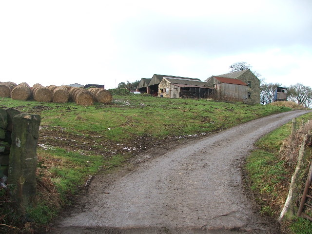
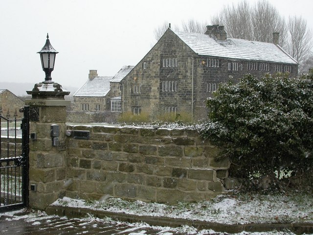
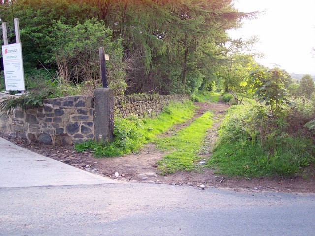
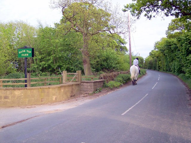
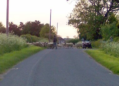
Arthington is a small village with a population of around 400 residents. It has a rich history dating back to the medieval period, with evidence of settlement in the area since Roman times. The village is known for its picturesque countryside and is surrounded by rolling hills and woodland, making it a popular destination for outdoor enthusiasts.

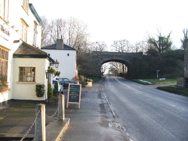
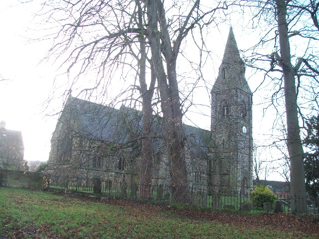
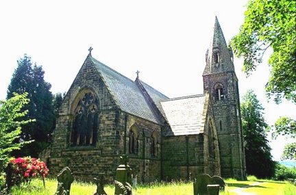
The village itself has a charming and traditional character, with a mix of historic buildings, including a Norman church dating back to the 12th century. There is also a village hall, a primary school, and a pub, which serves as a social hub for the community.

Arthington benefits from its proximity to Leeds, which provides residents with access to a range of amenities and services, including shopping centers, leisure facilities, and transport links. The village is well-connected to the rest of the region by road and rail, with a train station providing regular services to Leeds and Harrogate.

Overall, Arthington offers a peaceful and rural lifestyle within easy reach of the amenities of a larger city. It is a close-knit community with a strong sense of history and a beautiful natural environment.

If you have any feedback on the listing, please let us know in the comments section below.

Arthington Images

Images are sourced within 2km of 53.897029/-1.586265 or Grid Reference SE2744. Thanks to Geograph Open Source API. All images are credited.

Arthington Viaduct Arthington Viaduct, built 1846, carries the Harrogate-Leeds railway line from North Yorkshire across the River Wharfe into West Yorkshire.  The viaduct, for the Leeds and Thirsk Railway, was engineered by Thomas Granger and built by James Bray. It was 1510 feet long, had 21 arches and required over 50,000 tons of stone to construct.
Arthington Viaduct
Arthington Viaduct, built 1846, carries the Harrogate-Leeds railway line from North Yorkshire across the River Wharfe into West Yorkshire. The viaduct, for the Leeds and Thirsk Railway, was engineered by Thomas Granger and built by James Bray. It was 1510 feet long, had 21 arches and required over 50,000 tons of stone to construct.
Railway bridge by 'The Wharfedale'. Looking E along the A659.
Railway bridge by 'The Wharfedale'.
Looking E along the A659.
Mill Farm. with WHARFEDALE viaduct in the background.
Mill Farm.
with WHARFEDALE viaduct in the background.
St Peters, Arthington.
Bank End Farm. Looking W from Bedlam Lane.
Bank End Farm.
Looking W from Bedlam Lane.
Arthington House Arthington House is a private residence between Pool and Arthington.
Arthington House
Arthington House is a private residence between Pool and Arthington.
Farm buildings belonging to Creskeld Home Farm The Creskeld Herd dates back to 1920
Farm buildings belonging to Creskeld Home Farm
The Creskeld Herd dates back to 1920
Snowy fields at Ingfield Farm The bare hedgerow, trees and snow-lined furrows make a wintry scene.
Snowy fields at Ingfield Farm
The bare hedgerow, trees and snow-lined furrows make a wintry scene.
The Nunnery Now a private residence, a Cluniac Nunnery was founded on this site in 1150 by Peter de Arthington.
The Nunnery
Now a private residence, a Cluniac Nunnery was founded on this site in 1150 by Peter de Arthington.
Bridleway near Arthington Quarry Looking west down bridleway off Blackhill Lane which connects to Creskeld Lane.
Bridleway near Arthington Quarry
Looking west down bridleway off Blackhill Lane which connects to Creskeld Lane.
Bank Top Farm, Blackhill Lane Looking south on Blackhill Lane at entrance to Bank Top Farm. Horse rider is going towards Adel, Leeds. Location is where the Ebor Way long distance path crosses the road.
Bank Top Farm, Blackhill Lane
Looking south on Blackhill Lane at entrance to Bank Top Farm. Horse rider is going towards Adel, Leeds. Location is where the Ebor Way long distance path crosses the road.
Chapel Hill Farm Looking north east to Castle Hill Farm from just after the railway bridge.
Chapel Hill Farm
Looking north east to Castle Hill Farm from just after the railway bridge.
Sheep at Wescoe Hill Sheep being herded across the road at Wescoe Hill near the former Brymoor Ice Cream Parlour. Farmer's son has a quad bike. Picture taken looking north east.
Sheep at Wescoe Hill
Sheep being herded across the road at Wescoe Hill near the former Brymoor Ice Cream Parlour. Farmer's son has a quad bike. Picture taken looking north east.
Arthington, St Peter's Church
Arthington Hall, Arthington The O/S grid line splits Arthington Hall from west to east.  The southern part of the Hall at grid reference SE274449 and the northern part is at grid reference SE274450 <a href="https://www.geograph.org.uk/photo/267333">SE2745 : Arthington Hall,   Arthington</a>.  This photograph is the southern facade of the Hall.

There is also a view of the western facade <a href="https://www.geograph.org.uk/photo/267334">SE2744 : Arthington  Hall, Arthington</a>.
Arthington Hall, Arthington
The O/S grid line splits Arthington Hall from west to east. The southern part of the Hall at grid reference SE274449 and the northern part is at grid reference SE274450 SE2745 : Arthington Hall, Arthington. This photograph is the southern facade of the Hall. There is also a view of the western facade SE2744 : Arthington Hall, Arthington.
Arthington Hall,   Arthington The OS grid line splits Arthington Hall from east to west.  The southern part of the Hall is  at <a href="https://www.geograph.org.uk/gridref/SE274449">SE274449</a> <a href="https://www.geograph.org.uk/photo/267330">SE2744 : Arthington Hall, Arthington</a> and the northern part is in <a href="https://www.geograph.org.uk/gridref/SE274450">SE274450</a>. This is the northern part of the Hall.

There is also a view of the western facade <a href="https://www.geograph.org.uk/photo/267334">SE2744 : Arthington  Hall, Arthington</a>.
Arthington Hall, Arthington
The OS grid line splits Arthington Hall from east to west. The southern part of the Hall is at SE274449 SE2744 : Arthington Hall, Arthington and the northern part is in SE274450. This is the northern part of the Hall. There is also a view of the western facade SE2744 : Arthington Hall, Arthington.
Arthington  Hall, Arthington This is the western facade of the Hall and is in two OS grid squares. The northern part of the facade is at <a href="https://www.geograph.org.uk/gridref/SE274450">SE274450</a> <a href="https://www.geograph.org.uk/photo/267333">SE2745 : Arthington Hall,   Arthington</a> and the southern part in <a href="https://www.geograph.org.uk/gridref/SE274449">SE274449</a> <a href="https://www.geograph.org.uk/photo/267330">SE2744 : Arthington Hall, Arthington</a>.
Arthington Hall, Arthington
This is the western facade of the Hall and is in two OS grid squares. The northern part of the facade is at SE274450 SE2745 : Arthington Hall, Arthington and the southern part in SE274449 SE2744 : Arthington Hall, Arthington.
Arthington Viaduct from Arthington hall.
Show me another place!

Arthington is located at Grid Ref: SE2744 (Lat: 53.897029, Lng: -1.586265)

Division: West Riding

Administrative County: West Yorkshire

District: Leeds

Police Authority: West Yorkshire

What 3 Words

///absent.fingernails.applause. Near Pool, West Yorkshire

Nearby Locations

Arthington Arthington

Related Wikis

Arthington

Arthington is a linear village in Wharfedale, in the City of Leeds metropolitan borough in West Yorkshire, England. It is a civil parish which, according...

Kirkstall Road Viaduct

Kirkstall Road Viaduct is a Grade II listed railway viaduct carrying the Harrogate line over the A65 Kirkstall Road, the River Aire, and the Leeds and...
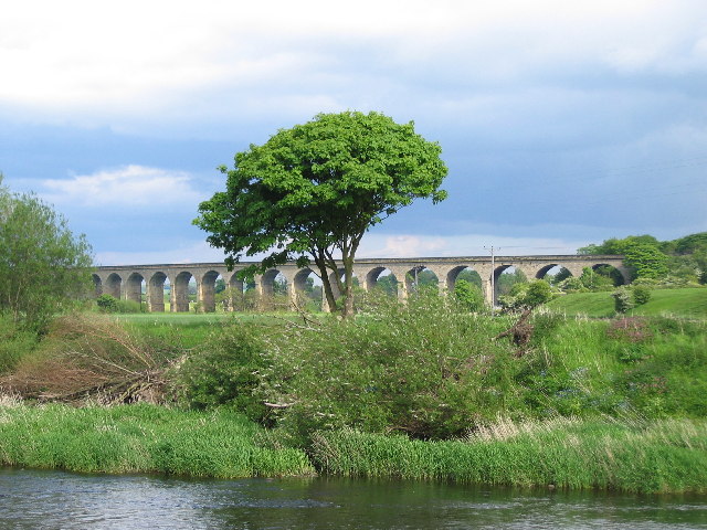
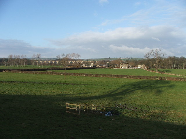
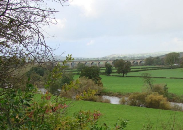
Arthington Viaduct

Arthington Viaduct, listed known as the Wharfedale Viaduct, carries the Harrogate Line across the Wharfe valley between Arthington in West Yorkshire...
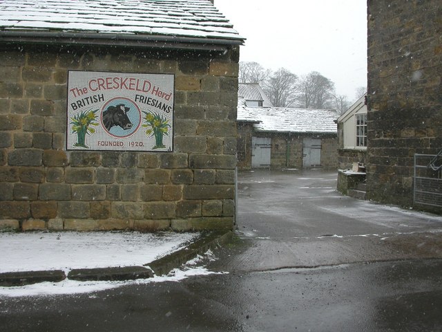
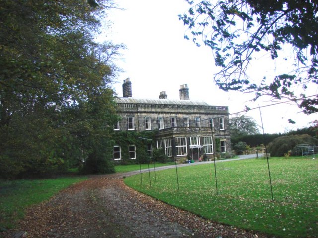
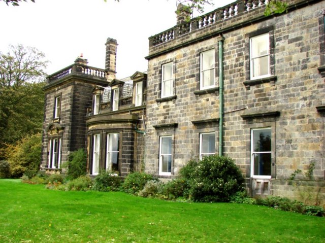
Creskeld Hall

Creskeld Hall is a grade II listed Country House located in Arthington, near Otley, West Yorkshire, England. == Etymology == The place-name is first attested...

Castley

Castley is a village and civil parish in the Harrogate district of North Yorkshire, England. It lies on a bend in the River Wharfe about 10 miles (16 km...

Arthington railway station

Arthington railway station served the village of Arthington in the English county of West Yorkshire, near the North Yorkshire town of Harrogate. ��2...
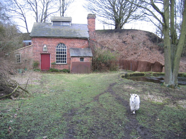
Arthington Priory

Arthington Priory was an English monastery which was home to a community of nuns in Arthington, West Yorkshire, founded in the mid-12th century. The priory...

Bramhope Tunnel

Bramhope Tunnel is on the Harrogate Line between Horsforth station and the Arthington Viaduct in West Yorkshire, England. Services through the railway...

Nearby Amenities

Located within 500m of 53.897029,-1.586265
Arthington
Is In: UK, England, West Yorkshire, Wharfedale
Is In Country Code: GB
Is In County: West Yorkshire
Is In Historic County: West Riding of Yorkshire
Is In Municipality: Leeds
Is In Valley: Wharfedale
Place: village
Population: 561
Postal Code: LS21
Wikidata: Q657157
Wikipedia: en:Arthington
Lat/Long: 53.8971657/-1.5914638
Arthington Hall
Building: house
Historic: house
Source: NPE
Lat/Long: 53.9005725/-1.5842893
Bus Stop
Arthington Lane
Local Ref: 45014711
Naptan AtcoCode: 450014711
Naptan Bearing: W
Naptan CommonName: Arthington Lane
Naptan Indicator: Stop 45014711
Naptan Landmark: Crag View House
Naptan PlusbusZoneRef: LEEDS
Naptan ShortCommonName: Arthington School
Naptan Street: Arthington Lane
Naptan Verified: no
Source: naptan_import
Lat/Long: 53.8977619/-1.5910514
Bus Stop
Arthington Lane Park Cottages
Bus: yes
Naptan AtcoCode: 450028909
Naptan Bearing: W
Naptan CommonName: Grange Farm
Naptan Indicator: adj
Naptan Landmark: Unknown
Naptan NaptanCode: 45028909
Naptan PlusbusZoneRef: LEEDS
Naptan ShortCommonName: Park Cottages
Naptan Street: Arthington Lane
Naptan Verified: no
Public Transport: platform
Source: naptan_import
Lat/Long: 53.8976996/-1.5833971
Bus Stop
Arthington Lane Crag View House
Bus: yes
Naptan AtcoCode: 450028913
Naptan Bearing: E
Naptan CommonName: Arthington Lane Crag View House
Naptan Landmark: Crag View House
Naptan ShortCommonName: Crag View
Naptan Street: Arthington Lane
Naptan Verified: no
Public Transport: platform
Source: naptan_import
Lat/Long: 53.8978453/-1.5909697
Defibrillator
Emergency: defibrillator
Indoor: no
Location: On Extermal of Arthington Village Hall, facing road
Lat/Long: 53.8975898/-1.5894761
Post Box
Operator: Royal Mail
Post Box Type: lamp
Ref: LS21 112
Lat/Long: 53.8977511/-1.5909644
Disused Amenity: post_box
Note: Plaque above box reads "This Victorian Post Box stood opposite Arthington Church for over 100 years, until it was taken out of service by the Royal Mail. It was rescued and re-sited by the Parish Council in 1992"
Post Box Type: wall
Royal Cypher: VR
Lat/Long: 53.8975676/-1.5894299
Entrance: yes
Lat/Long: 53.8975572/-1.5894357
Waste Basket
Collection Times: Fr
Condition: POOR
Ref UK Leedscc Bin: 6880
Waste Basket Model: YELLOW POST BIN
Lat/Long: 53.897242/-1.58633
Bus: yes
Public Transport: stop_position
Lat/Long: 53.8978077/-1.5909758
Turning Loop
Lat/Long: 53.9002683/-1.5843467
Bus Stop
Arthington Lane Park Cottages
Bus: yes
Local Ref: 45014709
Naptan AtcoCode: 450014709
Naptan Bearing: E
Naptan CommonName: Arthington Lane Park Cottages
Naptan Crossing: Nr/Opp Black Hill Road
Naptan Indicator: at
Naptan Landmark: Park Cottages
Naptan NaptanCode: 45014709
Naptan PlusbusZoneRef: LEEDS
Naptan ShortCommonName: Park Cottages
Naptan Street: Arthington Lane
Naptan Verified: no
Public Transport: platform
Source: naptan_import
Lat/Long: 53.8977608/-1.5834691
The data included in this document is from www.openstreetmap.org. The data is made available under ODbL.

Have you been to Arthington?

Leave your review of Arthington below (or comments, questions and feedback).