Brightgate

Settlement in Derbyshire Derbyshire Dales

England

Brightgate

Grazing land on the south side of Oaker Looking down towards Snitterton.
Grazing land on the south side of Oaker Credit: Bill Boaden

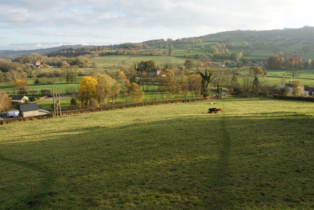
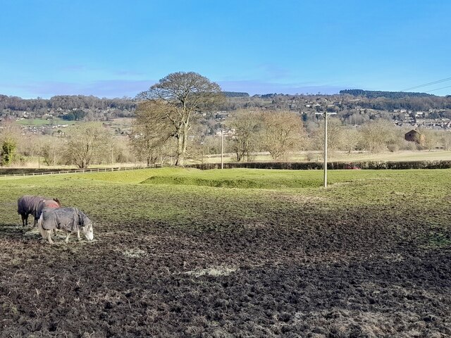
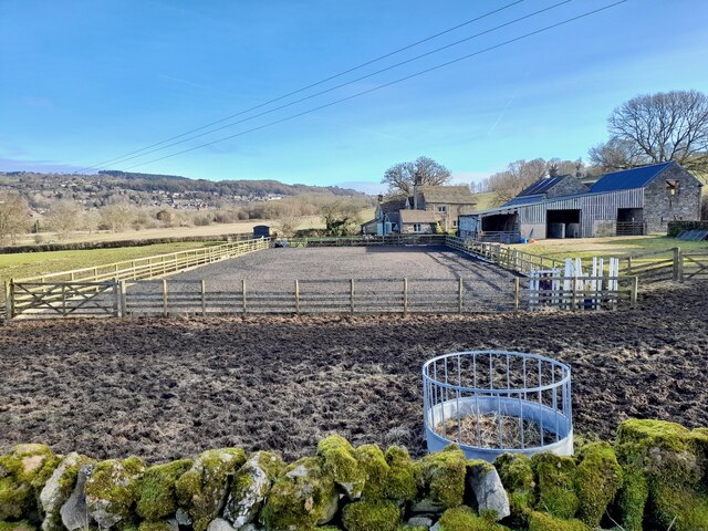
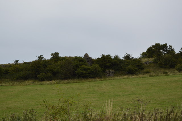
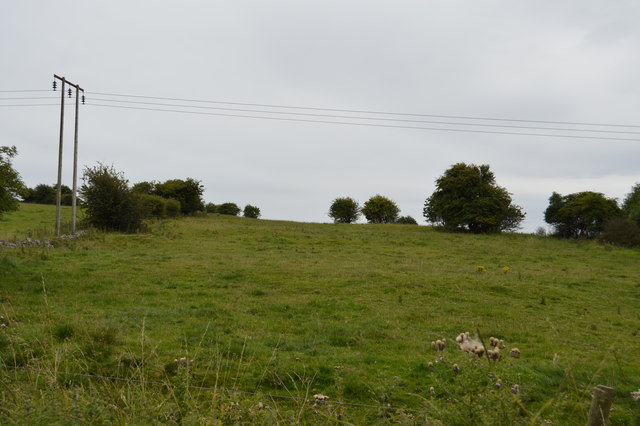
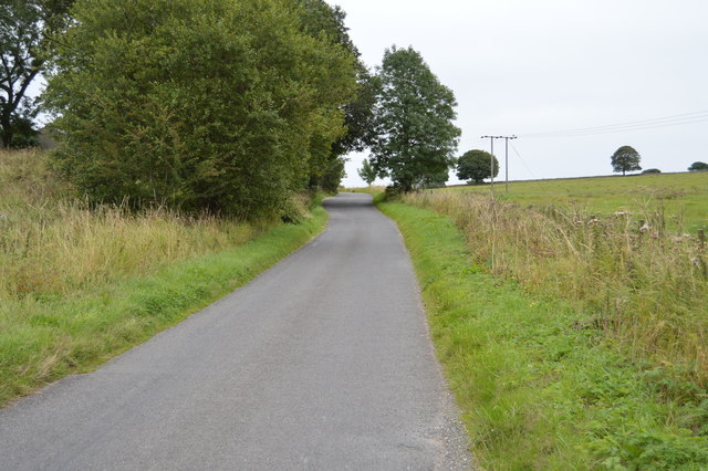
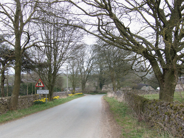
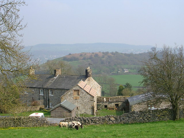
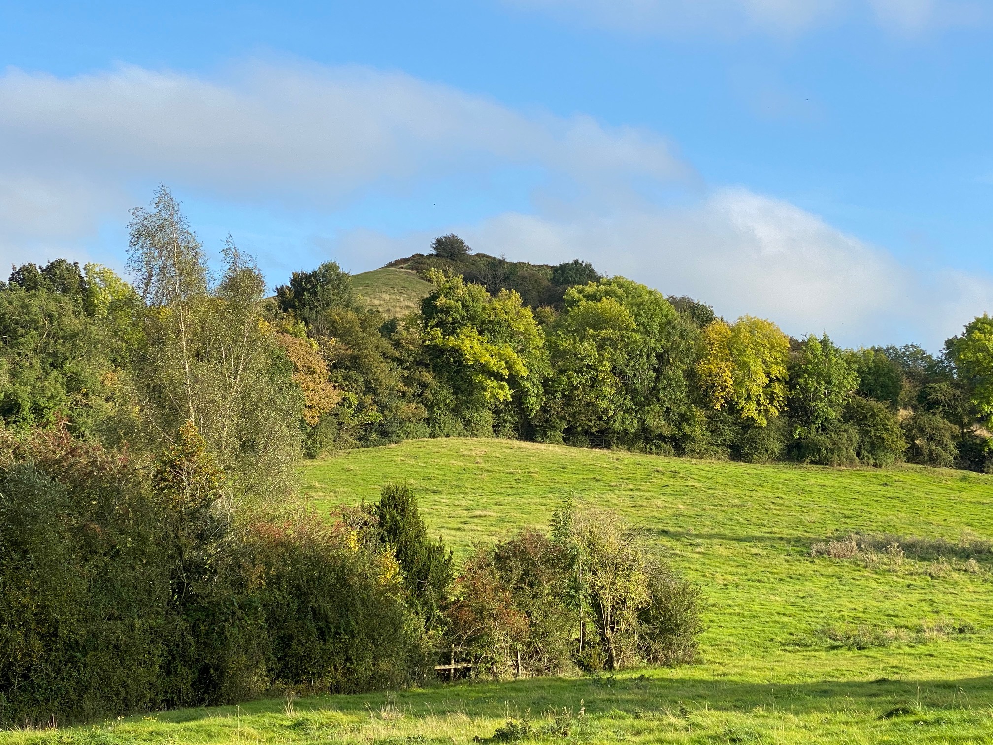
Brightgate is a small village located in the county of Derbyshire, England. Situated in the picturesque Peak District National Park, it is surrounded by stunning natural beauty and offers a tranquil and idyllic setting for residents and visitors alike. The village is nestled in a valley, surrounded by rolling hills and lush green fields, creating a peaceful and serene atmosphere.

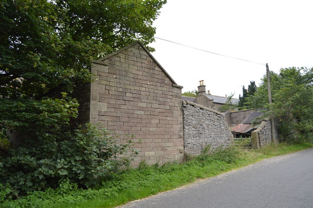
Brightgate is known for its charming stone cottages that line its narrow, winding streets. These traditional buildings add to the village's quaint and traditional character. The community in Brightgate is close-knit and friendly, with a strong sense of community spirit.

The village is home to a small but well-regarded primary school, providing education to the local children. There is also a village hall that serves as a hub for social gatherings, events, and various community activities. Additionally, a local pub offers a cozy and inviting atmosphere for residents and visitors to enjoy a drink or a meal.

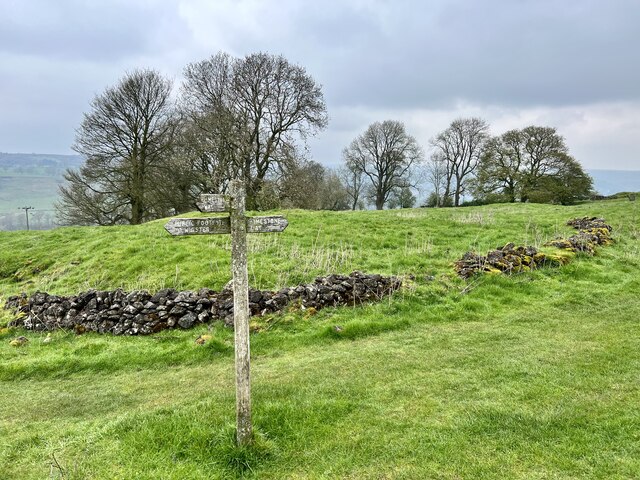
Nature lovers will find themselves in paradise in Brightgate, as the surrounding countryside offers a plethora of walking and hiking trails. The nearby reservoirs provide opportunities for fishing and boating, while the expansive moorlands are ideal for birdwatching and wildlife spotting.

In summary, Brightgate is a charming and picturesque village in Derbyshire's Peak District. With its stunning natural surroundings, traditional architecture, and strong community spirit, it is a truly delightful place to live or visit for those seeking a peaceful and rural retreat.

If you have any feedback on the listing, please let us know in the comments section below.

Brightgate Images

Images are sourced within 2km of 53.131995/-1.606878 or Grid Reference SK2659. Thanks to Geograph Open Source API. All images are credited.

Grazing land on the south side of Oaker Looking down towards Snitterton.
Grazing land on the south side of Oaker
Looking down towards Snitterton.
A medieval moat in a field of horses The dry moat runs around the site of the medieval Snitterton Hall.
A medieval moat in a field of horses
The dry moat runs around the site of the medieval Snitterton Hall.
All-weather surface at Manor Farm As can be seen from the churned-up muddy field around it, all-weather surfaces are great for schooling horses all year round in the British climate.
All-weather surface at Manor Farm
As can be seen from the churned-up muddy field around it, all-weather surfaces are great for schooling horses all year round in the British climate.
Signpost on the Limestone Way Near Winster.
Signpost on the Limestone Way
Near Winster.
Hilltop tor
Hilltop tor
Footpath off Bonsall Lane
Wooded tors
Wooded tors
Bonsall Lane
Bonsall Lane
Almost a hedge
Almost a hedge
Road sign, Bonsall Lane
Bonsallmoor Lane
Bonsallmoor Lane
Bonsall Lane
Bonsall Lane
Wooded gritstone tors
Grazing land by Bonsall Lane
Bonsall Lane
Bonsall Lane
Bonsall Lane Farm
Bonsall Lane Farm
Barn, Bonsall Lane Farm
Grazing, Blakelow Hill
Show me another place!

Brightgate is located at Grid Ref: SK2659 (Lat: 53.131995, Lng: -1.606878)

Administrative County: Derbyshire

District: Derbyshire Dales

Police Authority: Derbyshire

What 3 Words

///submitted.panting.angel. Near Matlock, Derbyshire

Nearby Locations

Brightgate Ash Plantation

Related Wikis

Brightgate

Brightgate is a village in Derbyshire, England. The population is recorded in the civil parish of Bonsall, Derbyshire. == References ==

Beans and Bacon mine

The Beans and Bacon mine is a disused lead mine on Bonsall Moor near the village of Bonsall, Derbyshire, United Kingdom. The nearest large town is Matlock...

Wensley, Derbyshire

Wensley is a small village in South Darley parish in Derbyshire of limestone and gritstone properties mainly arranged along the single road which zig-zags...

Snitterton

Snitterton is a hamlet in Derbyshire, England, in South Darley parish, of some fifteen properties including two working farms and Snitterton Hall, a late...

Snitterton Hall

Snitterton Hall is a late medieval manor house in Snitterton in South Darley parish, near Matlock, Derbyshire, England, and within the Peak District National...

Oker, Derbyshire

Oker is a hamlet in Derbyshire, located in South Darley parish, with groups of houses along two sides of Oker Hill. The houses are largely older limestone...

South Darley

South Darley is a civil parish in the Derbyshire Dales. It is a largely rural parish and covers the villages of Darley Bridge, Wensley and the hamlets...

Bonsall, Derbyshire

Bonsall is a village and civil parish in the Derbyshire Dales on the edge of the Peak District. The civil parish population, including Brightgate and Horse...

Nearby Amenities

Located within 500m of 53.131995,-1.606878
Post Box
Operator: Royal Mail
Ref: DE4 923
Lat/Long: 53.1328535/-1.6064929
Brightgate
Ele: 297.6516113
Place: hamlet
Source: Village sign
Wikidata: Q4967537
Lat/Long: 53.1326635/-1.6059378
Barrier: stile
Ele: 328.8942871
Material: stone
Source: survey;bing;gps
Stile: squeezer
Lat/Long: 53.1294158/-1.6084017
Barrier: stile
Ele: 318.5601807
Material: stone
Source: survey;bing
Stile: squeezer
Lat/Long: 53.1284367/-1.6063475
Barrier: stile
Ele: 317.5988770
Stile: squeezer
Lat/Long: 53.1283202/-1.6063287
Barrier: stile
Ele: 313.9938965
Stile: squeezer
Lat/Long: 53.1281856/-1.6056185
Barrier: stile
Ele: 286.0000000
Material: stone
Stile: squeezer
Lat/Long: 53.1326731/-1.599679
Barrier: stile
Ele: 293.0000000
Material: stone
Stile: squeezer
Lat/Long: 53.1334669/-1.6003574
Barrier: stile
Ele: 291.0000000
Steps: 0
Stile: stepover
Lat/Long: 53.1334938/-1.6003759
Ele: 294.0000000
Lat/Long: 53.1337246/-1.6006065
Barrier: stile
Ele: 294.0000000
Material: stone
Steps: 0
Stile: stepover
Lat/Long: 53.1337269/-1.6006075
Ele: 295.0000000
Lat/Long: 53.1337555/-1.6006035
Barrier: stile
Ele: 302.0000000
Stile: squeezer
Lat/Long: 53.1337323/-1.6004618
Barrier: stile
Steps: 2
Stile: stepover
Lat/Long: 53.1329124/-1.60539
Ele: 296.0000000
Lat/Long: 53.1349863/-1.6101472
Ele: 294.0000000
Lat/Long: 53.1354632/-1.6098785
Ele: 295.0000000
Lat/Long: 53.1354273/-1.6101944
Ele: 301.0000000
Lat/Long: 53.1360567/-1.609117
Ele: 301.0000000
Lat/Long: 53.1357716/-1.609247
Barrier: entrance
Source: survey;gps
Lat/Long: 53.1292795/-1.6012185
Barrier: stile
Material: stone
Source: survey;bing;gps
Stile: squeezer
Lat/Long: 53.1297835/-1.6012924
Barrier: stile
Material: stone
Source: survey;gps
Steps: 2
Stile: stepover
Lat/Long: 53.130911/-1.6026802
Barrier: stile
Material: stone
Source: survey;bing;gps
Steps: 2
Stile: stepover
Lat/Long: 53.1324727/-1.60494
Barrier: stile
Material: stone
Source: survey;bing
Stile: squeezer
Lat/Long: 53.1299057/-1.6096302
Power: pole
Lat/Long: 53.1349979/-1.6123724
Power: pole
Lat/Long: 53.1351105/-1.6105646
Power: pole
Lat/Long: 53.1351539/-1.6084752
Power: pole
Lat/Long: 53.1355305/-1.6072977
Power: pole
Lat/Long: 53.1356753/-1.6065601
The data included in this document is from www.openstreetmap.org. The data is made available under ODbL.

Have you been to Brightgate?

Leave your review of Brightgate below (or comments, questions and feedback).