Arkengarthdale

Civil Parish in Yorkshire Richmondshire

England

Arkengarthdale

Beck Crooks Ford This ford is found on Beck Crooks.
Beck Crooks Ford Credit: John Walton

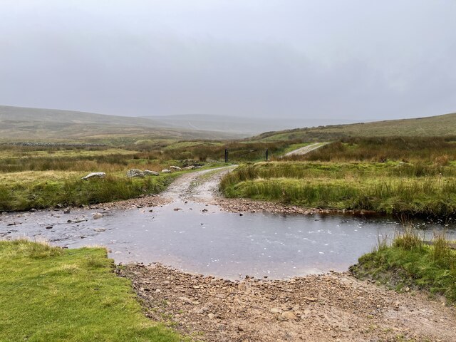
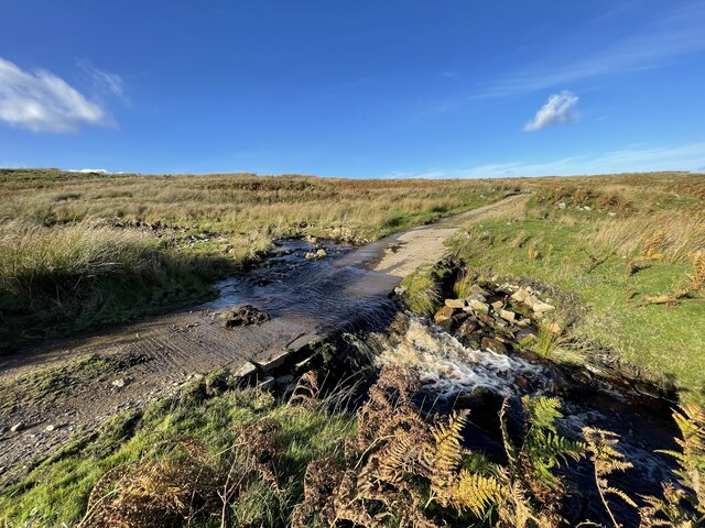
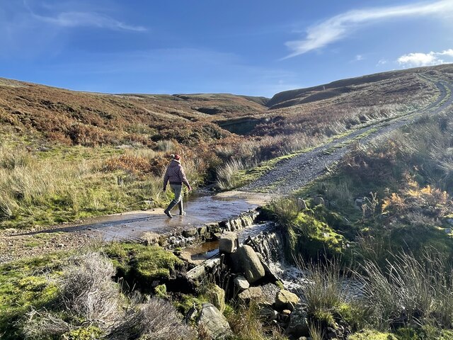
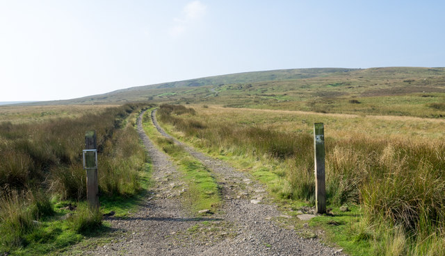
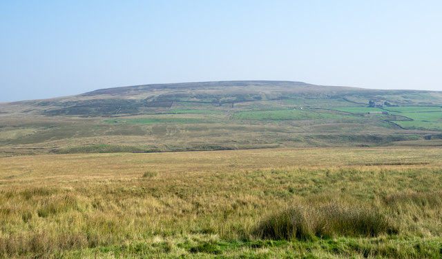
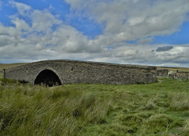
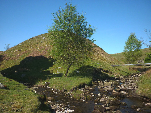
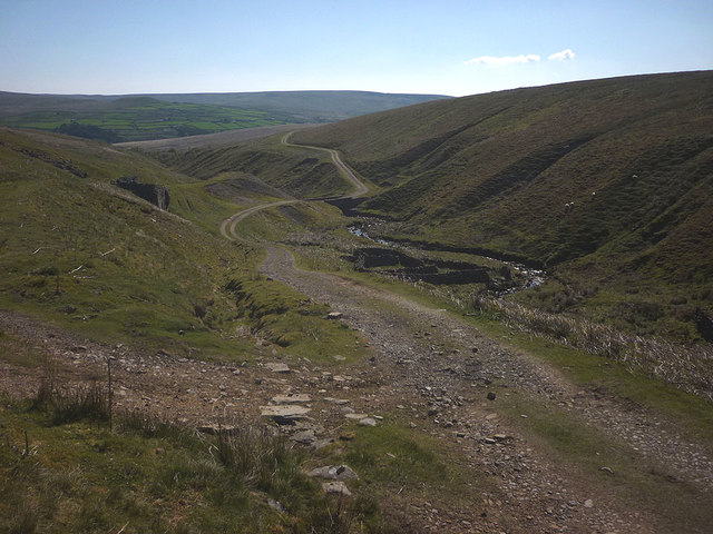
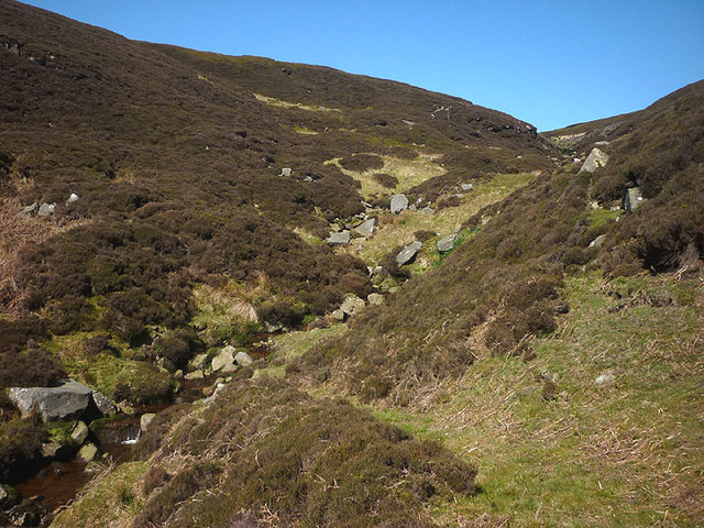
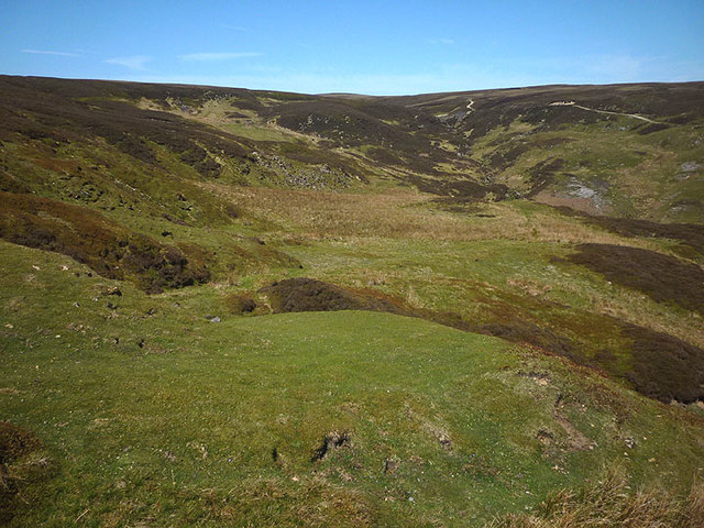
Arkengarthdale is a Civil Parish situated in the district of Richmondshire, within the county of Yorkshire, England. It lies in the northern part of the Yorkshire Dales National Park, surrounded by picturesque landscapes and rolling hills. The parish covers an area of approximately 66 square kilometers and is home to a population of around 300 people.

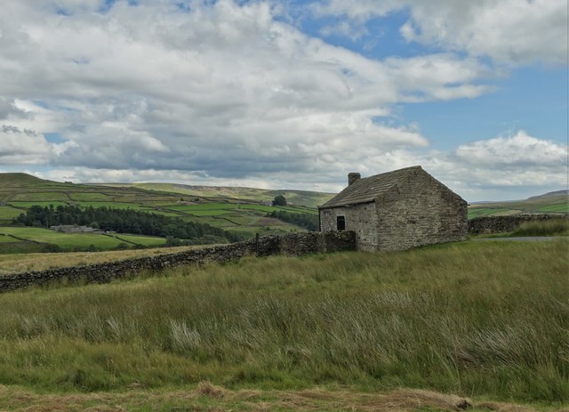
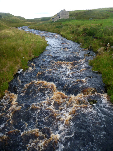
The village of Arkengarthdale is the main settlement in the parish and is located on the banks of the River Arkle. It is a traditional Yorkshire Dales village, with stone-built houses and a charming, rural atmosphere. The village has a small primary school, a church, and a village hall, which serves as a community center for various activities and events.

The economy of Arkengarthdale is primarily based on agriculture and tourism. The fertile land supports farming activities, particularly sheep farming, which has been a way of life for generations. The area also attracts tourists who come to enjoy the natural beauty of the Yorkshire Dales and engage in outdoor activities such as hiking, cycling, and birdwatching.

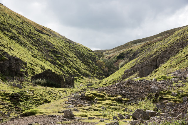
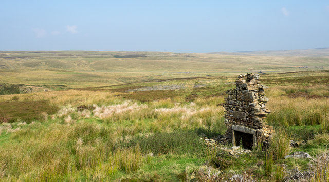
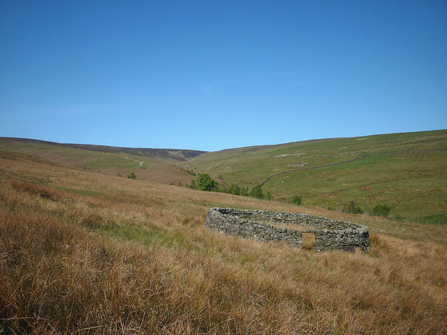
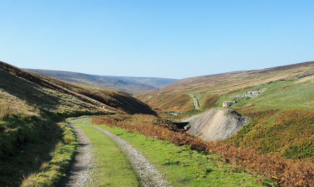
The parish is dotted with several historic landmarks, including the ruins of several lead mining works that were active in the past. These remnants provide a glimpse into the area's industrial heritage and attract history enthusiasts.

Overall, Arkengarthdale offers a tranquil and idyllic setting, perfect for those seeking a peaceful retreat amidst the stunning Yorkshire countryside.

If you have any feedback on the listing, please let us know in the comments section below.

Arkengarthdale Images

Images are sourced within 2km of 54.443914/-2.072209 or Grid Reference NY9505. Thanks to Geograph Open Source API. All images are credited.

Beck Crooks Ford This ford is found on Beck Crooks.
Beck Crooks Ford
This ford is found on Beck Crooks.
Annaside Rigg Ford This is the second of three fords on this track. A video of the ford can be viewed at:
<span class="nowrap"><a title="https://youtu.be/N_3pef5sw_w" rel="nofollow ugc noopener" href="https://youtu.be/N_3pef5sw_w">Link</a><img style="margin-left:2px;" alt="External link" title="External link - shift click to open in new window" src="https://s1.geograph.org.uk/img/external.png" width="10" height="10"/></span>
Annaside Rigg Ford
This is the second of three fords on this track. A video of the ford can be viewed at: LinkExternal link
Lad Gill Ford This is the third of the three fords on this track.
Lad Gill Ford
This is the third of the three fords on this track.
Boundary stone near to Great Punchard Head Great Punchard Head is an area of moorland drained by a number of minor streams that combine to form Great Punchard Gill. The boundary stone is one of a number marked on OS maps running (initially) near to east from Water Crag.
Boundary stone near to Great Punchard Head
Great Punchard Head is an area of moorland drained by a number of minor streams that combine to form Great Punchard Gill. The boundary stone is one of a number marked on OS maps running (initially) near to east from Water Crag.
Valley of Little Punchard Gill A contre-jour photograph into the narrowing upper valley of Little Punchard Gill. The ruined building is a relic of the old lead mining industry.
Valley of Little Punchard Gill
A contre-jour photograph into the narrowing upper valley of Little Punchard Gill. The ruined building is a relic of the old lead mining industry.
Estate road rising towards Leading Stead Leading Stead is an ill-defined upland location named on OS maps as part of Arkengarthdale Moor - another of them! The estate road climbs only a short way up the slope which is on the south side of Arkengarthdale.
Estate road rising towards Leading Stead
Leading Stead is an ill-defined upland location named on OS maps as part of Arkengarthdale Moor - another of them! The estate road climbs only a short way up the slope which is on the south side of Arkengarthdale.
Moorland in Arkengarthdale Grassy moorland on the north side of the valley road as seen from a location named on OS maps as White Hill. The distant feature is Cleasby Hill.
Moorland in Arkengarthdale
Grassy moorland on the north side of the valley road as seen from a location named on OS maps as White Hill. The distant feature is Cleasby Hill.
Chimney on moorland near Annaside Beck The chimney has the appearance of a currick when viewed from the estate road near to Annaside Beck both of which are to the left, out of view in the image. It must surely have been part of a small building yet there's very little evidence of one remaining: presumably the stone has been removed for use elsewhere.
The valley below the moorland on which the chimney stands is Arkengarthdale.
Chimney on moorland near Annaside Beck
The chimney has the appearance of a currick when viewed from the estate road near to Annaside Beck both of which are to the left, out of view in the image. It must surely have been part of a small building yet there's very little evidence of one remaining: presumably the stone has been removed for use elsewhere. The valley below the moorland on which the chimney stands is Arkengarthdale.
Beck Crooks Bridge over Arkle Beck
Beck Crooks Bridge
Beck Crooks Bridge
Roadside barn at Punchard Gate
Arkle Beck from Dale Head New Bridge Dale Head is connected to the Arkengarthdale road by a track which the public right of way (a footpath) only partially follows. The routes certainly coincide over the bridge, from where we found ourselves peering both upstream (as seen here) and downstream to see if this would be too high up the dale to put on to Arkle Beck for a paddling trip. It's a difficult judgement to make in August when even recent damp weather has not raised the beck to anything like the sort of wet winter levels one would need. I suspect that Whaw bridge would be a more sensible option.
Arkle Beck from Dale Head New Bridge
Dale Head is connected to the Arkengarthdale road by a track which the public right of way (a footpath) only partially follows. The routes certainly coincide over the bridge, from where we found ourselves peering both upstream (as seen here) and downstream to see if this would be too high up the dale to put on to Arkle Beck for a paddling trip. It's a difficult judgement to make in August when even recent damp weather has not raised the beck to anything like the sort of wet winter levels one would need. I suspect that Whaw bridge would be a more sensible option.
Sheepfold, Great Punchard Gill Looking towards the new tree plantings by the confluence with Little Punchard Gill.
Sheepfold, Great Punchard Gill
Looking towards the new tree plantings by the confluence with Little Punchard Gill.
Confluence of Great and Little Punchard Gills A scatter of trees has been planted around this pleasant spot.
Confluence of Great and Little Punchard Gills
A scatter of trees has been planted around this pleasant spot.
Shooters track, Great Punchard Gill
Bridleway, Great Punchard Gill The bridleway which branches south off the shooters track is very elusive around the vicinity of the beck but can be followed by close observation. It was most likely used to transport lead ore to the smelting mills further south.
Bridleway, Great Punchard Gill
The bridleway which branches south off the shooters track is very elusive around the vicinity of the beck but can be followed by close observation. It was most likely used to transport lead ore to the smelting mills further south.
Bridleway, Punchard Moor At a pronounced bend the track is an obvious smooth green path.
Bridleway, Punchard Moor
At a pronounced bend the track is an obvious smooth green path.
Hill road descending to Great Punchard Gill The road descends to cross the valley stream by a substantial stone bridge then climbs to the northern slope - it can be seen doing so. The large spoil heap is from the Routh Level; part of the old lead mining activity; there's a pair of lime kilns there too.
Hill road descending to Great Punchard Gill
The road descends to cross the valley stream by a substantial stone bridge then climbs to the northern slope - it can be seen doing so. The large spoil heap is from the Routh Level; part of the old lead mining activity; there's a pair of lime kilns there too.
Show me another place!

Arkengarthdale is located at Grid Ref: NY9505 (Lat: 54.443914, Lng: -2.072209)

Division: North Riding

Administrative County: North Yorkshire

District: Richmondshire

Police Authority: North Yorkshire

What 3 Words

///intrigues.flattery.hourglass. Near Bowes, Co. Durham

Nearby Locations

Arkengarthdale

Related Wikis

Arkengarthdale Gunnerside and Reeth Moors

Arkengarthdale Gunnerside and Reeth Moors (grid reference NY935070 and SD970990) is a 7,634.72 hectares (18,865.8 acres) biological Site of Special Scientific...

Arkengarthdale

Arkengarthdale is a dale, or valley, on the east side of the Pennines in North Yorkshire, England. Running roughly north-west to south-east, it is the...

Walney to Wear and Whitby Cycle Route

The Walney to Wear and Whitby Cycle Route (or W2W) is the name of a cross-country cycle route in Northern England. It runs from Walney Island in Cumbria...

National Cycle Route 70

National Cycle Network (NCN) Route 70 is a Sustrans National Route that runs from Walney Island in Cumbria to Sunderland. The route is fully open and signed...

Whaw

Whaw is a hamlet in Arkengarthdale in North Yorkshire, England. It is one of few settlements in the dale and is one of the smallest. Its name derives from...

Arkle Beck Meadows, Whaw

Arkle Beck Meadows, Whaw (grid reference NY984041) is a 8.4 hectares (21 acres) biological Site of Special Scientific Interest (SSSI) at Whaw in Arkengarthdale...

Rogan's Seat

Rogan's Seat is a remote hill located near East Stonesdale and Gunnerside Gill, in the Yorkshire Dales in England. It is a high expanse of moorland that...

Eskeleth

Eskeleth is a hamlet in Arkengarthdale in North Yorkshire, England. It is in the Yorkshire Dales National Park. Eskeleth sits 4 miles (6.4 km) from the...

Nearby Amenities

Located within 500m of 54.443914,-2.072209
Natural: sinkhole
Source: aerial imagery;OS OpenData StreetView (April 2016)
Lat/Long: 54.4440562/-2.0691086
Natural: sinkhole
Source: aerial imagery;OS OpenData StreetView (April 2016)
Lat/Long: 54.4434588/-2.067827
The data included in this document is from www.openstreetmap.org. The data is made available under ODbL.

Have you been to Arkengarthdale?

Leave your review of Arkengarthdale below (or comments, questions and feedback).