Appledore

Civil Parish in Kent Ashford

England

Appledore

Junction of Moor Lane and Woodchurch Road in Appledore
Junction of Moor Lane and Woodchurch Road in Appledore Credit: Ron Lee

Appledore is a civil parish located in the county of Kent, England. Situated on the southern edge of the Romney Marsh, it is bordered by the River Rother to the south and the Royal Military Canal to the north. The village of Appledore itself is positioned around two miles northwest of the town of New Romney.

With a population of around 1,200 residents, Appledore is a small and close-knit community. The village boasts a rich history, dating back to the medieval period. It was an important settlement during the Middle Ages, serving as a port on the River Rother, which was a significant trade route at the time.

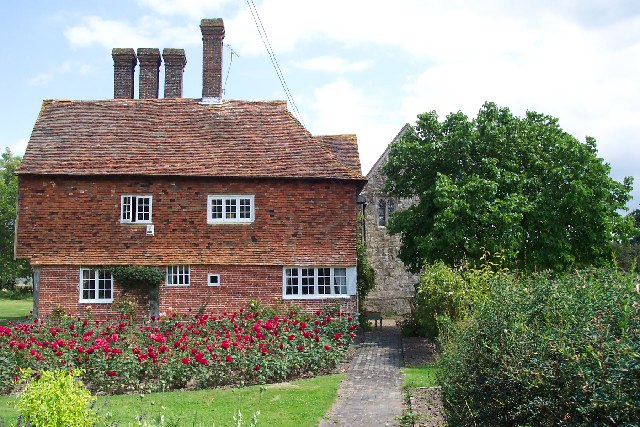
Today, Appledore retains its historic charm, with many timber-framed and thatched-roof buildings still standing. The village is home to St. Peter and St. Paul Church, a Grade I listed building that dates back to the 12th century.

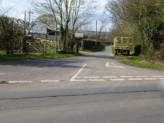
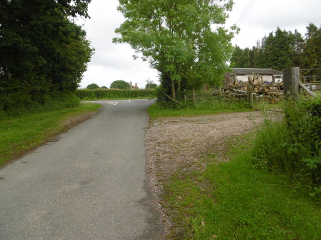
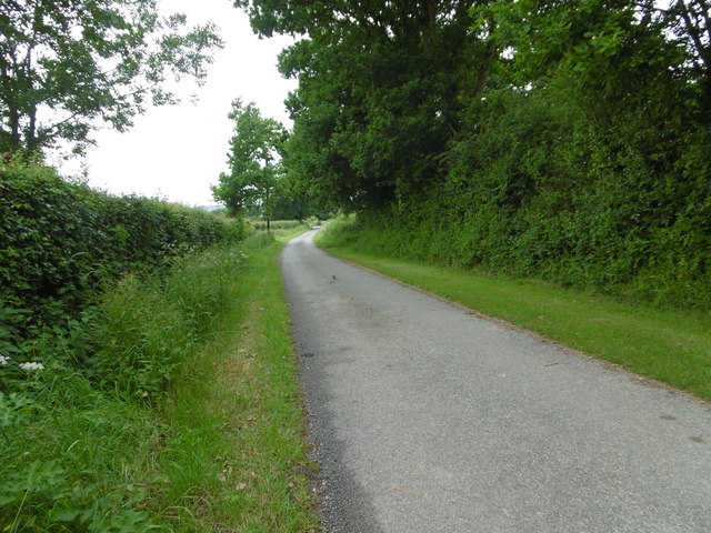
The surrounding area offers picturesque countryside views and is popular with nature enthusiasts. The wide-open spaces of the Romney Marsh provide opportunities for walking, cycling, and birdwatching.

Appledore is well-connected to nearby towns and cities. The A259 road runs through the village, linking it to New Romney and Rye. The closest railway station is located in the neighboring village of Ham Street, providing easy access to London and other major destinations.

Overall, Appledore is a charming and historic village, offering a tranquil and picturesque setting for residents and visitors alike.

If you have any feedback on the listing, please let us know in the comments section below.

Appledore Images

Images are sourced within 2km of 51.036635/0.785145 or Grid Reference TQ9530. Thanks to Geograph Open Source API. All images are credited.

Junction of Moor Lane and Woodchurch Road in Appledore
Manclark Cottage, Appledore Grade II listed <span class="nowrap"><a title="https://www.historicengland.org.uk/listing/the-list/list-entry/1071027" rel="nofollow ugc noopener" href="https://www.historicengland.org.uk/listing/the-list/list-entry/1071027">Link</a><img style="margin-left:2px;" alt="External link" title="External link - shift click to open in new window" src="https://s1.geograph.org.uk/img/external.png" width="10" height="10"/></span>
Manclark Cottage, Appledore
Grade II listed LinkExternal link
Woodchurch Road crossroads From School Road, Kenardington Road across.

Merrymead house on the corner, Grade II listed <span class="nowrap"><a title="https://www.historicengland.org.uk/listing/the-list/list-entry/1071023" rel="nofollow ugc noopener" href="https://www.historicengland.org.uk/listing/the-list/list-entry/1071023">Link</a><img style="margin-left:2px;" alt="External link" title="External link - shift click to open in new window" src="https://s1.geograph.org.uk/img/external.png" width="10" height="10"/></span>
Woodchurch Road crossroads
From School Road, Kenardington Road across. Merrymead house on the corner, Grade II listed LinkExternal link
Merrymead , Woodchurch Road Grade II listed <span class="nowrap"><a title="https://www.historicengland.org.uk/listing/the-list/list-entry/1071023" rel="nofollow ugc noopener" href="https://www.historicengland.org.uk/listing/the-list/list-entry/1071023">Link</a><img style="margin-left:2px;" alt="External link" title="External link - shift click to open in new window" src="https://s1.geograph.org.uk/img/external.png" width="10" height="10"/></span>
Merrymead , Woodchurch Road
Grade II listed LinkExternal link
Gusbourne Farm
Gusbourne Farm
Gusbourne Farm
Gusbourne Farm
Hornes Place Grade II* listed <span class="nowrap"><a title="https://www.historicengland.org.uk/listing/the-list/list-entry/1362879" rel="nofollow ugc noopener" href="https://www.historicengland.org.uk/listing/the-list/list-entry/1362879">Link</a><img style="margin-left:2px;" alt="External link" title="External link - shift click to open in new window" src="https://s1.geograph.org.uk/img/external.png" width="10" height="10"/></span>
Hornes Place
Grade II* listed LinkExternal link
Hornes Place Oast, Kenardington Road, Appledore Twin square kiln oast house, missing cowls.
Hornes Place Oast, Kenardington Road, Appledore
Twin square kiln oast house, missing cowls.
This Friday House built around 2010/11 in the grounds of Roundabout Friday.
This Friday
House built around 2010/11 in the grounds of Roundabout Friday.
Appledore Heath This is Woodchurch Road approaching the centre of Appledore Heath. At the crossroads ahead School Road is to the right and Kenardington Road is to the left.
Appledore Heath
This is Woodchurch Road approaching the centre of Appledore Heath. At the crossroads ahead School Road is to the right and Kenardington Road is to the left.
Woodchurch Road Woodchurch Road is leaving Appledore Heath here.
Woodchurch Road
Woodchurch Road is leaving Appledore Heath here.
Moor Lane Moor Lane meets Woodchurch Road just ahead.
Moor Lane
Moor Lane meets Woodchurch Road just ahead.
Moor Lane Moor Lane winds across Shirley Moor to eventually meet the B2067 between Woodchurch and Tenterden.
Moor Lane
Moor Lane winds across Shirley Moor to eventually meet the B2067 between Woodchurch and Tenterden.
Moor Lane Moor Lane winds across Shirley Moor to eventually meet the B2067 between Woodchurch and Tenterden. This is just past Hole Farm.
Moor Lane
Moor Lane winds across Shirley Moor to eventually meet the B2067 between Woodchurch and Tenterden. This is just past Hole Farm.
Moor Lane Moor Lane winds across Shirley Moor to eventually meet the B2067 between Woodchurch and Tenterden. This is just past Hole Farm.
Moor Lane
Moor Lane winds across Shirley Moor to eventually meet the B2067 between Woodchurch and Tenterden. This is just past Hole Farm.
Cradlebridge Sewer Another of the delightful names in this part of Kent, this is the view from Tenterden Road.
Cradlebridge Sewer
Another of the delightful names in this part of Kent, this is the view from Tenterden Road.
Cradlebridge Sewer Another of the delightful names in this part of Kent, this is the view from Tenterden Road. In this view Woodchurch Windmill can just be made out touching the horizon to the left of centre.
Cradlebridge Sewer
Another of the delightful names in this part of Kent, this is the view from Tenterden Road. In this view Woodchurch Windmill can just be made out touching the horizon to the left of centre.
Path through the wheat, Shirley Moor A public footpath running from Shirley Moor to Appledore Heath
Path through the wheat, Shirley Moor
A public footpath running from Shirley Moor to Appledore Heath
Show me another place!

Appledore is located at Grid Ref: TQ9530 (Lat: 51.036635, Lng: 0.785145)

Administrative County: Kent

District: Ashford

Police Authority: Kent

What 3 Words

///dislikes.surely.crest. Near Stone, Kent

Nearby Locations

Appledore Appledore Heath

Related Wikis

Appledore, Kent

Appledore is a village and civil parish in the Ashford District of Kent, England. The village centre is on the northern edge of the Romney Marsh, 12 miles...

Horne's Place Chapel

Horne's Place Chapel, is a late mediaeval timber-framed house with private chapel in Appledore, Kent England. It is designated by English Heritage as a...

Appledore railway station

Appledore railway station is a Grade II listed station east of Appledore in Kent, England. It is on the Marshlink line, and train services are provided...

Stone-cum-Ebony

Stone-cum-Ebony is a large mostly rural and marshland civil parish centred 7 miles (11 km) SSW of Ashford in Kent, South East England. It includes the...

Ebony, Kent

Ebony is a hamlet south of Ashford in Kent, South East England, in the civil parish of Stone-cum-Ebony, on the Isle of Oxney in the Ashford district of...

Stone in Oxney

Stone in Oxney is a village south of Ashford in Kent, South East England, in the civil parish of Stone-cum-Ebony near Appledore. The village is 11 miles...

Royal Military Canal Path

The Royal Military Canal Path is a long-distance path in England, mainly following the Royal Military Canal. Its end points are Seabrook, Kent (51.0720...

Reading Street, Ashford

Reading Street is a hamlet approximately 3 miles (4.8 km) south east of Tenterden in Kent, England. It is situated on the B2080 road between Tenterden...

Nearby Amenities

Located within 500m of 51.036635,0.785145
Appledore Heath
Created By: Potlatch 0.10b
Place: hamlet
Source: npe
Lat/Long: 51.0409298/0.785215
Give Way
Direction: forward
Lat/Long: 51.0360376/0.7870716
Bus Stop
Heathside
Bus: yes
Flag: no
Naptan AtcoCode: 2400A037210A
Naptan Bearing: S
Naptan BusStopType: CUS
Naptan CommonName: Heathside
Naptan Indicator: adj
Naptan Landmark: Heathside
Naptan NaptanCode: kntdmwtg
Naptan Street: Heath Road
Naptan Verified: no
Public Transport: platform
Ref: kntdmwtg
Source: naptan_import
Source Date: 2018-02-19T14:55:00
Lat/Long: 51.0396736/0.7849892
Bus Stop
Heathside
Bus: yes
Flag: no
Naptan AtcoCode: 2400A037220A
Naptan Bearing: N
Naptan BusStopType: CUS
Naptan CommonName: Heathside
Naptan Indicator: opp
Naptan Landmark: Heathside
Naptan NaptanCode: kntdmwtj
Naptan Street: Heath Road
Naptan Verified: no
Public Transport: platform
Ref: kntdmwtj
Source: naptan_import
Source Date: 2018-02-19T14:55:00
Lat/Long: 51.0396241/0.7848007
Bus Stop
Scotland and Bates Garage
Bus: yes
Flag: no
Naptan AtcoCode: 2400A070250A
Naptan Bearing: N
Naptan BusStopType: CUS
Naptan CommonName: Scotland and Bates Garage
Naptan Indicator: o/s
Naptan Landmark: Scotland and Bates Garage
Naptan NaptanCode: kntgdgmp
Naptan Street: Heath Road
Naptan Verified: no
Public Transport: platform
Ref: kntgdgmp
Source: naptan_import
Source Date: 2018-02-15T11:36:00
Lat/Long: 51.038105/0.7858937
Power: tower
Lat/Long: 51.0380351/0.788406
Power: tower
Lat/Long: 51.0369279/0.7853675
Power: tower
Lat/Long: 51.0356764/0.7822143
Generator Method: photovoltaic
Generator Output Electricity: yes
Generator Source: solar
Generator Type: solar_photovoltaic_panel
Location: roof
Power: generator
Lat/Long: 51.0331576/0.7876583
Generator Method: photovoltaic
Generator Output Electricity: yes
Generator Source: solar
Generator Type: solar_photovoltaic_panel
Location: roof
Power: generator
Lat/Long: 51.0332673/0.7874048
Generator Method: photovoltaic
Generator Output Electricity: yes
Generator Source: solar
Generator Type: solar_photovoltaic_panel
Location: roof
Power: generator
Lat/Long: 51.0355443/0.7877079
Generator Method: photovoltaic
Generator Output Electricity: yes
Generator Source: solar
Generator Type: solar_photovoltaic_panel
Location: roof
Power: generator
Lat/Long: 51.0355401/0.7876261
Generator Method: photovoltaic
Generator Output Electricity: yes
Generator Source: solar
Generator Type: solar_photovoltaic_panel
Location: roof
Power: generator
Lat/Long: 51.0356051/0.7877066
Defibrillator
Emergency: defibrillator
Indoor: no
Ref GB The Circuit: 2330B672-0A48-4337-8778-AEAC00AEEED6
Lat/Long: 51.0343605/0.7879717
Bus Stop
Scotland and Bates Garage
Bus: yes
Flag: no
Naptan AtcoCode: 2400105435
Naptan Bearing: S
Naptan BusStopType: CUS
Naptan CommonName: Scotland and Bates Garage
Naptan Indicator: opp
Naptan Landmark: Scotland and Bates Garage
Naptan NaptanCode: kntjtamw
Naptan Street: Woodchurch Road
Public Transport: platform
Ref: kntjtamw
Source: NAPTAN
Source Date: 2018-02-15T11:37:00
Lat/Long: 51.0380896/0.7861638
Bus Stop
Recreation Ground
Bus: yes
Flag: no
Naptan AtcoCode: 2400105439
Naptan Bearing: N
Naptan BusStopType: CUS
Naptan CommonName: Recreation Ground
Naptan Indicator: opp
Naptan Landmark: Recreation Ground
Naptan NaptanCode: kntjtapd
Naptan Street: The Street
Public Transport: platform
Ref: kntjtapd
Source: NAPTAN
Source Date: 2018-02-15T11:41:00
Lat/Long: 51.0344002/0.7877398
Bus Stop
Recreation Ground
Bus: yes
Flag: no
Naptan AtcoCode: 2400105437
Naptan Bearing: S
Naptan BusStopType: CUS
Naptan CommonName: Recreation Ground
Naptan Indicator: adj
Naptan Landmark: Recreation Ground
Naptan NaptanCode: kntjtapa
Naptan Street: The Street
Public Transport: platform
Ref: kntjtapa
Source: NAPTAN
Source Date: 2018-02-15T11:41:00
Lat/Long: 51.0340521/0.7880042
Post Box
Collection Plate: CP7D
Collection Times: Mo-Fr 09:00; Sa 07:00
Operator: Royal Mail
Operator Wikidata: Q638098
Post Box Mounting: pier
Post Box Type: lamp
Ref: TN26 40D
Royal Cypher: EIIR
Royal Cypher Wikidata: Q33102113
Source: survey
Survey Date: 2023-09-18
Lat/Long: 51.0397335/0.784978
Generator Method: photovoltaic
Generator Output Electricity: yes
Generator Source: solar
Generator Type: solar_photovoltaic_panel
Location: roof
Power: generator
Lat/Long: 51.0382924/0.7829864
Generator Method: photovoltaic
Generator Output Electricity: yes
Generator Source: solar
Generator Type: solar_photovoltaic_panel
Location: roof
Power: generator
Lat/Long: 51.0382477/0.7828483
Generator Method: photovoltaic
Generator Output Electricity: yes
Generator Source: solar
Generator Type: solar_photovoltaic_panel
Location: roof
Power: generator
Lat/Long: 51.0409824/0.7848465
Generator Method: photovoltaic
Generator Output Electricity: yes
Generator Source: solar
Generator Type: solar_photovoltaic_panel
Location: roof
Power: generator
Lat/Long: 51.040339/0.7848385
Generator Method: photovoltaic
Generator Output Electricity: yes
Generator Source: solar
Generator Type: solar_photovoltaic_panel
Location: roof
Power: generator
Lat/Long: 51.0403289/0.7847714
Generator Method: photovoltaic
Generator Output Electricity: yes
Generator Source: solar
Generator Type: solar_photovoltaic_panel
Location: roof
Power: generator
Lat/Long: 51.0402564/0.7847781
Generator Method: photovoltaic
Generator Output Electricity: yes
Generator Source: solar
Generator Type: solar_photovoltaic_panel
Location: roof
Power: generator
Lat/Long: 51.0402715/0.7848693
Generator Method: photovoltaic
Generator Output Electricity: yes
Generator Source: solar
Generator Type: solar_photovoltaic_panel
Location: roof
Power: generator
Lat/Long: 51.0387958/0.785037
Generator Method: photovoltaic
Generator Output Electricity: yes
Generator Source: solar
Generator Type: solar_photovoltaic_panel
Location: roof
Power: generator
Lat/Long: 51.0356562/0.7894009
Generator Method: photovoltaic
Generator Output Electricity: yes
Generator Source: solar
Generator Type: solar_photovoltaic_panel
Location: roof
Power: generator
Lat/Long: 51.0359623/0.7891421
Generator Method: photovoltaic
Generator Output Electricity: yes
Generator Source: solar
Generator Type: solar_photovoltaic_panel
Location: roof
Power: generator
Lat/Long: 51.0360104/0.7895525
Generator Method: photovoltaic
Generator Output Electricity: yes
Generator Source: solar
Generator Type: solar_photovoltaic_panel
Location: roof
Power: generator
Lat/Long: 51.035905/0.7895444
Generator Method: photovoltaic
Generator Output Electricity: yes
Generator Source: solar
Generator Type: solar_photovoltaic_panel
Location: roof
Power: generator
Lat/Long: 51.0358223/0.7894304
Stop
Direction: backward
Stop: minor
Lat/Long: 51.0373909/0.77879
Stop
Direction: backward
Stop: minor
Lat/Long: 51.0373255/0.7787227
Generator Method: photovoltaic
Generator Output Electricity: yes
Generator Source: solar
Generator Type: solar_photovoltaic_panel
Location: roof
Power: generator
Lat/Long: 51.0344839/0.788037
The data included in this document is from www.openstreetmap.org. The data is made available under ODbL.

Have you been to Appledore?

Leave your review of Appledore below (or comments, questions and feedback).