Anstey

Civil Parish in Leicestershire Charnwood

England

Anstey

Farmland along Groby Road, Anstey
Farmland along Groby Road, Anstey Credit: Mat Fascione

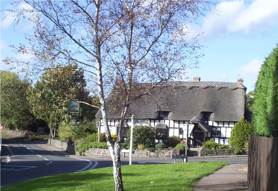
Anstey is a civil parish located in the county of Leicestershire, England. Situated approximately six miles northwest of the city of Leicester, Anstey is a vibrant and historic village with a population of around 6,000 people.

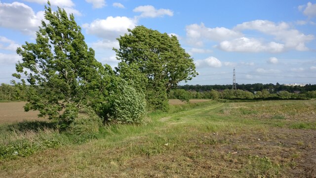
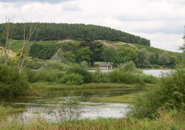
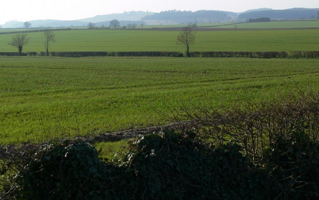
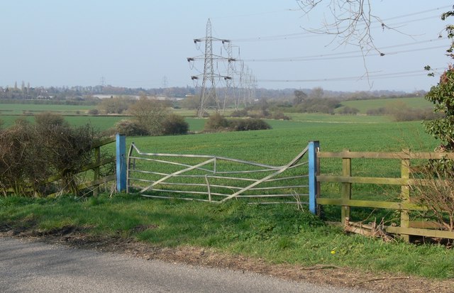
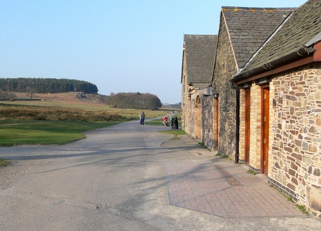
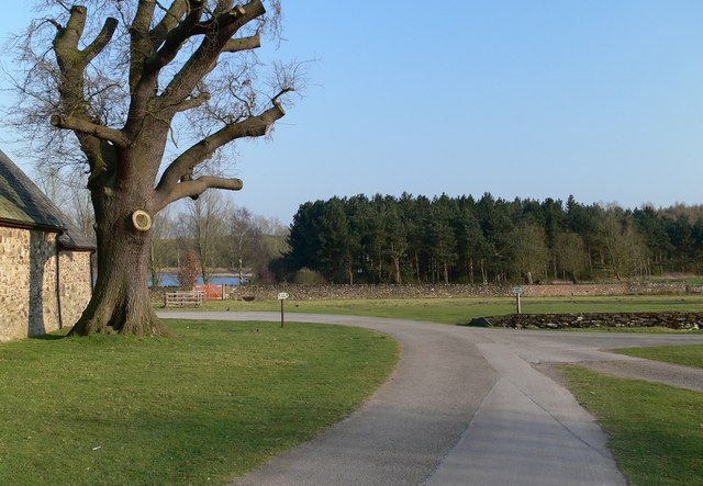
The village is well-known for its picturesque surroundings, nestled in the heart of the Charnwood Forest. This location offers residents and visitors alike beautiful countryside views and a tranquil atmosphere. Anstey is surrounded by rolling hills, lush green fields, and ancient woodlands, making it an ideal destination for nature lovers and outdoor enthusiasts.

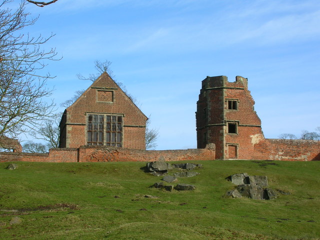
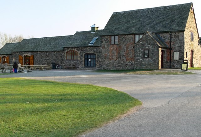
Anstey has a rich history dating back centuries. It was mentioned in the Domesday Book of 1086, highlighting its historical significance. The village has several notable historic buildings, including the 14th-century St. Mary's Church and the Old Hall, a magnificent timber-framed house dating back to the 16th century.

The village boasts a range of amenities and facilities, including shops, cafes, pubs, and restaurants, providing residents with all the necessary amenities for daily living. It also has a primary school, a community center, and various sports clubs, ensuring a vibrant community spirit.

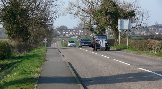
Anstey benefits from good transport links, with easy access to major roads such as the A46 and A50, connecting it to Leicester and nearby towns. The village also has regular bus services, offering convenient transportation options.

Overall, Anstey is a charming and historic village with a strong sense of community, beautiful natural surroundings, and a rich cultural heritage.

If you have any feedback on the listing, please let us know in the comments section below.

Anstey Images

Images are sourced within 2km of 52.673621/-1.192237 or Grid Reference SK5408. Thanks to Geograph Open Source API. All images are credited.

Farmland along Groby Road, Anstey
Boathouse and Cropston Reservoir The paths in Bradgate park lead round this reservoir.
Boathouse and Cropston Reservoir
The paths in Bradgate park lead round this reservoir.
Cropston House Farm This farm is on the southern edge of the village
Cropston House Farm
This farm is on the southern edge of the village
The Chapel at Bradgate House Bradgate House, now a ruin, was the birthplace of the ill-fated Lady Jane Grey, Queen of England for just nine days in 1553.
The Chapel at Bradgate House
Bradgate House, now a ruin, was the birthplace of the ill-fated Lady Jane Grey, Queen of England for just nine days in 1553.
Cropston Road looking north towards Cropston in the distance.
Photo taken from Cropston Road looking west across farmland towards Bradgate Park.
Electricity pylons crossing farmland between Cropston and Thurcaston.
Bradgate Country Park visitor centre and Deer Barn Teas Room.
Bradgate Country Park. Cropston Reservoir is visible in the background.
Bradgate Country Park.
Cropston Reservoir is visible in the background.
Bradgate House ruins
Bradgate House ruins The large building on the left is the Chapel.
Bradgate House ruins
The large building on the left is the Chapel.
Bradgate House ruins
Bradgate House ruins. Leicester city is visible on the horizon.
Bradgate House ruins.
Leicester city is visible on the horizon.
Bradgate House ruins
Queen Adelaide's Oak, Bradgate Reputedly the site of a July picnic with the Queen Dowager, the widow of William IV.
Queen Adelaide's Oak, Bradgate
Reputedly the site of a July picnic with the Queen Dowager, the widow of William IV.
Show me another place!

Anstey is located at Grid Ref: SK5408 (Lat: 52.673621, Lng: -1.192237)

Administrative County: Leicestershire

District: Charnwood

Police Authority: Leicestershire

What 3 Words

///task.brings.broad. Near Anstey, Leicestershire

Nearby Locations

Anstey

Related Wikis

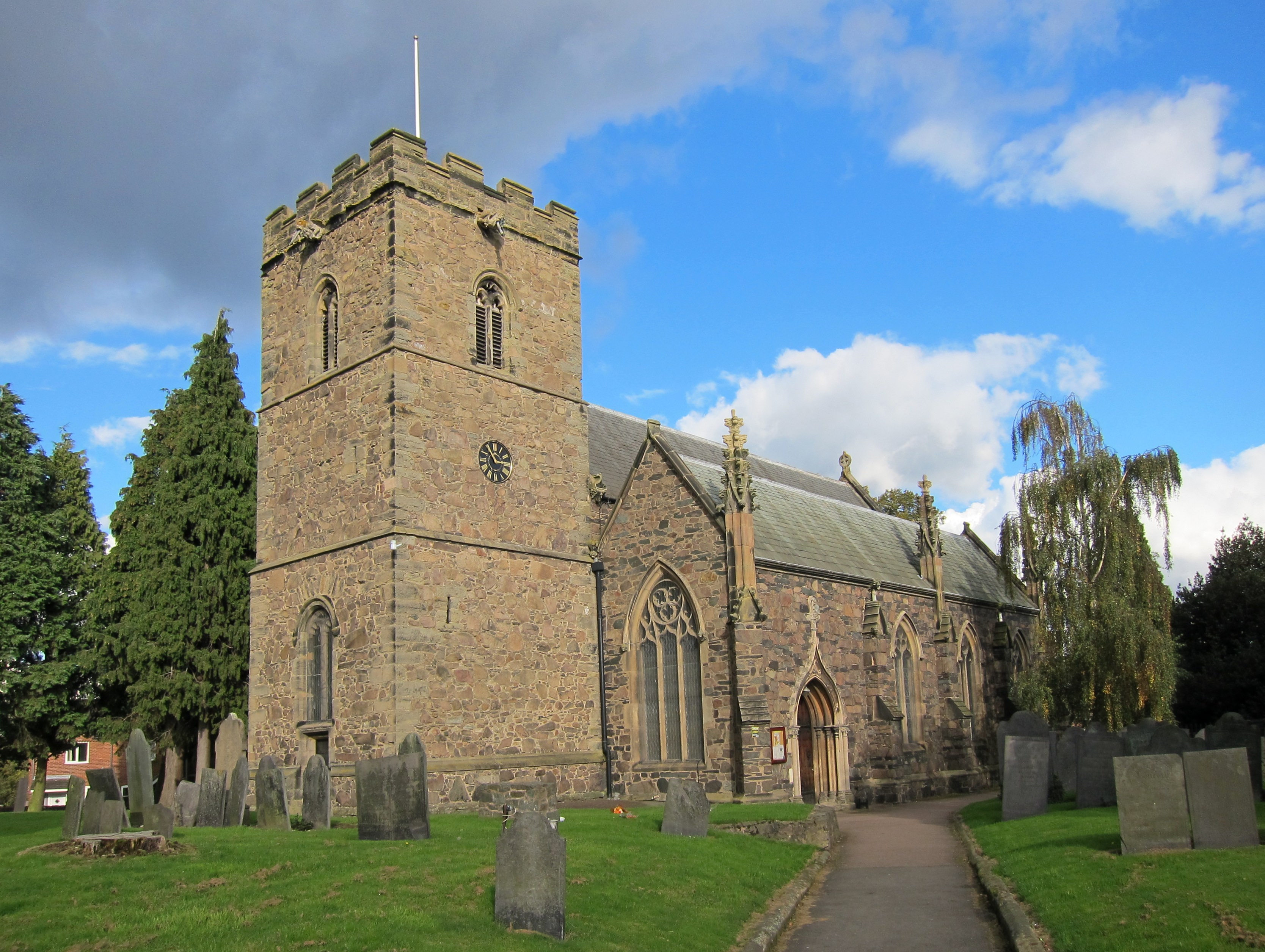
St Mary's Church, Anstey

St Mary's Church is the Church of England parish church in Anstey, Leicestershire, in the Diocese of Leicester. == The church == The church is situated...

Anstey, Leicestershire

Anstey is a large village in Leicestershire, England, located north west of Leicester in the borough of Charnwood. Its population was 6,528 at the 2011...

The Martin High School, Anstey

The Martin High School is a coeducational secondary school with academy status, located in the village of Anstey, Leicestershire, on the outskirts of Leicester...

Anstey Nomads F.C.

Anstey Nomads Football Club is a football club based in Anstey, Leicestershire, England. They are currently members of the Northern Premier League Division...

Beaumont Shopping Centre

Beaumont Shopping Centre is in Beaumont Leys, on the edge of Leicester. The 301,099 sq ft (27,973.0 m2) shopping centre is owned by British Land and managed...

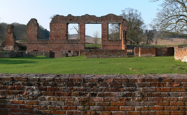
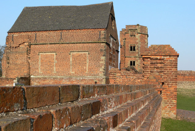
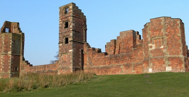
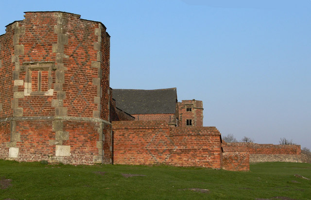
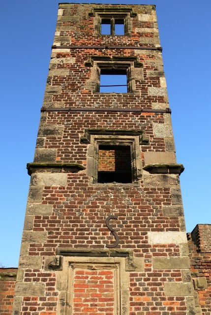
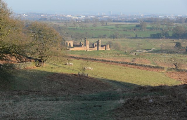
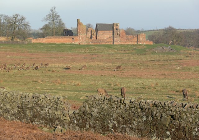
Bradgate House, Bradgate Park

Bradgate House is a 16th-century ruin in Bradgate Park, Leicestershire, England. Edward Grey's son Sir John Grey of Groby married Elizabeth Woodville,...

Leicestershire

Leicestershire ( LEST-ər-sheer, -⁠shər) is a ceremonial county in the East Midlands of England. It is bordered by Derbyshire, Nottinghamshire, and Lincolnshire...

Cropston

Cropston is a village and former civil parish, now in the parish of Thurcaston and Cropston, part of the Borough of Charnwood in Leicestershire, England...

Related Videos

22 October 2023

Sunday walk in Bradgate Park Leicestershire and Sunday Lunch.

Bradgate Park Leicester 2021 (Sen Fi Dem Travel)

Bradgate Park is a huge park that offers some great scenary with some great photo opportunitys. the lower part of the Park is ...

The Best Park In Leicestershire

Bradgate Park Nestled in the heart of Leicestershire, this picturesque haven is a nature lover's paradise. With its sprawling ...

Nearby Amenities

Located within 500m of 52.673621,-1.192237
Anstey
Is In County: Leicestershire
Is In District: Charnwood
Place: village
Lat/Long: 52.6745715/-1.1893416
Pub
Old Hare and Hounds
Lat/Long: 52.6716271/-1.1885524
Pub
Coach and Horses
Created By: Potlatch 0.5d
Lat/Long: 52.6725651/-1.1865548
Place Of Worship
Anstey United Reformed Church
Denomination: united_reformed
Religion: christian
Lat/Long: 52.671617/-1.1905791
Barrier: bollard
Lat/Long: 52.6757186/-1.1980712
Bus Stop
The Nook
Alt Name: Anstey - Cropston Road
Bus: yes
Naptan AltCommonName: Anstey - Cropston Road
Naptan AtcoCode: 260006003
Naptan Bearing: NE
Naptan CommonName: The Nook
Naptan Indicator: next
Naptan Landmark: The Nook
Naptan NaptanCode: leiajgag
Naptan Notes: Hourly - County
Naptan PlusbusZoneRef: LESTER
Naptan Street: Cropston Road
Naptan Verified: no
Public Transport: platform
Source: naptan_import
Lat/Long: 52.6729832/-1.1862407
Bus Stop
Dalby Road
Bus: yes
Naptan AtcoCode: 260006012
Naptan Bearing: W
Naptan CommonName: Dalby Road
Naptan Indicator: adjacent
Naptan Landmark: Dalby Road
Naptan NaptanCode: leiajgap
Naptan Notes: Hourly - County
Naptan PlusbusZoneRef: LESTER
Naptan Street: Link Road
Naptan Verified: no
Public Transport: platform
Source: naptan_import
Lat/Long: 52.6776557/-1.192148
Bus Stop
Dalby Road
Bus: yes
Naptan AtcoCode: 260006013
Naptan Bearing: SW
Naptan CommonName: Dalby Road
Naptan Indicator: opposite
Naptan Landmark: Dalby Road
Naptan NaptanCode: leiadmjp
Naptan Notes: Hourly - County
Naptan PlusbusZoneRef: LESTER
Naptan Street: Link Road
Naptan Verified: no
Public Transport: platform
Source: naptan_import
Lat/Long: 52.6767146/-1.1942028
Bus Stop
Hazelhead Road
Bus: yes
Naptan AtcoCode: 260006014
Naptan Bearing: S
Naptan CommonName: Hazelhead Road
Naptan Indicator: adjacent
Naptan Landmark: Hazelhead Road
Naptan NaptanCode: leiajdgw
Naptan Notes: Hourly - County
Naptan Street: Link Road
Naptan Verified: no
Public Transport: platform
Source: naptan_import
Lat/Long: 52.6745437/-1.1962247
Bus Stop
The Nook
Alt Name: Anstey - Leicester Road
Bench: yes
Bin: yes
Bus: yes
Departures Board: realtime
Naptan AltCommonName: Anstey - Leicester Road
Naptan AtcoCode: 260006018
Naptan Bearing: SE
Naptan CommonName: The Nook
Naptan Indicator: outside
Naptan Landmark: The Nook
Naptan NaptanCode: leiadmpd
Naptan Notes: Hourly - County
Naptan PlusbusZoneRef: LESTER
Naptan Street: Leicester Road
Naptan Verified: no
Passenger Information Display: realtime
Public Transport: platform
Shelter: yes
Source: naptan_import
Lat/Long: 52.6722538/-1.186062
Bus Stop
Forest Gate
Bus: yes
Naptan AtcoCode: 260006024
Naptan Bearing: NW
Naptan CommonName: Forest Gate
Naptan Indicator: before
Naptan Landmark: Forest Gate
Naptan NaptanCode: leidtpam
Naptan Notes: Non-Hourly - County
Naptan PlusbusZoneRef: LESTER
Naptan Street: Bradgate Road
Naptan Verified: no
Public Transport: platform
Source: naptan_import
Lat/Long: 52.6727364/-1.1948676
Bus Stop
Bradgate Road
Bus: yes
Naptan AtcoCode: 260006025
Naptan Bearing: NW
Naptan CommonName: Bradgate Road
Naptan Indicator: opposite
Naptan Landmark: 187 & bridlepath
Naptan NaptanCode: leidtpap
Naptan Notes: Non-Hourly - County
Naptan Street: Bradgate Road
Naptan Verified: no
Public Transport: platform
Source: naptan_import
Lat/Long: 52.6747587/-1.1986576
Bus Stop
Bradgate Road
Bus: yes
Naptan AtcoCode: 260006028
Naptan Bearing: SE
Naptan CommonName: Bradgate Road
Naptan Indicator: outside
Naptan Landmark: 203 Bradgate Road
Naptan NaptanCode: leidtpda
Naptan Notes: Non-Hourly - County
Naptan Street: Bradgate Road
Naptan Verified: no
Public Transport: platform
Source: naptan_import
Lat/Long: 52.6749587/-1.1991012
Bus Stop
Forest Gate
Bus: yes
Naptan AtcoCode: 260006029
Naptan Bearing: SE
Naptan CommonName: Forest Gate
Naptan Indicator: after
Naptan Landmark: Forest Gate
Naptan NaptanCode: leiajgtm
Naptan Notes: Hourly - County
Naptan PlusbusZoneRef: LESTER
Naptan Street: Bradgate Road
Naptan Verified: no
Public Transport: platform
Source: naptan_import
Lat/Long: 52.6731312/-1.1952525
Bus Stop
The Nook
Bus: yes
Naptan AtcoCode: 260006030
Naptan Bearing: W
Naptan CommonName: Highfield Street
Naptan Indicator: opp
Naptan Landmark: The Nook
Naptan NaptanCode: leidtpdg
Naptan Notes: Non-Hourly - County
Naptan PlusbusZoneRef: LESTER
Naptan Street: The Nook
Naptan Verified: no
Public Transport: platform
Source: naptan_import
Lat/Long: 52.6728955/-1.1873032
Bus Stop
Conservative Club
Bus: yes
Naptan AtcoCode: 260006031
Naptan Bearing: NW
Naptan CommonName: Conservative Club
Naptan Indicator: outside
Naptan Landmark: 52 & opp Conservative Club
Naptan NaptanCode: leidtpdj
Naptan Notes: Non-Hourly - County
Naptan PlusbusZoneRef: LESTER
Naptan Street: Stadon Road
Naptan Verified: no
Public Transport: platform
Source: naptan_import
Lat/Long: 52.6733703/-1.18894
Bus Stop
Ellis Street
Bus: yes
Naptan AtcoCode: 260006033
Naptan Bearing: SW
Naptan CommonName: Ellis Street
Naptan Indicator: opp
Naptan Landmark: Ellis Street
Naptan NaptanCode: leidtpdp
Naptan Notes: Non-Hourly - County
Naptan PlusbusZoneRef: LESTER
Naptan Street: Hollow Road
Naptan Verified: no
Public Transport: platform
Source: naptan_import
Lat/Long: 52.6739462/-1.192967
Bus Stop
Hollow Road
Bus: yes
Naptan AtcoCode: 260006034
Naptan Bearing: NE
Naptan CommonName: Ulverscroft Books
Naptan Indicator: corner
Naptan Landmark: Bradgate Road
Naptan NaptanCode: leiadmjw
Naptan Notes: Hourly - County
Naptan PlusbusZoneRef: LESTER
Naptan Street: Hollow Road
Naptan Verified: no
Public Transport: platform
Source: bing;naptan;bing;naptan_compare_tool
Lat/Long: 52.6728853/-1.1942881
Bus Stop
Ellis Street
Alt Name: Anstey - Settex House
Bus: yes
Naptan AltCommonName: Anstey - Settex House
Naptan AtcoCode: 260006035
Naptan Bearing: NE
Naptan CommonName: Ellis Street
Naptan Indicator: adj
Naptan Landmark: Ellis Street
Naptan NaptanCode: leiajgma
Naptan Notes: Hourly - County
Naptan PlusbusZoneRef: LESTER
Naptan Street: Hollow Road
Naptan Verified: no
Public Transport: platform
Source: naptan_import
Lat/Long: 52.674546/-1.192601
Bus Stop
Highfield Street
Bus: yes
Naptan AtcoCode: 260006038
Naptan Bearing: E
Naptan CommonName: Highfield Street
Naptan Indicator: adj
Naptan Landmark: 25 Stadon Road
Naptan NaptanCode: leimjgjm
Naptan Notes: Hourly - County
Naptan PlusbusZoneRef: LESTER
Naptan Street: Stadon Road
Naptan Verified: no
Public Transport: platform
Source: naptan_import
Lat/Long: 52.6731424/-1.1880027
Turning Circle
Lat/Long: 52.6708669/-1.1879031
Noexit: yes
Lat/Long: 52.6711678/-1.1879771
Turning Circle
Lat/Long: 52.6738791/-1.1864617
Post Office
Anstey Post Office
Addr Postcode: LE7 7AB
Branch: Anstey
Brand: Post Office
Brand Wikidata: Q1783168
Check Date: 2020-02-20
Ref Pol Id: 2941
Lat/Long: 52.6722891/-1.1878859
Bench
Lat/Long: 52.6738327/-1.1915555
Atm
Lat/Long: 52.6731595/-1.1853235
Bank
Nationwide
Addr Country: GB
Atm: yes
Brand: Nationwide
Brand Wikidata: Q846735
Brand Wikipedia: en:Nationwide Building Society
Contact Website: https://locations.nationwidebranches.co.uk/leicester/29-the-nook
Disused Amenity: yes
Lat/Long: 52.6729134/-1.1868086
Traffic Calming: table
Lat/Long: 52.6757086/-1.1983982
Power: substation
Substation: minor_distribution
Lat/Long: 52.675491/-1.1982986
Bus Stop
Bradgate Road
Addr Street: Bradgate Road
Bench: yes
Bin: yes
Bus: yes
Naptan AtcoCode: 260007358
Naptan Bearing: E
Naptan CommonName: Groby Road
Naptan Indicator: opp
Naptan NaptanCode: leiagpjt
Naptan Street: BRADGATE ROAD
Public Transport: platform
Shelter: no
Source: naptan;bing;naptan_compare_tool
Lat/Long: 52.6720208/-1.192548
Bus Stop
Hollow Road
Addr Street: Hollow Road
Bus: yes
Naptan AtcoCode: 260009008
Naptan Bearing: SW
Naptan CommonName: Ulverscroft Books
Naptan Indicator: adj
Naptan NaptanCode: leidwpdp
Naptan PlusbusZoneRef: LESTER
Naptan Street: Hollow Road
Naptan Verified: no
Public Transport: platform
Source: bing;naptan;bing;naptan_compare_tool
Lat/Long: 52.6727281/-1.1942531
Pharmacy
Well Pharmacy
Brand: Well Pharmacy
Brand Wikidata: Q7726524
Brand Wikipedia: en:Well Pharmacy
Healthcare: pharmacy
Website: https://finder.well.co.uk/store/anstey-bradgate-road
Lat/Long: 52.672575/-1.1873853
Londis
Brand: Londis
Brand Wikidata: Q21008564
Brand Wikipedia: en:Londis (United Kingdom)
Shop: convenience
Lat/Long: 52.6729764/-1.1869416
OptiCare
Shop: optician
Lat/Long: 52.6723854/-1.1872843
Birds
Brand: Birds
Brand Wikidata: Q63001935
Brand Wikipedia: en:Birds Bakery
Official Name: Birds Bakery
Shop: bakery
Lat/Long: 52.6723642/-1.1871985
Roots & Fruits
Shop: greengrocer
Lat/Long: 52.6723463/-1.1871153
Cafe
Nook Corner Coffee Shop
Lat/Long: 52.6728688/-1.1866747
Crossing
Crossing: zebra
Lat/Long: 52.6709276/-1.1955935
Memorial Garden Cenotaph
Historic: memorial
Inscription: IN HONOURED MEMORY OF THE MEN OF ANSTEY WHO GAVE THEIR LIVES FOR KING & COUNTRY IN THE GREAT WAR 1914 - 1919. [NAMES] ALSO OF THOSE WHO DIED IN THE WORLD WAR 1939 - 1945 [NAMES]
Memorial: war_memorial
Lat/Long: 52.6739759/-1.1912597
Bus Stop
Bus: yes
Naptan AtcoCode: 260006032
Naptan NaptanCode: leidtpdm
Public Transport: platform
Lat/Long: 52.673963/-1.1908866
Turning Circle
Lat/Long: 52.671052/-1.1875427
Restaurant
Vojon
Addr City: Anstey
Addr Housenumber: 7
Addr Postcode: LE7 7AY
Addr Street: Stadon Road
Cuisine: indian
Delivery: no
Source: https://take-a-way.co.uk/browse-restaurants/City-Anstey/
Takeaway: yes
Website: https://take-a-way.co.uk/menu/8505/Vojon%20-%20Anstey/
Lat/Long: 52.6730538/-1.1875596
QD Stores
Shop: variety_store
Lat/Long: 52.6729518/-1.1858614
Man Made: water_well
Lat/Long: 52.6731312/-1.1959817
Generator Method: photovoltaic
Generator Output Electricity: yes
Generator Source: solar
Generator Type: solar_photovoltaic_panel
Location: roof
Power: generator
Lat/Long: 52.6751063/-1.1916518
Generator Method: photovoltaic
Generator Output Electricity: yes
Generator Source: solar
Generator Type: solar_photovoltaic_panel
Location: roof
Power: generator
Lat/Long: 52.6709516/-1.1937252
Generator Method: photovoltaic
Generator Output Electricity: yes
Generator Source: solar
Generator Type: solar_photovoltaic_panel
Location: roof
Power: generator
Lat/Long: 52.6748501/-1.1956456
Generator Method: photovoltaic
Generator Output Electricity: yes
Generator Source: solar
Generator Type: solar_photovoltaic_panel
Location: roof
Power: generator
Lat/Long: 52.6738662/-1.1886182
Generator Method: photovoltaic
Generator Output Electricity: yes
Generator Source: solar
Generator Type: solar_photovoltaic_panel
Location: roof
Power: generator
Lat/Long: 52.6766943/-1.1964047
Generator Method: photovoltaic
Generator Output Electricity: yes
Generator Source: solar
Generator Type: solar_photovoltaic_panel
Location: roof
Power: generator
Lat/Long: 52.6759397/-1.1909625
Generator Method: photovoltaic
Generator Output Electricity: yes
Generator Source: solar
Generator Type: solar_photovoltaic_panel
Location: roof
Power: generator
Lat/Long: 52.6747509/-1.1910899
Generator Method: photovoltaic
Generator Output Electricity: yes
Generator Source: solar
Generator Type: solar_photovoltaic_panel
Location: roof
Power: generator
Lat/Long: 52.6705418/-1.1905843
Generator Method: photovoltaic
Generator Output Electricity: yes
Generator Source: solar
Generator Type: solar_photovoltaic_panel
Location: roof
Power: generator
Lat/Long: 52.6752632/-1.1943045
Generator Method: photovoltaic
Generator Output Electricity: yes
Generator Source: solar
Generator Type: solar_photovoltaic_panel
Location: roof
Power: generator
Lat/Long: 52.6739426/-1.1886317
Generator Method: photovoltaic
Generator Output Electricity: yes
Generator Source: solar
Generator Type: solar_photovoltaic_panel
Location: roof
Power: generator
Lat/Long: 52.6766813/-1.1963135
Generator Method: photovoltaic
Generator Output Electricity: yes
Generator Source: solar
Generator Type: solar_photovoltaic_panel
Location: roof
Power: generator
Lat/Long: 52.6749184/-1.1900854
Generator Method: photovoltaic
Generator Output Electricity: yes
Generator Source: solar
Generator Type: solar_photovoltaic_panel
Location: roof
Power: generator
Lat/Long: 52.6739995/-1.1906648
Generator Method: photovoltaic
Generator Output Electricity: yes
Generator Source: solar
Generator Type: solar_photovoltaic_panel
Location: roof
Power: generator
Lat/Long: 52.6738743/-1.1973757
Generator Method: photovoltaic
Generator Output Electricity: yes
Generator Source: solar
Generator Type: solar_photovoltaic_panel
Location: roof
Power: generator
Lat/Long: 52.6764244/-1.1949536
Generator Method: photovoltaic
Generator Output Electricity: yes
Generator Source: solar
Generator Type: solar_photovoltaic_panel
Location: roof
Power: generator
Lat/Long: 52.6769838/-1.191971
Generator Method: photovoltaic
Generator Output Electricity: yes
Generator Source: solar
Generator Type: solar_photovoltaic_panel
Location: roof
Power: generator
Lat/Long: 52.6717258/-1.1956832
Generator Method: photovoltaic
Generator Output Electricity: yes
Generator Source: solar
Generator Type: solar_photovoltaic_panel
Location: roof
Power: generator
Lat/Long: 52.6763626/-1.1967132
Generator Method: photovoltaic
Generator Output Electricity: yes
Generator Source: solar
Generator Type: solar_photovoltaic_panel
Location: roof
Power: generator
Lat/Long: 52.6744143/-1.1894578
Generator Method: photovoltaic
Generator Output Electricity: yes
Generator Source: solar
Generator Type: solar_photovoltaic_panel
Location: roof
Power: generator
Lat/Long: 52.6739451/-1.1905548
Generator Method: photovoltaic
Generator Output Electricity: yes
Generator Source: solar
Generator Type: solar_photovoltaic_panel
Location: roof
Power: generator
Lat/Long: 52.6747639/-1.1978155
Generator Method: photovoltaic
Generator Output Electricity: yes
Generator Source: solar
Generator Type: solar_photovoltaic_panel
Location: roof
Power: generator
Lat/Long: 52.6761479/-1.1913729
Generator Method: photovoltaic
Generator Output Electricity: yes
Generator Source: solar
Generator Type: solar_photovoltaic_panel
Location: roof
Power: generator
Lat/Long: 52.6752266/-1.1915794
Generator Method: photovoltaic
Generator Output Electricity: yes
Generator Source: solar
Generator Type: solar_photovoltaic_panel
Location: roof
Power: generator
Lat/Long: 52.6710476/-1.1939773
Generator Method: photovoltaic
Generator Output Electricity: yes
Generator Source: solar
Generator Type: solar_photovoltaic_panel
Location: roof
Power: generator
Lat/Long: 52.6749038/-1.195769
Generator Method: photovoltaic
Generator Output Electricity: yes
Generator Source: solar
Generator Type: solar_photovoltaic_panel
Location: roof
Power: generator
Lat/Long: 52.6745232/-1.1921749
Generator Method: photovoltaic
Generator Output Electricity: yes
Generator Source: solar
Generator Type: solar_photovoltaic_panel
Location: roof
Power: generator
Lat/Long: 52.6753559/-1.1976278
Generator Method: photovoltaic
Generator Output Electricity: yes
Generator Source: solar
Generator Type: solar_photovoltaic_panel
Location: roof
Power: generator
Lat/Long: 52.6760438/-1.1911932
Atm
Lat/Long: 52.676154/-1.1924095
Family Choice Superstore
Shop: convenience
Lat/Long: 52.6748537/-1.1872974
Fast Food
Cuisine: fish_and_chips
Lat/Long: 52.6730163/-1.1870593
LOROS
Shop: charity
Lat/Long: 52.6730346/-1.1871217
Crossing
Crossing: traffic_signals
Kerb: lowered
Tactile Paving: yes
Lat/Long: 52.6724968/-1.1868877
Traffic Signals
Traffic Signals: signal
Lat/Long: 52.6725883/-1.1869738
Traffic Signals
Traffic Signals: signal
Lat/Long: 52.6725668/-1.1869027
Potters
Shop: flooring
Lat/Long: 52.6722106/-1.1855891
Bus Stop
Paper Mill Close
Bus: yes
Naptan AtcoCode: 260006036
Naptan Bearing: SE
Naptan CommonName: Paper Mill Close
Naptan Indicator: opp
Naptan NaptanCode: leiajtpw
Naptan PlusbusZoneRef: LESTER
Naptan Street: Stadon Road
Naptan Verified: no
Public Transport: platform
Lat/Long: 52.6736314/-1.189687
The data included in this document is from www.openstreetmap.org. The data is made available under ODbL.

Have you been to Anstey?

Leave your review of Anstey below (or comments, questions and feedback).