All Saints

Civil Parish in Dorset East Devon

England

All Saints

All Saints Road, Smallridge A village of houses and cottages to the north of Axminster.
All Saints Road, Smallridge Credit: Jonathan Billinger

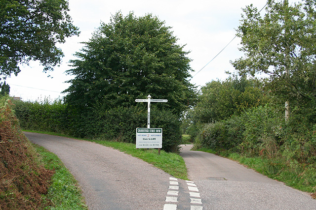
All Saints is a civil parish located in Dorset, a county in South West England. The parish is situated in the district of West Dorset and covers an area of approximately 11 square kilometers. It is home to a small population of around 150 people.

The parish is predominantly rural and is characterized by its picturesque countryside, rolling hills, and charming villages. It is surrounded by stunning natural landscapes, including the Marshwood Vale and the Dorset Area of Outstanding Natural Beauty. The parish is also close to the Jurassic Coast, a UNESCO World Heritage Site known for its fossil-rich cliffs and beautiful beaches.

All Saints itself is a small village within the parish, with a handful of residential properties and a historic church. The village has a close-knit community and a peaceful atmosphere. It offers a tranquil escape from the hustle and bustle of larger towns and cities.

The area is popular with outdoor enthusiasts due to its proximity to the countryside and coast. There are numerous walking and cycling routes, as well as opportunities for horse riding and birdwatching. The nearby market town of Bridport provides amenities and services for residents, including shops, schools, and healthcare facilities.

Overall, All Saints, Dorset is a charming and idyllic parish, offering a rural lifestyle and natural beauty for its residents and visitors to enjoy.

If you have any feedback on the listing, please let us know in the comments section below.

All Saints Images

Images are sourced within 2km of 50.809286/-2.985013 or Grid Reference ST3001. Thanks to Geograph Open Source API. All images are credited.

All Saints Road, Smallridge A village of houses and cottages to the north of Axminster.
All Saints Road, Smallridge
A village of houses and cottages to the north of Axminster.
Unnamed stream, Smallridge A lovely September afternoon to be on the footbridge here.
Unnamed stream, Smallridge
A lovely September afternoon to be on the footbridge here.
Converted Chapel, Smallridge Designed to resemble Noah's Ark, a very early Methodist Chapel dating to 1796 which was closed in 2002 and is now a comfortable holiday let.
Converted Chapel, Smallridge
Designed to resemble Noah's Ark, a very early Methodist Chapel dating to 1796 which was closed in 2002 and is now a comfortable holiday let.
Houses in Smallridge
Churchill Farm
Churchill Farm
Houses in Goldsmiths Lane
A large grass field, Axe Farm, near Wadbrook
Weir above Weycroft Mill
Axe Farm from the level crossing
Old iron bridge over the R. Axe at Wadbrook
Chardstock: Churchill Farm Seen from the public footpath at Churchill Lane; the field is accessed up a steep flight of steps from the lane
Chardstock: Churchill Farm
Seen from the public footpath at Churchill Lane; the field is accessed up a steep flight of steps from the lane
Chardstock: Birchill Cross Also known as The Triangle. Looking north
Chardstock: Birchill Cross
Also known as The Triangle. Looking north
River Axe at Weycroft Looking upstream from Weycroft Bridge on the Fosse Way. The cottage backs on to the mill stream which supplied the adjacent mills.
River Axe at Weycroft
Looking upstream from Weycroft Bridge on the Fosse Way. The cottage backs on to the mill stream which supplied the adjacent mills.
Power lines Parallel with Greatwood Lane, west of Weycroft.
Power lines
Parallel with Greatwood Lane, west of Weycroft.
Back gardens of Smallridge
Looking across the Axe valley A view from a bend on Lodge Lane, looking obliquely up the Axe valley. The field is crossed to the left by Axminster Footpath 4. The trees framing the view are alongside the drive to Bagley Hill Farm.
Looking across the Axe valley
A view from a bend on Lodge Lane, looking obliquely up the Axe valley. The field is crossed to the left by Axminster Footpath 4. The trees framing the view are alongside the drive to Bagley Hill Farm.
Field near Waggs Plot The A358 is behind the trees on the right, and the freshly-cut field is seen from a gateway close to where the lane called Waggs Plot joins the main road.
Field near Waggs Plot
The A358 is behind the trees on the right, and the freshly-cut field is seen from a gateway close to where the lane called Waggs Plot joins the main road.
Fordwater Farm An L-shaped farmhouse, seen from All Saints Footpath 49 as it crosses a meadow beside the River Kit.
Fordwater Farm
An L-shaped farmhouse, seen from All Saints Footpath 49 as it crosses a meadow beside the River Kit.
Show me another place!

All Saints is located at Grid Ref: ST3001 (Lat: 50.809286, Lng: -2.985013)

Administrative County: Devon

District: East Devon

Police Authority: Devon & Cornwall

What 3 Words

///oaks.pavilions.hamster. Near Axminster, Devon

Related Wikis

All Saints, Devon

All Saints is a civil parish in East Devon, Devon, England. It has a population of 498 according to the 2001 census. The parish includes the hamlets...

Alston, East Devon

Alston is a hamlet in Devon, England. == References ==

Smallridge

Smallridge is a large hamlet in All Saints parish in the East Devon district of Devon, England. The hamlet is situated about 1 mile north of the town of...

Blackwater River (River Axe)

The Blackwater River is a 10-kilometre (6.2 mi) long river in the counties of Dorset and Devon, in the south-west of England. It rises to the north of...

Axminster Town A.F.C.

Axminster Town Association Football Club is a football club based in Axminster, Devon, England. They are currently members of the South West Peninsula...

Tytherleigh

Tytherleigh is a village in the civil parish of Chardstock in Devon, England (historically in Dorset), close to the borders with Dorset and Somerset on...

Membury Castle

Membury Castle is an Iron Age hillfort situated above the village of Membury in Devon. The fort occupies a commanding hilltop position some 204 metres...

Axe Valley Academy

Axe Valley Academy, previously known as The Axe Valley Community College, is a coeducational secondary school and sixth form located in Axminster, Devon...

Nearby Amenities

Located within 500m of 50.809286,-2.985013
All Saints Cross
Junction: yes
Lat/Long: 50.806455/-2.9816879
All Saints
Place: hamlet
Lat/Long: 50.805436/-2.9875049
Source: OS
Lat/Long: 50.808723/-2.9813032
Entrance: yes
Lat/Long: 50.805216/-2.98731
Power: pole
Source: bing
Lat/Long: 50.8093263/-2.9911459
Power: pole
Source: bing
Lat/Long: 50.8082297/-2.9909366
Power: pole
Source: bing
Lat/Long: 50.8071382/-2.9907113
Power: pole
Source: bing
Lat/Long: 50.8071416/-2.9887024
Power: pole
Source: bing
Lat/Long: 50.8071365/-2.9874685
Power: pole
Source: bing
Lat/Long: 50.8071441/-2.9860751
Power: pole
Source: bing
Lat/Long: 50.8052008/-2.9824716
Power: pole
Source: bing
Lat/Long: 50.8058093/-2.9829356
Power: pole
Source: bing
Transformer: distribution
Lat/Long: 50.8066019/-2.985329
Power: pole
Source: bing
Lat/Long: 50.8071483/-2.9836035
Power: pole
Source: bing
Lat/Long: 50.8065517/-2.9834291
Power: pole
Source: bing
Lat/Long: 50.8071467/-2.9848829
Power: pole
Source: bing
Lat/Long: 50.8121177/-2.9796097
Power: pole
Source: bing
Transformer: distribution
Lat/Long: 50.8112653/-2.9814523
Power: pole
Source: bing
Lat/Long: 50.8118966/-2.9810554
Power: pole
Source: bing
Lat/Long: 50.8126991/-2.9809822
Power: pole
Source: bing
Lat/Long: 50.8125414/-2.9826057
Power: pole
Source: bing
Transformer: distribution
Lat/Long: 50.8123948/-2.9841158
Power: pole
Source: bing
Transformer: distribution
Lat/Long: 50.8077424/-2.9844028
Defibrillator
Access: yes
Defibrillator Location: outside All Saints Village Hall
Emergency: defibrillator
Indoor: no
Lat/Long: 50.8051902/-2.9872471
Advertising: board
Lat/Long: 50.8054052/-2.9872506
The data included in this document is from www.openstreetmap.org. The data is made available under ODbL.

Have you been to All Saints?

Leave your review of All Saints below (or comments, questions and feedback).