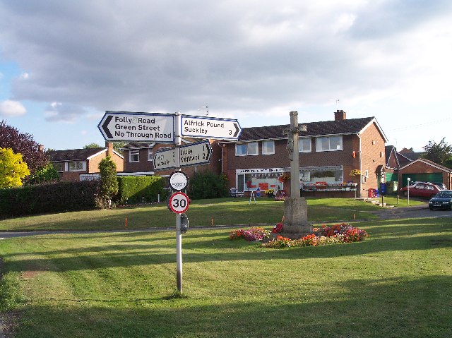
Alfrick

Civil Parish in Worcestershire Malvern Hills

England

Alfrick

The Beck Trig Point Flush Bracket S3827
The Beck Trig Point Flush Bracket S3827 Credit: thejackrustles

Alfrick is a civil parish located in Worcestershire, England. Situated in the Malvern Hills District, it is a small rural village with a population of around 600 residents. The parish covers an area of approximately 9 square kilometers.

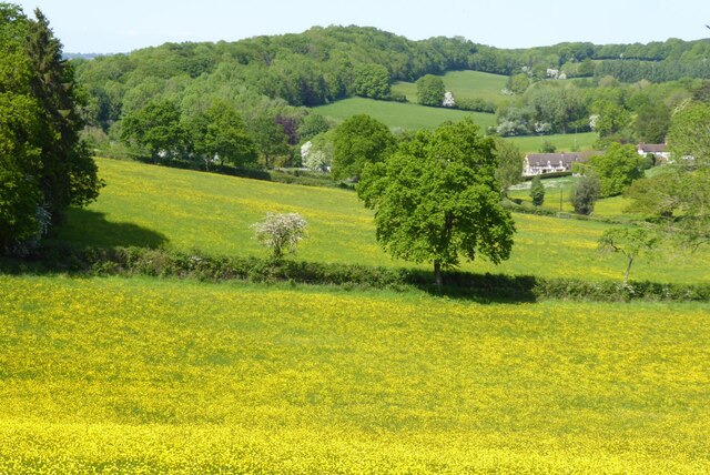
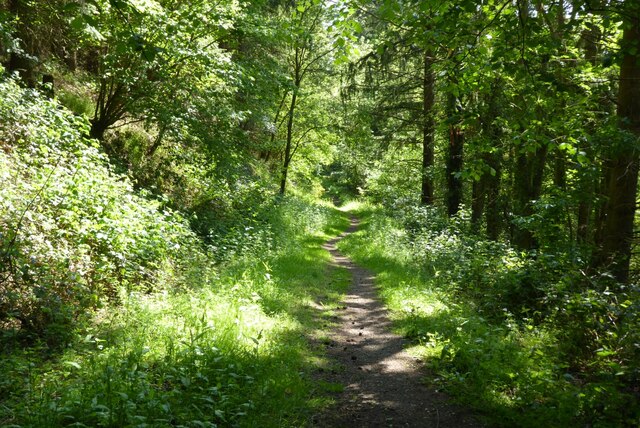
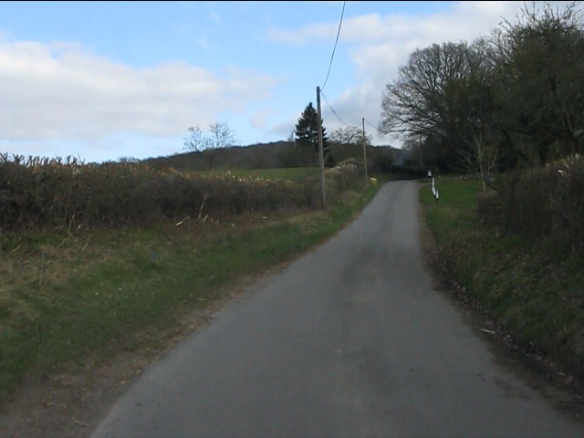
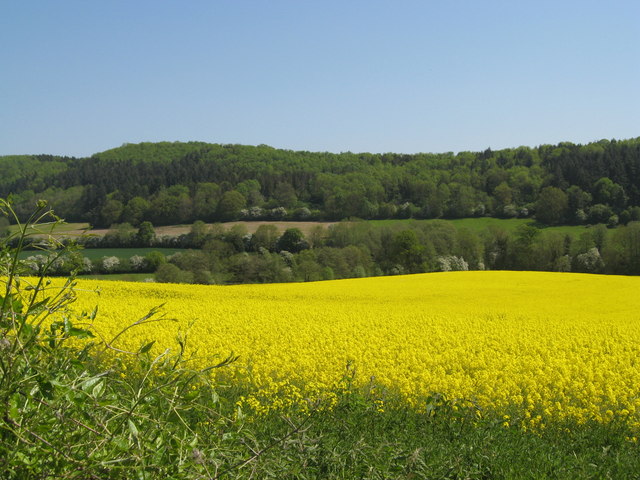
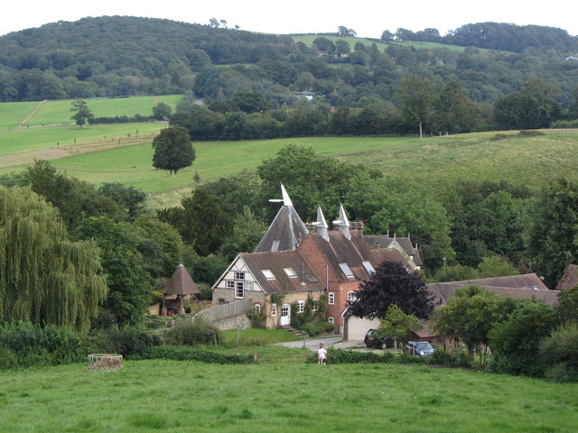
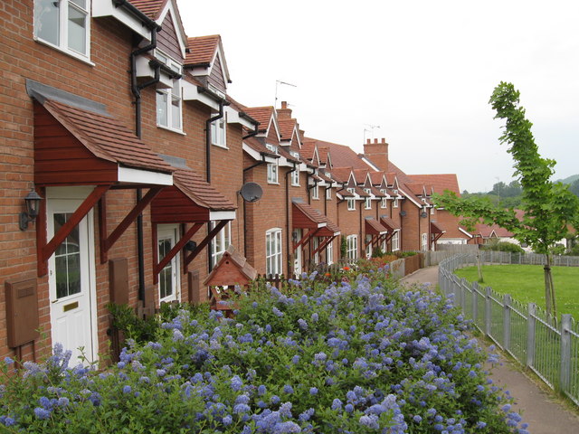
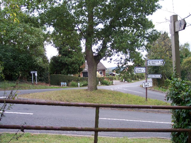
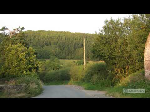
Alfrick is nestled in the beautiful countryside, surrounded by picturesque landscapes and rolling hills. The village is known for its peaceful and tranquil atmosphere, providing a perfect escape from the hustle and bustle of city life. It offers a serene environment, making it an ideal place for nature lovers and those seeking a slower pace of life.

The village has a rich history, dating back to medieval times. It is home to several historical landmarks, including St. Mary Magdalene Church, a Grade II listed building that dates back to the 12th century. The church features stunning architectural details and is a popular spot for visitors interested in history and architecture.

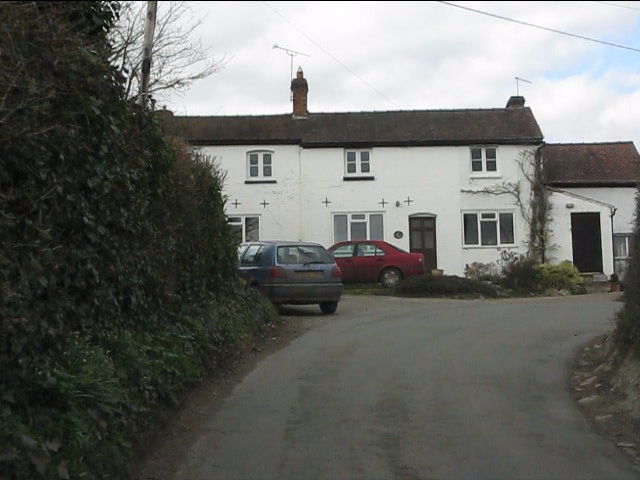
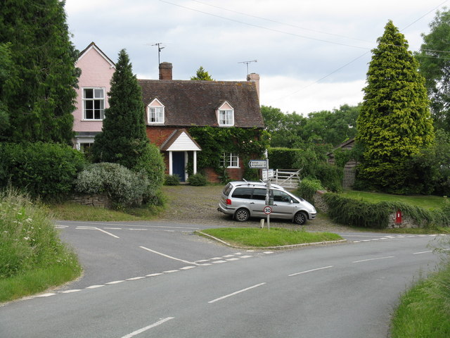
Alfrick has limited amenities, with a small number of shops and services available to cater to the local community. The village has a primary school, which serves the educational needs of the young residents. It also has a village hall and a community center, where various events and activities take place throughout the year, fostering a sense of community spirit.

Overall, Alfrick offers a charming and idyllic countryside setting, allowing residents to enjoy a peaceful lifestyle amidst the natural beauty of Worcestershire.

If you have any feedback on the listing, please let us know in the comments section below.
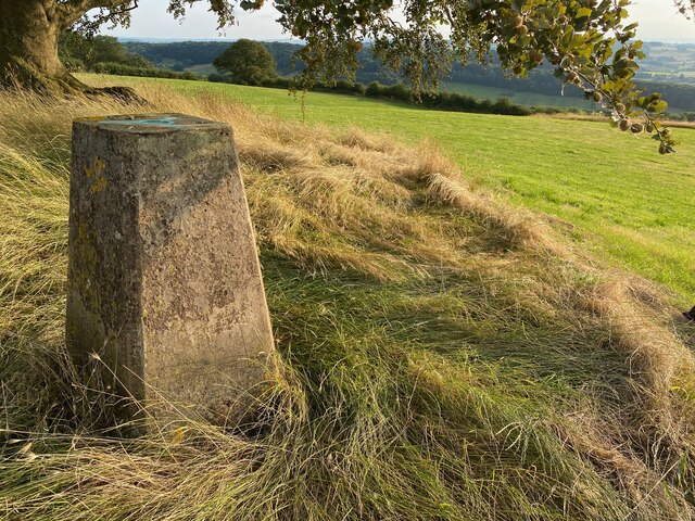
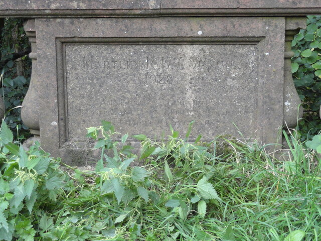
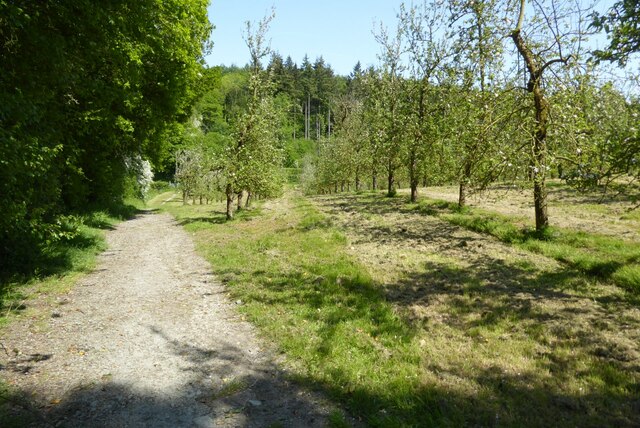
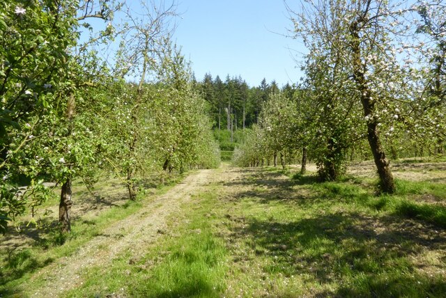
Alfrick Images

Images are sourced within 2km of 52.170374/-2.371908 or Grid Reference SO7452. Thanks to Geograph Open Source API. All images are credited.

The Beck Trig Point Flush Bracket S3827
Old Bridge Marker on Mousehole Bridge, Suckley parish Bridge Marker inscribed in a recess in the east parapet of Mousehole Bridge on Leigh Brook, southwest of Alfrick Pound. Suckley parish. Inscribed MARTLEY R D COUNCIL / 1928 (remainder illegible).

Milestone Society National ID: WO_SUCK01br
Old Bridge Marker on Mousehole Bridge, Suckley parish
Bridge Marker inscribed in a recess in the east parapet of Mousehole Bridge on Leigh Brook, southwest of Alfrick Pound. Suckley parish. Inscribed MARTLEY R D COUNCIL / 1928 (remainder illegible). Milestone Society National ID: WO_SUCK01br
Old Bridge Marker on Mousehole Bridge, Suckley parish Bridge Marker inscribed in a recess in the west parapet of Mousehole Bridge on Leigh Brook, southwest of Alfrick Pound. Suckley parish. Inscribed MOUSEHOLE BRIDGE (remainder illegible).

Milestone Society National ID: WO_SUCK02br
Old Bridge Marker on Mousehole Bridge, Suckley parish
Bridge Marker inscribed in a recess in the west parapet of Mousehole Bridge on Leigh Brook, southwest of Alfrick Pound. Suckley parish. Inscribed MOUSEHOLE BRIDGE (remainder illegible). Milestone Society National ID: WO_SUCK02br
The Worcestershire Way in the Suckley Hills The Worcestershire Way passing an apple orchard in blossom in the Suckley Hills.
The Worcestershire Way in the Suckley Hills
The Worcestershire Way passing an apple orchard in blossom in the Suckley Hills.
Apple blossom An orchard of apple trees in blossom in the Suckley Hills.
Apple blossom
An orchard of apple trees in blossom in the Suckley Hills.
A field of buttercups A field of buttercups viewed from the Worcestershire Way in the Suckley Hills.
A field of buttercups
A field of buttercups viewed from the Worcestershire Way in the Suckley Hills.
Buttercups in flower A profusion of buttercup flowers in a field in the Suckley Hills.
Buttercups in flower
A profusion of buttercup flowers in a field in the Suckley Hills.
Woodland path Woodland path in springtime in the Suckley Hills.
Woodland path
Woodland path in springtime in the Suckley Hills.
Overdue repairs on Stocks Road After a mere 2.5 years of waiting, repairs are being made to the slipped embankment on Stocks Road.  This is the first week's work.
Overdue repairs on Stocks Road
After a mere 2.5 years of waiting, repairs are being made to the slipped embankment on Stocks Road. This is the first week's work.
Byways - a former pub Once a small pub frequented by farmworkers, the building has for many years been a private dwelling.
Byways - a former pub
Once a small pub frequented by farmworkers, the building has for many years been a private dwelling.
Birchwood Lane near Byways
Looking north from near Byways Byways is a former pub on Birchwood Lane.  Lower Tundridge Farm's fields form much of the view.
Looking north from near Byways
Byways is a former pub on Birchwood Lane. Lower Tundridge Farm's fields form much of the view.
It's a pig's paradise Following on from Pigwig <a title="https://www.geograph.org.uk/photo/860570" href="https://www.geograph.org.uk/photo/860570">Link</a> a multitude of porkers now range on the hillside above Lower Tundridge Farm.  Delicious!
It's a pig's paradise
Following on from Pigwig Link a multitude of porkers now range on the hillside above Lower Tundridge Farm. Delicious!
Houses on the slopes of the Suckley Hills "Black and white" cottages, barn conversions and a former oast house feature.
Houses on the slopes of the Suckley Hills
"Black and white" cottages, barn conversions and a former oast house feature.
View towards Mousehole Bridge From the "green lane" which runs west from Byways.
View towards Mousehole Bridge
From the "green lane" which runs west from Byways.
New barn near Byways
Field of rapeseed before the Suckley Hills
View towards Upper Tundridge Farm, Suckley Hills
Show me another place!

Alfrick is located at Grid Ref: SO7452 (Lat: 52.170374, Lng: -2.371908)

Administrative County: Worcestershire

District: Malvern Hills

Police Authority: West Mercia

What 3 Words

///duos.unfilled.hurt. Near Evesbatch, Herefordshire

Nearby Locations

Alfrick Alfrick Pound

Related Wikis

Alfrick Pound

Alfrick Pound is a small village in the county of Worcestershire, England, in the United Kingdom. == Location == Alfrick Pound village is located on the...

Alfrick

Alfrick is a village and civil parish in the Malvern Hills district of Worcestershire, England, about seven miles west of Worcester. == Amenities == The...

Malvern Hills District

Malvern Hills is a local government district in Worcestershire, England. Its council is based in the town of Malvern, and its area covers most of the western...

Suckley

Suckley is a village and civil parish in the Malvern Hills District in the county of Worcestershire, England, close to the border with Herefordshire....

Crowcroft

Crowcroft is a small hamlet just outside Leigh Sinton in Worcestershire, England. The main industry for the area is fruit growing, particularly for local...

Knightwick railway station

Knightwick railway station was a station in Knightwick, Worcestershire, England. The station was opened on 2 May 1874 and closed on 7 September 1964....

Suckley railway station

Suckley railway station was a station in Suckley, Worcestershire, England. The station was opened on 1 March 1878 and closed on 7 September 1964. ��2...

Broadwas

Broadwas, or Broadwas-on-Teme, is a village and civil parish (with Cotheridge) in the Malvern Hills district of Worcestershire, England. According to...

Related Videos

Suckley, Worcestershire

Some pictures and clips of Suckley, taken on 8th August 2020. This is a truly beautiful spot on the borders of Worcestershire and ...

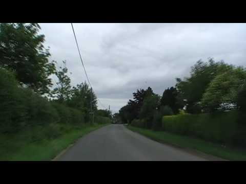
Driving Between Alfrick & Leigh, Worcestershire, England 21st June 2009

Driving between the Worcestershire villages of Alfrick & Leigh. Videoed on Sunday, 21st June 2009 To watch all of the day's ...

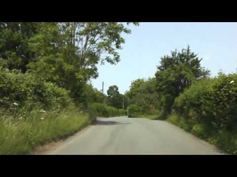
Driving From Suckley To Knightwick, Worcestershire, England Friday, 5th July 2013

Driving from Suckley to Knightwick, Worcestershire, England Videoed on Friday, 5th July 2013 Playlist: ...

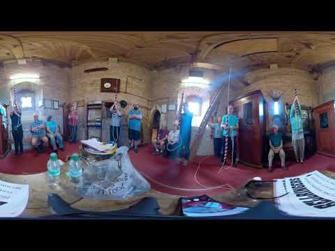
4K 360 VR - Bell Ringing at Suckley, Worcestershire

Suckley, Worcestershire, S John Bapt, 6, 11-3-20 (606kg) in F# Pause the video, take a look around!

Nearby Amenities

Located within 500m of 52.170374,-2.371908
Stocks Road Junction
Naptan AtcoCode: 2000G069400
Naptan Bearing: NW
Naptan BusStopType: CUS
Naptan CommonName: Stocks Road Junction
Naptan Indicator: Adj
Naptan Landmark: Opp Old School House
Naptan NaptanCode: wocgadgj
Naptan Street: Stocks Road
Naptan Verified: no
Source: naptan_import
Lat/Long: 52.1674078/-2.3751345
Alfrick- Upper House Bungalow
Naptan AtcoCode: 2000G069500
Naptan Bearing: NW
Naptan BusStopType: CUS
Naptan CommonName: Alfrick- Upper House Bungalow
Naptan Indicator: Opp
Naptan Landmark: Opp. Upper House Road
Naptan NaptanCode: wocgadgm
Naptan Street: Alfrick Road
Naptan Verified: no
Source: naptan_import
Lat/Long: 52.1731634/-2.3718342
Post Box
Collection Times: Mo-Fr 17:00; Sa 10:45
Post Box Mounting: brick_pillar
Post Box Type: wall
Ref: WR6 266
Royal Cypher: GR
Royal Cypher Wikidata: Q33102273
Lat/Long: 52.1731208/-2.3714335
Barrier: stile
Foot: yes
Lat/Long: 52.1740186/-2.3689693
Post Box
Collection Times: Mo-Fr 17:00; Sa 10:30
Post Box Type: lamp
Ref: WR6 401
Royal Cypher: EIIR
Royal Cypher Wikidata: Q33102113
Lat/Long: 52.1669502/-2.3754341
Generator Method: photovoltaic
Generator Output Electricity: yes
Generator Source: solar
Generator Type: solar_photovoltaic_panel
Location: roof
Power: generator
Lat/Long: 52.1673063/-2.375477
Generator Method: photovoltaic
Generator Output Electricity: yes
Generator Source: solar
Generator Type: solar_photovoltaic_panel
Location: roof
Power: generator
Lat/Long: 52.17305/-2.3699838
Generator Method: photovoltaic
Generator Output Electricity: yes
Generator Source: solar
Generator Type: solar_photovoltaic_panel
Location: roof
Power: generator
Lat/Long: 52.1734168/-2.3699382
The Knapp
Location Transition: yes
Power: pole
Transformer: distribution
Voltage Primary: 11000
Lat/Long: 52.1673314/-2.3668872
Location Transition: yes
Power: pole
Lat/Long: 52.1675786/-2.3662495
Yarrington Hall Alfrick
Location Transition: yes
Power: pole
Transformer: distribution
Voltage Primary: 11000
Lat/Long: 52.1713878/-2.3779325
Power: pole
Lat/Long: 52.171308/-2.3766397
Power: pole
Lat/Long: 52.1720268/-2.3749258
Power: pole
Lat/Long: 52.1746957/-2.3718895
Power: pole
Lat/Long: 52.1738494/-2.3686279
Alfrick Grange
Power: pole
Transformer: distribution
Voltage Primary: 11000
Lat/Long: 52.1728436/-2.3689605
Power: pole
Lat/Long: 52.1737528/-2.3695479
Power: pole
Lat/Long: 52.1737582/-2.3690329
Power: pole
Lat/Long: 52.1737413/-2.3701568
Power: pole
Lat/Long: 52.173944/-2.3705303
Alfrick
Power: pole
Transformer: distribution
Voltage Primary: 11000
Lat/Long: 52.1735299/-2.3714241
Power: pole
Lat/Long: 52.1732787/-2.371978
Power: pole
Lat/Long: 52.1728658/-2.3729007
Power: pole
Lat/Long: 52.1723723/-2.374101
Power: pole
Lat/Long: 52.1718262/-2.3754421
Norgrove Alfrick
Power: pole
Transformer: distribution
Voltage Primary: 11000
Lat/Long: 52.1715876/-2.3759946
Power: pole
Lat/Long: 52.1709773/-2.3774511
Power: pole
Lat/Long: 52.1698883/-2.3778614
Power: pole
Lat/Long: 52.1704847/-2.3790758
Power: pole
Lat/Long: 52.1706512/-2.3784965
Power: pole
Lat/Long: 52.1709099/-2.3774806
Power: pole
Lat/Long: 52.1706257/-2.3776046
Power: pole
Lat/Long: 52.1702893/-2.3777327
Power: pole
Lat/Long: 52.1695174/-2.378017
Power: pole
Lat/Long: 52.1692196/-2.3781297
Power: pole
Lat/Long: 52.1686956/-2.3782973
Power: pole
Lat/Long: 52.1683132/-2.3781632
Wobbly Wheel
Power: pole
Transformer: distribution
Voltage Primary: 11000
Lat/Long: 52.1671204/-2.3763339
Power: pole
Lat/Long: 52.167373/-2.3770326
The data included in this document is from www.openstreetmap.org. The data is made available under ODbL.

Have you been to Alfrick?

Leave your review of Alfrick below (or comments, questions and feedback).