Aldercar and Langley Mill

Civil Parish in Derbyshire Amber Valley

England

Aldercar and Langley Mill

Heanor Road The houses here are very close to this very busy road.
Heanor Road Credit: Malcolm Neal

Aldercar and Langley Mill is a civil parish located in Derbyshire, England. It is situated between the towns of Eastwood and Heanor, and is bordered by the River Erewash to the east. The parish covers an area of approximately 2.5 square miles.

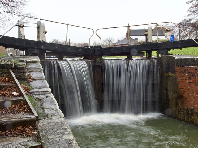
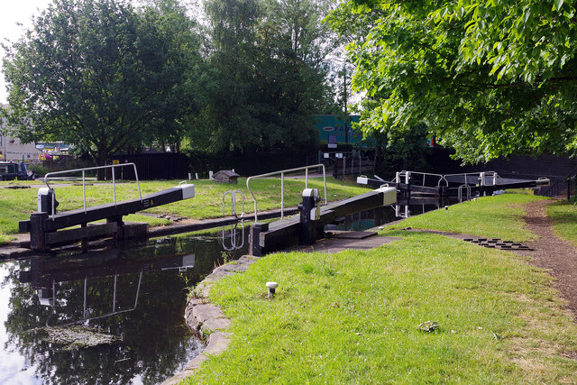
The area has a rich industrial history, with coal mining being a major industry in the past. The remnants of the collieries can still be seen in the form of old buildings and disused railway tracks. However, in recent years, the parish has undergone significant redevelopment, with former mining sites being transformed into residential and commercial areas.

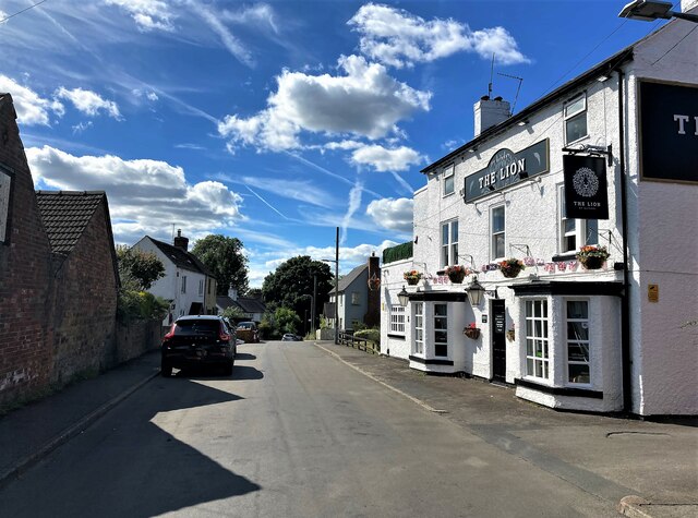
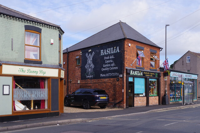
Aldercar and Langley Mill is home to a diverse population, with a mix of rural and urban areas. The parish has a range of amenities and facilities to cater to the needs of its residents. There are several primary schools in the area, as well as a secondary school and a sixth form college.

The parish is well-connected in terms of transport, with the A610 road passing through it, providing easy access to surrounding towns and cities. There are also regular bus services that operate in the area.

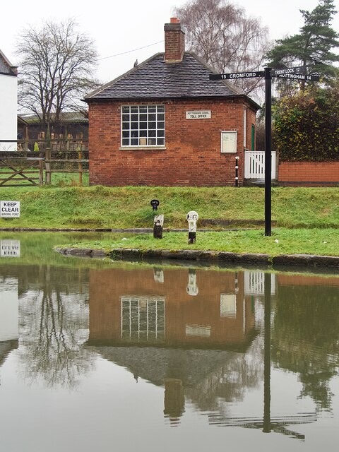
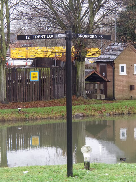
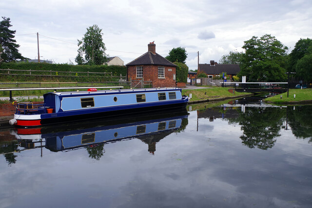
In terms of recreation, there is a local park that offers green spaces for outdoor activities, as well as a leisure center that provides sports facilities and swimming pools. Additionally, the nearby Erewash Canal is a popular spot for boating and fishing.

Overall, Aldercar and Langley Mill is a vibrant and evolving civil parish that combines its industrial heritage with modern development to create a thriving community.

If you have any feedback on the listing, please let us know in the comments section below.

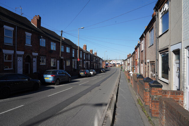
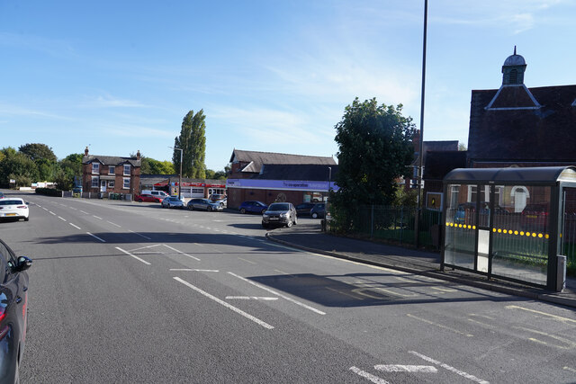
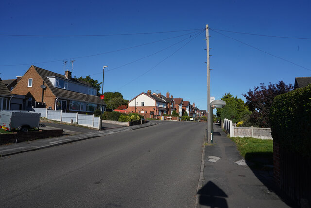
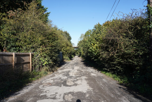
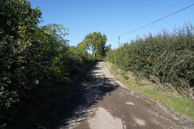
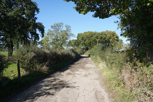
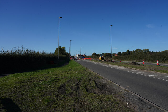
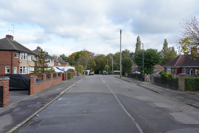
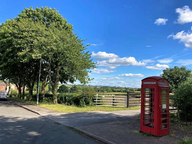
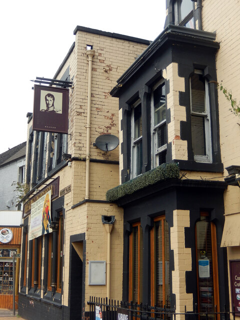
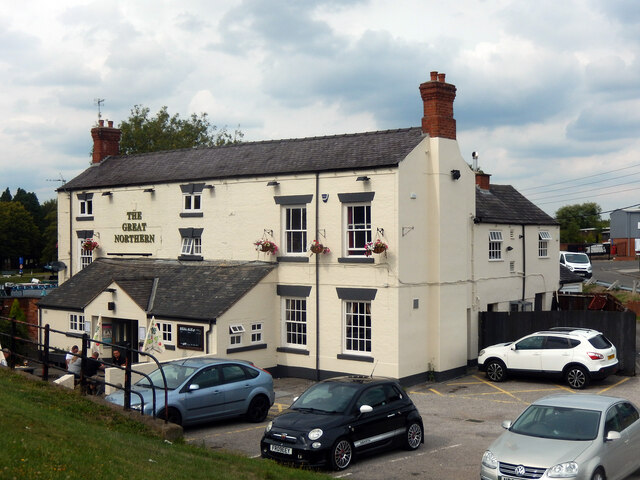
Aldercar and Langley Mill Images

Images are sourced within 2km of 53.029693/-1.339976 or Grid Reference SK4448. Thanks to Geograph Open Source API. All images are credited.

Heanor Road The houses here are very close to this very busy road.
Heanor Road
The houses here are very close to this very busy road.
Mansfield Road The flat roofed building between the trees is the Co-operative Society Funeral service.
Mansfield Road
The flat roofed building between the trees is the Co-operative Society Funeral service.
Lower Dunstead Road This road runs up the hill in Langley Mill ending at a cross road junction with Aldercar Lane and Cromford Road.
Lower Dunstead Road
This road runs up the hill in Langley Mill ending at a cross road junction with Aldercar Lane and Cromford Road.
Aldercar Lane Aldercar lane is more like a track with a very poor surface with many deep potholes.  Just ahead is the flyover for the A610. To the right of the hedge is the site of Aldercar Allotments.
Aldercar Lane
Aldercar lane is more like a track with a very poor surface with many deep potholes. Just ahead is the flyover for the A610. To the right of the hedge is the site of Aldercar Allotments.
Aldercar Lane Now out beyond the allotments with field to either side. It is a busy lane despite the poor surface, especially for the use of tractors.
Aldercar Lane
Now out beyond the allotments with field to either side. It is a busy lane despite the poor surface, especially for the use of tractors.
Aldercar Lane This is close to the end of the lane as it comes to a stop after turning right and crossing the railway track.
Aldercar Lane
This is close to the end of the lane as it comes to a stop after turning right and crossing the railway track.
Cromford Road The A610 or Cromford Road has some road works up ahead with the sign saying NO 'U' turns.
Cromford Road
The A610 or Cromford Road has some road works up ahead with the sign saying NO 'U' turns.
Fall Road This is a quiet cul-de-sac that is a continuation of Midland Road in Heanor.
Fall Road
This is a quiet cul-de-sac that is a continuation of Midland Road in Heanor.
Water overflowing the lock gates at Langley Mill Lock Langley Mill Basin is where the Erewash Canal joins the Cromford and Nottingham Canals.
Water overflowing the lock gates at Langley Mill Lock
Langley Mill Basin is where the Erewash Canal joins the Cromford and Nottingham Canals.
The junction of the Cromford and Nottingham Canals The building is the former toll office for the Nottingham Canal. This location is unusual in that three canals meet here, the third being the Erewash Canal to Trent Lock. The three way finger post <a href="https://www.geograph.org.uk/photo/7044762">SK4547 : Direction signpost at Langley Mill Basin</a> is a recent addition, not present when the location was last geographed in 2017 <a href="https://www.geograph.org.uk/photo/5607048">SK4547 : Junction of the Nottingham and Cromford Canals</a>
The junction of the Cromford and Nottingham Canals
The building is the former toll office for the Nottingham Canal. This location is unusual in that three canals meet here, the third being the Erewash Canal to Trent Lock. The three way finger post SK4547 : Direction signpost at Langley Mill Basin is a recent addition, not present when the location was last geographed in 2017 SK4547 : Junction of the Nottingham and Cromford Canals
Direction signpost at Langley Mill Basin An unusual location where three canals meet: the Erewash, Nottingham and Cromford Canals.
Direction signpost at Langley Mill Basin
An unusual location where three canals meet: the Erewash, Nottingham and Cromford Canals.
Public House on Hall Lane in Brinsley A warm welcome was proffered in The Lion on this warm July afternoon.
Public House on Hall Lane in Brinsley
A warm welcome was proffered in The Lion on this warm July afternoon.
Telephone Box on Hall Lane in Brinsley This scenically placed example is now a mini-library.
Telephone Box on Hall Lane in Brinsley
This scenically placed example is now a mini-library.
Great Northern Basin This pleasant spot was once a canal junction where the Erewash, Nottingham and Cromford Canals met; today only the first of these is navigable so it is effectively a dead end for boats that make their way here from Trent Lock. A few yards of the Nottingham Canal provide private moorings and access is through the swing bridge seen here; the small restored building was a toll house. Visiting boats can moor where the blue narrowboat is.
Great Northern Basin
This pleasant spot was once a canal junction where the Erewash, Nottingham and Cromford Canals met; today only the first of these is navigable so it is effectively a dead end for boats that make their way here from Trent Lock. A few yards of the Nottingham Canal provide private moorings and access is through the swing bridge seen here; the small restored building was a toll house. Visiting boats can moor where the blue narrowboat is.
King of Prussia, Heanor This pub reopened in 2015 after a long period of closure, reverting to its old name even though it had been known as the Market Hotel for a century. This view from 2009 shows it when it was boarded up: <a href="https://www.geograph.org.uk/photo/1265193">SK4346 : Market Hotel, Heanor</a>.
King of Prussia, Heanor
This pub reopened in 2015 after a long period of closure, reverting to its old name even though it had been known as the Market Hotel for a century. This view from 2009 shows it when it was boarded up: SK4346 : Market Hotel, Heanor.
The Great Northern, Langley Mill This pub, located next to the Great Northern Basin at the end of the Nottingham and Erewash canals, actually takes its name from the railway that used to run to the east of the pub. The railway was opened in 1876 as a branch line to Pinxton; although its primary traffic was always coal, a passenger service was provided which included a station here called Eastwood & Langley Mill. The station closed in 1963 and all traces have since been obliterated.
The Great Northern, Langley Mill
This pub, located next to the Great Northern Basin at the end of the Nottingham and Erewash canals, actually takes its name from the railway that used to run to the east of the pub. The railway was opened in 1876 as a branch line to Pinxton; although its primary traffic was always coal, a passenger service was provided which included a station here called Eastwood & Langley Mill. The station closed in 1963 and all traces have since been obliterated.
Langley Lock, Erewash Canal This is the very top of the Erewash Canal and relatively few boats ever get this far. Yet the moorings are pleasant enough and just about every facility is near at hand.
Langley Lock, Erewash Canal
This is the very top of the Erewash Canal and relatively few boats ever get this far. Yet the moorings are pleasant enough and just about every facility is near at hand.
Cromford Road, Langley Mill There are three interesting businesses here. Firstly, The Bunny Hop is one of several micropubs in the area; it first opened in 2016. To the right is Basilia, a café 'with a European feel' and, beyond that, Langley Mill Records which claims to carry over 200,000 items 'including CDs, vinyl records, cassettes, DVD's and books covering a wide range of genres and styles'.
Cromford Road, Langley Mill
There are three interesting businesses here. Firstly, The Bunny Hop is one of several micropubs in the area; it first opened in 2016. To the right is Basilia, a café 'with a European feel' and, beyond that, Langley Mill Records which claims to carry over 200,000 items 'including CDs, vinyl records, cassettes, DVD's and books covering a wide range of genres and styles'.
Show me another place!

Aldercar and Langley Mill is located at Grid Ref: SK4448 (Lat: 53.029693, Lng: -1.339976)

Administrative County: Derbyshire

District: Amber Valley

Police Authority: Derbyshire

What 3 Words

///wire.circles.satellite. Near Heanor, Derbyshire

Nearby Locations

Aldercar and Langley Mill

Related Wikis

Aldercar High School

Aldercar High School is a coeducational secondary school and sixth form located in Aldercar, Derbyshire, England.It is close to the A610 and Langley Mill...

Aldercar and Langley Mill

Aldercar and Langley Mill is a civil parish in the Amber Valley district of Derbyshire, England. It includes the villages of Aldercar and Langley Mill...

Langley Mill

Langley Mill is a large village in the Amber Valley district of Derbyshire, England. == History == Originally named Long Lea, the village of Langley Mill...

Woodlinkin

Woodlinkin is a hamlet in Derbyshire, on the A610 road between the villages of Codnor and Aldercar.

Langley Mill railway station

Langley Mill railway station (formerly known as Langley Mill for Heanor and Langley Mill and Eastwood) on the Erewash Valley Line serves the large village...

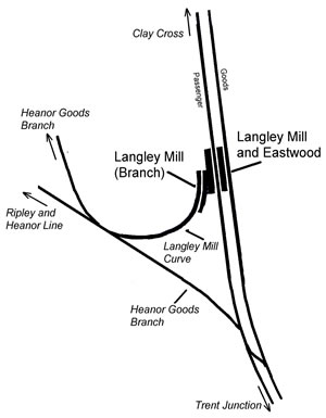
Langley Mill railway station (Erewash Valley line)

Langley Mill railway station was a railway station which served the village of Langley Mill in Derbyshire, England. It was opened in 1895 by the Midland...

Heanor railway station (Midland Railway)

Heanor railway station was a railway station which served the town of Heanor in Derbyshire, England. It was opened in 1890 by the Midland Railway on its...

Eastwood and Langley Mill railway station

Eastwood and Langley Mill railway station is a former railway station serving the town of Eastwood and the village of Langley Mill in Derbyshire, England...

Nearby Amenities

Located within 500m of 53.029693,-1.339976
Telephone
Booth: KX100
Door: no
Source: survey
Lat/Long: 53.0265632/-1.3363251
Barrier: cycle_barrier
Lat/Long: 53.0258223/-1.3366769
Barrier: stile
Lat/Long: 53.0333785/-1.3397788
Aldercar Hall
Addr Street: Aldercar Lane
Building: house
Source: survey
Lat/Long: 53.032601/-1.34097
Barrier: bollard
Lat/Long: 53.0286728/-1.3335222
Bench
Backrest: yes
Lat/Long: 53.0266752/-1.3364324
Note: 'Restricted byway' sign here pointing NW up lane
Lat/Long: 53.0286059/-1.3334486
Note: 'Public bridleway' sign here pointing east
Lat/Long: 53.0294439/-1.3341557
Grit Bin
Lat/Long: 53.0268888/-1.3382616
Bus Stop
St John's Church
Bus: yes
Public Transport: platform
Shelter: yes
Lat/Long: 53.0264439/-1.3363348
Bus Stop
St John's Church
Bus: yes
Naptan AtcoCode: 1000DAUD4981
Naptan NaptanCode: dbsgwgmd
Public Transport: platform
Shelter: yes
Lat/Long: 53.0264612/-1.3361955
Advertising: board
Operator: Aldercar and Langley Mill Parish Council
Lat/Long: 53.0265693/-1.3360726
Historic: memorial
Memorial: war_memorial
Source: survey
Lat/Long: 53.0266181/-1.3360357
Bench
Lat/Long: 53.0266203/-1.3360602
Note: Another building here
Lat/Long: 53.0333071/-1.339129
Man Made: mast
Tower Type: communication
Lat/Long: 53.0295383/-1.3348617
Generator Method: photovoltaic
Generator Output Electricity: yes
Generator Source: solar
Generator Type: solar_photovoltaic_panel
Location: roof
Power: generator
Lat/Long: 53.0272177/-1.3439257
Generator Method: photovoltaic
Generator Output Electricity: yes
Generator Source: solar
Generator Type: solar_photovoltaic_panel
Location: roof
Power: generator
Lat/Long: 53.0270354/-1.3426543
Generator Method: photovoltaic
Generator Output Electricity: yes
Generator Source: solar
Generator Type: solar_photovoltaic_panel
Location: roof
Power: generator
Lat/Long: 53.0275597/-1.3424129
Generator Method: photovoltaic
Generator Output Electricity: yes
Generator Source: solar
Generator Type: solar_photovoltaic_panel
Location: roof
Power: generator
Lat/Long: 53.0274629/-1.3418469
Generator Method: photovoltaic
Generator Output Electricity: yes
Generator Source: solar
Generator Type: solar_photovoltaic_panel
Location: roof
Power: generator
Lat/Long: 53.0274742/-1.3419623
Generator Method: photovoltaic
Generator Output Electricity: yes
Generator Source: solar
Generator Type: solar_photovoltaic_panel
Location: roof
Power: generator
Lat/Long: 53.0275065/-1.3421125
Generator Method: photovoltaic
Generator Output Electricity: yes
Generator Source: solar
Generator Type: solar_photovoltaic_panel
Location: roof
Power: generator
Lat/Long: 53.0274661/-1.3416941
Generator Method: photovoltaic
Generator Output Electricity: yes
Generator Source: solar
Generator Type: solar_photovoltaic_panel
Location: roof
Power: generator
Lat/Long: 53.0274968/-1.3401491
Direction: 70
Man Made: surveillance
Surveillance: public
Surveillance Type: ALPR
Surveillance Zone: traffic
Lat/Long: 53.0278019/-1.3424112
Direction: 250
Man Made: surveillance
Surveillance: public
Surveillance Type: ALPR
Surveillance Zone: traffic
Lat/Long: 53.027989/-1.3420946
The data included in this document is from www.openstreetmap.org. The data is made available under ODbL.

Have you been to Aldercar and Langley Mill?

Leave your review of Aldercar and Langley Mill below (or comments, questions and feedback).