Bridstow

Settlement in Herefordshire

England

Bridstow

Fire truck snack bar An innovative use of an old french fire chief's van on the Ashburton Industrial Estate.
Fire truck snack bar Credit: Jonathan Billinger

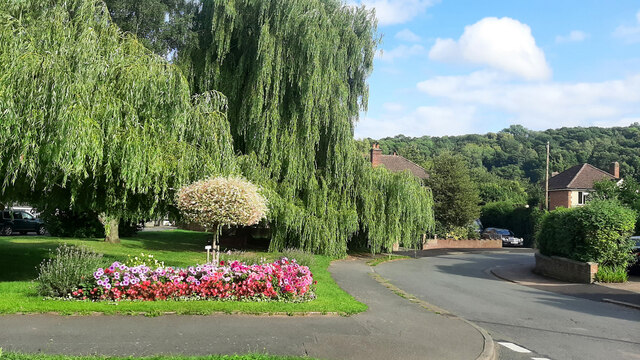
Bridstow is a small village located in the county of Herefordshire, England. Situated on the western bank of the River Wye, it is nestled amidst the scenic countryside, offering residents and visitors a tranquil and picturesque setting.

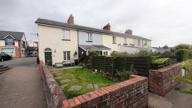
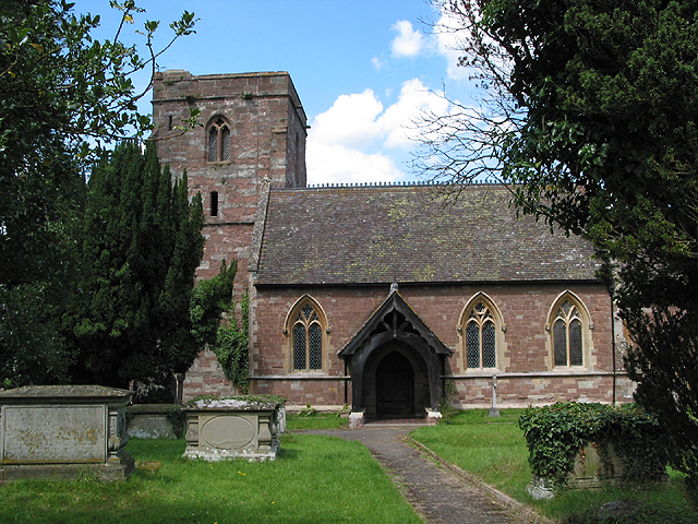
With a population of around 400 people, Bridstow retains its quaint and close-knit community atmosphere. The village is characterized by its charming traditional architecture, including several timber-framed cottages and a beautiful medieval church, St. Bridget's Church, which dates back to the 12th century. The church's stunning stained glass windows and ornate interior make it a notable landmark in the area.

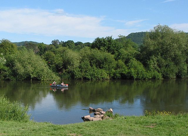
Bridstow benefits from its proximity to the River Wye, which provides a range of recreational activities for locals. Fishing is particularly popular, with the river known for its abundance of salmon and trout. The village also boasts a well-maintained riverside walkway, offering scenic views and a peaceful stroll for residents and visitors alike.

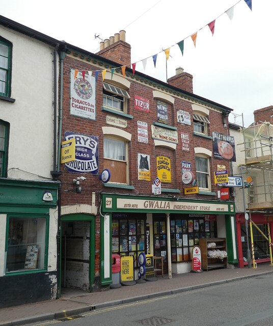
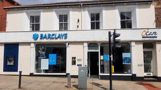
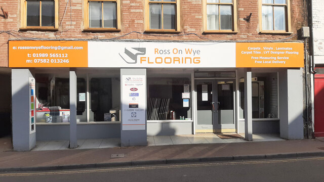
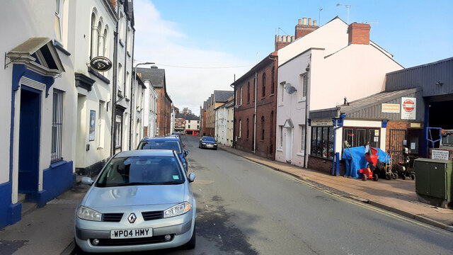
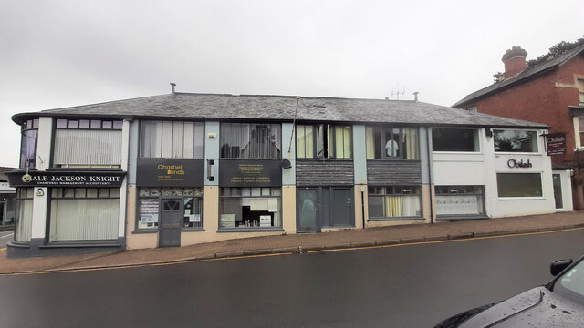
Although Bridstow is primarily a residential area, it is within easy reach of nearby towns such as Ross-on-Wye and Hereford, providing access to a broader range of amenities and services. The village is well-connected by road, with the A40 passing nearby, making it convenient for those commuting or exploring the wider region.

Overall, Bridstow offers a tranquil and idyllic setting, with its charming architecture, stunning natural surroundings, and strong sense of community making it a desirable place to live or visit in Herefordshire.

If you have any feedback on the listing, please let us know in the comments section below.

Bridstow Images

Images are sourced within 2km of 51.917947/-2.604597 or Grid Reference SO5824. Thanks to Geograph Open Source API. All images are credited.

Fire truck snack bar An innovative use of an old french fire chief's van on the Ashburton Industrial Estate.
Fire truck snack bar
An innovative use of an old french fire chief's van on the Ashburton Industrial Estate.
Pelargonium peltatum, L'Elegance Ivy-leaved geranium, back lit by July evening sun.
Pelargonium peltatum, L'Elegance
Ivy-leaved geranium, back lit by July evening sun.
Ross on Wye - Gwalia independent store This shop, which is proudly an "independent store", is in the heart of Ross on Wye and was established in 1872. It is festooned with old tin signs on its upper levels - I wonder if these are genuinely ones that it has displayed over the nearly 150 years that it has been in existence. It is called 'Gwalia' which is an archaic Welsh name for Wales derived from the Mediaeval Latin 'Wallia'.
Ross on Wye - Gwalia independent store
This shop, which is proudly an "independent store", is in the heart of Ross on Wye and was established in 1872. It is festooned with old tin signs on its upper levels - I wonder if these are genuinely ones that it has displayed over the nearly 150 years that it has been in existence. It is called 'Gwalia' which is an archaic Welsh name for Wales derived from the Mediaeval Latin 'Wallia'.
Fritz Fryer building The lighting retailer has moved to a unit on the town's outskirts.
See <a href="https://www.geograph.org.uk/photo/1241463">SO6024 : Lighting shop, Station Street, Ross-on-Wye</a> from 2009.
Fritz Fryer building
The lighting retailer has moved to a unit on the town's outskirts. See SO6024 : Lighting shop, Station Street, Ross-on-Wye from 2009.
Covid-aware queuing Folks waiting in line at the chip shop in Broad Street, Ross-on-Wye.
Covid-aware queuing
Folks waiting in line at the chip shop in Broad Street, Ross-on-Wye.
Terrace of cottages, Ross-on-Wye Six cottages at the bottom of Hill Street.
Terrace of cottages, Ross-on-Wye
Six cottages at the bottom of Hill Street.
Barclays Bank, Ross-on-Wye This branch is due to close for good in August 2021.
Barclays Bank, Ross-on-Wye
This branch is due to close for good in August 2021.
Ross On Wye Flooring, Broad Street Independent business in Ross-on-Wye town centre.
Ross On Wye Flooring, Broad Street
Independent business in Ross-on-Wye town centre.
Station Street, Ross-on-Wye The Dew Drop PH to the left, W James's engineering business on the right.
Station Street, Ross-on-Wye
The Dew Drop PH to the left, W James's engineering business on the right.
Merrivale Lane, Ross-on-Wye The small planted area is maintained by local residents.
Merrivale Lane, Ross-on-Wye
The small planted area is maintained by local residents.
Bee visiting a Globe Thistle Late August sunshine bring bees out to flowers such as Echinops ritro.
Bee visiting a Globe Thistle
Late August sunshine bring bees out to flowers such as Echinops ritro.
Three Gloucester Road businesses An insurance broker, home furnishings outlet and Obilash, an Indian restaurant.
Three Gloucester Road businesses
An insurance broker, home furnishings outlet and Obilash, an Indian restaurant.
Ross-on-Wye recycling centre A late Sunday afternoon view.
Ross-on-Wye recycling centre
A late Sunday afternoon view.
Kyrle Street - Ross-on-Wye
Colourful front garden One of the cottages in The Crofts, Ross-on-Wye.
Colourful front garden
One of the cottages in The Crofts, Ross-on-Wye.
September Rose A second-flush bloom in early morning 'golden hour' light.
September Rose
A second-flush bloom in early morning 'golden hour' light.
Anemone, after rain After a September shower this Japanese Anemone holds the raindrops for a while.
Anemone, after rain
After a September shower this Japanese Anemone holds the raindrops for a while.
Detritus at the surgery This is one of many items of discarded PPE in and around the Alton Street Surgery car park. An unfortunate sign of the times in 2021.
Detritus at the surgery
This is one of many items of discarded PPE in and around the Alton Street Surgery car park. An unfortunate sign of the times in 2021.
Show me another place!

Bridstow is located at Grid Ref: SO5824 (Lat: 51.917947, Lng: -2.604597)

Unitary Authority: County of Herefordshire

Police Authority: West Mercia

What 3 Words

///punters.remotes.pockets. Near Ross on Wye, Herefordshire

Nearby Locations

Wilton Bridstow Poolmill

Related Wikis

Bridstow

Bridstow is a village and civil parish in Herefordshire, England, 2 km (1.2 miles) west of Ross-on-Wye and 17 km (10.6 miles) south-east of Hereford. The...

Wilton Castle

Wilton Castle is a 12th-century Norman castle located in south-eastern Herefordshire, England on the River Wye adjacent to the town of Ross-on-Wye. The...
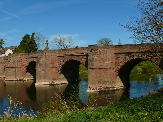
Wilton Bridge

Wilton Bridge is a Grade I listed bridge crossing the River Wye between Wilton, Herefordshire and Ross-on-Wye, Herefordshire, England. == History == The...

Ross Town F.C.

Ross Town F.C. was a football club based in Ross-on-Wye, Herefordshire, England. The club was formed in the summer of 1993 following the amalgamation of...

Wilton, Herefordshire

Wilton is a village in south Herefordshire, England just under a mile west of the market town of Ross-on-Wye. In 1100, Henry I set up three royal manors...

Ross Rowing Club

Ross Rowing Club is a rowing club on the River Wye, based at The Ropewalk, Ross-on-Wye, Herefordshire. The Ross Regatta is held over the August Bank Holiday...

Ross-on-Wye

Ross-on-Wye is a market town and civil parish in Herefordshire, England, near the border with Wales. It had a population estimated at 10,978 in 2021. It...

Herefordshire Trail

The Herefordshire Trail is a long distance footpath in Herefordshire, England. == Route and distance == The trail, running for 154 miles (248 km) as a...

Nearby Amenities

Located within 500m of 51.917947,-2.604597
Bus Stop
Hoarwithy Turn
Naptan AtcoCode: 2090A18460
Naptan Bearing: E
Naptan CommonName: Hoarwithy Turn
Naptan Indicator: adj
Naptan Landmark: N/K
Naptan NaptanCode: heragtdp
Naptan Street: A49 Ross Road
Naptan Verified: no
Source: naptan_import
Lat/Long: 51.9178351/-2.6082069
Bus Stop
School
Naptan AtcoCode: 2090A18462
Naptan Bearing: W
Naptan CommonName: School
Naptan Indicator: adj bus shelter
Naptan Landmark: Bus Shelter
Naptan NaptanCode: heragtdt
Naptan Street: A49 Hereford Road
Naptan Verified: no
Source: naptan_import
Lat/Long: 51.917589/-2.6053683
Bus Stop
School
Naptan AtcoCode: 2090A18464
Naptan Bearing: SE
Naptan BusStopType: CUS
Naptan CommonName: School
Naptan Indicator: adj
Naptan Landmark: War Memorial
Naptan NaptanCode: heragtdw
Naptan Street: A49 Ross Road
Naptan Verified: no
Source: naptan_import
Lat/Long: 51.9177601/-2.6053269
Bus Stop
Wilton
Naptan AtcoCode: 2090A20058
Naptan Bearing: NW
Naptan CommonName: Wilton
Naptan Indicator: adj Wilton Lane
Naptan Landmark: Wilton Lane
Naptan NaptanCode: heramwja
Naptan Street: Wilton Road
Naptan Verified: no
Source: naptan_import
Lat/Long: 51.9154037/-2.598802
Bus Stop
Wilton
Naptan AtcoCode: 2090A20060
Naptan Bearing: SE
Naptan CommonName: Wilton
Naptan Indicator: opp Wilton Lane
Naptan Landmark: Wilton Lane
Naptan NaptanCode: heramwjd
Naptan Street: Wilton Road
Naptan Verified: no
Source: naptan_import
Lat/Long: 51.9155485/-2.5989333
Crossing
Bicycle: yes
Crossing: traffic_signals
Crossing Ref: toucan
Source: survey
Lat/Long: 51.9165908/-2.6001943
Crossing
Bicycle: yes
Crossing: traffic_signals
Crossing Ref: toucan
Source: survey
Lat/Long: 51.9164797/-2.6001479
Turning Circle
Source: bing
Lat/Long: 51.9145056/-2.602666
Bridstow
Place: hamlet
Source: OS OpenData StreetView
Wikidata: Q3784039
Lat/Long: 51.9172143/-2.606935
Restaurant
The Bridge at Wilton
Accommodation: yes
Lat/Long: 51.9154974/-2.5985254
Wilton Court Hotel
Tourism: hotel
Lat/Long: 51.9147558/-2.5994772
Wilton
Place: hamlet
Source: OS OpenData StreetView
Wikidata: Q3784213
Lat/Long: 51.915655/-2.5999217
Entrance: yes
Lat/Long: 51.9203845/-2.6055077
Barrier: kissing_gate
Source: survey
Lat/Long: 51.9203373/-2.6065291
Barrier: kissing_gate
Source: survey
Lat/Long: 51.9203868/-2.6049887
Bench
Lat/Long: 51.9162659/-2.6002032
Barrier: kissing_gate
Source: survey
Lat/Long: 51.9203621/-2.6058365
Power: pole
Lat/Long: 51.918439/-2.6075931
Power: pole
Lat/Long: 51.9188765/-2.6085046
Power: pole
Lat/Long: 51.9193778/-2.6095077
Power: pole
Source: survey
Transformer: distribution
Voltage Primary: 11000
Lat/Long: 51.9197864/-2.6103084
Power: pole
Source: Bing
Lat/Long: 51.9170423/-2.6006659
Wilton
Location Transition: yes
Power: pole
Source: bing
Transformer: distribution
Voltage Primary: 11000
Lat/Long: 51.9171064/-2.5977825
Generator Method: photovoltaic
Generator Output Electricity: yes
Generator Source: solar
Generator Type: solar_photovoltaic_panel
Location: roof
Power: generator
Lat/Long: 51.9147339/-2.6005411
Generator Method: photovoltaic
Generator Output Electricity: yes
Generator Source: solar
Generator Type: solar_photovoltaic_panel
Location: roof
Power: generator
Lat/Long: 51.916304/-2.5983444
Generator Method: photovoltaic
Generator Output Electricity: yes
Generator Source: solar
Generator Type: solar_photovoltaic_panel
Location: roof
Power: generator
Lat/Long: 51.9159996/-2.5986072
Power: pole
Source: Bing
Lat/Long: 51.917264/-2.6021361
Poolmill Bridge
Power: pole
Transformer: distribution
Voltage Primary: 11000
Lat/Long: 51.9189447/-2.6115388
Power: pole
Lat/Long: 51.9202276/-2.6106496
Location Transition: yes
Power: pole
Source: Bing
Lat/Long: 51.9168784/-2.6002748
Location Transition: yes
Power: pole
Lat/Long: 51.917919/-2.6065378
Barrier: bollard
Lat/Long: 51.9158109/-2.5994491
Defibrillator
Defibrillator Location: On wall
Emergency: defibrillator
Lat/Long: 51.9178261/-2.6044314
Power: pole
Lat/Long: 51.9162767/-2.6087929
Power: pole
Lat/Long: 51.9158523/-2.6097572
Power: pole
Lat/Long: 51.9155694/-2.6103741
Power: pole
Lat/Long: 51.9195623/-2.6111117
The Pippins
Power: pole
Transformer: distribution
Voltage Primary: 11000
Lat/Long: 51.9150971/-2.6006699
Wilton Dale
Location Transition: yes
Power: pole
Transformer: distribution
Voltage Primary: 11000
Lat/Long: 51.9140121/-2.6034131
Power: pole
Lat/Long: 51.9136424/-2.6038429
Power: pole
Lat/Long: 51.9141118/-2.6046087
Power: pole
Lat/Long: 51.9146992/-2.6055555
Bannut Tree Lane
Power: pole
Transformer: distribution
Voltage Primary: 11000
Lat/Long: 51.9153184/-2.6065654
Power: pole
Lat/Long: 51.9156472/-2.6072775
Power: pole
Lat/Long: 51.9159681/-2.6079635
Juniper Cottage
Power: transformer
Transformer: distribution
Voltage Primary: 11000
Lat/Long: 51.9171585/-2.6068899
Bridstow School
Power: pole
Transformer: distribution
Voltage Primary: 11000
Lat/Long: 51.9177264/-2.6042157
Location Transition: yes
Power: pole
Lat/Long: 51.9173682/-2.602933
Wilton Oak Tree
Power: pole
Transformer: distribution
Voltage Primary: 11000
Lat/Long: 51.918946/-2.5975277
Power: pole
Lat/Long: 51.9181511/-2.5975531
Power: pole
Lat/Long: 51.9174339/-2.5974499
The data included in this document is from www.openstreetmap.org. The data is made available under ODbL.

Have you been to Bridstow?

Leave your review of Bridstow below (or comments, questions and feedback).