Poolmill

Settlement in Herefordshire

England

Poolmill

House in Buckcastle Hill, Bridstow Rural Herefordshire west of Ross-on-Wye.
House in Buckcastle Hill, Bridstow Credit: Jaggery

Poolmill is a small village located in the county of Herefordshire, England. Situated in the western part of the county, it is nestled within the picturesque landscape of the Wye Valley, a designated Area of Outstanding Natural Beauty. The village is situated approximately 6 miles northeast of the market town of Ross-on-Wye and 15 miles southwest of Hereford, the county town.

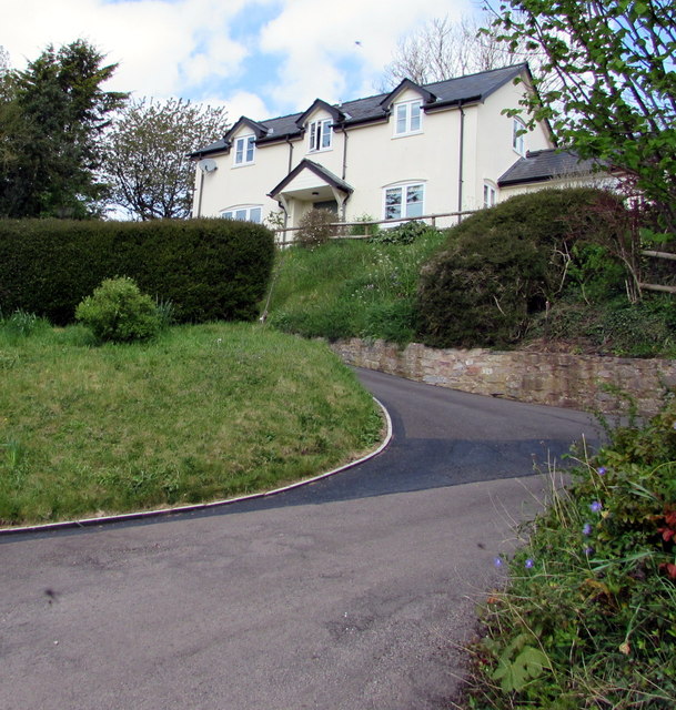
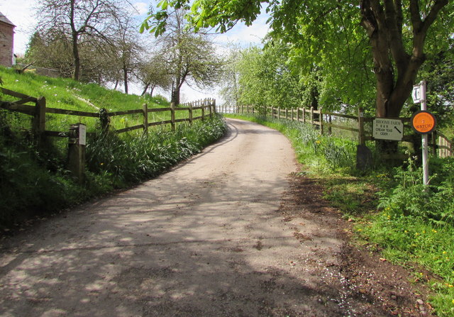
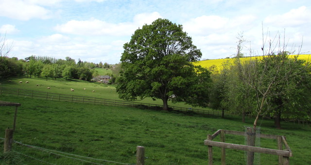
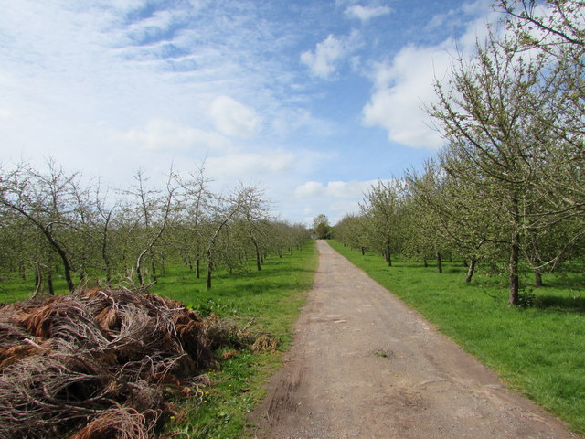
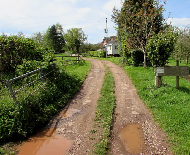
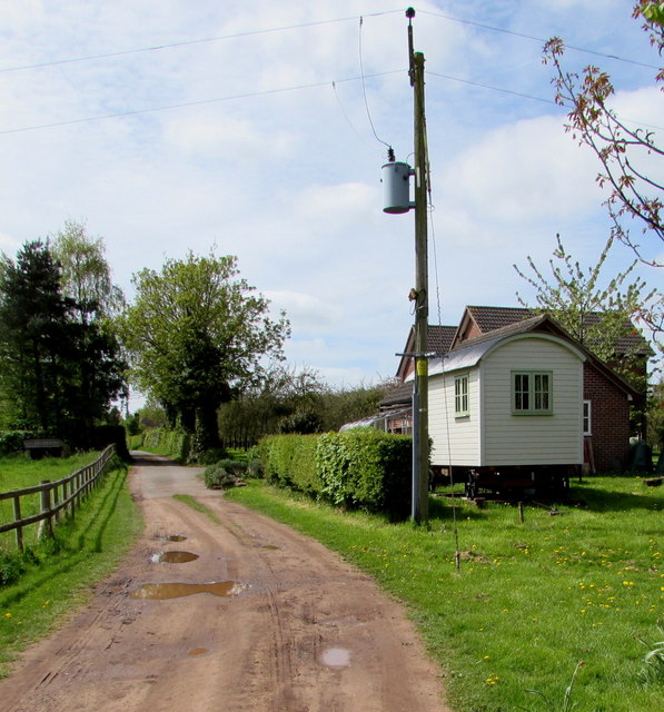
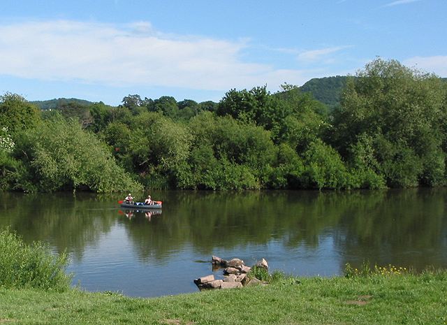
Poolmill is known for its tranquil and idyllic surroundings, with rolling hills, lush green fields, and the River Wye flowing nearby. The village itself is characterized by a cluster of traditional stone and timber-framed houses, giving it a charming and quintessentially English feel.

Despite its small size, Poolmill has a strong sense of community, with a close-knit population that takes pride in maintaining the village's rural character. The village is home to a few local amenities, including a village hall and a small pub, where residents and visitors can enjoy a warm and friendly atmosphere.

For nature enthusiasts, Poolmill offers an abundance of outdoor activities. The nearby River Wye provides opportunities for fishing, canoeing, and kayaking, while the surrounding countryside is perfect for walking, hiking, and cycling. The village is also within close proximity to several popular tourist attractions, including the historic Goodrich Castle and the renowned Symonds Yat viewpoint.

In summary, Poolmill is a picturesque village located in the heart of the Wye Valley, offering a peaceful and scenic retreat for both residents and visitors.

If you have any feedback on the listing, please let us know in the comments section below.
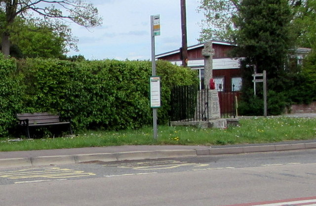
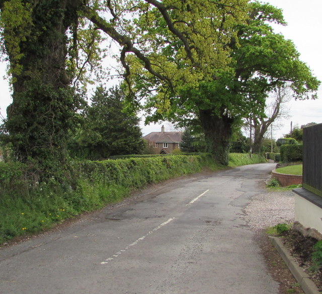
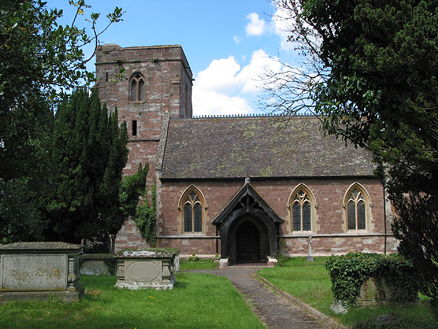
Poolmill Images

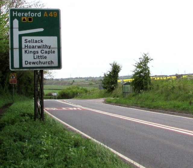
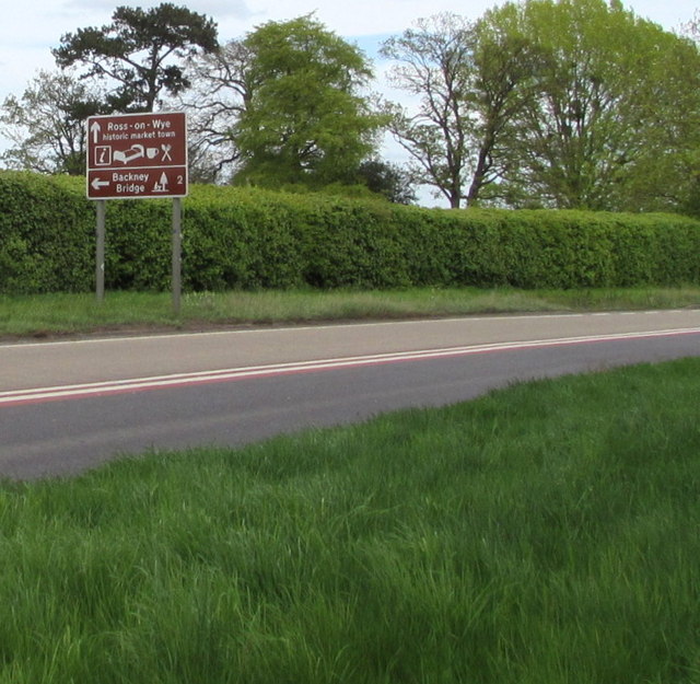
Images are sourced within 2km of 51.912937/-2.6120023 or Grid Reference SO5824. Thanks to Geograph Open Source API. All images are credited.

House in Buckcastle Hill, Bridstow Rural Herefordshire west of Ross-on-Wye.
House in Buckcastle Hill, Bridstow
Rural Herefordshire west of Ross-on-Wye.
This way for Broome Farm near Peterstow The black arrow on a sign points towards Broome Farm B&B, cream teas and cider.
The black-edged orange sign shows that this is a Neighbourhood Watch area.
This way for Broome Farm near Peterstow
The black arrow on a sign points towards Broome Farm B&B, cream teas and cider. The black-edged orange sign shows that this is a Neighbourhood Watch area.
Oak near Broome Farm, Peterstow Rural Herefordshire west of Ross-on-Wye.
Oak near Broome Farm, Peterstow
Rural Herefordshire west of Ross-on-Wye.
Basic facility alongside the Peterstow-Bridstow Loop Earth closet toilet on a part of the Peterstow-Bridstow 
Loop walk, here through Herefordshire cider orchards.
Basic facility alongside the Peterstow-Bridstow Loop
Earth closet toilet on a part of the Peterstow-Bridstow Loop walk, here through Herefordshire cider orchards.
Path through cider orchards, Peterstow Part of the Peterstow-Bridstow Loop walk.
Path through cider orchards, Peterstow
Part of the Peterstow-Bridstow Loop walk.
Track towards The New Road, Peterstow This is part of the Peterstow-Bridstow Loop walk, here towards The New Road which leads to the A49. 
Out of shot 100 metres to the right is Old Lane.
Track towards The New Road, Peterstow
This is part of the Peterstow-Bridstow Loop walk, here towards The New Road which leads to the A49. Out of shot 100 metres to the right is Old Lane.
The New Road, Peterstow Part of the Peterstow-Bridstow Loop walk, here along The New Road which leads to the A49 in Peterstow.
The New Road, Peterstow
Part of the Peterstow-Bridstow Loop walk, here along The New Road which leads to the A49 in Peterstow.
Overhead fibre drop, Peterstow A small BT label on the New Road pole shows CAUTION OVERHEAD FIBRE DROP 
which indicates that this rural area has (or is about to have) access
to BT's fibre optic broadband service, unlike many other rural parts
of the UK where in 2015 there is no such access.
Overhead fibre drop, Peterstow
A small BT label on the New Road pole shows CAUTION OVERHEAD FIBRE DROP which indicates that this rural area has (or is about to have) access to BT's fibre optic broadband service, unlike many other rural parts of the UK where in 2015 there is no such access.
From 50 to 40 on the A49 near Bridstow The 50mph speed limit on the road from Peterstow drops to 40mph 
on the approach to Bridstow in rural Herefordshire near Ross-on-Wye.
From 50 to 40 on the A49 near Bridstow
The 50mph speed limit on the road from Peterstow drops to 40mph on the approach to Bridstow in rural Herefordshire near Ross-on-Wye.
From 40 to 50 on the A49 towards Peterstow The 40mph speed limit on the road from Bridstow increases 
to 50mph towards Peterstow in rural Herefordshire near Ross-on-Wye.
From 40 to 50 on the A49 towards Peterstow
The 40mph speed limit on the road from Bridstow increases to 50mph towards Peterstow in rural Herefordshire near Ross-on-Wye.
Junction of the A49 and a minor road, Bridstow The minor road to Sellack, Hoarwithy, Kings Caple and Little Dewchurch descends from the A49.
Junction of the A49 and a minor road, Bridstow
The minor road to Sellack, Hoarwithy, Kings Caple and Little Dewchurch descends from the A49.
Bridstow bus shelter On the north side of the A49 in rural Herefordshire near Ross-on-Wye.
Bridstow bus shelter
On the north side of the A49 in rural Herefordshire near Ross-on-Wye.
Minor road junction ahead, Bridstow Ahead on the A49 for Hereford or turn right for Sellack, Hoarwithy, Kings Caple and Little Dewchurch.
Minor road junction ahead, Bridstow
Ahead on the A49 for Hereford or turn right for Sellack, Hoarwithy, Kings Caple and Little Dewchurch.
Warning - school and minor road junctions ahead, Bridstow On the north side of the A49 on the western approach to Bridstow School.
Warning - school and minor road junctions ahead, Bridstow
On the north side of the A49 on the western approach to Bridstow School.
Direction sign, Bridstow Stay on the A49 for Ross-on-Wye, historic market town, or turn left ahead for Backney Bridge (2 miles).
Direction sign, Bridstow
Stay on the A49 for Ross-on-Wye, historic market town, or turn left ahead for Backney Bridge (2 miles).
Bridstow School bus stop and shelter Alongside the A49. Bridstow School <a title="https://www.geograph.org.uk/photo/4460590" href="https://www.geograph.org.uk/photo/4460590">Link</a> is about 100 metres away, alongside the minor road on the left.
Bridstow School bus stop and shelter
Alongside the A49. Bridstow School Link is about 100 metres away, alongside the minor road on the left.
War Memorial bus stop, Bridstow Viewed across the A49 looking towards the War Memorial. <a title="https://www.geograph.org.uk/photo/4460109" href="https://www.geograph.org.uk/photo/4460109">Link</a>
War Memorial bus stop, Bridstow
Viewed across the A49 looking towards the War Memorial. Link
Bannuttree Lane trees, Bridstow Viewed from the corner of the A49. Bridstow is a village in Herefordshire near Ross-on-Wye.
Bannuttree Lane trees, Bridstow
Viewed from the corner of the A49. Bridstow is a village in Herefordshire near Ross-on-Wye.
Show me another place!

Poolmill is located at Grid Ref: SO5824 (Lat: 51.912937, Lng: -2.6120023)

Unitary Authority: County of Herefordshire

Police Authority: West Mercia

What 3 Words

///fancy.punt.confusion. Near Ross on Wye, Herefordshire

Nearby Locations

Poolmill Bridstow Wilton

Related Wikis

Wilton, Herefordshire

Wilton is a village in south Herefordshire, England just under a mile west of the market town of Ross-on-Wye. In 1100, Henry I set up three royal manors...

Bridstow

Bridstow is a village and civil parish in Herefordshire, England, 2 km (1.2 miles) west of Ross-on-Wye and 17 km (10.6 miles) south-east of Hereford. The...
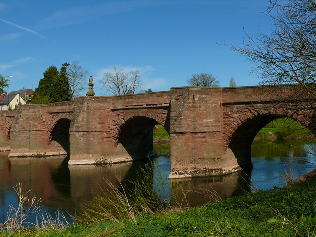
Wilton Bridge

Wilton Bridge is a Grade I listed bridge crossing the River Wye between Wilton, Herefordshire and Ross-on-Wye, Herefordshire, England. == History == The...

Ross Town F.C.

Ross Town F.C. was a football club based in Ross-on-Wye, Herefordshire, England. The club was formed in the summer of 1993 following the amalgamation of...

Nearby Amenities

Located within 500m of 51.912937,-2.6120023
Parking
Parking: layby
Lat/Long: 51.9134715/-2.6092853
Parking
Parking: layby
Source: Bing
Lat/Long: 51.9133871/-2.6087864
Weirend
Place: locality
Lat/Long: 51.9108416/-2.6183648
Power: pole
Lat/Long: 51.9162767/-2.6087929
Power: pole
Lat/Long: 51.9158523/-2.6097572
Power: pole
Lat/Long: 51.9155694/-2.6103741
Power: pole
Lat/Long: 51.9150582/-2.6114872
Power: pole
Lat/Long: 51.9145188/-2.6126513
Power: pole
Lat/Long: 51.9137727/-2.6143438
Power: pole
Lat/Long: 51.9128527/-2.616401
Power: pole
Lat/Long: 51.9118625/-2.618583
Gosbrook Farm
Power: pole
Transformer: distribution
Voltage Primary: 11000
Lat/Long: 51.9123564/-2.6138395
Power: pole
Lat/Long: 51.9131688/-2.6141359
Power: pole
Lat/Long: 51.9123456/-2.6175222
Power: pole
Lat/Long: 51.9132705/-2.6154689
Power: pole
Lat/Long: 51.9141118/-2.6135807
Power: pole
Lat/Long: 51.9157903/-2.6144209
Power: pole
Lat/Long: 51.9151604/-2.6135264
White Cross Farm
Power: pole
Transformer: distribution
Voltage Primary: 11000
Lat/Long: 51.916419/-2.6153134
Wilton Sewerage
Power: pole
Transformer: distribution
Voltage Primary: 11000
Lat/Long: 51.9122178/-2.6065379
Power: pole
Lat/Long: 51.9122877/-2.6058291
Power: pole
Lat/Long: 51.9125491/-2.604956
Power: pole
Lat/Long: 51.9146992/-2.6055555
Bannut Tree Lane
Power: pole
Transformer: distribution
Voltage Primary: 11000
Lat/Long: 51.9153184/-2.6065654
Power: pole
Lat/Long: 51.9156472/-2.6072775
Power: pole
Lat/Long: 51.9159681/-2.6079635
The data included in this document is from www.openstreetmap.org. The data is made available under ODbL.

Have you been to Poolmill?

Leave your review of Poolmill below (or comments, questions and feedback).