Addingham
Civil Parish in Yorkshire Bradford
England
Addingham

Addingham is a civil parish located in the county of Yorkshire, England. It is situated in the Aire Valley, near the Yorkshire Dales National Park. The village of Addingham is known for its picturesque countryside, historic buildings, and vibrant community.
The village has a population of around 4,000 residents and is home to a range of amenities including shops, pubs, and restaurants. Addingham is well-connected by road, with easy access to nearby towns and cities such as Ilkley, Skipton, and Leeds.
Addingham is a popular destination for outdoor enthusiasts, with numerous walking and cycling routes in the surrounding area. The village is also close to the River Wharfe, providing opportunities for fishing and boating.
The history of Addingham can be traced back to the Domesday Book, where it was recorded as a small farming community. Today, the village retains much of its historic charm, with a number of listed buildings and a thriving local economy.
Overall, Addingham is a charming and picturesque village in the heart of Yorkshire, offering a peaceful and idyllic setting for residents and visitors alike.
If you have any feedback on the listing, please let us know in the comments section below.
Addingham Images
Images are sourced within 2km of 53.954524/-1.891191 or Grid Reference SE0750. Thanks to Geograph Open Source API. All images are credited.


![Bolton Bridge [7] Flat Bridge carries the B6160 road over Hambleton Beck. The bridge is seen, across the field, from a bypassed section of the former A59 road. The bridge was built circa 1800 and widened in the mid 19th century. Constructed of snecked rubble stone with freestone dressings. Listed, grade II, with details at: <span class="nowrap"><a title="https://historicengland.org.uk/listing/the-list/list-entry/1317054" rel="nofollow ugc noopener" href="https://historicengland.org.uk/listing/the-list/list-entry/1317054">Link</a><img style="margin-left:2px;" alt="External link" title="External link - shift click to open in new window" src="https://s1.geograph.org.uk/img/external.png" width="10" height="10"/></span>
Bolton Bridge is a bridge carrying the A59 road across the River Wharfe. The original bridge replaced a ferry and was itself bypassed when the A59 was straightened and a new bridge constructed in the 1990s. The hamlet of the same name grew up around the river crossing.](https://s0.geograph.org.uk/geophotos/07/02/74/7027404_9940d344.jpg)
![Bolton Bridge [8] This is the former A59 road, here carried by Bolton Bridge across the River Wharfe. The bridge, of two segmental arches, was built in the 18th century of ashlar. Listed, grade II, with details at: <span class="nowrap"><a title="https://historicengland.org.uk/listing/the-list/list-entry/1166702" rel="nofollow ugc noopener" href="https://historicengland.org.uk/listing/the-list/list-entry/1166702">Link</a><img style="margin-left:2px;" alt="External link" title="External link - shift click to open in new window" src="https://s1.geograph.org.uk/img/external.png" width="10" height="10"/></span>
Bolton Bridge is a bridge carrying the A59 road across the River Wharfe. The original bridge replaced a ferry and was itself bypassed when the A59 was straightened and a new bridge constructed in the 1990s. The hamlet of the same name grew up around the river crossing.](https://s3.geograph.org.uk/geophotos/07/02/74/7027407_5280a9ff.jpg)
![Bolton Bridge [9] Seen from the Dales Way long distance footpath, Bolton Bridge carries the former A59 road across the River Wharfe. The bridge, of two segmental arches, was built in the 18th century of ashlar. Listed, grade II, with details at: <span class="nowrap"><a title="https://historicengland.org.uk/listing/the-list/list-entry/1166702" rel="nofollow ugc noopener" href="https://historicengland.org.uk/listing/the-list/list-entry/1166702">Link</a><img style="margin-left:2px;" alt="External link" title="External link - shift click to open in new window" src="https://s1.geograph.org.uk/img/external.png" width="10" height="10"/></span>
Bolton Bridge is a bridge carrying the A59 road across the River Wharfe. The original bridge replaced a ferry and was itself bypassed when the A59 was straightened and a new bridge constructed in the 1990s. The hamlet of the same name grew up around the river crossing.](https://s1.geograph.org.uk/geophotos/07/02/74/7027409_f306cecc.jpg)
![Bolton Bridge [11] The River Wharfe, looking downstream, seen from Bolton Bridge, which carries the former A59 road. The A59 road is now carried over the river on the new bridge, seen here some 100 yards downstream.
Bolton Bridge is a bridge carrying the A59 road across the River Wharfe. The original bridge replaced a ferry and was itself bypassed when the A59 was straightened and a new bridge constructed in the 1990s. The hamlet of the same name grew up around the river crossing.](https://s3.geograph.org.uk/geophotos/07/02/74/7027415_c4a0ed1e.jpg)
![Bolton Bridge [12] Bridgeend, alongside the former A59 road, was built in the 17th century with later additions and alterations. Constructed of rubble stone with freestone dressings, under a stone slate roof. Listed, grade II, with details at: <span class="nowrap"><a title="https://historicengland.org.uk/listing/the-list/list-entry/1317015" rel="nofollow ugc noopener" href="https://historicengland.org.uk/listing/the-list/list-entry/1317015">Link</a><img style="margin-left:2px;" alt="External link" title="External link - shift click to open in new window" src="https://s1.geograph.org.uk/img/external.png" width="10" height="10"/></span>
Bolton Bridge is a bridge carrying the A59 road across the River Wharfe. The original bridge replaced a ferry and was itself bypassed when the A59 was straightened and a new bridge constructed in the 1990s. The hamlet of the same name grew up around the river crossing.](https://s0.geograph.org.uk/geophotos/07/02/74/7027420_0f3d3547.jpg)
![Bolton Bridge [13] Ivy Cottage and Rose Cottage, alongside the former A59 road, were built in the 18th century. Constructed of rubble stone with freestone dressings, all under a stone slate roof. Listed, grade II, with details at: <span class="nowrap"><a title="https://historicengland.org.uk/listing/the-list/list-entry/1166607" rel="nofollow ugc noopener" href="https://historicengland.org.uk/listing/the-list/list-entry/1166607">Link</a><img style="margin-left:2px;" alt="External link" title="External link - shift click to open in new window" src="https://s1.geograph.org.uk/img/external.png" width="10" height="10"/></span>
Bolton Bridge is a bridge carrying the A59 road across the River Wharfe. The original bridge replaced a ferry and was itself bypassed when the A59 was straightened and a new bridge constructed in the 1990s. The hamlet of the same name grew up around the river crossing.](https://s0.geograph.org.uk/geophotos/07/02/77/7027756_f6021135.jpg)
![Bolton Bridge [14] Ferry House, alongside the former A59 road, was built in the 16th century and added to in the 17th century. Constructed in rubble stone with freestone dressings, all under a stone slate roof. Listed, grade II, with details at: <span class="nowrap"><a title="https://historicengland.org.uk/listing/the-list/list-entry/1131770" rel="nofollow ugc noopener" href="https://historicengland.org.uk/listing/the-list/list-entry/1131770">Link</a><img style="margin-left:2px;" alt="External link" title="External link - shift click to open in new window" src="https://s1.geograph.org.uk/img/external.png" width="10" height="10"/></span>
Bolton Bridge is a bridge carrying the A59 road across the River Wharfe. The original bridge replaced a ferry and was itself bypassed when the A59 was straightened and a new bridge constructed in the 1990s. The hamlet of the same name grew up around the river crossing.](https://s1.geograph.org.uk/geophotos/07/02/77/7027761_4b485ee4.jpg)

Addingham is located at Grid Ref: SE0750 (Lat: 53.954524, Lng: -1.891191)
Division: West Riding
Administrative County: West Yorkshire
District: Bradford
Police Authority: West Yorkshire
What 3 Words
///rummage.goes.amplifier. Near Addingham, West Yorkshire
Nearby Locations
Related Wikis

Farfield Friends Meeting House
Farfield Friends Meeting House is a Quaker meeting house no longer regularly in use by a Quaker meeting and now owned by the Historic Chapels Trust. It...

Addingham railway station
Addingham railway station was on the Midland Railway route from Skipton to Ilkley. It served the village of Addingham in West Yorkshire, England. ��2...
Beamsley
Beamsley is a village and civil parish in the Craven district of North Yorkshire, England. It is just within the boundary of the Yorkshire Dales National...

Chelker Reservoir
Chelker Reservoir is a man-made lake in North Yorkshire, England. It lies in the parish of Draughton, immediately north of the A65 road, between Skipton...

St Peter's Church, Addingham
St Peter's Church is a Church of England parish church in Addingham, West Yorkshire. It is a Grade I listed building, with the main structure dating to...
Beamsley Hospital
Beamsley Hospital is an Almshouse building at Beamsley, near Skipton in North Yorkshire, and founded in 1593 by the Lady Margaret Russell, the Countess...
Addingham
Addingham (formerly Haddincham c. 972, Odingehem 1086) is a village and civil parish in the City of Bradford in West Yorkshire, England. It is situated...

Nesfield
Nesfield is a small village, 2 miles (3.2 km) north-west of Ilkley on the north bank of the River Wharfe, in the civil parish of Nesfield with Langbar...
Related Videos
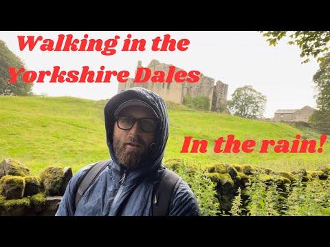
Walking in The Yorkshire Dales - Barden Tower - Bolton Abbey Path. Rainy Day & stuck at wedding!
Back at it again walking in the South Yorkshire Dales! Starting from Barden Tower/ Priests House car park (private parking .. oops) ...
![Bolton Abbey walking tour 4K, Yorkshire, England, UK [4K] | 2021 🇬🇧](https://i.ytimg.com/vi/Bc7QbmtnO28/hqdefault.jpg)
Bolton Abbey walking tour 4K, Yorkshire, England, UK [4K] | 2021 🇬🇧
Join us for this virtual Bolton Abbey walking tour. Bolton Abbey in Wharfedale, North Yorkshire, England, takes its name from the ...
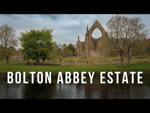
How You Could Spend A Day At Bolton Abbey Estate, Yorkshire, England
Set in the Yorkshire Dales, Bolton Abbey Estate is a popular day out for people of all ages. In this video we take you on a circular ...
Nearby Amenities
Located within 500m of 53.954524,-1.891191Have you been to Addingham?
Leave your review of Addingham below (or comments, questions and feedback).