Abdon and Heath
Civil Parish in Shropshire
England
Abdon and Heath

Abdon and Heath is a civil parish located in the county of Shropshire, England. It is nestled in the picturesque South Shropshire Hills, a designated Area of Outstanding Natural Beauty. The parish covers an area of approximately 6 square miles and has a population of around 200 people.
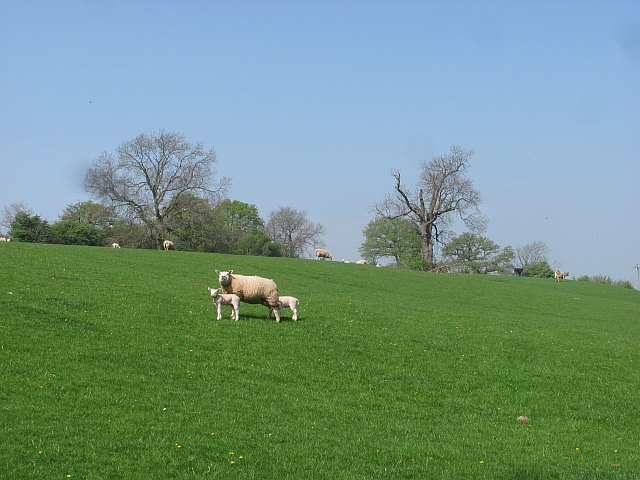
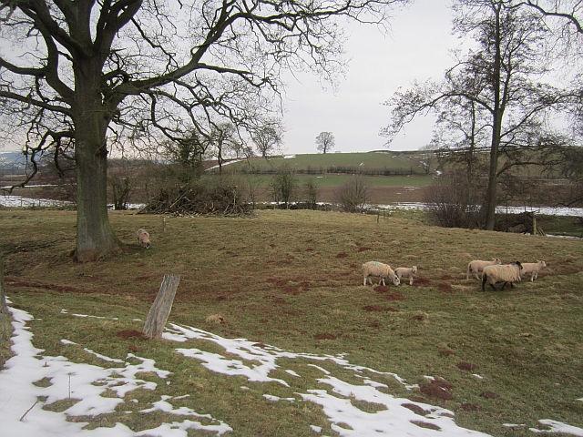
The parish consists of two main settlements, Abdon and Heath, which are situated a short distance apart. Abdon is a small village, characterized by its charming stone cottages and traditional English countryside atmosphere. It is home to the historic St. Margaret's Church, which dates back to the 12th century and boasts a beautiful Norman font.
Heath, on the other hand, is a smaller hamlet within the parish. It is surrounded by rolling hills and offers breathtaking views of the surrounding countryside. The area is known for its agricultural heritage, with many of the residents being involved in farming or related industries.
The parish is a haven for nature lovers and outdoor enthusiasts. The South Shropshire Hills offer numerous walking and cycling trails, providing opportunities to explore the stunning landscapes and encounter a variety of wildlife. The area is also popular for birdwatching, with several rare and endangered species being spotted in the vicinity.
Although Abdon and Heath may be small in size, they offer a tranquil and idyllic setting for residents and visitors alike. The close-knit community values its rural character and takes pride in preserving the natural beauty of the area.
If you have any feedback on the listing, please let us know in the comments section below.
Abdon and Heath Images
Images are sourced within 2km of 52.483323/-2.640722 or Grid Reference SO5687. Thanks to Geograph Open Source API. All images are credited.


Abdon and Heath is located at Grid Ref: SO5687 (Lat: 52.483323, Lng: -2.640722)
Unitary Authority: Shropshire
Police Authority: West Mercia
What 3 Words
///orders.gravitate.outings. Near Cardington, Shropshire
Nearby Locations
Related Wikis

Tugford
Tugford is a village and former civil parish, now in the parish of Abdon and Heath, in the Shropshire district, in the ceremonial county of Shropshire...

Abdon, Shropshire
Abdon is an upland village and former civil parish, now in the parish of Abdon and Heath, in Shropshire, England. In 2011 the parish had a population of...
Heath, Shropshire
Heath is a hamlet and former civil parish, now in the parish of Abdon and Heath, in the Clee Hills area of Shropshire, England. The settlement and wider...
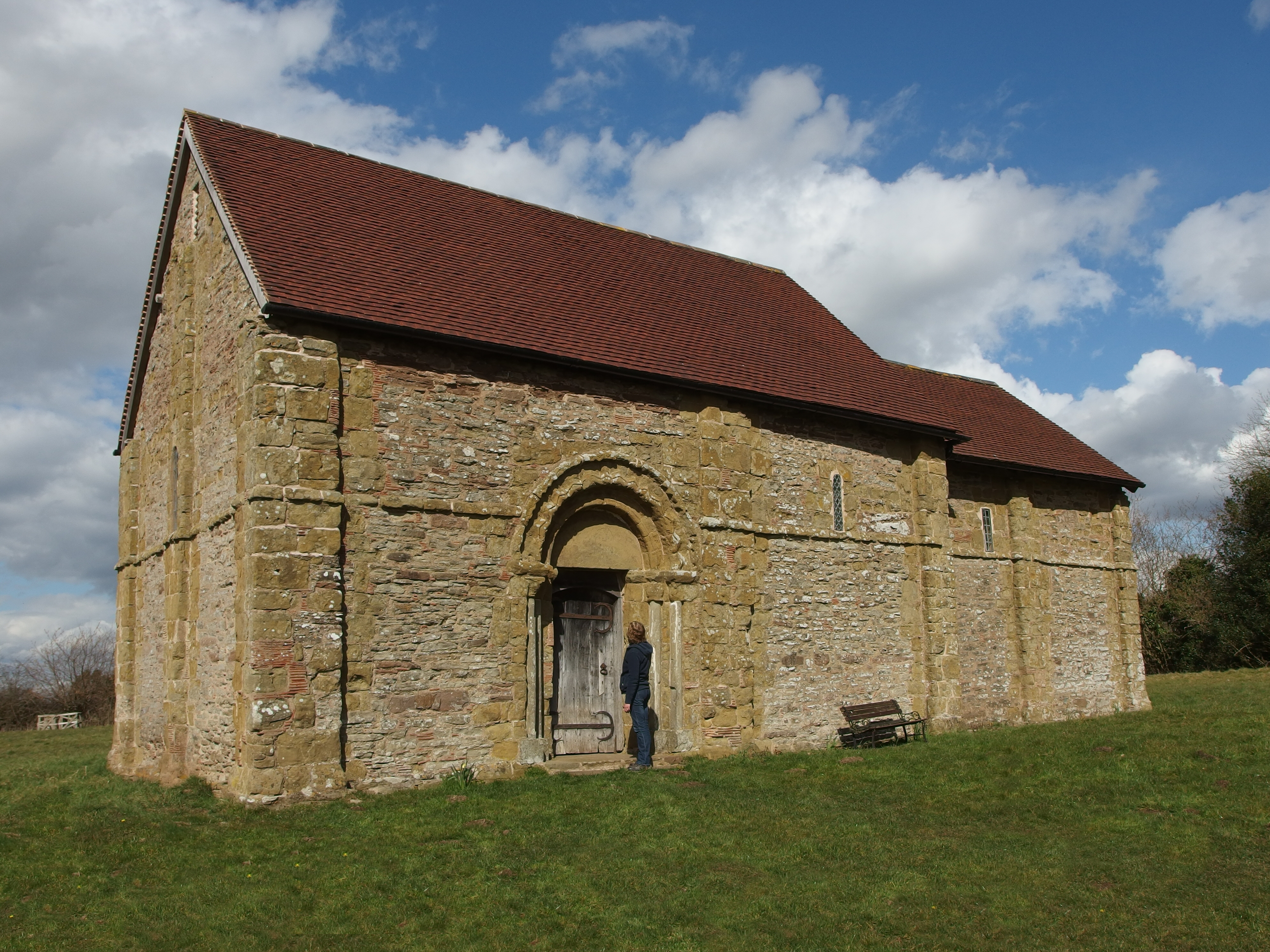
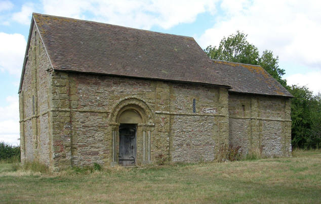
Heath Chapel
Heath Chapel is located in an isolated position in a field in the former civil parish of Heath, Shropshire, England. It is an Anglican chapel in the deanery...

Holdgate
Holdgate (or Stanton Holdgate or Castle Holdgate) is a small village and former civil parish, now in the parish of Abdon and Heath, in the Shropshire district...
Holy Trinity Church, Holdgate
Holy Trinity Church is in the village of Holdgate, Shropshire, England. It is an active Anglican parish church in the deanery of Ludlow, the archdeaconry...

Brown Clee Hill
Brown Clee Hill is the highest hill in the rural English county of Shropshire, at 540 metres (1,770 ft) above sea level. It is one of the Clee Hills,...

Nordy Bank
Nordy Bank is an Iron Age hill fort on Brown Clee Hill in the Shropshire Hills Area of Outstanding Natural Beauty in South Shropshire, England. == Location... ==
Have you been to Abdon and Heath?
Leave your review of Abdon and Heath below (or comments, questions and feedback).