Waunfawr
Community in Caernarfonshire
Wales
Waunfawr
Waunfawr is a small community located in the county of Caernarfonshire in Wales. Situated in the beautiful Snowdonia National Park, it is surrounded by breathtaking landscapes and offers a peaceful and picturesque setting.
The community is primarily residential, with a population of around 1,500 people. It is known for its close-knit community and friendly atmosphere. The village itself is centered around a main road, with a few local shops, a post office, and a pub that serves as a social hub for residents and visitors alike.
Waunfawr is also home to the Rhyd Ddu railway station, which is part of the Welsh Highland Railway. This heritage steam railway attracts tourists who come to enjoy the scenic train rides through the stunning countryside.
Outdoor enthusiasts are drawn to Waunfawr due to its proximity to the Snowdonia National Park. The village serves as a gateway to Mount Snowdon, the highest peak in Wales, and offers various hiking and cycling trails for all levels of experience. The area is also popular for fishing, with nearby lakes and rivers providing opportunities for anglers.
Overall, Waunfawr is a charming and peaceful community that offers a tranquil escape for nature lovers and those seeking a slower pace of life. Its stunning surroundings and friendly residents make it a delightful place to visit or call home.
If you have any feedback on the listing, please let us know in the comments section below.
Waunfawr Images
Images are sourced within 2km of 53.110525/-4.180472 or Grid Reference SH5459. Thanks to Geograph Open Source API. All images are credited.
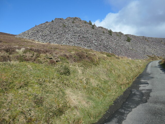
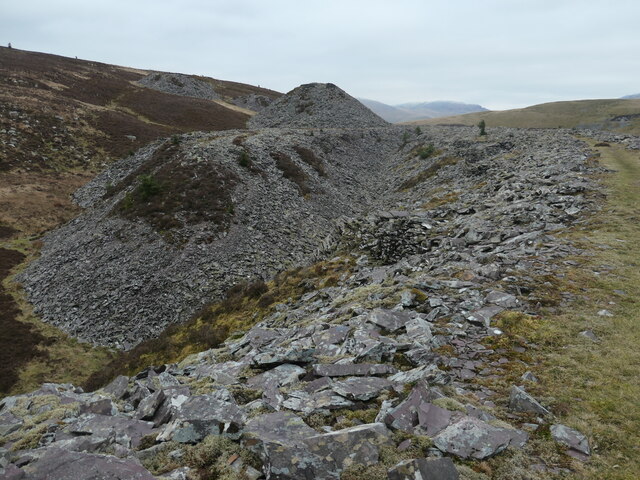
![Hen dramffordd ddiwydiannol / former industrial tramway One of the tongues of slate on the south side of Cefn Du. Waste slate from Chwarel Fawr [Cefn Du] was dumped here off the end of each tip. The tramway on this particular tip was not mapped by the OS in 1888, but was mapped in 1899. It had disappeared by 1913, but the tip itself still remains.](https://s1.geograph.org.uk/geophotos/07/42/84/7428429_34505e68.jpg)
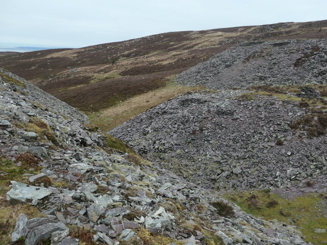
![Gwastraff llechi / Slate waste, Cefn Du [1] From a small quarry that was described as 'old' in 1899.](https://s0.geograph.org.uk/geophotos/07/42/84/7428432_72b169b6.jpg)
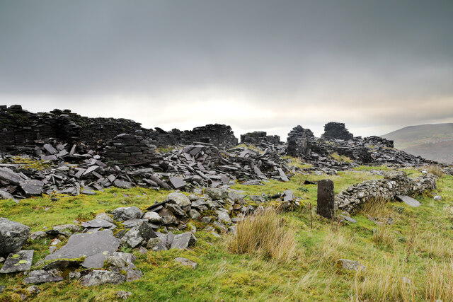
![Diwedd y domen lechi / the end of the slate tip The tipping point on one of the slate tips on the south side of Cefn Du. Waste slate from Chwarel Fawr [Cefn Du] was dumped here off the end of each tip. The tramway on this particular tip was not mapped by the OS in 1888, but was mapped in 1899. It had disappeared by 1913, but the tip itself still remains.](https://s1.geograph.org.uk/geophotos/07/42/84/7428437_e533fc93.jpg)
![Y man gollwng ar y domen lechi / The slate tip's tipping point [1] Built up so the wagon can tip up. Waste slate from Chwarel Fawr [Cefn Du] was dumped here off the end of each tip. The tramway on this particular tip was not mapped by the OS in 1888, but was mapped in 1899. It had disappeared by 1913, but the tip itself still remains.](https://s2.geograph.org.uk/geophotos/07/42/84/7428442_da1d5d5e.jpg)
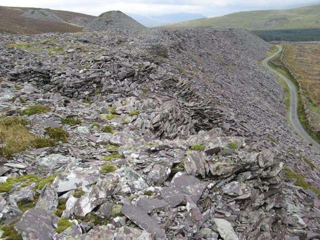
![Gwastraff llechi / Slate waste, Cefn Du [2] Nature is very slowly colonising the slate tips.](https://s3.geograph.org.uk/geophotos/07/42/84/7428443_754c6fb3.jpg)
![Coeden ar y domen lechi / Tree on the slate tip It's common enough to see small conifers growing on the Chwarel Fawr [Cefn Du] slate tips, but very unusual to see a deciduous tree.](https://s3.geograph.org.uk/geophotos/07/42/86/7428627_c55f6f6a.jpg)
![Coeden binwydd ar y domen lechi / Pine tree on the slate tip Small conifers are beginning to colonise the slate tips of Chwarel Fawr [Cefn Du].](https://s2.geograph.org.uk/geophotos/07/42/86/7428634_03daf28f.jpg)
![Diwedd y domen llechen hir / The end of the long slate tip Built up so the wagon can tip up. Waste slate from Chwarel Fawr [Cefn Du] was dumped here off the end of each tip. The tramway on this particular tip was mapped by the OS in 1888 and 1899. It had disappeared by 1913, but the tip itself still remains.](https://s1.geograph.org.uk/geophotos/07/42/86/7428637_16f9bd34.jpg)
Waunfawr is located at Grid Ref: SH5459 (Lat: 53.110525, Lng: -4.180472)
Unitary Authority: Gwynedd
Police Authority: North Wales
What 3 Words
///tissue.point.seaweed. Near Llanberis, Gwynedd
Nearby Locations
Related Wikis
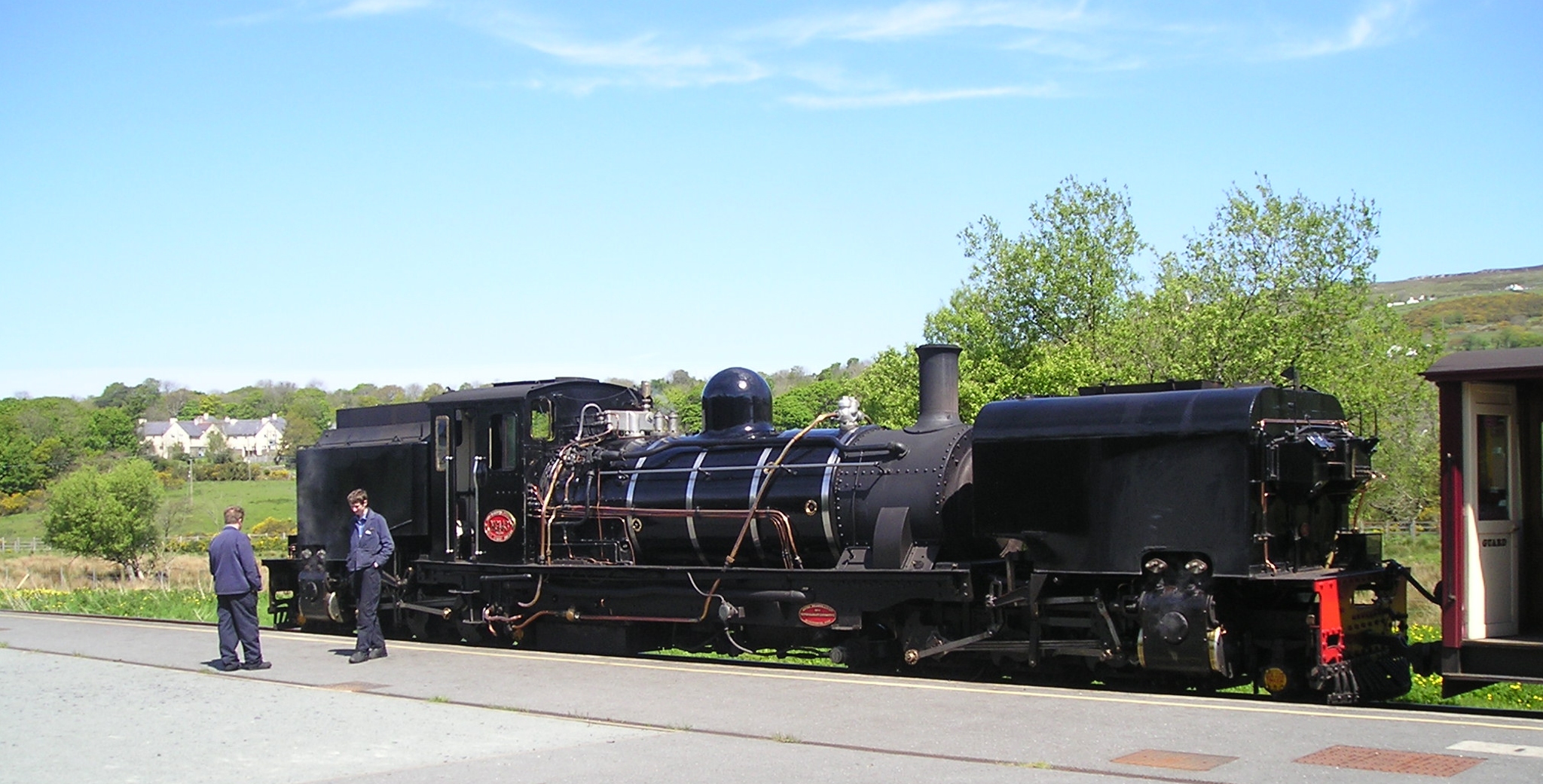
Waunfawr railway station
Waunfawr is a station on the narrow gauge Welsh Highland Railway, which was built in 1877 as the North Wales Narrow Gauge Railways Moel Tryfan Undertaking...

Waunfawr
Waunfawr (gwaun + mawr, English: large moorland/meadow) is a village and community, 6 kilometres (3.7 mi) SE of Caernarfon, near the Snowdonia National...

Betws Garmon
Betws Garmon is a community and small hamlet outside Waunfawr and near Beddgelert in Gwynedd, Wales. It has a population of 249.The summit of Snowdon...

Moel Eilio
Moel Eilio is a mountain in Snowdonia, North Wales, that is situated approximately 3 miles north-west of Snowdon itself. It has two subsidiary tops, Foel...
Nearby Amenities
Located within 500m of 53.110525,-4.180472Have you been to Waunfawr?
Leave your review of Waunfawr below (or comments, questions and feedback).