Uzmaston, Boulston and Slebech

Community in Pembrokeshire

Wales

Uzmaston, Boulston and Slebech

South Hills Farm
South Hills Farm Credit: Alan Hughes

The requested URL returned error: 429 Too Many Requests

If you have any feedback on the listing, please let us know in the comments section below.

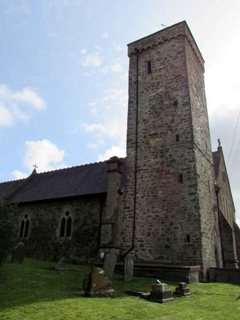
Uzmaston, Boulston and Slebech Images

Images are sourced within 2km of 51.802573/-4.92984 or Grid Reference SM9815. Thanks to Geograph Open Source API. All images are credited.

South Hills Farm
South Hills Farm
St Ismael’s Church, Uzmaston
Coastal House Business offices for Coastal Cottages, Haverfordwest.
Coastal House
Business offices for Coastal Cottages, Haverfordwest.
Riverside View Houses on the green at Uzmaston.
Riverside View
Houses on the green at Uzmaston.
Hanton Bridge
Hanton Bridge
A glimpse of the Western Cleddau
A40 east of Haverfordwest This is the view of the A40 facing east from a lay-by near the entrance to Haverfordwest Golf Club.
A40 east of Haverfordwest
This is the view of the A40 facing east from a lay-by near the entrance to Haverfordwest Golf Club.
Roundabout Haverfordwest
A40 Haverfordwest bypass A view looking along the tree-lined A40 Haverfordwest bypass heading for the roundabout near the railway station.
A40 Haverfordwest bypass
A view looking along the tree-lined A40 Haverfordwest bypass heading for the roundabout near the railway station.
A40 at Narbeth Road roundabout
Ordnance Survey Fundamental Bench Mark This block can be found on a banking beside the footpath.
For more detail see : <span class="nowrap"><a title="http://www.bench-marks.org.uk/bm1078" rel="nofollow ugc noopener" href="http://www.bench-marks.org.uk/bm1078">Link</a><img style="margin-left:2px;" alt="External link" title="External link - shift click to open in new window" src="https://s1.geograph.org.uk/img/external.png" width="10" height="10"/></span>
Ordnance Survey Fundamental Bench Mark
This block can be found on a banking beside the footpath. For more detail see : LinkExternal link
Welcome to Haverfordwest Alongside the A40 Narberth Road at the eastern edge of Haverfordwest, Pembrokeshire's main commercial and administrative centre and the county's most populous urban area.
The sign shows that Haverfordwest is twinned with Oberkirch in Germany.
Welcome to Haverfordwest
Alongside the A40 Narberth Road at the eastern edge of Haverfordwest, Pembrokeshire's main commercial and administrative centre and the county's most populous urban area. The sign shows that Haverfordwest is twinned with Oberkirch in Germany.
Two tracks into one NE of Haverfordwest railway station Viewed from the A40 Narberth Road bridge. Most of the railway line in this area is single track. The twin tracks allow trains travelling in opposite directions to pass each other, though the current (April 2014) schedule of one passenger train every two hours in each direction means that there is usually never more than one train on the line between Haverfordwest and the terminus at Milford Haven. Haverfordwest railway station is about 350 metres behind the camera.
Two tracks into one NE of Haverfordwest railway station
Viewed from the A40 Narberth Road bridge. Most of the railway line in this area is single track. The twin tracks allow trains travelling in opposite directions to pass each other, though the current (April 2014) schedule of one passenger train every two hours in each direction means that there is usually never more than one train on the line between Haverfordwest and the terminus at Milford Haven. Haverfordwest railway station is about 350 metres behind the camera.
A40 distances east of Haverfordwest The sign alongside the A40 Narberth Road shows 21 (miles) to St Clears and 30 to Carmarthen.
A40 distances east of Haverfordwest
The sign alongside the A40 Narberth Road shows 21 (miles) to St Clears and 30 to Carmarthen.
FRF Motors, Haverfordwest Toyota dealership on the north side of the A40 Narberth Road.
FRF Motors, Haverfordwest
Toyota dealership on the north side of the A40 Narberth Road.
A40 westbound
A40 westbound
A40 westbound
A40 westbound
Entrance to Haverfordwest
Show me another place!

Uzmaston, Boulston and Slebech is located at Grid Ref: SM9815 (Lat: 51.802573, Lng: -4.92984)

Unitary Authority: Pembrokeshire

Police Authority: Dyfed-Powys

Also known as: Uzmaston, Boulston a Slebets

What 3 Words

///crouch.outnumber.tumblers. Near Haverfordwest, Pembrokeshire

Related Wikis

Uzmaston

Uzmaston is a small parish in Pembrokeshire, Wales, about 2 kilometres south-east of Haverfordwest. The village, to the northwest of Boulston, forms part...

Haverfordwest railway station

Haverfordwest railway station serves the town of Haverfordwest in Pembrokeshire, Wales. It is 63 miles (101 km) west of Swansea on the Milford Haven branch...

Prendergast, Pembrokeshire

Prendergast is a former village and parish in Pembrokeshire, Wales, now a suburb of Haverfordwest, Pembrokeshire's county town. The name survives as an...

Haverfordwest High VC School

Haverfordwest High VC School is a secondary school in Haverfordwest, Pembrokeshire, Wales, that teaches through the medium of English. It opened in September...

Nearby Amenities

Located within 500m of 51.802573,-4.92984
Power: pole
Lat/Long: 51.8056699/-4.9342839
Power: tower
Lat/Long: 51.806475/-4.9328269
Power: pole
Lat/Long: 51.8056699/-4.9336912
Power: tower
Lat/Long: 51.803819/-4.9327068
Power: tower
Lat/Long: 51.8014334/-4.9326013
Power: tower
Lat/Long: 51.8001717/-4.9348365
Power: pole
Lat/Long: 51.8056749/-4.9340801
Power: pole
Lat/Long: 51.8056716/-4.9338762
Design: h-frame
Power: tower
Lat/Long: 51.8068831/-4.9314505
Power: pole
Lat/Long: 51.7990449/-4.932746
Power: pole
Lat/Long: 51.8012194/-4.9242809
Power: pole
Lat/Long: 51.8012343/-4.925952
Power: pole
Lat/Long: 51.8013339/-4.9278724
Power: pole
Lat/Long: 51.8014151/-4.929758
Power: pole
Lat/Long: 51.801508/-4.9318984
Power: pole
Lat/Long: 51.8017104/-4.93597
Power: pole
Lat/Long: 51.8022909/-4.9348381
Power: pole
Lat/Long: 51.8027802/-4.9339959
Power: pole
Lat/Long: 51.8036393/-4.9340791
Power: pole
Lat/Long: 51.8001363/-4.9353397
Power: pole
Lat/Long: 51.8008645/-4.9343607
Power: pole
Lat/Long: 51.8016059/-4.9341112
Power: pole
Lat/Long: 51.8026574/-4.9337786
Power: pole
Lat/Long: 51.8036012/-4.9338698
Power: pole
Lat/Long: 51.8044172/-4.9339557
Power: pole
Lat/Long: 51.8010054/-4.9365708
Power: pole
Lat/Long: 51.8025944/-4.933961
Power: pole
Lat/Long: 51.8029195/-4.9335989
Power: pole
Lat/Long: 51.8039064/-4.9337089
Power: pole
Lat/Long: 51.8009109/-4.933202
Power: pole
Lat/Long: 51.8015777/-4.933269
Power: pole
Lat/Long: 51.8022975/-4.9333361
Power: pole
Lat/Long: 51.8030522/-4.9334353
Power: pole
Lat/Long: 51.803918/-4.9335131
Give Way
Direction: backward
Lat/Long: 51.8006556/-4.9285994
Give Way
Direction: forward
Lat/Long: 51.8007125/-4.9286216
Give Way
Direction: backward
Lat/Long: 51.8057905/-4.9281101
Give Way
Direction: backward
Lat/Long: 51.8006421/-4.9342886
Cotts Park
Place: farm
Lat/Long: 51.8022637/-4.92859
The data included in this document is from www.openstreetmap.org. The data is made available under ODbL.

Have you been to Uzmaston, Boulston and Slebech?

Leave your review of Uzmaston, Boulston and Slebech below (or comments, questions and feedback).