Porthmadog

Community in Caernarfonshire

Wales

Porthmadog

Tremadog Market Square, Tremadog.
Tremadog Credit: Colin Kinnear

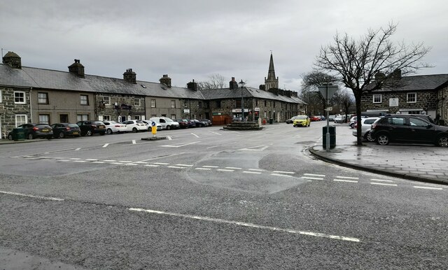
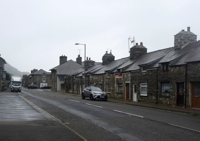
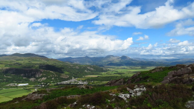
Porthmadog is a small town located in the county of Caernarfonshire, Gwynedd, Wales. Situated on the north-western coast of Wales, it lies on the southern edge of the Snowdonia National Park. Porthmadog is a popular tourist destination due to its stunning natural beauty and rich historical heritage.

The town's name translates to "Madog's port" in Welsh, in honor of the Welsh prince Madog ap Owain Gwynedd, who is believed to have established the town in the early 19th century. Porthmadog's development can be attributed to its connection with the slate industry during the Industrial Revolution, when it served as a major port for exporting slate from nearby mines.

Today, Porthmadog is known for its picturesque harbor and stunning views of the estuary of the River Glaslyn. The town offers a range of amenities and attractions for visitors, including a variety of shops, cafes, and restaurants. The Ffestiniog Railway, a historic narrow-gauge steam railway, is one of the town's main tourist attractions, taking visitors on a scenic journey through the beautiful Welsh countryside.

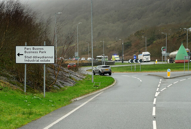
In addition to its natural beauty, Porthmadog is also a hub for outdoor activities. It is a popular base for exploring Snowdonia National Park, offering opportunities for hiking, climbing, and water sports. The town also hosts various cultural events and festivals throughout the year, attracting visitors from near and far.

Overall, Porthmadog is a charming and vibrant town with a rich history and stunning natural surroundings, making it a must-visit destination for those seeking a mix of culture, history, and outdoor adventures.

If you have any feedback on the listing, please let us know in the comments section below.

Porthmadog Images

Images are sourced within 2km of 52.922329/-4.146097 or Grid Reference SH5538. Thanks to Geograph Open Source API. All images are credited.

Tremadog Market Square, Tremadog.
Tremadog
Market Square, Tremadog.
A487, Tremadog Roundabout The A487 is one of the most important roads in Wales. It covers the majority of the west coast from St Davids to Menai Bridge, and is a primary route for most of its length, including a section where it multiplexes with the A470, another important north-south road. Along the way, it runs through two national parks: Snowdonia and Pembrokeshire Coast. Despite its length and importance, it is predominantly single carriageway, although the road has been upgraded in numerous places. It is 174 miles long.
<span class="nowrap"><a title="http://www.sabre-roads.org.uk/wiki/index.php?title=A487" rel="nofollow ugc noopener" href="http://www.sabre-roads.org.uk/wiki/index.php?title=A487">Link</a><img style="margin-left:2px;" alt="External link" title="External link - shift click to open in new window" src="https://s1.geograph.org.uk/img/external.png" width="10" height="10"/></span>
A487, Tremadog Roundabout
The A487 is one of the most important roads in Wales. It covers the majority of the west coast from St Davids to Menai Bridge, and is a primary route for most of its length, including a section where it multiplexes with the A470, another important north-south road. Along the way, it runs through two national parks: Snowdonia and Pembrokeshire Coast. Despite its length and importance, it is predominantly single carriageway, although the road has been upgraded in numerous places. It is 174 miles long. LinkExternal link
Study in grey (Dublin Street, Tremadog) An exceptionally grey day even for the vicinity and I have lightened the photo as much as I dare. Each house in the terrace has a separate Cadw grade-II listing, with No. 15 as an example (85316 <span class="nowrap"><a title="https://cadwpublic-api.azurewebsites.net/reports/listedbuilding/FullReport?lang=&id=85316" rel="nofollow ugc noopener" href="https://cadwpublic-api.azurewebsites.net/reports/listedbuilding/FullReport?lang=&id=85316">Link</a><img style="margin-left:2px;" alt="External link" title="External link - shift click to open in new window" src="https://s1.geograph.org.uk/img/external.png" width="10" height="10"/></span> ), which notes that the terrace is probably the earliest surviving structure in Tremadog. Note the 'raked half dormer' roofs and huge chimney breasts.  The name Dublin Street refers to the hope in the early 19th Century that this would be on the route to Dublin (via Porth Dinllaen) although Holyhead eventually took that prize.
Study in grey (Dublin Street, Tremadog)
An exceptionally grey day even for the vicinity and I have lightened the photo as much as I dare. Each house in the terrace has a separate Cadw grade-II listing, with No. 15 as an example (85316 LinkExternal link ), which notes that the terrace is probably the earliest surviving structure in Tremadog. Note the 'raked half dormer' roofs and huge chimney breasts. The name Dublin Street refers to the hope in the early 19th Century that this would be on the route to Dublin (via Porth Dinllaen) although Holyhead eventually took that prize.
The Golden Fleece Inn, Tremadog Compare the same building taken in bright sunshine... <a title="https://www.geograph.org.uk/photo/5627105" href="https://www.geograph.org.uk/photo/5627105">Link</a> .   The inn was built ca. 1810 and is grade-II listed by Cadw: 85353 <span class="nowrap"><a title="https://cadwpublic-api.azurewebsites.net/reports/listedbuilding/FullReport?lang=&id=85353" rel="nofollow ugc noopener" href="https://cadwpublic-api.azurewebsites.net/reports/listedbuilding/FullReport?lang=&id=85353">Link</a><img style="margin-left:2px;" alt="External link" title="External link - shift click to open in new window" src="https://s1.geograph.org.uk/img/external.png" width="10" height="10"/></span> .
The Golden Fleece Inn, Tremadog
Compare the same building taken in bright sunshine... Link . The inn was built ca. 1810 and is grade-II listed by Cadw: 85353 LinkExternal link .
On Moel-y-Gest - view to Tremadog, Cnicht & Moelwyn Mawr
Ordnance Survey 1GL Bolt This OS Bolt can be found on the west face of the church. It marks a point 5.467m above mean sea level.
Ordnance Survey 1GL Bolt
This OS Bolt can be found on the west face of the church. It marks a point 5.467m above mean sea level.
Ordnance Survey Flush Bracket (G2621) This OS Flush Bracket can be found on the Madoc Hotel behind the BT Box.
Ordnance Survey Flush Bracket (G2621)
This OS Flush Bracket can be found on the Madoc Hotel behind the BT Box.
Y Sgwar, Tremadog Tremadog, an exceptionally fine example of a planned town, was founded by William Alexander Madocks, who bought the land in 1798. At that time, the flat area surrounding the Glaslyn River was all salt marsh. Madocks was well aware of the possibilities of draining fenland, and set about building an embankment to separate the land from the sea. His first embankment built in 1800 won the area where Tremadog now stands. By 1805, the first cottages for workers were built in what he called "Pentre Gwaelod" or "Bottom Village". Within the year he had changed the name of the village to Tre Madoc or Madocks' Town. <span class="nowrap"><a title="http://www.tremadog.org.uk/content/14.php" rel="nofollow ugc noopener" href="http://www.tremadog.org.uk/content/14.php">Link</a><img style="margin-left:2px;" alt="External link" title="External link - shift click to open in new window" src="https://s1.geograph.org.uk/img/external.png" width="10" height="10"/></span>
Y Sgwar, Tremadog
Tremadog, an exceptionally fine example of a planned town, was founded by William Alexander Madocks, who bought the land in 1798. At that time, the flat area surrounding the Glaslyn River was all salt marsh. Madocks was well aware of the possibilities of draining fenland, and set about building an embankment to separate the land from the sea. His first embankment built in 1800 won the area where Tremadog now stands. By 1805, the first cottages for workers were built in what he called "Pentre Gwaelod" or "Bottom Village". Within the year he had changed the name of the village to Tre Madoc or Madocks' Town. LinkExternal link
Public Conveniences on Main Street
Gateway to the former church of St Mary Both church and gateway date from circa 1811 during the period when Tremadog was being developed on reclaimed land. What appears to be a rather finely carved stone gateway and arch is actually an example of 'Coadestone', an artificial stone produced by the use of moulds. Coadestone was invented in the late 18th century, the company being owned by a Mrs Eleanor Coade who had showrooms in London and who produced stonework, sculptures etc by a secret process. Work was done for George III and included stonework at Buckingham Palace. The gateway is grade two listed and is described as an 'eclectic composition'.
Gateway to the former church of St Mary
Both church and gateway date from circa 1811 during the period when Tremadog was being developed on reclaimed land. What appears to be a rather finely carved stone gateway and arch is actually an example of 'Coadestone', an artificial stone produced by the use of moulds. Coadestone was invented in the late 18th century, the company being owned by a Mrs Eleanor Coade who had showrooms in London and who produced stonework, sculptures etc by a secret process. Work was done for George III and included stonework at Buckingham Palace. The gateway is grade two listed and is described as an 'eclectic composition'.
Centre of Tremadog village At the centre of Tremadog the road widens into a square [Y Sgwar] with the Market Hall dominating the scene. Tremadog was built on reclaimed land by the Madocks family and was intended as a post town on the route from London to Dublin via a new port at Porth Dinllaen - a development that never happened. The Market Hall originally had open arches on the ground floor. These were infilled with ironwork designed by Clough Williams Ellis in the early 20thC, but in the 1970's there was a further change when the windows were added.
Centre of Tremadog village
At the centre of Tremadog the road widens into a square [Y Sgwar] with the Market Hall dominating the scene. Tremadog was built on reclaimed land by the Madocks family and was intended as a post town on the route from London to Dublin via a new port at Porth Dinllaen - a development that never happened. The Market Hall originally had open arches on the ground floor. These were infilled with ironwork designed by Clough Williams Ellis in the early 20thC, but in the 1970's there was a further change when the windows were added.
Businesses in Stryd y Llan, Tremadog
The Golden Fleece Inn, Tremadog This is known in Welsh as Tafarn y Cnu Aur.
The Golden Fleece Inn, Tremadog
This is known in Welsh as Tafarn y Cnu Aur.
Sgwar Tremadog Square Craig y Castell scar towers above the former Town Hall building.
Sgwar Tremadog Square
Craig y Castell scar towers above the former Town Hall building.
Houses and businesses on the east side of Sgwar Tremadog Square In the centre of the terrace is the Union Inn.
Houses and businesses on the east side of Sgwar Tremadog Square
In the centre of the terrace is the Union Inn.
St Mary's Church
St Mary's Church
Church Street Looking along Church Street in Tremadog.
Church Street
Looking along Church Street in Tremadog.
Church Street meets High Street Looking from Church Street onto High Street in Tremadog.
Church Street meets High Street
Looking from Church Street onto High Street in Tremadog.
Show me another place!

Porthmadog is located at Grid Ref: SH5538 (Lat: 52.922329, Lng: -4.146097)

Unitary Authority: Gwynedd

Police Authority: North Wales

What 3 Words

///identity.matter.nightfall. Near Porthmadog, Gwynedd

Related Wikis

Porthmadog

Porthmadog (Welsh: [pɔrθˈmadɔɡ] ), originally Portmadoc until 1974 and locally as "Port", is a coastal town and community in the Eifionydd area of Gwynedd...
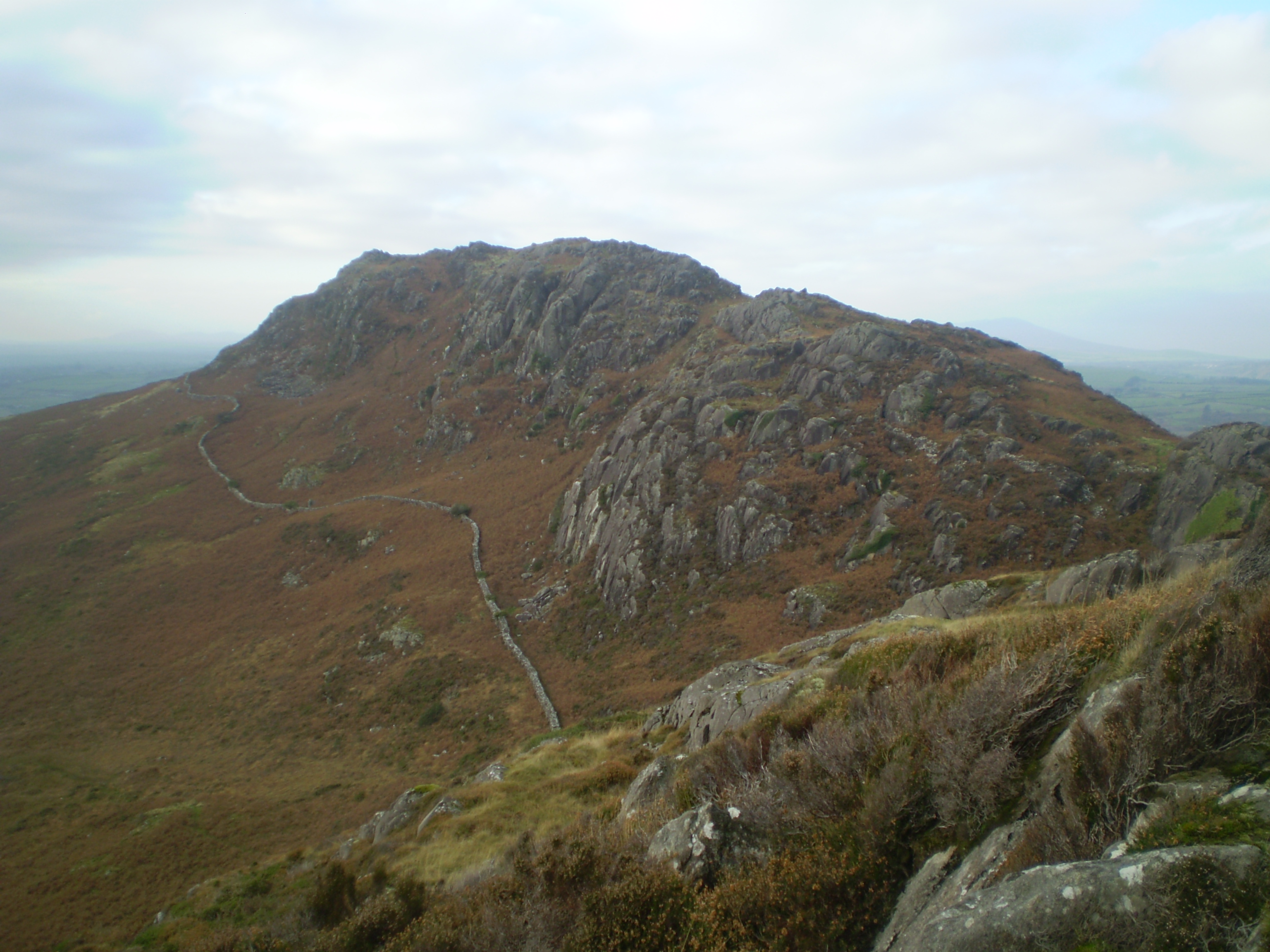
Moel y Gest

Moel y Gest is a 263 m (863 ft) hill to the west of Porthmadog in North Wales. It is a very rocky hill with high topographic prominence because of the...

Porthmadog railway station

Porthmadog railway station serves the town of Porthmadog on the Llŷn Peninsula in Gwynedd, Wales. The station is on the Cambrian Coast Railway with passenger...

Portmadoc, Beddgelert and South Snowdon Railway

The Porthmadog, Beddgelert and South Snowdon Railway (PB&SSR) was a 1 ft 11+1⁄2 in (597 mm) narrow gauge railway intended to connect Porthmadog with the...

Nearby Amenities

Located within 500m of 52.922329,-4.146097
Natural: spring
Lat/Long: 52.9252167/-4.1460462
The data included in this document is from www.openstreetmap.org. The data is made available under ODbL.

Have you been to Porthmadog?

Leave your review of Porthmadog below (or comments, questions and feedback).