Newport

Community in Pembrokeshire

Wales

Newport

Sea wall, Cwm-yr-Eglwys: Dinas
Sea wall, Cwm-yr-Eglwys: Dinas Credit: Dylan Moore

Newport, Pembrokeshire is a charming coastal community located in the southwest of Wales, United Kingdom. Nestled between the Preseli Hills and the stunning Pembrokeshire Coast National Park, Newport offers a unique blend of natural beauty and rich history.

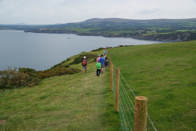
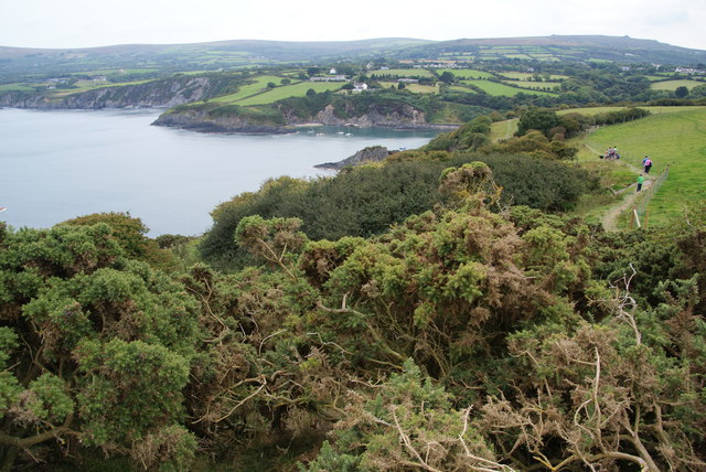
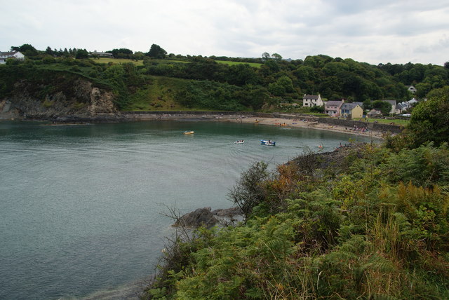
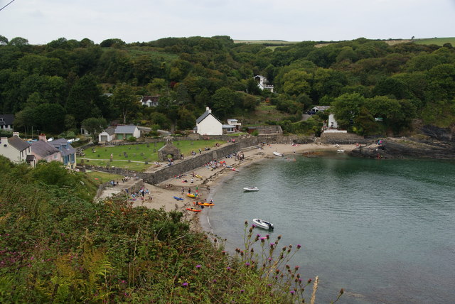
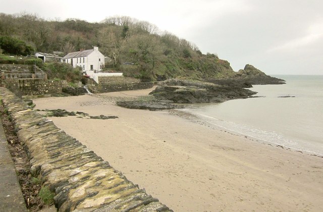
The town itself is small but vibrant, with a population of around 1,300 residents. It is known for its picturesque setting, boasting a sandy beach, rolling hills, and a peaceful estuary. The Pembrokeshire Coast Path, a renowned long-distance trail, passes through Newport, attracting hikers and nature enthusiasts from all over the world.

History buffs will find plenty to explore in Newport as well. The town is home to several ancient monuments, including the Iron Age hill fort of Carn Ingli and the Neolithic burial chamber of Pentre Ifan. These sites provide glimpses into the area's rich cultural heritage.

In addition to its natural and historical attractions, Newport offers a range of amenities to cater to both residents and visitors. The town features a variety of shops, cafes, and restaurants, offering delicious local cuisine and handmade crafts. There are also accommodation options available, including cozy bed and breakfasts and self-catering cottages.

Overall, Newport, Pembrokeshire is a hidden gem on the Welsh coast, offering a tranquil retreat for those seeking natural beauty, outdoor activities, and a taste of Welsh culture. With its stunning landscapes and welcoming community, it is a destination that truly has something for everyone.

If you have any feedback on the listing, please let us know in the comments section below.
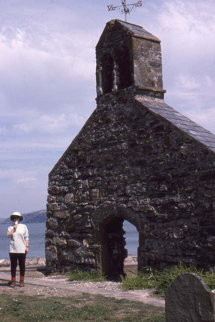
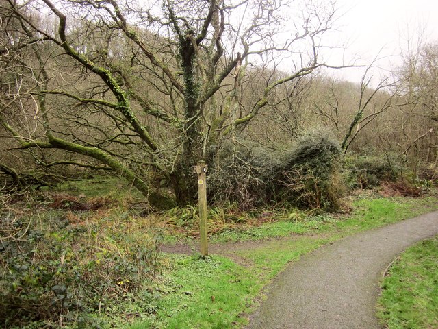
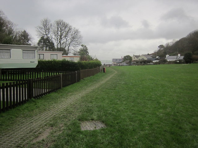
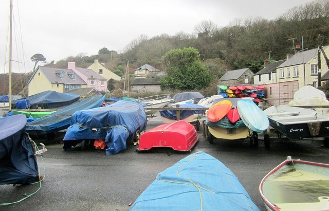
Newport Images

Images are sourced within 2km of 52.021147/-4.877432 or Grid Reference SN0239. Thanks to Geograph Open Source API. All images are credited.

Sea wall, Cwm-yr-Eglwys: Dinas
St Brynach's Church
St Brynach's Church
Pwll Glas on Dinas Island
Church of St Brynach remains At Cwm-yr-Eglwys
Church of St Brynach remains
At Cwm-yr-Eglwys
Cwm-yr-Eglwys Beach View from the sea wall round to Pig y Baw
Cwm-yr-Eglwys Beach
View from the sea wall round to Pig y Baw
Cwm-yr-Eglwys Beach View to Trywn Isaac with more of the sea defences on the far right
Cwm-yr-Eglwys Beach
View to Trywn Isaac with more of the sea defences on the far right
Remains of St Brynach's church
Churchyard and ruined church, Cwm yr Eglwys All that remains of the church of St Brynach, the rest having been washed away by the so-called Royal Charter Storm of October 1859.   A somewhat melancholy sight, all the more so on a drizzly afternoon. 

As for the meaning of the name, if this were Cornwall rather than West Wales, the wording on the map might well be 'Church Cove'.
Churchyard and ruined church, Cwm yr Eglwys
All that remains of the church of St Brynach, the rest having been washed away by the so-called Royal Charter Storm of October 1859. A somewhat melancholy sight, all the more so on a drizzly afternoon. As for the meaning of the name, if this were Cornwall rather than West Wales, the wording on the map might well be 'Church Cove'.
Coastal path on Dinas Island The path is currently aiming at Carningli, with Newport down to the left. This is a popular walk and the path can get crowded.
Coastal path on Dinas Island
The path is currently aiming at Carningli, with Newport down to the left. This is a popular walk and the path can get crowded.
Non-flowering gorse by the coast path on Dinas Island The gorse on the moors is a blaze of colour currently, so it was a surprise to see this not in flower.
Non-flowering gorse by the coast path on Dinas Island
The gorse on the moors is a blaze of colour currently, so it was a surprise to see this not in flower.
The bay at Cwm-yr-Eglwys This is the view which opens up from the coastal path on Dinas Island.
The bay at Cwm-yr-Eglwys
This is the view which opens up from the coastal path on Dinas Island.
The bay at Cwm-yr-Eglwys Viewed from the south side where it is approached by a narrow road. St Brynach's Church stands in the centre.
The bay at Cwm-yr-Eglwys
Viewed from the south side where it is approached by a narrow road. St Brynach's Church stands in the centre.
Ruins of St Brynach's church, Cwm-yr-Eglwys
Path junction, Cwm-yr-Eglwys Footpath PP16 45/2 joins the coast path here from the left. (The coast path is mapped as an alternative to the strenuous route around Dinas Island). On the left is the swampy woodland shown in <a href="https://www.geograph.org.uk/photo/4529419">SN0139 : Swampy woodland, Cwm Dewi</a>.
Path junction, Cwm-yr-Eglwys
Footpath PP16 45/2 joins the coast path here from the left. (The coast path is mapped as an alternative to the strenuous route around Dinas Island). On the left is the swampy woodland shown in SN0139 : Swampy woodland, Cwm Dewi.
Cwm-yr-Eglwys Caravan Park The easy inland version of the coast path runs through this caravan site to the sea by the ruined church.
Cwm-yr-Eglwys Caravan Park
The easy inland version of the coast path runs through this caravan site to the sea by the ruined church.
Boat park, Cwm-yr-Eglwys From the inland arm of the coast path.
Boat park, Cwm-yr-Eglwys
From the inland arm of the coast path.
Beach, Cwm-yr-Eglwys With Carreg y Defaid (rocks) and the point of Pig-y-Baw, plus the cottage Y Bont.
Beach, Cwm-yr-Eglwys
With Carreg y Defaid (rocks) and the point of Pig-y-Baw, plus the cottage Y Bont.
Old advert, Cwm-yr-Eglwys An advertising sign for Thomas L Ainsley, a marine optician of Alexandra Road, Newport, and fixed to the side of a hut near the car park. I can find a reference to him trading as a bookseller as well as a marine optician, and based in Cardiff, but nothing for Newport. I must search out an old Kelly's ...
Old advert, Cwm-yr-Eglwys
An advertising sign for Thomas L Ainsley, a marine optician of Alexandra Road, Newport, and fixed to the side of a hut near the car park. I can find a reference to him trading as a bookseller as well as a marine optician, and based in Cardiff, but nothing for Newport. I must search out an old Kelly's ...
Show me another place!

Newport is located at Grid Ref: SN0239 (Lat: 52.021147, Lng: -4.877432)

Unitary Authority: Pembrokeshire

Police Authority: Dyfed-Powys

Also known as: Trefdraeth

What 3 Words

///name.fabricate.runways. Near Newport, Pembrokeshire

Related Wikis

Cwm-yr-Eglwys

Cwm-yr-Eglwys (English: Valley of the Church) is a hamlet in a picturesque cove on the eastern side of the Dinas Island peninsula in the community of Dinas...

Newport Bay (Wales)

Newport Bay (Welsh: Bae Trefdraeth) is a bay on a section of the north Pembrokeshire coast, Wales, which is within the Pembrokeshire Coast National Park...

Brynhenllan

Bryn-henllan, Bryn Henllan or Brynhenllan is a small settlement in the community of Dinas Cross, north Pembrokeshire, Wales, just north of the A487 road...

Cwm Dewi

Cwm Dewi is a Site of Special Scientific Interest (or SSSI) in Pembrokeshire, South Wales. It has been designated as a Site of Special Scientific Interest...

Dinas Island

Dinas Island (Welsh: Ynys Dinas) is a peninsula, partially detached from the mainland, in the community of Dinas Cross between Fishguard and Newport, Pembrokeshire...

Pwllgwaelod

Pwllgwaelod (originally Y Pwll Gwaelod, Welsh for The Bottom Cove/Creek) is a small scattered hamlet centred on a bay on the south-western side of the...

River Nevern

The River Nevern (Welsh: Afon Nyfer) is a river in Pembrokeshire, Wales. Its source is north of the village of Crymych and its length is about 11 miles...
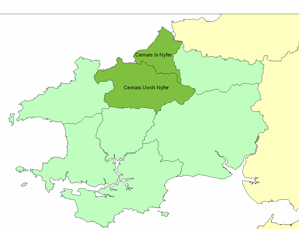
Cemais Is Nyfer

Cemais Is Nyfer was a mediaeval commote in the Dyfed cantref of Cemais, Wales. It consisted of the territory between the rivers Nyfer and Teifi, and comprised...

Nearby Amenities

Located within 500m of 52.021147,-4.877432
Aberfforest Waterfall
Waterway: waterfall
Lat/Long: 52.0169648/-4.8799154
Ford: stepping_stones
Lat/Long: 52.0172386/-4.8803261
Ford: stepping_stones
Lat/Long: 52.0169565/-4.8797792
The data included in this document is from www.openstreetmap.org. The data is made available under ODbL.

Have you been to Newport?

Leave your review of Newport below (or comments, questions and feedback).