Nantglyn

Community in Denbighshire

Wales

Nantglyn

Derelict Water Treatment Works Above Ffridd Fawr
Derelict Water Treatment Works Above Ffridd Fawr Credit: Chris Andrews

The requested URL returned error: 429 Too Many Requests

If you have any feedback on the listing, please let us know in the comments section below.
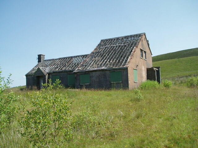
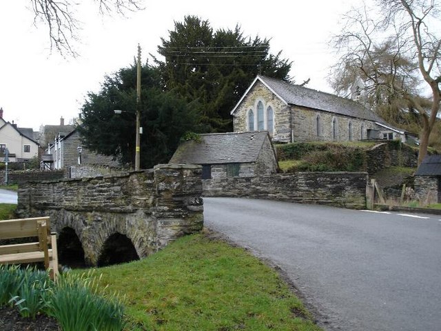
Nantglyn Images

Images are sourced within 2km of 53.123061/-3.517725 or Grid Reference SH9859. Thanks to Geograph Open Source API. All images are credited.

Derelict Water Treatment Works Above Ffridd Fawr
Lanes off the B4501
Lanes off the B4501
South facing view across the bog and down the lake
Walking part of the Clwydian Way near Llyn Brenig The Clwydian Way skirts part of Llyn Brenig and then heads north into Gors-Maen llwyd Nature Reserve.
Walking part of the Clwydian Way near Llyn Brenig
The Clwydian Way skirts part of Llyn Brenig and then heads north into Gors-Maen llwyd Nature Reserve.
Part of the Clwydian Way next to the B5401 The path here runs adjacent to the road.
Part of the Clwydian Way next to the B5401
The path here runs adjacent to the road.
Home from Home Derelict property alongside A543 leading into Denbigh.
Home from Home
Derelict property alongside A543 leading into Denbigh.
Gorsedd Bran Parked on minor road to SW then up field beside conifer plantation. Climb into dense forest opposite rogue conifer in field before you reach highest point of field. Head in at right angles to gain trig.
Name: Gorsedd Bran
Hill number: 3355
Height: 518m / 1699ft
Area: 30C: Llandudno to Wrexham
Class: Hu,5
Grid ref: SH 96919 59754
Summit feature: trig point
Drop: 120m
Col: 398m  SH979586
Gorsedd Bran
Parked on minor road to SW then up field beside conifer plantation. Climb into dense forest opposite rogue conifer in field before you reach highest point of field. Head in at right angles to gain trig. Name: Gorsedd Bran Hill number: 3355 Height: 518m / 1699ft Area: 30C: Llandudno to Wrexham Class: Hu,5 Grid ref: SH 96919 59754 Summit feature: trig point Drop: 120m Col: 398m SH979586
Llyn  Brenig: Wind farm across the reservoir
Llyn Brenig: Wind farm across the reservoir
Logging at Rhiwiau Not a vast amount of timber on this hill, but logging is currently going on at various points along this road.
Logging at Rhiwiau
Not a vast amount of timber on this hill, but logging is currently going on at various points along this road.
Gorsedd Brân Nodweddiadol o fryniau Hiraethog.
Typical of the Denbigh moor hills.
Gorsedd Brân
Nodweddiadol o fryniau Hiraethog. Typical of the Denbigh moor hills.
Wern Uchaf Fferm fynyddig.
Welsh mountain farm
Wern Uchaf
Fferm fynyddig. Welsh mountain farm
Cuddliw? Camouflage? - no comment!!
Cuddliw?
Camouflage? - no comment!!
Ffordd y mynydd. Ffordd tuag at Bryn Llwyd.
Track towards Bryn llwyd.
Ffordd y mynydd.
Ffordd tuag at Bryn Llwyd. Track towards Bryn llwyd.
Pen y Lôn Enw addas iawn! Ffordd hir, gul a serth i'w gyrraedd.
Translated means 'End of the road'. A very appropriate name as it is at the end of a long narrow steep road.
Pen y Lôn
Enw addas iawn! Ffordd hir, gul a serth i'w gyrraedd. Translated means 'End of the road'. A very appropriate name as it is at the end of a long narrow steep road.
Old water works building near Ffridd Fawr
Sheep grazing on the top of a hidden reservoir near Ffridd Fawr
Cors Maen Llwyd Moorland nature reserve owned by the North Wales Wildlife Trust. It is part of the Mynydd Hiraethog SSSI. In the distance are the windmills of the Clocaenog Wind Farm.
Cors Maen Llwyd
Moorland nature reserve owned by the North Wales Wildlife Trust. It is part of the Mynydd Hiraethog SSSI. In the distance are the windmills of the Clocaenog Wind Farm.
Show me another place!

Nantglyn is located at Grid Ref: SH9859 (Lat: 53.123061, Lng: -3.517725)

Unitary Authority: Denbighshire

Police Authority: North Wales

What 3 Words

///senses.mandolin.rating. Near Henllan, Denbighshire

Related Wikis

Cader

Cader is a village in Denbighshire, Wales.

Nantglyn

Nantglyn is a small village and community in Denbighshire, Wales. The population of the community taken at the 2011 census was 323. It is situated in a...

Bylchau

Bylchau () is a hamlet in Conwy County Borough, Wales. It is located at the junction of the A544 with the A543, some 5 miles to the south-west of Denbigh...
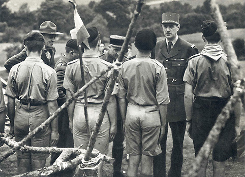
Brynbach

Brynbach was a National Campsite of the Scout Association, situated near Saron in Denbighshire in North Wales. The 200-acre site had its heyday between...

Have you been to Nantglyn?

Leave your review of Nantglyn below (or comments, questions and feedback).