Mwynglawdd

Community in Denbighshire

Wales

Mwynglawdd

Peniel Chapel Dating from 1823, now sadly derelict.
Peniel Chapel Credit: John H Darch

The requested URL returned error: 429 Too Many Requests

If you have any feedback on the listing, please let us know in the comments section below.

Mwynglawdd Images

Images are sourced within 2km of 53.057936/-3.106086 or Grid Reference SJ2551. Thanks to Geograph Open Source API. All images are credited.

Peniel Chapel Dating from 1823, now sadly derelict.
Peniel Chapel
Dating from 1823, now sadly derelict.
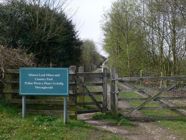
Southern entrance to the Minera Lead Mines Country Park
Minera Lead Mines The mines here were worked for many centuries until finally closing in 1914.
Minera Lead Mines
The mines here were worked for many centuries until finally closing in 1914.
Minera Lead Mine Walking towards the Engine House at Meadow Shaft.
Minera Lead Mine
Walking towards the Engine House at Meadow Shaft.
Minera Lead Mine Meadow Shaft Engine House, restored in the 1990's.
Minera Lead Mine
Meadow Shaft Engine House, restored in the 1990's.
Gateway, Wern Hall Estate A new housing development near Minera, built on the site of the old City Arms.
Gateway, Wern Hall Estate
A new housing development near Minera, built on the site of the old City Arms.
Remains of Minera Lead mine Ecclusham Mountain as a backdrop
Remains of Minera Lead mine
Ecclusham Mountain as a backdrop
Old mine building, Minera Ruined remains of one of the lead mine buildings at Minera Country Park.
Old mine building, Minera
Ruined remains of one of the lead mine buildings at Minera Country Park.
Hen coop, Minera
Hen coop, Minera
Detached house with large garden, Minera
Plas Dinas, Minera
Plas Dinas, Minera
Approaching a sharp bend in the Wern Road, near Minera
Sharp bend near Ty Brith Lane, Minera Leading to a narrow bridge over the River Clywedog
Sharp bend near Ty Brith Lane, Minera
Leading to a narrow bridge over the River Clywedog
Bridge over the River Clywedog, near Minera The bridge is on a sharp bend of the B5426, south of the village.
Bridge over the River Clywedog, near Minera
The bridge is on a sharp bend of the B5426, south of the village.
Bridge over the river Clywedog, south of Minera The bridge was built in 1876, viewed from Pentre Hill.
Bridge over the river Clywedog, south of Minera
The bridge was built in 1876, viewed from Pentre Hill.
Bus Shelter, Minera On the junction of Church Road and Pentre Hill.
Bus Shelter, Minera
On the junction of Church Road and Pentre Hill.
Plaque on the bus shelter, Minera The plaque shows a hand-drawn map of the village of Minera, created from the drawings, memories, poems and records of the people of Minera and children from the local school.
Plaque on the bus shelter, Minera
The plaque shows a hand-drawn map of the village of Minera, created from the drawings, memories, poems and records of the people of Minera and children from the local school.
Minera Aided Primary School Has about 100 pupils.
Minera Aided Primary School
Has about 100 pupils.
Show me another place!

Mwynglawdd is located at Grid Ref: SJ2551 (Lat: 53.057936, Lng: -3.106086)

Unitary Authority: Wrexham

Police Authority: North Wales

Also known as: Minera

What 3 Words

///seemingly.nimbly.kindest. Near Brymbo, Wrexham

Nearby Locations

Minera Lynwood Mwynglawdd

Related Wikis

Ogof Dydd Byraf

Ogof Dydd Byraf is a cave which extends under Esclusham Mountain in the north-east Wales from its entrance in the south face of the Minera Limeworks quarry...

Berwig Halt railway station

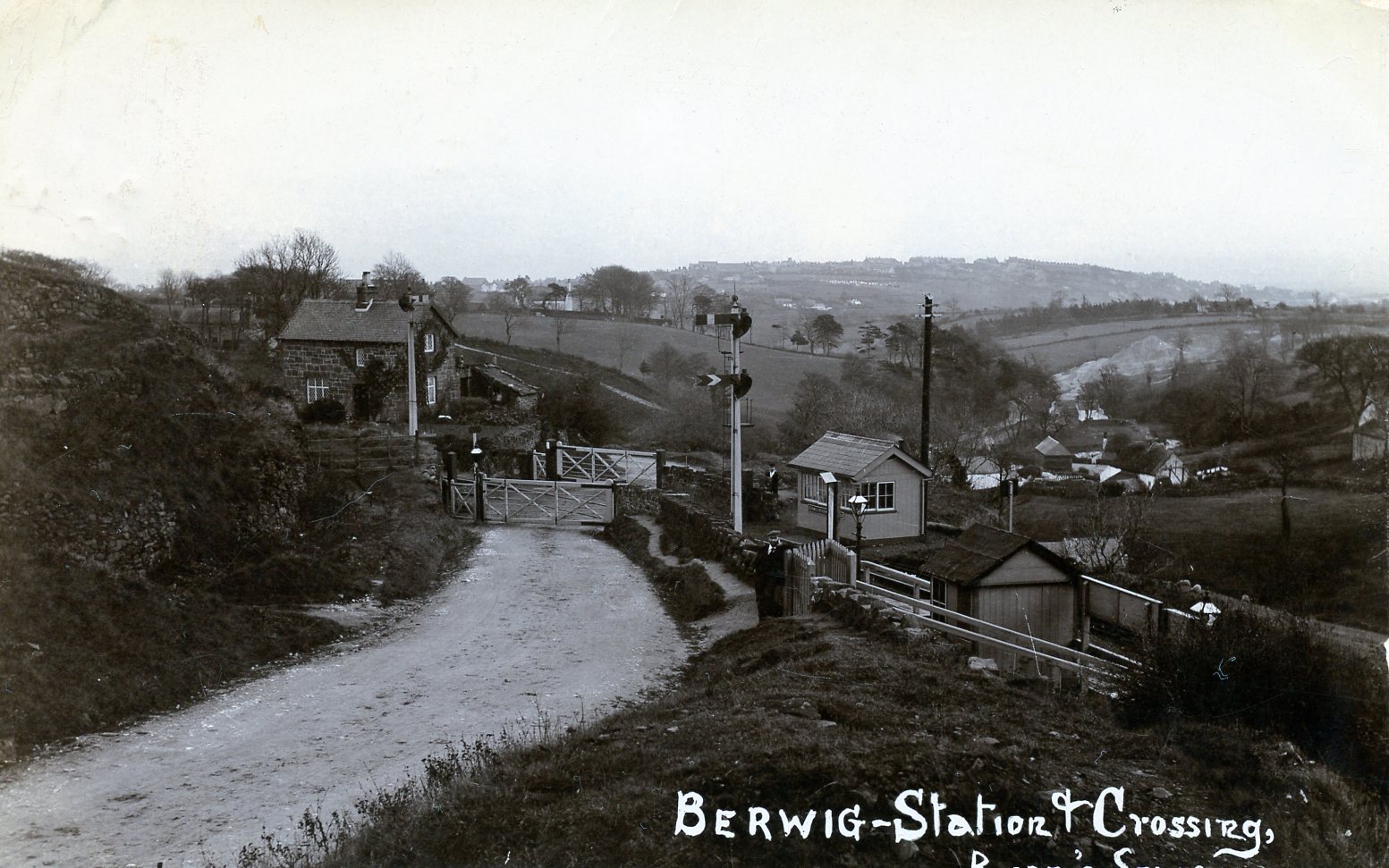
Berwig Halt railway station was a station in Minera, Wrexham, Wales. The station was opened on 1 May 1905 and closed on 1 January 1931.The location of...

Minera Limeworks

The Minera Limeworks were extensive lime quarries and kilns at Minera in Wrexham, Wales. It was located at grid reference SJ253520, near the villages...

Minera

Minera (Welsh: Mwynglawdd; ) is a village and community in Wrexham County Borough, Wales. It adjoins the village of Coedpoeth. The community, which in...

Nearby Amenities

Located within 500m of 53.057936,-3.106086
Grit Bin
Lat/Long: 53.059862/-3.106587
Post Box
Ref: LL11 258
Source: survey
Lat/Long: 53.0602578/-3.1050846
Power: tower
Lat/Long: 53.0565758/-3.1120814
Power: tower
Lat/Long: 53.056524/-3.1050932
Power: tower
Lat/Long: 53.0565466/-3.1076571
Power: tower
Lat/Long: 53.0565629/-3.1098766
Power: tower
Lat/Long: 53.0557407/-3.1033213
Power: tower
Lat/Long: 53.0548863/-3.1014652
Direction: 190
Man Made: adit
Lat/Long: 53.0549922/-3.1057574
Direction: 190
Man Made: adit
Lat/Long: 53.0550405/-3.1054865
Direction: 190
Man Made: adit
Lat/Long: 53.0552952/-3.1055294
Direction: 190
Man Made: adit
Lat/Long: 53.0546407/-3.1059076
Direction: 190
Man Made: adit
Lat/Long: 53.054415/-3.1059934
Historic: mine_shaft
Lat/Long: 53.0548214/-3.110682
Minera Mines Grand Turk Shaft
Historic: mine_shaft
Lat/Long: 53.0574939/-3.1010599
Minera Mines Busy Bee Shaft
Historic: mine_shaft
Lat/Long: 53.0578319/-3.1031806
Minera Mines Boundary Shaft
Historic: mine_shaft
Lat/Long: 53.0584937/-3.1041102
Minera Mines Maesffynnon Shaft
Historic: mine_shaft
Lat/Long: 53.0599159/-3.1056808
Fixme: continues
Lat/Long: 53.0581515/-3.1051837
The data included in this document is from www.openstreetmap.org. The data is made available under ODbL.

Have you been to Mwynglawdd?

Leave your review of Mwynglawdd below (or comments, questions and feedback).