Meidrim

Community in Carmarthenshire

Wales

Meidrim

Footpath to Sarnau Farm This path could do with a bit more use
Footpath to Sarnau Farm Credit: Alistair Hare

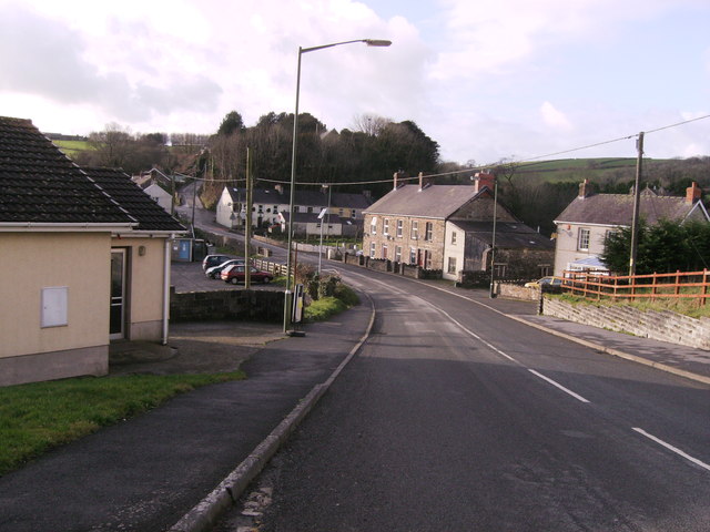
Meidrim is a small rural community located in the county of Carmarthenshire, Wales. Situated in the picturesque Tywi Valley, it is surrounded by rolling hills and lush green farmland. The community is situated approximately 8 miles to the northeast of Carmarthen, the county town.

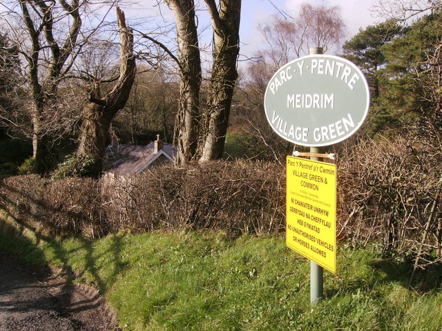
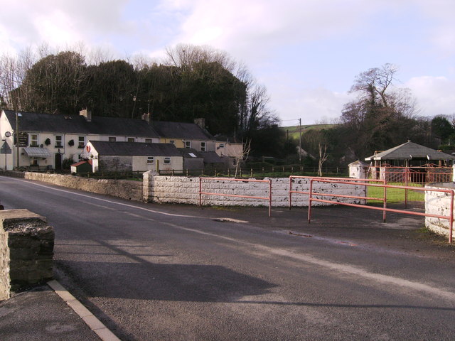
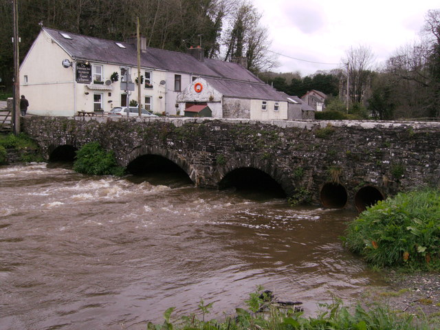
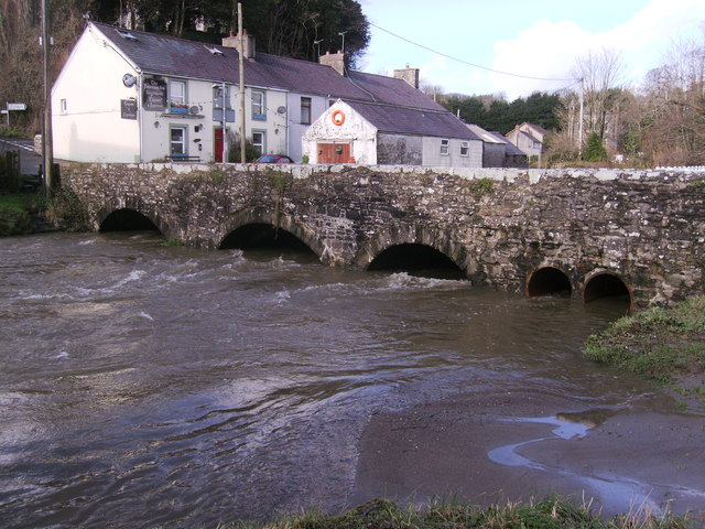
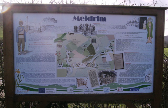
With a population of around 600 residents, Meidrim is known for its close-knit and friendly community. The village is centered around St. Meidrim's Church, a historic building that dates back to the 12th century. The church, along with its charming churchyard, is a focal point for both religious and community events.

Agriculture plays a significant role in the local economy, with many residents engaged in farming and livestock rearing. The community benefits from the fertile land and mild climate of the area, making it an ideal location for agricultural activities.

Despite its small size, Meidrim offers a range of amenities including a primary school, a village hall, a post office, and a local pub. The village hall serves as a meeting place for various community activities and events.

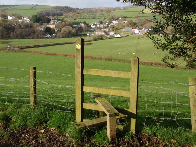
The surrounding countryside provides ample opportunities for outdoor activities such as walking, cycling, and fishing. Meidrim is also conveniently located near several historical attractions, including the National Botanic Garden of Wales and the ruins of Kidwelly Castle.

Overall, Meidrim is a peaceful and scenic community that offers a tranquil rural lifestyle while still providing access to essential amenities and nearby attractions.

If you have any feedback on the listing, please let us know in the comments section below.
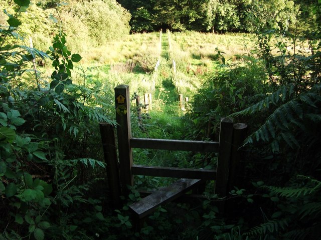
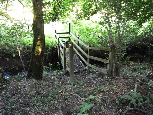
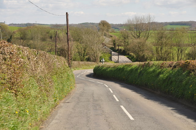
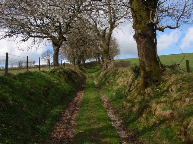
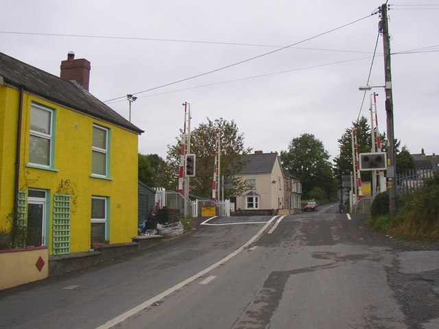
Meidrim Images

Images are sourced within 2km of 51.861054/-4.472505 or Grid Reference SN2920. Thanks to Geograph Open Source API. All images are credited.

Footpath to Sarnau Farm This path could do with a bit more use
Footpath to Sarnau Farm
This path could do with a bit more use
Footpath and bridge near Meidrim Footpaths in this area are in quite good order, but could do with more usage
Footpath and bridge near Meidrim
Footpaths in this area are in quite good order, but could do with more usage
Carmarthenshire : The B4298 A road heading through the Carmarthenshire countryside.
Carmarthenshire : The B4298
A road heading through the Carmarthenshire countryside.
Ceuffordd Bryn Niwl / Bryn Niwl holloway Hen geuffordd ysblennydd a arwain lan o Ffarm Bryn Niwl i gyfeiriad Ffarm Waun Oleu Fach. Creuwyd ceuffyrdd gan erydiad, dwr a thrafnidiaeth ac y mae rhai ohonynt yn dyddio nol i'r Oes Haearn.  

A splendid old holloway climbing upwards from Bryn Niwl Farm (trans. Hill of Mist) to Waun Oleu Farm (trans. Bright Meadow). Holloways are formed by erosion, water and traffic and some date as far back as the Iron Age.
Ceuffordd Bryn Niwl / Bryn Niwl holloway
Hen geuffordd ysblennydd a arwain lan o Ffarm Bryn Niwl i gyfeiriad Ffarm Waun Oleu Fach. Creuwyd ceuffyrdd gan erydiad, dwr a thrafnidiaeth ac y mae rhai ohonynt yn dyddio nol i'r Oes Haearn. A splendid old holloway climbing upwards from Bryn Niwl Farm (trans. Hill of Mist) to Waun Oleu Farm (trans. Bright Meadow). Holloways are formed by erosion, water and traffic and some date as far back as the Iron Age.
Sticil Meidrum / Meidrim stile Llwybr cyhoeddus yn dringo i fyny bryn uwchlaw Meidrum a chymryd taw enw'r ffarm ar y gopa yw'r Lan dyma yw enw'r bryncyn hefyd. Meidrum yw'r pentre yn y pellter.

A public footpath ascending a hill above the village of Meidrim (Middle Ridge) and as the farm on the summit is known as (y) Lan (The Hill) it seems very likely that this is also the name of the hill in question. Meidrim is the  village in the distance.
Sticil Meidrum / Meidrim stile
Llwybr cyhoeddus yn dringo i fyny bryn uwchlaw Meidrum a chymryd taw enw'r ffarm ar y gopa yw'r Lan dyma yw enw'r bryncyn hefyd. Meidrum yw'r pentre yn y pellter. A public footpath ascending a hill above the village of Meidrim (Middle Ridge) and as the farm on the summit is known as (y) Lan (The Hill) it seems very likely that this is also the name of the hill in question. Meidrim is the village in the distance.
Rebuilt house at Meidrim House in 2007 photo "Top-down Development" <a href="https://www.geograph.org.uk/photo/472655">SN2920 : Top-down development?</a> now finished. Parc-y-Pentre set in the Meidrim village green
Rebuilt house at Meidrim
House in 2007 photo "Top-down Development" SN2920 : Top-down development? now finished. Parc-y-Pentre set in the Meidrim village green
Meidrim village green sign Arrow points in left direction, down a narrow drive, rebuilt house just visible, but no horses allowed or unauthorised vehicles!
Meidrim village green sign
Arrow points in left direction, down a narrow drive, rebuilt house just visible, but no horses allowed or unauthorised vehicles!
Meidrim Meidrim village with The Fountain Inn in distance on the cross roads of B4299 and B4298 and the village community hall on left
Meidrim
Meidrim village with The Fountain Inn in distance on the cross roads of B4299 and B4298 and the village community hall on left
Playground in Meidrim Village Children's play area.
Playground in Meidrim
Village Children's play area.
Afon Dewi Fawr Very muddy water after the recent heavy rains. For photographer to be in same grid square I would need waders, better to wait for the waters to go down.
Afon Dewi Fawr
Very muddy water after the recent heavy rains. For photographer to be in same grid square I would need waders, better to wait for the waters to go down.
Sewage pump station The village of Meidrim hasits own sewage treatment works further down the river, this is the pump enclosure that is in the village.
Sewage pump station
The village of Meidrim hasits own sewage treatment works further down the river, this is the pump enclosure that is in the village.
Sewage pump station Notice on gate of pump station, informative!
Sewage pump station
Notice on gate of pump station, informative!
Ysgol Meidrim The school had this bunting/streamers on its railings: do not know for what reason, but they are still there.  With all the winds that there have been, this day in the summer, hardly any wind, but did manage to get a little "flutter" from the streamers/bunting. The road is the B4298.
Ysgol Meidrim
The school had this bunting/streamers on its railings: do not know for what reason, but they are still there. With all the winds that there have been, this day in the summer, hardly any wind, but did manage to get a little "flutter" from the streamers/bunting. The road is the B4298.
Afon Dewi Fawr 2014 A repeat of last year, but these waters are earlier. This bridge carries the B4298 over the river and the Fountain Inn (Tafarn y Ffynnon) in the background, similar photo of Ruth Sharville in 2010, and my photo of 2013.
Afon Dewi Fawr 2014
A repeat of last year, but these waters are earlier. This bridge carries the B4298 over the river and the Fountain Inn (Tafarn y Ffynnon) in the background, similar photo of Ruth Sharville in 2010, and my photo of 2013.
Information about Meidrim 1 This information board is a new addition to the parking area by the Afon Dewi Fawr, this is the left portion in Welsh.
Information about Meidrim 1
This information board is a new addition to the parking area by the Afon Dewi Fawr, this is the left portion in Welsh.
Information about Meidrim 2 Second of the pictures of the information board in the car park by the Afon Dewi Fawr. English version.
Information about Meidrim 2
Second of the pictures of the information board in the car park by the Afon Dewi Fawr. English version.
Information about Meidrim 3 The centre part of the information board in the car park by the Afon Dewi Fawr. I hope the information is readable breaking up the board this way.
Information about Meidrim 3
The centre part of the information board in the car park by the Afon Dewi Fawr. I hope the information is readable breaking up the board this way.
Information about Meidrim 4 The complete information board in the car park by the Afon Dewi Fawr.
Information about Meidrim 4
The complete information board in the car park by the Afon Dewi Fawr.
Show me another place!

Meidrim is located at Grid Ref: SN2920 (Lat: 51.861054, Lng: -4.472505)

Unitary Authority: Carmarthenshire

Police Authority: Dyfed-Powys

What 3 Words

///weeds.retail.untruth. Near Abernant, Carmarthenshire

Nearby Locations

Meidrim Meidrim Common

Related Wikis

Meidrim

Meidrim is a village and community some 8 miles (13 km) west of Carmarthen and 3.3 miles (5.3 km) north of St Clears in Carmarthenshire, Wales. Meidrim...

Trelech (electoral ward)

Trelech is the name of an electoral ward for Carmarthenshire County Council in Carmarthenshire, Wales. It is represented by one county councillor. ��2...

Great Western Railway in West Wales

The Great Western Railway was a railway company that was dominant in West Wales, in the United Kingdom. The main line from Swansea to Neyland, a port on...

St Clears railway station

St Clears railway station served the town of St Clears, Carmarthenshire, Wales between 1854 and 1964. It was on the West Wales Line. == History == The...

Nearby Amenities

Located within 500m of 51.861054,-4.472505
Give Way
Direction: forward
Lat/Long: 51.8630678/-4.4737257
Give Way
Direction: forward
Lat/Long: 51.863117/-4.4737907
Give Way
Direction: forward
Lat/Long: 51.8591322/-4.4697165
Direction: 165
Generator Method: photovoltaic
Generator Output Electricity: yes
Generator Solar Modules: 16
Generator Source: solar
Generator Type: solar_photovoltaic_panel
Location: roof
Power: generator
Lat/Long: 51.8611141/-4.4745526
Direction: 165
Generator Method: photovoltaic
Generator Output Electricity: yes
Generator Solar Modules: 16
Generator Source: solar
Generator Type: solar_photovoltaic_panel
Location: roof
Power: generator
Lat/Long: 51.8616187/-4.4758049
Direction: 165
Generator Method: photovoltaic
Generator Output Electricity: yes
Generator Solar Modules: 16
Generator Source: solar
Generator Type: solar_photovoltaic_panel
Location: roof
Power: generator
Lat/Long: 51.8615524/-4.4762313
Direction: 185
Generator Method: photovoltaic
Generator Output Electricity: yes
Generator Solar Modules: 14
Generator Source: solar
Generator Type: solar_photovoltaic_panel
Location: roof
Power: generator
Lat/Long: 51.8597522/-4.477677
The data included in this document is from www.openstreetmap.org. The data is made available under ODbL.

Have you been to Meidrim?

Leave your review of Meidrim below (or comments, questions and feedback).