Llandyfaelog

Community in Carmarthenshire

Wales

Llandyfaelog

Y wlad ger Idole/Countryside near Idole
Y wlad ger Idole/Countryside near Idole Credit: Gareth Evans

Llandyfaelog is a small community located in Carmarthenshire, southwestern Wales. It is situated about 12 miles northwest of the county town of Carmarthen. The community covers an area of approximately 7 square miles and is home to a population of around 500 people.

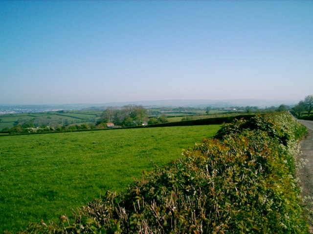
Llandyfaelog is known for its picturesque countryside, with rolling hills and farmland surrounding the village. The community is predominantly rural, with a scattering of small farms and cottages. The landscape is dotted with historic landmarks, including the 13th-century St. Tyfaelog's Church, which is the focal point of the village.

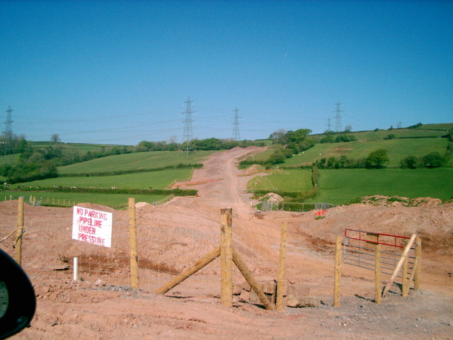
The community is well-connected, with easy access to the A484 road, which runs through the area, providing links to neighboring towns and cities. Despite its rural nature, Llandyfaelog benefits from amenities such as a primary school, a village hall, and a pub, which serves as a social hub for residents.

The area is popular with outdoor enthusiasts, offering opportunities for walking, cycling, and exploring the beautiful countryside. The nearby River Gwendraeth provides fishing opportunities for anglers, while the coast is just a short drive away, offering sandy beaches and stunning coastal walks.

Llandyfaelog is a close-knit community, with a strong sense of community spirit. Local events and activities, such as agricultural shows and community festivals, are held throughout the year, bringing residents together and fostering a sense of pride in the area.

If you have any feedback on the listing, please let us know in the comments section below.

Llandyfaelog Images

Images are sourced within 2km of 51.798419/-4.299216 or Grid Reference SN4113. Thanks to Geograph Open Source API. All images are credited.

Y wlad ger Idole/Countryside near Idole
Cloigyn
Cloigyn
Glanrhydw Mansion Lodge
Llandyfaelog
Llandyfaelog
Y biblin LNG /The LNG  pipeline Mae'r biblin yn cael ei hadeiladu i gario  LNG o Aberdaugleddau i Sir Gaerloyw,gan groesi un o rannau prydferthaf Prydain./The pipeline is being constructed to carry LNG  from Milford Haven to Gloucestershire across some of the most beautiful scenery in Britain.
Y biblin LNG /The LNG pipeline
Mae'r biblin yn cael ei hadeiladu i gario LNG o Aberdaugleddau i Sir Gaerloyw,gan groesi un o rannau prydferthaf Prydain./The pipeline is being constructed to carry LNG from Milford Haven to Gloucestershire across some of the most beautiful scenery in Britain.
Capel Rama, Upland Arms.
Farmland near Towy Castle farm
The driveway to Upland
Looking towards Cilmarch farm The farm is just visible beyond the hedge.
Looking towards Cilmarch farm
The farm is just visible beyond the hedge.
Farm Track Track to a farm near Crugan-fawr
Farm Track
Track to a farm near Crugan-fawr
Farmland, Crugan-fawr Between the rather large hedges on the left, runs an unclassified road.
Farmland, Crugan-fawr
Between the rather large hedges on the left, runs an unclassified road.
Old Track This looked like an old track that once followed the edge of a field.
Old Track
This looked like an old track that once followed the edge of a field.
Here comes a tractor Just to complete the country scene, a tractor makes its way along this small country lane just off the A484.
Here comes a tractor
Just to complete the country scene, a tractor makes its way along this small country lane just off the A484.
Country Lane Country lane near Bancycapel. The lane in the top left of the picture is the same as that in the foreground.
Country Lane
Country lane near Bancycapel. The lane in the top left of the picture is the same as that in the foreground.
The Red Lion Inn - Llandyfaelog
Derelict Chapel - Llandyfaelog
Terraced row of cottages - Llandyfaelog
White house beside the old chapel  - Llandyfaelog
White house beside the old chapel - Llandyfaelog
Show me another place!

Llandyfaelog is located at Grid Ref: SN4113 (Lat: 51.798419, Lng: -4.299216)

Unitary Authority: Carmarthenshire

Police Authority: Dyfed-Powys

What 3 Words

///treatable.coiling.drips. Near Llangain, Carmarthenshire

Nearby Locations

Llandyfaelog

Related Wikis

Upland Arms

Upland Arms is a village located in Carmarthenshire, Wales, based along the A484 running between Carmarthen and Kidwelly.

Llandyfaelog

Llandyfaelog () is a community located in Carmarthenshire, Wales. According to the 2001 census the community has a population of 1,272, of which 71.88...

Cantref Gwarthaf (Dyfed)

Cantref Gwarthaf was the largest of the seven cantrefi of Dyfed in southwest Wales. It subsequently became part of Deheubarth in around 950. It consisted...

Idole

Idole is a village in Carmarthenshire, Wales. Within the village is the Ysgol Y Fro school for juniors. == References ==

Nearby Amenities

Located within 500m of 51.798419,-4.299216
Power: tower
Lat/Long: 51.7993481/-4.2995543
Power: tower
Lat/Long: 51.796968/-4.2985995
Power: tower
Lat/Long: 51.8019921/-4.3029354
Power: tower
Lat/Long: 51.7988891/-4.301006
Power: tower
Lat/Long: 51.8010819/-4.3037854
Power: tower
Lat/Long: 51.7973574/-4.2969791
Power: pole
Lat/Long: 51.8012509/-4.2952037
Power: pole
Lat/Long: 51.8004315/-4.2950642
Power: pole
Lat/Long: 51.799579/-4.2949301
Power: pole
Lat/Long: 51.7982785/-4.2947799
The data included in this document is from www.openstreetmap.org. The data is made available under ODbL.

Have you been to Llandyfaelog?

Leave your review of Llandyfaelog below (or comments, questions and feedback).