Bridford

Settlement in Devon Teignbridge

England

Bridford

Rosebay willowherb near Bridford Epilobium angustifolium growing alongside the ridgetop byway between Plaistow Green and Windhill Gate.
Rosebay willowherb near Bridford Credit: Derek Harper

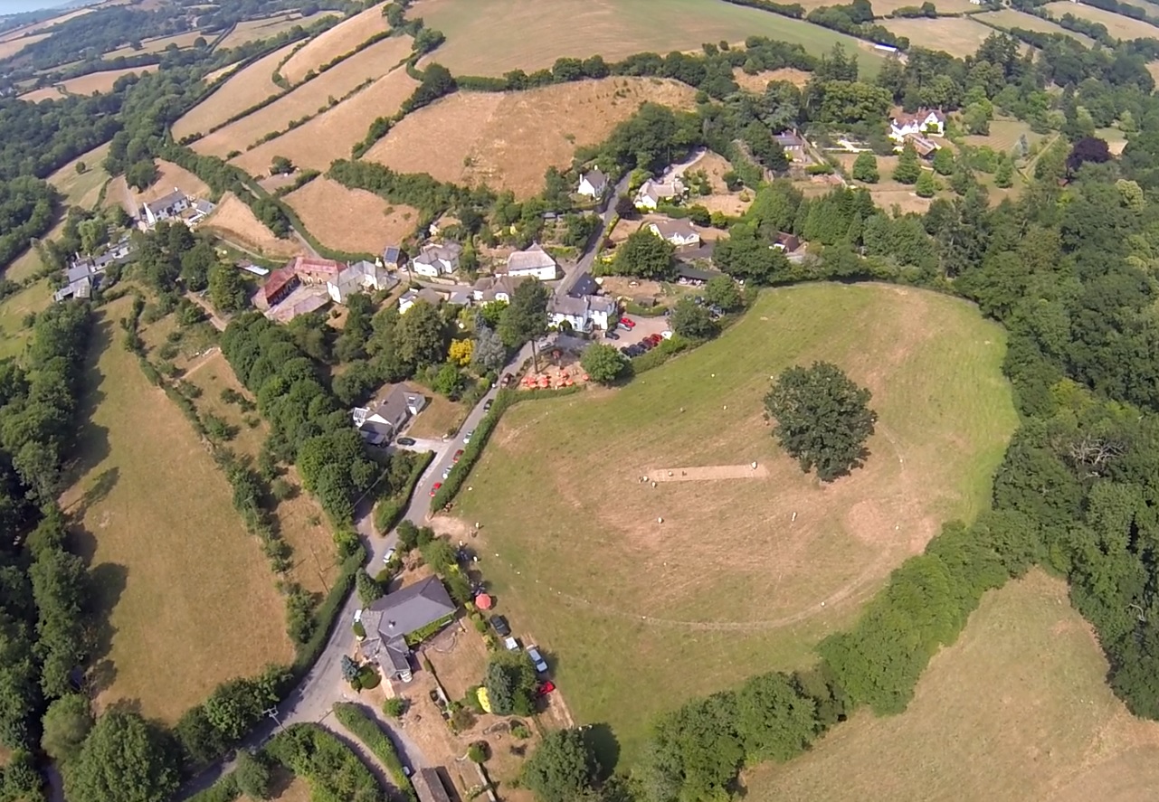
Bridford is a small village located in the Teign Valley, within the county of Devon, England. Situated approximately 10 miles southwest of the city of Exeter, it lies within the Dartmoor National Park, offering stunning natural surroundings and a peaceful setting.

The village itself is characterized by quaint stone cottages and a charming rural atmosphere. It has a relatively small population, with just over 200 residents, contributing to its close-knit community feel. The River Teign flows through the village, adding to its picturesque appeal.

Bridford boasts a rich history, with evidence of human habitation dating back thousands of years. The village church, St. Thomas of Canterbury, is a prominent landmark and a testament to its historical significance. The church, built in the 14th century, features beautiful stained glass windows and intricate architecture.

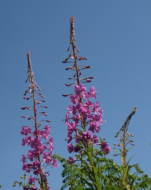
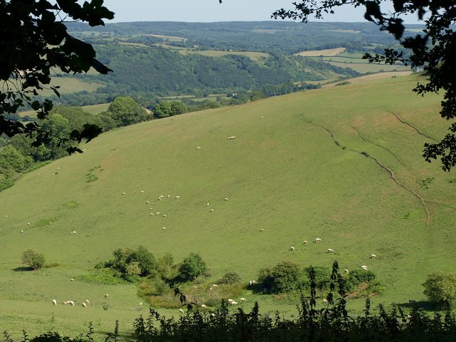
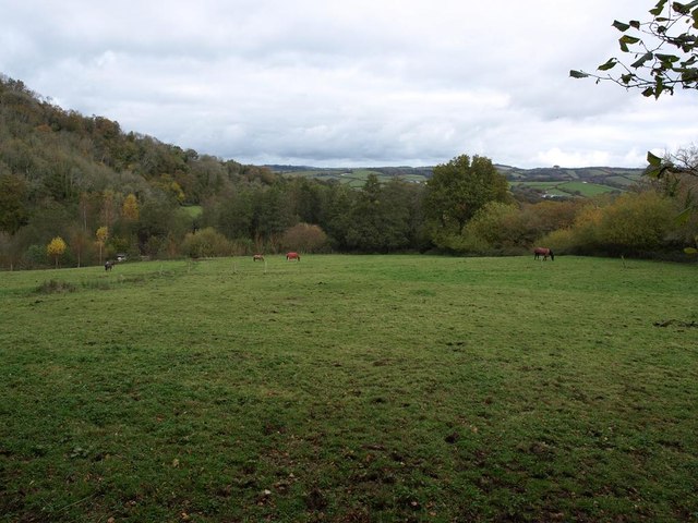
The surrounding area provides ample opportunities for outdoor activities, attracting visitors and locals alike. Dartmoor National Park offers extensive walking and hiking trails, perfect for exploring the stunning moorland landscapes, ancient stone tors, and wildlife.

Despite its small size, Bridford is not without amenities. The village is served by a village hall, which hosts community events and gatherings. There is also a local pub, offering a cozy spot for residents and visitors to relax and enjoy traditional English fare.

In summary, Bridford is a charming village nestled within the beauty of Dartmoor National Park. With its idyllic countryside, rich history, and close community, it offers a peaceful retreat for those seeking a rural escape.

If you have any feedback on the listing, please let us know in the comments section below.

Bridford Images

Images are sourced within 2km of 50.665349/-3.675447 or Grid Reference SX8186. Thanks to Geograph Open Source API. All images are credited.

Rosebay willowherb near Bridford Epilobium angustifolium growing alongside the ridgetop byway between Plaistow Green and Windhill Gate.
Rosebay willowherb near Bridford
Epilobium angustifolium growing alongside the ridgetop byway between Plaistow Green and Windhill Gate.
Rosebay willowherb near Bridford The ridgetop byway between Plaistow Green and Windhill Gate, approaching a Scots pine. This is just east of the junction with Seven Acre Lane.
Rosebay willowherb near Bridford
The ridgetop byway between Plaistow Green and Windhill Gate, approaching a Scots pine. This is just east of the junction with Seven Acre Lane.
Hillside below Windhill Gate A view from Windhill Gate of the head of the Nutcombe valley. Beyond on the eastern slopes of the Teign valley is Scanniclift Copse in <a href="https://www.geograph.org.uk/gridref/SX8486">SX8486</a>.
Hillside below Windhill Gate
A view from Windhill Gate of the head of the Nutcombe valley. Beyond on the eastern slopes of the Teign valley is Scanniclift Copse in SX8486.
Valley below Neadon A view from Neadon Lane of the valley shown in <a href="https://www.geograph.org.uk/photo/2501960">SX8286 : Hillside below Windhill Gate</a>, its wooded floor curving into <a href="https://www.geograph.org.uk/gridref/SX8286">SX8286</a>, and the Teign valley beyond.
Valley below Neadon
A view from Neadon Lane of the valley shown in SX8286 : Hillside below Windhill Gate, its wooded floor curving into SX8286, and the Teign valley beyond.
Road junction near Rowdon Brook A junction of minor roads; the side road leads from the Bridford to Moretonhampstead road to the reservoirs at Kennick
Road junction near Rowdon Brook
A junction of minor roads; the side road leads from the Bridford to Moretonhampstead road to the reservoirs at Kennick
The Bridford Inn
The Bridford Inn
Rookery Brook flowing beside the lane from Christow to Bridford
Grazing field beside lanebetween Christow and Bridford
Farm road to Bowden The start of the track shown in <a href="https://www.geograph.org.uk/photo/579607">SX8284 : Farm road to Bowden</a>, leading away from Commons Hill.
Farm road to Bowden
The start of the track shown in SX8284 : Farm road to Bowden, leading away from Commons Hill.
Lane to Bridford A gateway and trees by the lane leading north past Hole. The wood across the fields is Heckland Copse.
Lane to Bridford
A gateway and trees by the lane leading north past Hole. The wood across the fields is Heckland Copse.
Lane to Bridford Bridford Footpath 18 leaves the lane here, some 60 metres northeast from the Laployd Barton junction.
Lane to Bridford
Bridford Footpath 18 leaves the lane here, some 60 metres northeast from the Laployd Barton junction.
Field by Heckland Farm On the other side of the lane from the farm. Bowden Farm is hidden behind the trees at the end of the field.
Field by Heckland Farm
On the other side of the lane from the farm. Bowden Farm is hidden behind the trees at the end of the field.
Higher Hole The farm at Higher Hole, surrounded by trees, is seen from the same spot as <a href="https://www.geograph.org.uk/photo/3430529">SX8185 : Lane to Bridford</a>. On the hill behind is Beacon Plantation.
Higher Hole
The farm at Higher Hole, surrounded by trees, is seen from the same spot as SX8185 : Lane to Bridford. On the hill behind is Beacon Plantation.
Animal pen near Laployd Barton This is at the same spot as <a href="https://www.geograph.org.uk/photo/3430569">SX8085 : Lane to Bridford</a>.
Animal pen near Laployd Barton
This is at the same spot as SX8085 : Lane to Bridford.
Footpath to Hedgemoor Looking along Bridford Footpath 18 from the point shown in <a href="https://www.geograph.org.uk/photo/3430569">SX8085 : Lane to Bridford</a> where it leaves the lane, with <a href="https://www.geograph.org.uk/photo/3431944">SX8085 : Animal pen near Laployd Barton</a> on the right.
Footpath to Hedgemoor
Looking along Bridford Footpath 18 from the point shown in SX8085 : Lane to Bridford where it leaves the lane, with SX8085 : Animal pen near Laployd Barton on the right.
Junction near Laployd Barton On the signpost is the wording "Laployd Barton"; one would expect a cross symbol after this.
Junction near Laployd Barton
On the signpost is the wording "Laployd Barton"; one would expect a cross symbol after this.
Lane to Laployd Barton From the junction shown in <a href="https://www.geograph.org.uk/photo/3431987">SX8085 : Junction near Laployd Barton</a>. Further along the lane is the scene in [[176631].
Lane to Laployd Barton
From the junction shown in SX8085 : Junction near Laployd Barton. Further along the lane is the scene in [[176631].
Barn, Laployd Barton With the gable end referred to in <a href="https://www.geograph.org.uk/photo/3432026">SX7985 : Lane to Laployd Barton</a>.
Barn, Laployd Barton
With the gable end referred to in SX7985 : Lane to Laployd Barton.
Show me another place!

Bridford is located at Grid Ref: SX8186 (Lat: 50.665349, Lng: -3.675447)

Administrative County: Devon

District: Teignbridge

Police Authority: Devon and Cornwall

What 3 Words

///cabin.retraced.shadow. Near Moretonhampstead, Devon

Nearby Locations

Rowdon Plantation Bridford

Related Wikis

Bridford

Bridford is a village and civil parish in south west England, located in the Teign Valley, Devon on the edge of Dartmoor. The parish is surrounded (clockwise...

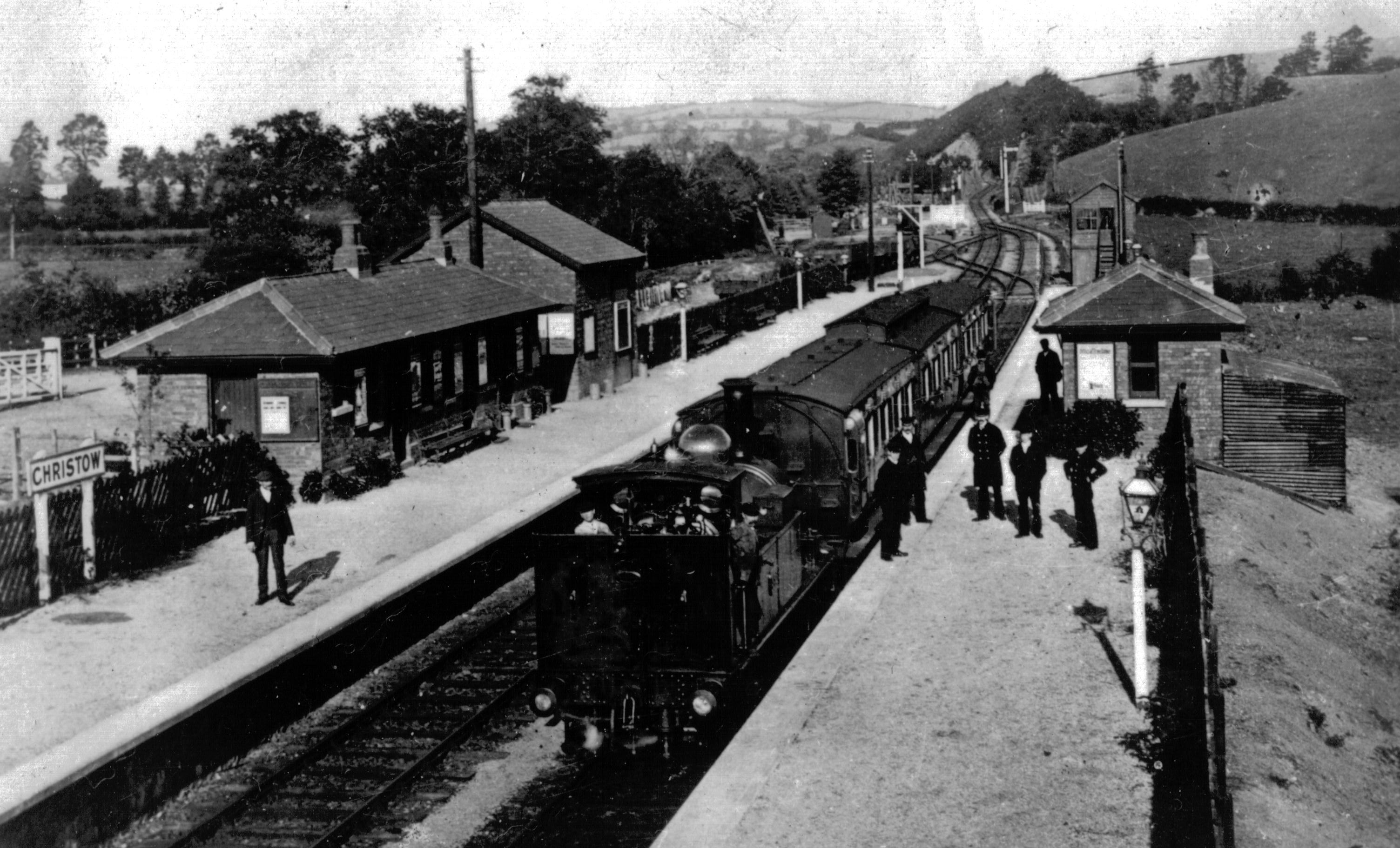
Christow railway station

Christow Railway Station's previously known as Teign House was a railway station serving the villages of Christow, Bridford and Doddiscombsleigh in Devon...

Christow

Christow is a village and civil parish in the Teignbridge district of Devon, England, about 12 miles (19 km) southwest of Exeter. The village is in the...

Dunsford

Dunsford is a village in Devon, England, just inside the Dartmoor National Park. The place-name 'Dunsford' is first attested in the Domesday Book of 1086...

Lower Ashton

Lower Ashton is a village on the western slopes of Haldon in Teignbridge, Devon, England. Along with Higher Ashton it is part of the civil parish of Ashton...

Ashton railway station

Ashton railway station was a railway station serving the village of Ashton in Devon, England. It was located on the Teign Valley line. == History == The...

Dunsford Halt railway station

Dunsford Halt was a railway station serving Dunsford, a small village in Devon, England, on the Teign Valley Line between the towns of Newton Abbot and...

Doddiscombsleigh

Doddiscombsleigh (anciently Doddescombe Leigh) is a small settlement in Devon, England. It is 5 miles (8 km) southwest of the city of Exeter and one mile...

Related Videos

Keep Steppin 👣. Feb 23 Treks

It's all about stepping even when you slip, get up and keep going. Have and laugh. When nature cuts you off, it doesn't mean no, ...

Dartmoor Walks: Steps Bridge and Mardon Down

A circular ~16k walk starting from Steps Bridge car park, in the North-East of Dartmoor National Park. The walk first passes ...

Nearby Amenities

Located within 500m of 50.665349,-3.675447
Bridford
Place: village
Source: npe
Website: https://www.bridfordvillage.co.uk/
Wikidata: Q4025967
Wikipedia: en:Bridford
Lat/Long: 50.6657226/-3.6755214
Turning Circle
Lat/Long: 50.6665763/-3.6735959
Turning Circle
Lat/Long: 50.6667834/-3.6749432
Pub
Bridford Inn
Addr City: Exeter
Addr Housename: Bridford Inn
Addr Postcode: EX6 7HT
Air Conditioning: no
Brewery: yes
Check Date: 2022-10-26
Cuisine: british
Internet Access: wlan
Internet Access Fee: customers
Microbrewery: no
Opening Hours: Mo-Tu 15:30-22:30; We-Th,Su 12:00-22:30; Fr-Sa 12:00-23:00
Operator: Free House
Outdoor Seating: yes
Payment Mastercard: yes
Payment Visa: yes
Real Fire: yes
Smoking: outside
Sport: soccer;pool;darts
Website: https://bridfordinn.co.uk/
Wikidata: Q70628200
Lat/Long: 50.6646247/-3.6770821
Townhall
Bridford Village Hall
Check Date: 2022-10-26
Polling Station: yes
Townhall Type: village
Lat/Long: 50.6649239/-3.6780585
Post Box
Brand: Royal Mail
Brand Wikidata: Q638098
Brand Wikipedia: en:Royal Mail
Collection Times: Mo-Fr 16:15; Sa 07:00; Su off
Drive Through: no
Operator: Royal Mail
Operator Wikidata: Q638098
Post Box Design: type_n
Post Box Mounting: pier
Post Box Type: lamp
Ref: EX6 153
Royal Cypher: EIIR
Royal Cypher Wikidata: Q33102113
Source: survey;streetlevel imagery;aerial imagery
Lat/Long: 50.6663673/-3.6749274
Public Bookcase
Booth: K6
Disused Amenity: telephone
Man Made: telephone_box
Public Bookcase Type: phone_box
Lat/Long: 50.6663516/-3.674999
Bench
Lat/Long: 50.6653738/-3.6721475
Place Of Worship
Chapel
Lat/Long: 50.6655717/-3.6749597
Barrier: bollard
Lat/Long: 50.6644699/-3.6767897
Turning Circle
Lat/Long: 50.6655496/-3.6757626
Bus Stop
Bridford
Bus: yes
Naptan AtcoCode: 1100DEB10003
Naptan NaptanCode: dvndatdg
Public Transport: platform
Lat/Long: 50.6657557/-3.6747344
Turning Circle
Lat/Long: 50.6647791/-3.6773458
Bench
Lat/Long: 50.6663423/-3.6745839
Berewood
Place: locality
Lat/Long: 50.6628968/-3.6695985
Poole Cottages
Place: hamlet
Lat/Long: 50.6625482/-3.672844
Poole House
Place: locality
Lat/Long: 50.6619464/-3.6757301
Ford: yes
Lat/Long: 50.6625658/-3.6743125
Generator Method: photovoltaic
Generator Output Electricity: yes
Generator Source: solar
Generator Type: solar_photovoltaic_panel
Location: roof
Power: generator
Lat/Long: 50.6642228/-3.6774565
Generator Method: photovoltaic
Generator Output Electricity: yes
Generator Source: solar
Generator Type: solar_photovoltaic_panel
Location: roof
Power: generator
Lat/Long: 50.6651068/-3.6753242
Generator Method: photovoltaic
Generator Output Electricity: yes
Generator Source: solar
Generator Type: solar_photovoltaic_panel
Location: roof
Power: generator
Lat/Long: 50.6670613/-3.674545
Generator Method: photovoltaic
Generator Output Electricity: yes
Generator Source: solar
Generator Type: solar_photovoltaic_panel
Location: roof
Power: generator
Lat/Long: 50.6661123/-3.675115
Generator Method: photovoltaic
Generator Output Electricity: yes
Generator Source: solar
Generator Type: solar_photovoltaic_panel
Location: roof
Power: generator
Lat/Long: 50.6656329/-3.6739764
Generator Method: photovoltaic
Generator Output Electricity: yes
Generator Source: solar
Generator Type: solar_photovoltaic_panel
Location: roof
Power: generator
Lat/Long: 50.6648466/-3.6774787
Generator Method: photovoltaic
Generator Output Electricity: yes
Generator Source: solar
Generator Type: solar_photovoltaic_panel
Location: roof
Power: generator
Lat/Long: 50.6662288/-3.678632
Generator Method: photovoltaic
Generator Output Electricity: yes
Generator Source: solar
Generator Type: solar_photovoltaic_panel
Location: roof
Power: generator
Lat/Long: 50.6622955/-3.6721812
Advertising: board
Lat/Long: 50.6663432/-3.67505
Post Office
Bridford Post Office
Addr City: Exeter
Addr Housename: Bridford Village Hall
Addr Postcode: EX6 7HS
Addr Street: Church Lane
Addr Suburb: Bridford
Check Date: 2022-10-26
Opening Hours: Th 14:45-16:45
Ref Pol Id: 117516
Source: pol_branch_list_2020‑11‑13
Wheelchair: limited
Lat/Long: 50.6649616/-3.6778979
Give Way
Direction: forward
Lat/Long: 50.6663351/-3.6746266
The data included in this document is from www.openstreetmap.org. The data is made available under ODbL.

Have you been to Bridford?

Leave your review of Bridford below (or comments, questions and feedback).