Bridell

Settlement in Pembrokeshire

Wales

Bridell

Pompren  Afon Plysgog / Afon Plysgog footbridge Pompren yn rhychwantu Afon Plysgog.

Footbridge spanning Afon Plysgog.
Pompren Afon Plysgog / Afon Plysgog footbridge Credit: Alan Richards

Bridell is a small village located in the county of Pembrokeshire, Wales. Situated approximately 3 miles northeast of the town of Cardigan, it lies in a picturesque rural setting surrounded by rolling hills and farmland. The village is nestled in the valley of the River Bridell, after which it is named.

With a population of just over 200 residents, Bridell is characterized by its peaceful and close-knit community. The village consists mainly of traditional Welsh stone houses, some of which date back several centuries. The charm of Bridell lies in its unspoiled natural beauty, offering residents and visitors a tranquil escape from the hustle and bustle of urban life.

Although small, the village has a few amenities to cater to the needs of its residents. These include a community hall, a local pub, and a post office. Additionally, Bridell benefits from being in close proximity to the larger town of Cardigan, where residents can access a wider range of services, shops, and entertainment options.

The surrounding countryside provides ample opportunities for outdoor activities, such as hiking, cycling, and fishing. The nearby River Bridell is particularly popular with anglers. The village is also within easy reach of the stunning Pembrokeshire Coast National Park, renowned for its rugged cliffs, sandy beaches, and diverse wildlife.

Overall, Bridell offers a peaceful and idyllic retreat for those seeking a slower-paced and picturesque village lifestyle, while still providing convenient access to nearby amenities and natural wonders.

If you have any feedback on the listing, please let us know in the comments section below.
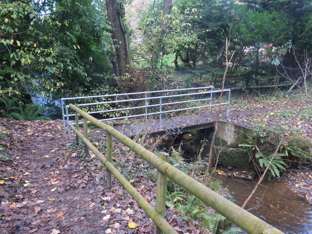
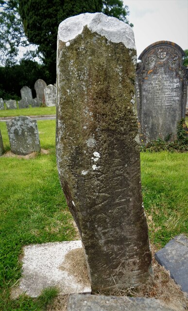
Bridell Images

Images are sourced within 2km of 52.047035/-4.660002 or Grid Reference SN1742. Thanks to Geograph Open Source API. All images are credited.

Pompren  Afon Plysgog / Afon Plysgog footbridge Pompren yn rhychwantu Afon Plysgog.

Footbridge spanning Afon Plysgog.
Pompren Afon Plysgog / Afon Plysgog footbridge
Pompren yn rhychwantu Afon Plysgog. Footbridge spanning Afon Plysgog.
Pontdroed Cwm Plysgog / Cwm Plysgog footbridge Pontdroed yn rhychwantu Afon Plysgog.

A footbridge spanning Afon Plysgog.
Pontdroed Cwm Plysgog / Cwm Plysgog footbridge
Pontdroed yn rhychwantu Afon Plysgog. A footbridge spanning Afon Plysgog.
Llwybr i Coed Fforest / Path to Forest Wood Llwybr troed cyhoeddus yn mynd i mewn i'r goedwig.

A public footpath enters woodland.
Llwybr i Coed Fforest / Path to Forest Wood
Llwybr troed cyhoeddus yn mynd i mewn i'r goedwig. A public footpath enters woodland.
Llwybr cyhoeddus ger Forest / Public path near Forest Llwybr cyhoeddus ger anhedd-dy o'r enw Forest.

A public footpath near a property known as Forest.
Llwybr cyhoeddus ger Forest / Public path near Forest
Llwybr cyhoeddus ger anhedd-dy o'r enw Forest. A public footpath near a property known as Forest.
Llwybr i Gilgerran / Path to Cilgerran Heol fynedfa a llwybr cyhoeddus yn mynd i gyfeiriad Cilgerran.

An access road and public footpath heading towards Cilgerran.
Llwybr i Gilgerran / Path to Cilgerran
Heol fynedfa a llwybr cyhoeddus yn mynd i gyfeiriad Cilgerran. An access road and public footpath heading towards Cilgerran.
Roadside field opposite Bryn-y-Wawr Field next to A478 on southern edge of Bridell.
Roadside field opposite Bryn-y-Wawr
Field next to A478 on southern edge of Bridell.
House on southern edge of Bridell 'Cwmwsni' off lay-by on A478.
House on southern edge of Bridell
'Cwmwsni' off lay-by on A478.
Cilgerran, St Llawddog
Country lane  Heading towards Pen-y-Bryn from the A487
Country lane
Heading towards Pen-y-Bryn from the A487
Penybryn Baptist Chapel Built in 1818 and rebuilt in 1869. It is now Grade II listed.
Penybryn Baptist Chapel
Built in 1818 and rebuilt in 1869. It is now Grade II listed.
Bridge across Afon Plysgog The minor road to the left of the house goes to Teifi Marshes Nature Reserve and Wildlife Centre
Bridge across Afon Plysgog
The minor road to the left of the house goes to Teifi Marshes Nature Reserve and Wildlife Centre
Penybryn Arms Public house on the A478
Penybryn Arms
Public house on the A478
Caradiff Arms, Cilgerran Built of Cilgerran stone, it is listed Grade II because it is one of the least altered village buildings in this material. Above the front door there hangs a coracle. Unfortunately, like many village pubs these days, the Cardiff Arms is closed and there is a "To Let" sign in the window.
Caradiff Arms, Cilgerran
Built of Cilgerran stone, it is listed Grade II because it is one of the least altered village buildings in this material. Above the front door there hangs a coracle. Unfortunately, like many village pubs these days, the Cardiff Arms is closed and there is a "To Let" sign in the window.
Pen-y-Bryn chapel Baptist chapel and cemetery
Pen-y-Bryn chapel
Baptist chapel and cemetery
St Llawddog Church Tower In the foreground is an ancient stone which looks recently damaged. This is the stone dedicated to Trenagus
St Llawddog Church Tower
In the foreground is an ancient stone which looks recently damaged. This is the stone dedicated to Trenagus
Trenagus Stone In the churchyard of St Llawddog, an inscribed stone which appears to have recent damage to the top
Trenagus Stone
In the churchyard of St Llawddog, an inscribed stone which appears to have recent damage to the top
Ogham Stone in Cilgerran Churchyard <span class="nowrap"><a title="https://www.megalithic.co.uk/article.php?sid=4306" rel="nofollow ugc noopener" href="https://www.megalithic.co.uk/article.php?sid=4306">Link</a><img style="margin-left:2px;" alt="External link" title="External link - shift click to open in new window" src="https://s1.geograph.org.uk/img/external.png" width="10" height="10"/></span>
Ogham Stone in Cilgerran Churchyard
St Llawddog's Church <span class="nowrap"><a title="https://coflein.gov.uk/en/site/402530/" rel="nofollow ugc noopener" href="https://coflein.gov.uk/en/site/402530/">Link</a><img style="margin-left:2px;" alt="External link" title="External link - shift click to open in new window" src="https://s1.geograph.org.uk/img/external.png" width="10" height="10"/></span>
St Llawddog's Church
Show me another place!

Bridell is located at Grid Ref: SN1742 (Lat: 52.047035, Lng: -4.660002)

Unitary Authority: Pembrokeshire

Police Authority: Dyfed Powys

What 3 Words

///digesting.mime.frock. Near Cardigan, Ceredigion

Related Wikis

Bridell

Bridell (Welsh: Y Bridell) is a small settlement and parish in north Pembrokeshire, Wales. The parish includes the village of Pen-y-bryn. Together with...

Cilgerran

Cilgerran (previously Kilgerran or Cil-Garon) is both a village, a parish, and also a community, situated on the south bank of the River Teifi in Pembrokeshire...

Cilgerran Castle

Cilgerran Castle (Welsh: Castell Cilgerran) is a 13th-century ruined castle located in Cilgerran, Pembrokeshire, Wales, near Cardigan. The first castle...

Rhoshill, Pembrokeshire

Rhoshill (also known as Rhos-hill) is a hamlet on the A478 road, in the community and parish of Cilgerran, in Pembrokeshire, South-west Wales. The hamlet...

Nearby Amenities

Located within 500m of 52.047035,-4.660002
Bridell
Is In: Pembrokeshire,Wales,UK
Place: village
Source: npe
Wikidata: Q4966131
Lat/Long: 52.0464034/-4.6616027
Man Made: water_well
Lat/Long: 52.044747/-4.6659995
Description: Scheduled monument consisting of a spotted dolorite stone with Ogam inscription.
Heritage: 2
Heritage Operator: cadw
Historic: memorial
Inscription: NETTASAGR[I]MAQIMUCO[I]BR[IA]CI
Material: stone
Memorial: stone
Ref Cadw: PE143
Url: http://www.coflein.gov.uk/en/site/304080/details/bridell-1-inscribed-stone-st-davids-church-bridell
Lat/Long: 52.0469079/-4.6604305
Power: pole
Lat/Long: 52.0499695/-4.6597225
Power: pole
Lat/Long: 52.0482992/-4.6613688
Power: pole
Lat/Long: 52.0477323/-4.661942
Power: pole
Lat/Long: 52.0452366/-4.6636453
Power: pole
Lat/Long: 52.0444034/-4.6641826
Power: pole
Lat/Long: 52.0491071/-4.6605468
Power: pole
Lat/Long: 52.0468575/-4.6625391
Power: pole
Lat/Long: 52.049848/-4.6596052
Power: pole
Lat/Long: 52.0491178/-4.6601379
Power: pole
Lat/Long: 52.0483799/-4.6606758
Power: pole
Lat/Long: 52.0479631/-4.6609147
Power: pole
Lat/Long: 52.0465897/-4.6614668
Power: pole
Lat/Long: 52.046089/-4.6616951
Power: pole
Lat/Long: 52.0438956/-4.662618
Power: pole
Lat/Long: 52.043097/-4.6628064
Power: pole
Lat/Long: 52.0501691/-4.659453
Power: pole
Lat/Long: 52.0502082/-4.6590938
Power: pole
Lat/Long: 52.0503151/-4.6576189
Power: pole
Lat/Long: 52.0500425/-4.6600086
Power: pole
Lat/Long: 52.0499864/-4.6602339
Power: pole
Lat/Long: 52.0493447/-4.6613417
Power: pole
Lat/Long: 52.0487856/-4.6623019
Power: pole
Lat/Long: 52.0475781/-4.6648098
Power: pole
Lat/Long: 52.0498907/-4.6616206
Power: pole
Lat/Long: 52.0493381/-4.6636323
Power: pole
Lat/Long: 52.0490965/-4.664268
Power: pole
Lat/Long: 52.0501002/-4.6604941
Power: pole
Lat/Long: 52.0506592/-4.6591807
Power: pole
Lat/Long: 52.0503157/-4.659806
Power: pole
Lat/Long: 52.0509815/-4.6565833
Power: pole
Lat/Long: 52.0502497/-4.6580984
Power: pole
Lat/Long: 52.0497457/-4.6588819
Power: pole
Lat/Long: 52.050597/-4.6575875
Power: pole
Lat/Long: 52.0502505/-4.6603502
Power: pole
Lat/Long: 52.0510043/-4.6591339
Power: pole
Lat/Long: 52.049533/-4.6654397
The data included in this document is from www.openstreetmap.org. The data is made available under ODbL.

Have you been to Bridell?

Leave your review of Bridell below (or comments, questions and feedback).