Brickfields

Settlement in Worcestershire Worcester

England

Brickfields

Worcestershire Breast Unit Part of the Worcestershire Royal Hospital. seen about midday on Xmas Day 2023.
Worcestershire Breast Unit Credit: Chris Allen

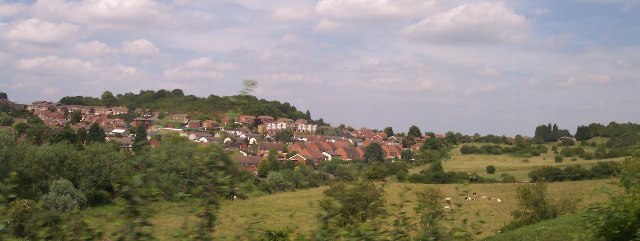
Brickfields is a small village located in Worcestershire, England. Situated in the picturesque countryside, it is surrounded by rolling hills and lush greenery, making it an ideal destination for nature lovers and those seeking a tranquil getaway.

The village itself is characterized by its charming rural atmosphere and traditional English architecture. It consists of a cluster of quaint cottages and farmhouses, many of which date back several centuries. The local community is tight-knit and friendly, with a strong sense of community spirit.

Despite its small size, Brickfields offers a range of amenities to its residents and visitors. There is a village shop where one can find basic necessities, as well as a cozy pub that serves delicious homemade meals and locally brewed ales. The village also has a primary school, ensuring that families have access to education within the area.

Brickfields is surrounded by picturesque walking trails, providing ample opportunities for outdoor activities such as hiking and cycling. The nearby countryside is dotted with farms, offering visitors a chance to experience rural life and sample fresh, locally sourced produce.

For those seeking a taste of history, the neighboring towns of Worcestershire boast several historical landmarks and attractions. The county is known for its beautiful medieval churches, stately homes, and ancient ruins, all of which are easily accessible from Brickfields.

Overall, Brickfields is a charming and idyllic village, perfect for those looking to escape the hustle and bustle of city life and immerse themselves in the beauty of the English countryside.

If you have any feedback on the listing, please let us know in the comments section below.
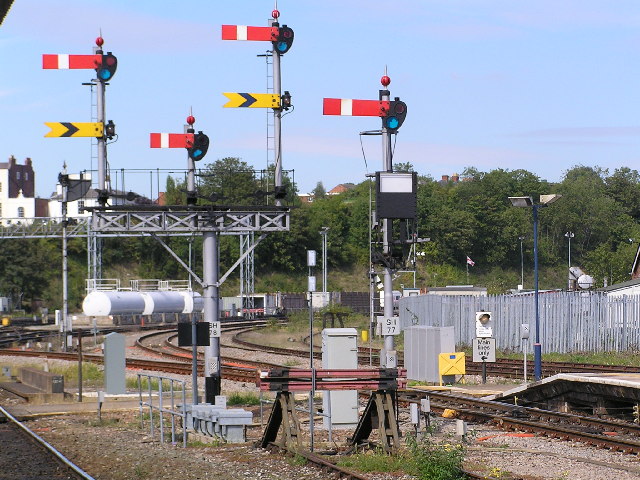
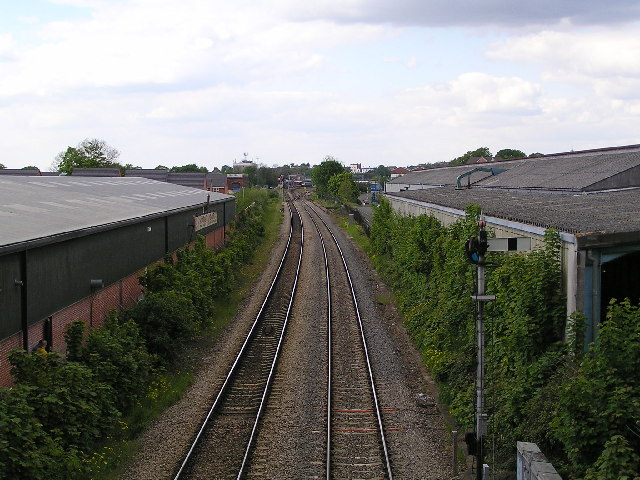
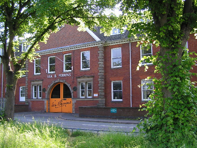
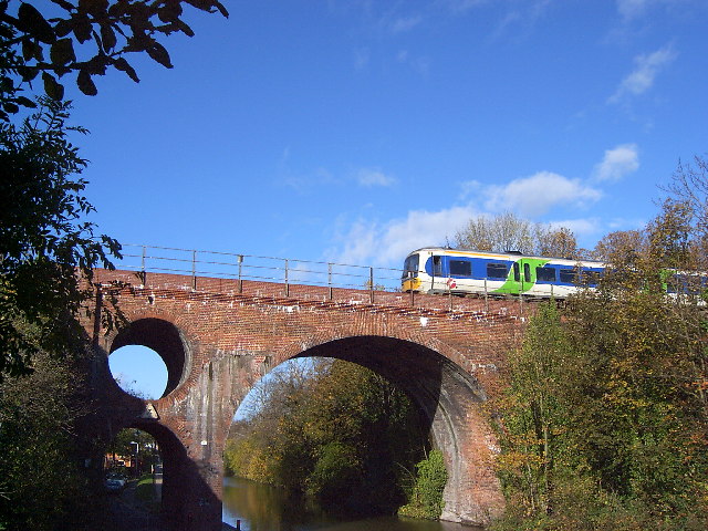
Brickfields Images

Images are sourced within 2km of 52.205713/-2.198238 or Grid Reference SO8656. Thanks to Geograph Open Source API. All images are credited.

Worcestershire Breast Unit Part of the Worcestershire Royal Hospital. seen about midday on Xmas Day 2023.
Worcestershire Breast Unit
Part of the Worcestershire Royal Hospital. seen about midday on Xmas Day 2023.
Worcestershire Royal Hospital - apparent problem The Aconbury East block was built in the 1970s but has had a very extensive refurbishment that includes several of these grey clad structures over air conditioning ducts. In the last few weeks these have been covered with coarse netting and scaffolding has been erected at the bottom to protect people and structures, such as the liquid oxygen tank behind the cream wall. My conclusion is that there must be a risk of the grey cladding being shed and that it is sufficient to warrant these measures. The cladding has only been there for about 5-6 years and this must be an embarrassment for somebody.
Worcestershire Royal Hospital - apparent problem
The Aconbury East block was built in the 1970s but has had a very extensive refurbishment that includes several of these grey clad structures over air conditioning ducts. In the last few weeks these have been covered with coarse netting and scaffolding has been erected at the bottom to protect people and structures, such as the liquid oxygen tank behind the cream wall. My conclusion is that there must be a risk of the grey cladding being shed and that it is sufficient to warrant these measures. The cladding has only been there for about 5-6 years and this must be an embarrassment for somebody.
Worcestershire Royal Hospital - Christmas morning 2023
Worcester Shrub Hill Station. Array of semaphore signals at the Birmingham end of Shrub Hill station, Worcester Light maintenance depot in the background.
Worcester Shrub Hill Station.
Array of semaphore signals at the Birmingham end of Shrub Hill station, Worcester Light maintenance depot in the background.
Looking NNW from bridge over Perry Wood road towards Shrub Hill Station.
All that is left of the old Ronkswood hospital. Since the new Worcester Royal Hospital was built the old Ronkswood site has been levelled apart from this building which still carries communications antennae. Ronkswood was used during the 2nd world war for treating large numbers of injured soldiers.
All that is left of the old Ronkswood hospital.
Since the new Worcester Royal Hospital was built the old Ronkswood site has been levelled apart from this building which still carries communications antennae. Ronkswood was used during the 2nd world war for treating large numbers of injured soldiers.
Lea & Perrins factory,  Worcester The home of "Worcestershire Sauce"
Lea & Perrins factory, Worcester
The home of "Worcestershire Sauce"
Ronkswood An open green space in Worcester.
Ronkswood
An open green space in Worcester.
Westbury Street Bridge, Worcester The bridge takes the Birmingham to Hereford railway over the Worcester and Birmingham Canal and Westbury Street, near the centre of Worcester. The bridge featured on a postage stamp for the 150 years of railways celebration. Various stories exist about the hole in the bridge, from dragon nests (fanciful) and civil war cannonballs (implausible) to engineering considerations (possible) and saving bricks (boring).
Westbury Street Bridge, Worcester
The bridge takes the Birmingham to Hereford railway over the Worcester and Birmingham Canal and Westbury Street, near the centre of Worcester. The bridge featured on a postage stamp for the 150 years of railways celebration. Various stories exist about the hole in the bridge, from dragon nests (fanciful) and civil war cannonballs (implausible) to engineering considerations (possible) and saving bricks (boring).
Worcester City Football Ground The Worcester and Birmingham canal passes alongside the Worcester City football ground.  On the left is the Cavalier public house.
Worcester City Football Ground
The Worcester and Birmingham canal passes alongside the Worcester City football ground. On the left is the Cavalier public house.
Worcester and Birmingham Canal Here the canal passes Flag Meadow, the Royal Grammar School playing field.
Worcester and Birmingham Canal
Here the canal passes Flag Meadow, the Royal Grammar School playing field.
Flag Meadow, Worcester Flag Meadow is the playing field for Worcester's Royal Grammar School.  The pavilion replaced a smaller traditional one in the early 1990s.  Behind the trees on the far side of the meadow is the Worcester to Birmingham canal. The meadow falls into four different grid squares.
Flag Meadow, Worcester
Flag Meadow is the playing field for Worcester's Royal Grammar School. The pavilion replaced a smaller traditional one in the early 1990s. Behind the trees on the far side of the meadow is the Worcester to Birmingham canal. The meadow falls into four different grid squares.
Entrance to Worcester City Football Ground Worcester City FC play at St George's Lane.

Worcester City FC played their last game here in April 2013, since then the site has been redeveloped with housing built on the ground's former site.  As for Worcester City, they remain a homeless team, their plans for a new stadium in Worcester haven't come to fruition for various reasons.  The original plan being to build a new stadium on Nunnery Way on the east side of the city, however, this plan was shelved.  In 2017, a plan to build a stadium and sporting complex at Perdiswell was rejected by Worcester City Council.  After leaving St George's Lane, Worcester City FC played their home games at Kidderminster Harrier's Aggborough stadium for a time and now play their games at The Victoria Ground, home of Bromsgrove Sporting. Extra information added January 2019.
Entrance to Worcester City Football Ground
Worcester City FC play at St George's Lane. Worcester City FC played their last game here in April 2013, since then the site has been redeveloped with housing built on the ground's former site. As for Worcester City, they remain a homeless team, their plans for a new stadium in Worcester haven't come to fruition for various reasons. The original plan being to build a new stadium on Nunnery Way on the east side of the city, however, this plan was shelved. In 2017, a plan to build a stadium and sporting complex at Perdiswell was rejected by Worcester City Council. After leaving St George's Lane, Worcester City FC played their home games at Kidderminster Harrier's Aggborough stadium for a time and now play their games at The Victoria Ground, home of Bromsgrove Sporting. Extra information added January 2019.
Blackpole East Industrial Estate north of Blackpole
Blackpole East
Industrial Estate north of Blackpole
Worcester Bosch Factory Units north of the B4639
Worcester Bosch
Factory Units north of the B4639
Autumn on the Worcester & Birmingham Looking north from the B4550 along the Worcester & Birmingham Canal and the railway bridge to the east of Foregate Street Station.
Autumn on the Worcester & Birmingham
Looking north from the B4550 along the Worcester & Birmingham Canal and the railway bridge to the east of Foregate Street Station.
Woodgreen Evangelical Church A modern church for a modern housing estate crisscrossed with roads intersecting with roundabouts in the infill between the old city and the M5.
Woodgreen Evangelical Church
A modern church for a modern housing estate crisscrossed with roads intersecting with roundabouts in the infill between the old city and the M5.
Entrance to King George's Fields The gates are dated 1937 with Worcester's coat of arms complete with the three Black Pears. The left hand pillar is inscribed "George V AD 1910-1936" and the right hand pillar "King George's Fields". It is interesting to note that there is a similar entrance located at Campsie Crescent, Omagh with plaques on either side <a href="https://www.geograph.org.uk/photo/608540">H4572 : Entrance, King George V Field, Omagh</a>.
Entrance to King George's Fields
The gates are dated 1937 with Worcester's coat of arms complete with the three Black Pears. The left hand pillar is inscribed "George V AD 1910-1936" and the right hand pillar "King George's Fields". It is interesting to note that there is a similar entrance located at Campsie Crescent, Omagh with plaques on either side H4572 : Entrance, King George V Field, Omagh.
Show me another place!

Brickfields is located at Grid Ref: SO8656 (Lat: 52.205713, Lng: -2.198238)

Administrative County: Worcestershire

District: Worcester

Police Authority: West Mercia

What 3 Words

///lived.tender.peanut. Near Worcester, Worcestershire

Nearby Locations

Brickfields

Related Wikis

Astwood Halt railway station

Astwood Halt railway station was a station in Worcester, Worcestershire, England. The station was opened in 1936 and closed in 1940. == References ==

Worcester (UK Parliament constituency)

Worcester is a borough constituency represented in the House of Commons of the Parliament of the United Kingdom. Since 1885 it has elected one Member of...

Tudor Grange Academy, Worcester

Tudor Grange Academy Worcester is a mixed secondary school in Worcester, Worcestershire, England. It occupies the site of the former Elgar Technology College...

Elgar Technology College

Elgar Technology College was a secondary school in Worcester, Worcestershire, England, that was formed in 1983 and closed in 2009. It was a co-educational...

RAF Worcester

Royal Air Force Worcester, or more simply RAF Worcester, is a former Royal Air Force relief landing ground (RLG) which was located 1.7 miles (2.7 km) north...

Ronkswood

Ronkswood is a suburb of the city of Worcester, the county seat of Worcestershire, England. It is around one mile east of the city centre, centred on Newtown...

Bishop Perowne Church of England College

Bishop Perowne CE College is a Church of England secondary school with academy status located in Worcester, Worcestershire, England. It is a co-educational...

Radio Wyvern

Radio Wyvern, formerly 106.7 Youthcomm Radio, is a community radio station, licensed by Ofcom, broadcasting to Worcester, England, on 106.7FM, DAB Digital...

Nearby Amenities

Located within 500m of 52.205713,-2.198238
Bus Stop
Poplar Avenue
Bus: yes
Naptan AtcoCode: 2000G007300
Naptan Bearing: W
Naptan CommonName: Poplar Avenue
Naptan Indicator: opp
Naptan Landmark: Poplar Avenue
Naptan NaptanCode: wocgdtdj
Naptan PlusbusZoneRef: WORCSFS
Naptan Street: Brickfields Road
Naptan Verified: no
Public Transport: platform
Source: naptan_import
Lat/Long: 52.2057027/-2.2004376
Bus Stop
Red Dial Parade
Bus: yes
Naptan AtcoCode: 2000G007301
Naptan Bearing: E
Naptan CommonName: Red Dial Parade
Naptan Indicator: Adj
Naptan Landmark: Red Dial Parade
Naptan NaptanCode: wocgdtdm
Naptan PlusbusZoneRef: WORCSFS
Naptan Street: Brickfields Road
Naptan Verified: no
Public Transport: platform
Source: naptan_import
Lat/Long: 52.2056777/-2.1939108
Bus Stop
Glenthorne Avenue
Bus: yes
Naptan AtcoCode: 2000G007302
Naptan Bearing: E
Naptan CommonName: Glenthorne Avenue
Naptan Indicator: Opp
Naptan Landmark: Glenthorne Avenue
Naptan NaptanCode: wocgdtdp
Naptan PlusbusZoneRef: WORCSFS
Naptan Street: Brickfields Road
Naptan Verified: no
Public Transport: platform
Source: naptan_import
Lat/Long: 52.2057364/-2.1964574
Bus Stop
Tunnel Hill
Bus: yes
Naptan AtcoCode: 2000G008501
Naptan Bearing: W
Naptan CommonName: Tunnel Hill
Naptan Indicator: West Bound
Naptan Landmark: Gorse Hill School
Naptan NaptanCode: wocgdwjm
Naptan PlusbusZoneRef: WORCSFS
Naptan Street: Tunnel Hill
Naptan Verified: no
Public Transport: platform
Source: naptan_import
Lat/Long: 52.2017986/-2.2011607
Bus Stop
Field Road
Bench: no
Bin: yes
Bus: yes
Lit: yes
Naptan AtcoCode: 2000G501892
Naptan Bearing: N
Naptan CommonName: Field Road
Naptan Crossing: Field Road
Naptan Indicator: Opp
Naptan NaptanCode: wocgdjgm
Naptan PlusbusZoneRef: WORCSFS
Naptan Street: Blackpole Road
Naptan Verified: no
Public Transport: platform
Shelter: no
Source: naptan_import
Tactile Paving: no
Lat/Long: 52.2088653/-2.2017104
Bus Stop
The Chequers Inn
Bench: yes
Bin: yes
Bus: yes
Lit: yes
Naptan AtcoCode: 2000G501893
Naptan Bearing: W
Naptan CommonName: The Chequers Inn
Naptan Crossing: Astwood Road
Naptan Indicator: opp
Naptan NaptanCode: wocgdjgp
Naptan PlusbusZoneRef: WORCSFS
Naptan Street: Brickfields Road
Naptan Verified: no
Public Transport: platform
Shelter: yes
Source: naptan_import
Tactile Paving: no
Lat/Long: 52.2065404/-2.2048023
Bus Stop
Field Road
Bench: no
Bin: no
Bus: yes
Lit: yes
Naptan AtcoCode: 2000G501905
Naptan Bearing: N
Naptan CommonName: Field Road
Naptan Crossing: Field Road
Naptan Indicator: adj
Naptan NaptanCode: wocgdjmt
Naptan PlusbusZoneRef: WORCSFS
Naptan Street: Blackpole Road
Naptan Verified: no
Public Transport: platform
Shelter: no
Source: naptan_import
Tactile Paving: no
Lat/Long: 52.2089548/-2.2019303
Bus Stop
Ennerdale Close
Bus: yes
Naptan AtcoCode: 2000G501975
Naptan Bearing: E
Naptan CommonName: Ennerdale Close
Naptan Indicator: Opp
Naptan Landmark: Ennerdale Close
Naptan NaptanCode: wocgdwmp
Naptan PlusbusZoneRef: WORCSFS
Naptan Street: Langdale Drive
Naptan Verified: no
Public Transport: platform
Source: naptan_import
Lat/Long: 52.2054923/-2.1918174
Bus Stop
Ennerdale Close
Bus: yes
Naptan AtcoCode: 2000G501976
Naptan Bearing: W
Naptan CommonName: Ennerdale Close
Naptan Indicator: Adj
Naptan Landmark: Ennerdale Close
Naptan NaptanCode: wocgdwmt
Naptan PlusbusZoneRef: WORCSFS
Naptan Street: Langdale Drive
Naptan Verified: no
Public Transport: platform
Source: naptan_import
Lat/Long: 52.2053303/-2.1919338
Bus Stop
Troutbeck Drive
Bus: yes
Naptan AtcoCode: 2000G501978
Naptan Bearing: N
Naptan CommonName: Troutbeck Drive
Naptan Indicator: adj
Naptan Landmark: opp The Lakes Inn
Naptan NaptanCode: wocgdwpa
Naptan PlusbusZoneRef: WORCSFS
Naptan Street: Troutbeck Drive
Naptan Verified: no
Public Transport: platform
Source: naptan_import
Lat/Long: 52.2033879/-2.1921888
Bus Stop
Linden Road
Bus: yes
Naptan AtcoCode: 2000G501979
Naptan Bearing: E
Naptan CommonName: Linden Road
Naptan Crossing: Linden Road
Naptan Indicator: adj
Naptan NaptanCode: wocgdwpd
Naptan PlusbusZoneRef: WORCSFS
Naptan Street: Troutbeck Drive
Naptan Verified: no
Public Transport: platform
Source: naptan_import
Lat/Long: 52.2023055/-2.1986093
Bus Stop
Linden Road
Bus: yes
Naptan AtcoCode: 2000G501980
Naptan Bearing: W
Naptan CommonName: Linden Road
Naptan Crossing: Linden Road
Naptan Indicator: opp
Naptan NaptanCode: wocgdwpg
Naptan PlusbusZoneRef: WORCSFS
Naptan Street: Troutbeck Drive
Naptan Verified: no
Public Transport: platform
Source: naptan_import
Lat/Long: 52.2021997/-2.1984903
Bus Stop
Red Dial Parade
Bus: yes
Naptan AtcoCode: 2000G501984
Naptan Bearing: W
Naptan CommonName: Red Dial Parade
Naptan Indicator: opp
Naptan Landmark: Red Dial Parade
Naptan NaptanCode: wocgdwpt
Naptan PlusbusZoneRef: WORCSFS
Naptan Street: Brickfields Road
Naptan Verified: no
Public Transport: platform
Source: naptan_import
Lat/Long: 52.2054979/-2.1939101
Bus Stop
Glenthorne Avenue
Bus: yes
Naptan AtcoCode: 2000G501985
Naptan Bearing: W
Naptan CommonName: Glenthorne Avenue
Naptan Indicator: Adj
Naptan Landmark: Glenthorne Avenue
Naptan NaptanCode: wocgdwpw
Naptan PlusbusZoneRef: WORCSFS
Naptan Street: Brickfields Road
Naptan Verified: no
Public Transport: platform
Source: naptan_import
Lat/Long: 52.2056443/-2.1977886
Bus Stop
Poplar Avenue
Bus: yes
Naptan AtcoCode: 2000G501987
Naptan Bearing: E
Naptan CommonName: Poplar Avenue
Naptan Indicator: Adj
Naptan Landmark: Poplar Avenue
Naptan NaptanCode: wocgdwta
Naptan PlusbusZoneRef: WORCSFS
Naptan Street: Brickfields Road
Naptan Verified: no
Public Transport: platform
Source: naptan_import
Lat/Long: 52.2059264/-2.2010532
Bus Stop
The Chequers Inn
Bench: no
Bin: no
Bus: yes
Naptan AtcoCode: 2000G501988
Naptan Bearing: SE
Naptan CommonName: The Chequers Inn
Naptan Crossing: Lime Avenue
Naptan Indicator: Adj
Naptan NaptanCode: wocdpmjm
Naptan PlusbusZoneRef: WORCSFS
Naptan Street: Brickfields Road
Naptan Verified: no
Public Transport: platform
Shelter: no
Source: naptan_import
Tactile Paving: no
Lat/Long: 52.206444/-2.2033531
Bus Stop
The Chequers Inn
Bench: no
Bin: no
Bus: yes
Lit: yes
Naptan AtcoCode: 2000G701905
Naptan Bearing: N
Naptan CommonName: The Chequers Inn
Naptan Crossing: opp Thorn Avenue
Naptan Indicator: Thorn Avenue
Naptan NaptanCode: wocgpgad
Naptan PlusbusZoneRef: WORCSFS
Naptan Street: Blackpole Road
Naptan Verified: no
Public Transport: platform
Shelter: no
Source: naptan_import
Tactile Paving: no
Lat/Long: 52.2077294/-2.2035053
Bus Stop
Tunnel Hill
Bus: yes
Naptan AtcoCode: 2000G008502
Naptan Bearing: E
Naptan CommonName: Tunnel Hill
Naptan Indicator: East Bound
Naptan Landmark: opposite Gorse Hill School
Naptan NaptanCode: wocgdwjp
Naptan PlusbusZoneRef: WORCSFS
Naptan Street: Tunnel Hill
Naptan Verified: no
Public Transport: platform
Source: naptan_import
Lat/Long: 52.2019415/-2.2006426
Turning Circle
Source: bing
Lat/Long: 52.2076009/-2.201214
Turning Circle
Lat/Long: 52.2032658/-2.1951485
Mini Roundabout
Direction: clockwise
Lat/Long: 52.2037131/-2.1918787
Mini Roundabout
Direction: clockwise
Lat/Long: 52.2053666/-2.1923148
Post Box
Collection Times: Mo-Fr 17:00; Sa 11:30
Post Box Design: type_k
Post Box Type: pillar
Ref: WR4 446
Source: GPS Survey
Lat/Long: 52.2059501/-2.2021922
Post Box
Collection Plate: CP1
Collection Times: Mo-Fr 16:45; Sa 11:30
Historic Operator: Post Office
Post Box Mounting: brick_pillar
Post Box Type: wall
Ref: WR4 470
Royal Cypher: EIIR
Royal Cypher Wikidata: Q33102113
Source: GPS Survey
Lat/Long: 52.2054457/-2.1933119
Post Box
Collection Plate: CP7
Collection Times: Mo-Fr 16:30; Sa 11:30
Historic Operator: Royal Mail
Post Box Type: lamp
Ref: WR4 48
Royal Cypher: EIIR
Royal Cypher Wikidata: Q33102113
Source: GPS Survey
Lat/Long: 52.2018147/-2.2009838
Post Box
Collection Times: Mo-Fr 16:45; Sa 11:30
Post Box Type: lamp
Ref: WR4 176
Source: GPS Survey
Lat/Long: 52.2092951/-2.1955126
Fast Food
Wing Sing
Addr City: Worcester
Addr Housenumber: 14B
Addr Postcode: WR4 9TH
Addr Street: Brickfields Road
Cuisine: chinese
Fhrs Id: 674705
Source Addr: FHRS Open Data
Lat/Long: 52.2060115/-2.202474
Traffic Calming: chicane
Lat/Long: 52.2054311/-2.1916906
Atm
RBS
Brand: RBS
Brand Wikidata: Q160126
Brand Wikipedia: en:Royal Bank of Scotland
Official Name: Royal Bank of Scotland
Operator: RBS
Operator Wikidata: Q160126
Lat/Long: 52.2058688/-2.2020904
Post Office
Brickfields Post Office
Brand: Post Office
Brand Wikidata: Q1783168
Check Date: 2023-09-27
Operator: One Stop
Ref Pol Id: 3568
Lat/Long: 52.205874/-2.2022274
Hobbo's Barbers
Shop: hairdresser
Lat/Long: 52.2059836/-2.2023894
Coral
Brand: Coral
Brand Wikidata: Q54621344
Brand Wikipedia: en:Coral (bookmaker)
Shop: bookmaker
Lat/Long: 52.2060953/-2.2027277
Love Hair Design's
Shop: hairdresser
Lat/Long: 52.2061232/-2.2028123
Note: Vacant store
Lat/Long: 52.2060394/-2.2025586
Traffic Calming: yes
Lat/Long: 52.2061162/-2.1932354
Traffic Calming: yes
Lat/Long: 52.2091938/-2.1936988
Crossing
Lat/Long: 52.2071021/-2.1920624
BT Worcester
Industry: telecom
Lat/Long: 52.2077595/-2.1988429
Fringe
Shop: hairdresser
Lat/Long: 52.2059272/-2.19412
Ladbrokes
Brand: Ladbrokes
Brand Wikidata: Q1799875
Brand Wikipedia: en:Ladbrokes Coral
Shop: bookmaker
Lat/Long: 52.2060328/-2.1943479
Nisa Local Devent Close
Shop: supermarket
Lat/Long: 52.2059858/-2.194199
Fast Food
Wing Lee
Addr City: Worcester
Addr Housenumber: 2
Addr Postcode: WR4 9TY
Addr Street: Derwent Close
Fhrs Id: 1062895
Source Addr: FHRS Open Data
Lat/Long: 52.2058691/-2.1940095
Note: Vacant store
Lat/Long: 52.2060674/-2.2026431
Waste Basket
Ref: Dog waste bin
Waste: dog_excrement
Lat/Long: 52.2063296/-2.2038494
Waste Basket
Ref: Dog waste bin
Waste: dog_excrement
Lat/Long: 52.2055987/-2.2045431
Waste Basket
Waste: dog_excrement
Lat/Long: 52.2051951/-2.2009462
Waste Basket
Ref: Dog waste bin
Waste: dog_excrement
Lat/Long: 52.2051682/-2.1986124
Waste Basket
Ref: Dog waste bin
Waste: dog_excrement
Lat/Long: 52.2037447/-2.1981572
Waste Basket
Ref: Dog waste bin
Waste: dog_excrement
Lat/Long: 52.2035178/-2.2022927
Generator Method: photovoltaic
Generator Output Electricity: yes
Generator Source: solar
Generator Type: solar_photovoltaic_panel
Location: roof
Power: generator
Lat/Long: 52.2052759/-2.1912628
Generator Method: photovoltaic
Generator Output Electricity: yes
Generator Source: solar
Generator Type: solar_photovoltaic_panel
Location: roof
Power: generator
Lat/Long: 52.2049997/-2.1910335
Generator Method: photovoltaic
Generator Output Electricity: yes
Generator Source: solar
Generator Type: solar_photovoltaic_panel
Location: roof
Power: generator
Lat/Long: 52.204971/-2.191126
Generator Method: photovoltaic
Generator Output Electricity: yes
Generator Source: solar
Generator Type: solar_photovoltaic_panel
Location: roof
Power: generator
Lat/Long: 52.2049274/-2.1912883
Generator Method: photovoltaic
Generator Output Electricity: yes
Generator Source: solar
Generator Type: solar_photovoltaic_panel
Location: roof
Power: generator
Lat/Long: 52.2048444/-2.191515
Generator Method: photovoltaic
Generator Output Electricity: yes
Generator Source: solar
Generator Type: solar_photovoltaic_panel
Location: roof
Power: generator
Lat/Long: 52.204897/-2.1913661
Generator Method: photovoltaic
Generator Output Electricity: yes
Generator Source: solar
Generator Type: solar_photovoltaic_panel
Location: roof
Power: generator
Lat/Long: 52.2032639/-2.1943179
Generator Method: photovoltaic
Generator Output Electricity: yes
Generator Source: solar
Generator Type: solar_photovoltaic_panel
Location: roof
Power: generator
Lat/Long: 52.2032088/-2.1943373
Generator Method: photovoltaic
Generator Output Electricity: yes
Generator Source: solar
Generator Type: solar_photovoltaic_panel
Location: roof
Power: generator
Lat/Long: 52.2031336/-2.194336
Generator Method: photovoltaic
Generator Output Electricity: yes
Generator Source: solar
Generator Type: solar_photovoltaic_panel
Location: roof
Power: generator
Lat/Long: 52.2030938/-2.1943561
Generator Method: photovoltaic
Generator Output Electricity: yes
Generator Source: solar
Generator Type: solar_photovoltaic_panel
Location: roof
Power: generator
Lat/Long: 52.2030305/-2.1943809
Generator Method: photovoltaic
Generator Output Electricity: yes
Generator Source: solar
Generator Type: solar_photovoltaic_panel
Location: roof
Power: generator
Lat/Long: 52.202996/-2.1943983
Waste: dog_excrement
Lat/Long: 52.2090523/-2.1977524
Waste: dog_excrement
Lat/Long: 52.2093087/-2.1987677
Generator Method: photovoltaic
Generator Output Electricity: yes
Generator Source: solar
Generator Type: solar_photovoltaic_panel
Location: roof
Power: generator
Lat/Long: 52.2093029/-2.1948838
Generator Method: photovoltaic
Generator Output Electricity: yes
Generator Source: solar
Generator Type: solar_photovoltaic_panel
Location: roof
Power: generator
Lat/Long: 52.2061923/-2.2033368
Stop
Direction: forward
Lat/Long: 52.2065213/-2.2040964
Crossing
Crossing: marked
Crossing Markings: yes
Tactile Paving: yes
Lat/Long: 52.2099011/-2.2007502
Telephone
Booth: KX100
Covered: booth
Lat/Long: 52.2074918/-2.1976781
Astwood Road
Power: transformer
Transformer: distribution
Voltage Primary: 11000
Lat/Long: 52.2066359/-2.205379
M.E.B Severn Region Office
Power: transformer
Transformer: distribution
Voltage Primary: 11000
Lat/Long: 52.2093539/-2.1993846
The data included in this document is from www.openstreetmap.org. The data is made available under ODbL.

Have you been to Brickfields?

Leave your review of Brickfields below (or comments, questions and feedback).