Ceiriog Ucha

Community in Denbighshire

Wales

Ceiriog Ucha

Llanarmon Dyffryn Ceiriog, minor road From the village to Pentre, where the road becomes an "other route with public access".
Llanarmon Dyffryn Ceiriog, minor road Credit: Mike Faherty

Ceiriog Ucha is a small rural community located in Denbighshire, Wales. It is situated in the picturesque Ceiriog Valley, which is known for its stunning natural beauty and rolling hills. The community is made up of several small villages and hamlets, including Glyn Ceiriog, Llanarmon Dyffryn Ceiriog, and Pandy.

Ceiriog Ucha is a popular destination for outdoor enthusiasts, with plenty of opportunities for hiking, cycling, and birdwatching in the surrounding countryside. The River Ceiriog runs through the valley, providing a peaceful spot for fishing and picnicking. The area is also known for its traditional Welsh culture and language, with many residents still speaking Welsh as their first language.

In terms of amenities, Ceiriog Ucha has a few small shops, pubs, and cafes serving the local community. There is also a primary school in the area, providing education for young children. Overall, Ceiriog Ucha offers a tranquil and idyllic setting for those looking to escape the hustle and bustle of city life and enjoy the beauty of the Welsh countryside.

If you have any feedback on the listing, please let us know in the comments section below.
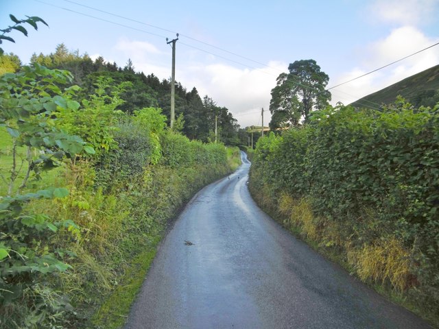
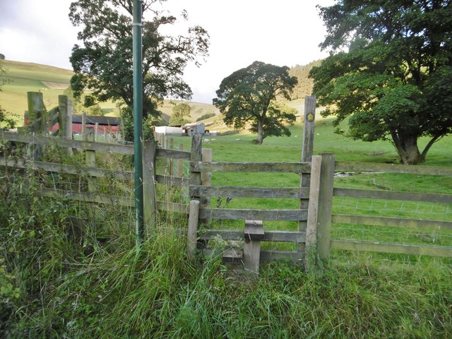
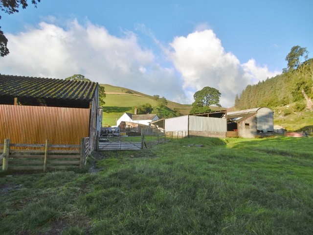
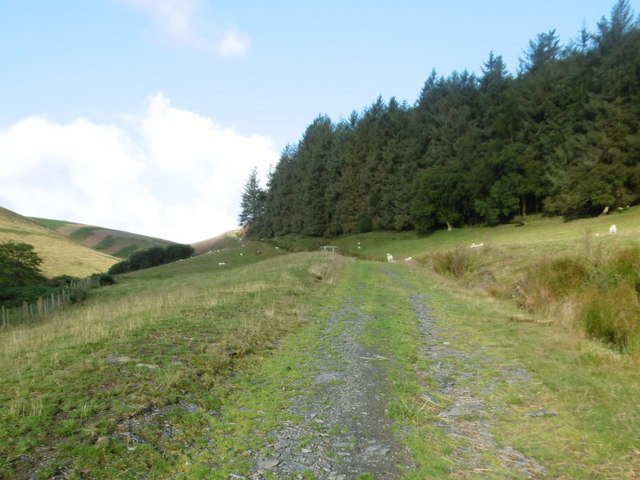
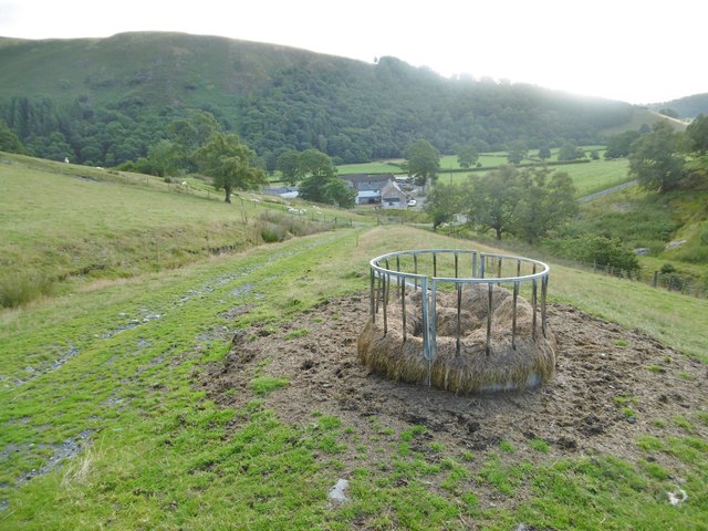
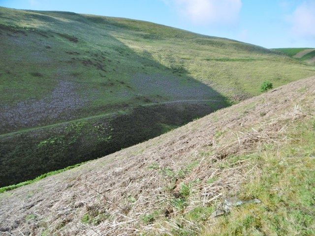
Ceiriog Ucha Images

Images are sourced within 2km of 52.899369/-3.27847 or Grid Reference SJ1434. Thanks to Geograph Open Source API. All images are credited.

Llanarmon Dyffryn Ceiriog, minor road From the village to Pentre, where the road becomes an "other route with public access".
Llanarmon Dyffryn Ceiriog, minor road
From the village to Pentre, where the road becomes an "other route with public access".
Llanarmon Dyffryn Ceiriog, stile At the beginning of the footpath up the valley of Pant Sarffle and back to the village.
Llanarmon Dyffryn Ceiriog, stile
At the beginning of the footpath up the valley of Pant Sarffle and back to the village.
Llanarmon Dyffryn Ceiriog, rams Handsome horned rams, grazing next to Nant Sarffle.
Llanarmon Dyffryn Ceiriog, rams
Handsome horned rams, grazing next to Nant Sarffle.
Llanarmon Dyffryn Ceiriog, Sarffle Farm Sheep farm on the Sarffle valley.
Llanarmon Dyffryn Ceiriog, Sarffle Farm
Sheep farm on the Sarffle valley.
Llanarmon Dyffryn Ceiriog, farm track From Sarffle Farm above the Nant Sarrfle valley (left) towards Foel Goch.
Llanarmon Dyffryn Ceiriog, farm track
From Sarffle Farm above the Nant Sarrfle valley (left) towards Foel Goch.
Llanarmon Dyffryn Ceiriog, sheep feeder Looking down the Nant Sarffle valley towards Sarffle Farm.
Llanarmon Dyffryn Ceiriog, sheep feeder
Looking down the Nant Sarffle valley towards Sarffle Farm.
Llanarmon Dyffryn Ceiriog, farm track From Sarffle Farm to Foel Goch.
Llanarmon Dyffryn Ceiriog, farm track
From Sarffle Farm to Foel Goch.
Llanarmon Dyffryn Ceiriog, Maengwyn Seen from the other side of the valley. The summit of the hill is at 501m.
Llanarmon Dyffryn Ceiriog, Maengwyn
Seen from the other side of the valley. The summit of the hill is at 501m.
Llanarmon Dyffryn Ceiriog, valley Formed by Nant Sarffle. Foel Wen to the East, and Foel Goch to the West.
Llanarmon Dyffryn Ceiriog, valley
Formed by Nant Sarffle. Foel Wen to the East, and Foel Goch to the West.
Llanarmon Dyffryn Ceiriog, minor road From the village to Pentre, after which it becomes an "other route" over the hills.
Llanarmon Dyffryn Ceiriog, minor road
From the village to Pentre, after which it becomes an "other route" over the hills.
Llanarmon Dyffryn Ceiriog, stream Nant Sarffle, shortly before it flows into Afon Ceiriog; Sarffle Farm in the distance.
Llanarmon Dyffryn Ceiriog, stream
Nant Sarffle, shortly before it flows into Afon Ceiriog; Sarffle Farm in the distance.
Pentre, settlement A small settlement with farm, a couple of cottages, disused chapel (right), postbox and phone box, on the minor road to the hills.
Pentre, settlement
A small settlement with farm, a couple of cottages, disused chapel (right), postbox and phone box, on the minor road to the hills.
Pentre, Ceiriog valley A flat field surprisingly without sheep.
Pentre, Ceiriog valley
A flat field surprisingly without sheep.
Pentre, sheep grazing On the lower slopes of Mynydd Tarw.
Pentre, sheep grazing
On the lower slopes of Mynydd Tarw.
Pentre, end of the road End of the minor road from Llanarmon Dyffryn Ceiriog, and start of the "other route" across the hills. The obscured sign gives distances to Llandrillo and Cynwyd.
Pentre, end of the road
End of the minor road from Llanarmon Dyffryn Ceiriog, and start of the "other route" across the hills. The obscured sign gives distances to Llandrillo and Cynwyd.
Cattle grazing below Graig Fawr Beef cattle in a field by Swch-cae-rhiw farm
Cattle grazing below Graig Fawr
Beef cattle in a field by Swch-cae-rhiw farm
Foxgloves by the roadside Digitalis purpurea flowering busily in mid summer by the road to Swch-cae-rhiw to Llanarmon DC.
Foxgloves by the roadside
Digitalis purpurea flowering busily in mid summer by the road to Swch-cae-rhiw to Llanarmon DC.
Pentre Bach farmhouse Currently disused (although the farm Pentre Mawr on the other side of the road has had quite a bit of money spent on recent refurbishments) Pentre Bach is late 17th or early 18th century, and was Grade II listed <span class="nowrap"><a title="https://britishlistedbuildings.co.uk/300081159-pentre-bach-ceiriog-ucha#.XVpEdehKhPY" rel="nofollow ugc noopener" href="https://britishlistedbuildings.co.uk/300081159-pentre-bach-ceiriog-ucha#.XVpEdehKhPY">Link</a><img style="margin-left:2px;" alt="External link" title="External link - shift click to open in new window" src="https://s1.geograph.org.uk/img/external.png" width="10" height="10"/></span> in 2003.
Pentre Bach farmhouse
Currently disused (although the farm Pentre Mawr on the other side of the road has had quite a bit of money spent on recent refurbishments) Pentre Bach is late 17th or early 18th century, and was Grade II listed LinkExternal link in 2003.
Show me another place!

Ceiriog Ucha is located at Grid Ref: SJ1434 (Lat: 52.899369, Lng: -3.27847)

Unitary Authority: Wrexham

Police Authority: North Wales

What 3 Words

///workloads.scare.tasters. Near Llanrhaeadr-ym-Mochnant, Powys

Nearby Amenities

Located within 500m of 52.899369,-3.27847
Place: farm
Lat/Long: 52.8985635/-3.2852293
Glas aber
Place: farm
Lat/Long: 52.8957675/-3.2802726
The data included in this document is from www.openstreetmap.org. The data is made available under ODbL.

Have you been to Ceiriog Ucha?

Leave your review of Ceiriog Ucha below (or comments, questions and feedback).